
Field Methods for Environmental Sciences Schedule
Welcome Picnic
A chance to meet fellow students from ISU and afar
Picnic will occur the Sunday before the course begins, 5-8pm, across the street from campus at 655 South 7th Ave. Basic food and drink will be provided but you are welcome to bring beverages or additional side dishes.
First Meeting
Orientation and Essential Information
8 am, on the first Monday (DO NOT BE LATE!)—Mandatory meeting in Physical Science Building, Room 220. A light breakfast buffet of bagels, yogurt, fruit, juice, etc. will be provided.
Wrap-up: Goodbyes and departures. We will be done on the final Saturday by 3 pm and provide rides to airports and shuttle services as needed. Remember to add this information to the linked google spreadsheet.
Approximate Course Schedule
Week One
Introduction to course goals, instructors, field area and expectations
Quantifying the water balance for a small watershed
- Inputs
- Programming and deployment of a meteorological station (rain gage, wind, solar radiation, temp, etc.)
- Visit to a near-by SNOTEL station (weather pending)
- Discussion of spatial variations in precipitation phase (snow vs. rain) and quantity
- Outputs
- Measurement techniques for water flux in small and large streams
- Programming and deployment of automated water quality sensors
- Measurements of evaporation and transpiration
- Change in Storage
- Measurements of soil moisture
- Measurements of groundwater variations
Week Two
Quantifying the carbon balance for a small watershed
- Gas Fluxes
- Measurement of gas fluxes from soils, plant leaves and plant communities
- Spatial extrapolation of measurements using remote sensing and topographic data
- Stream Fluxes
- Export by streams: sampling and analytical techniques, temporal variation
- Dissolved organic carbon
- Dissolved inorganic carbon
- Particulate organic carbon
- Export by streams: sampling and analytical techniques, temporal variation
- Change in Storage
- Sampling and analytical techniques for soil carbon
- Quantifying above- and below-ground carbon in plant biomass
Rough Schedule
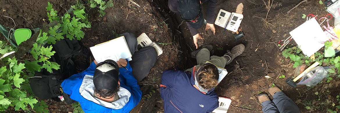
Day 01- Introductions, expectations, equipment and facilities, safety, schedule, field books, grading. Walking tour of the watershed. SNOTEL
Day 02 - Surveying and Positioning: Absolute vs. Relative positioning, Geographic vs. Projected Coordinates, Topo Maps/Compass, Pacing, Consumer GPS, Auto Level and Stadia, Laser Rangefinder, Total Station, RTK GPS. Import/Exporting positions and data from/to GIS.
Day 03 - Introduction to Hydrologic Cycle. Surface water fluxes. Gaging stations, stage data and rating curves. Online sources. Flow measurement techniques (midsection): Orange peels, Salt slugs, Rotating cups/impeller, Marsh, ADV, ADCP
Day 04 - Autonomous sensors: Dataloggers and programming, Input sensor types, Power supplies, Weather Stations. Meteorology : Precipitation (rain and snow vs. SWE)(spatial variation, elevation gradients), Wind and Potential Evaporation
Day 05 - Transpiration: Sap flux, shrubs and grasses (Lysimeters, other methods?)
Day 06 - Subsurface Water: soil moisture, groundwater (need access to a well in GJ! Install sensor now to measure variation). Summary work.
Day 07 - REST/HOMEWORK DAY
Day 08 - Introduction to Carbon Cycle. Water fluxes: DOC, DIC, POC collection and analysis techniques. Soil vs. Stream water. Temporal variation in fluxes. Auto samplers.
Day 09 - Soil Carbon Stocks. Pits, spatial variability, soil sampling and processing techniques, leaching, LOI, etc.
Day 10 - Soil Carbon Fluxes: Sources, temporal/spatial variability, association with vegetation and soil moisture, collars, LiCor work
Day 11 - Plant Carbon: above/belowground stocks and fluxes
Day 12 - Ctd . Field work? Prepare and make presentation of findings to stakeholders in afternoon.
Day 13 - Synthesis discussions and report generation