
Pleistocene mountain glaciation
In the Pleistocene, Idaho was a cooler, wetter place. Trees grew on the Snake River plain during maximum glacial cool intervals about 140,000 and 20,000 years ago. When the glaciers melted, constrictions in canyons produced local dams and periodic floods, on the Snake River, Columbia River, and Big Lost River systems.
PDF slideshows: Glaciation in central Idaho and Palouse Landscape by Jim Cash.
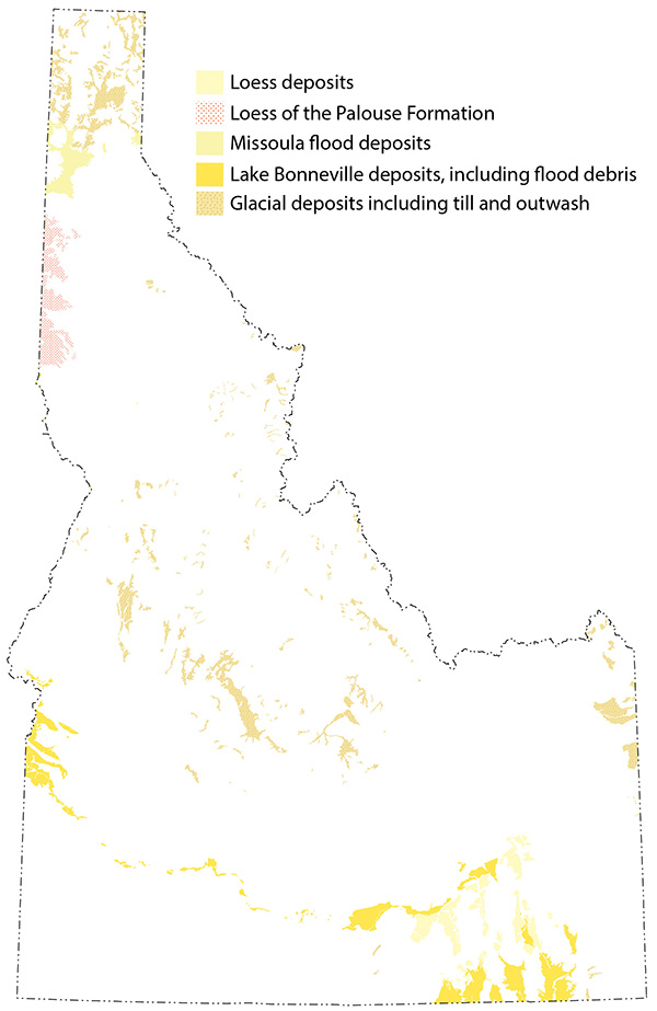
(Above) Map of glacial geology in Idaho, including glacial deposits, Lake Bonneville fill and shoreline deposits, Lake Bonneville and Missoula flood deposits, and wind-blown loess deposits.
Extent of Glaciation
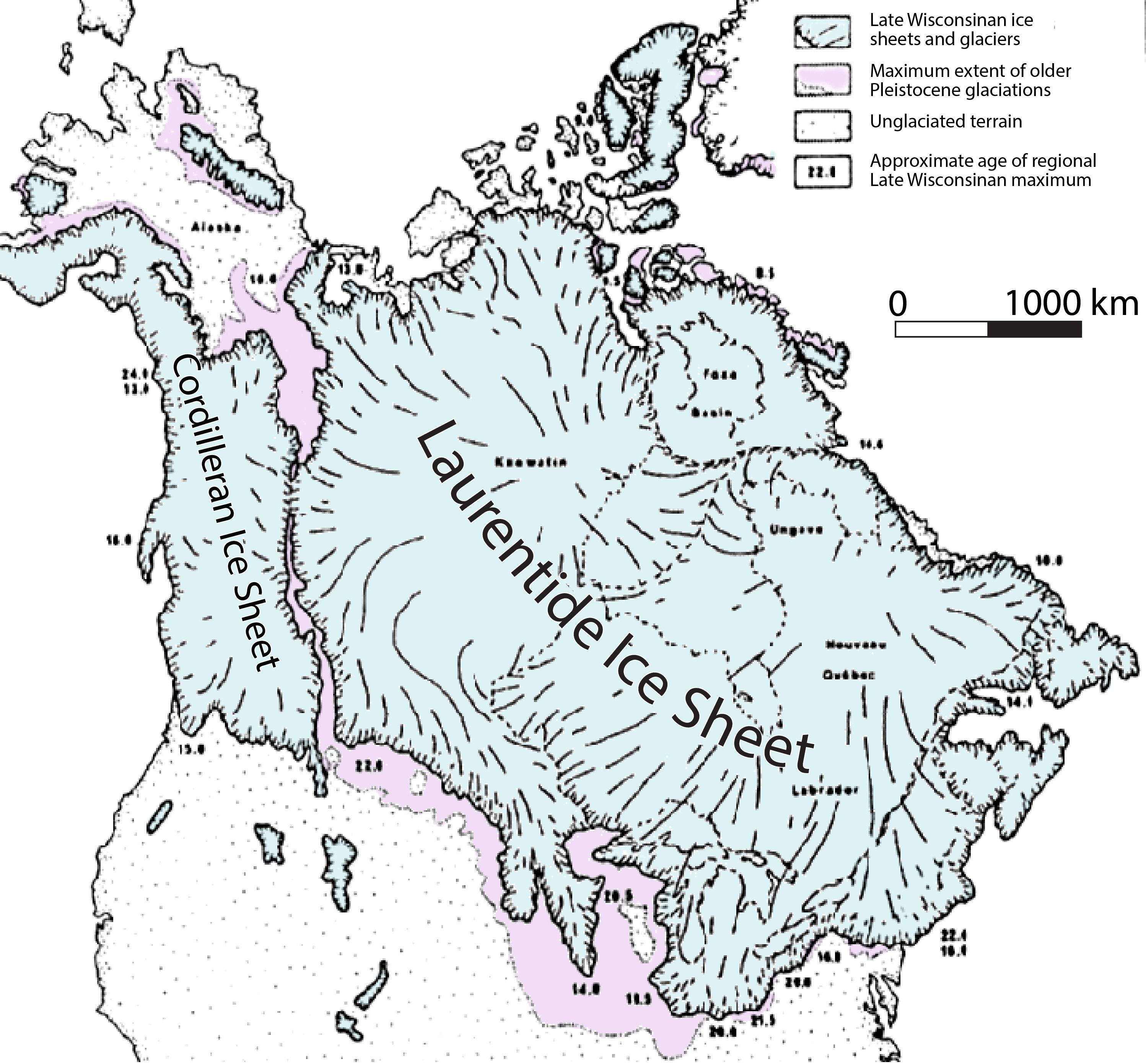
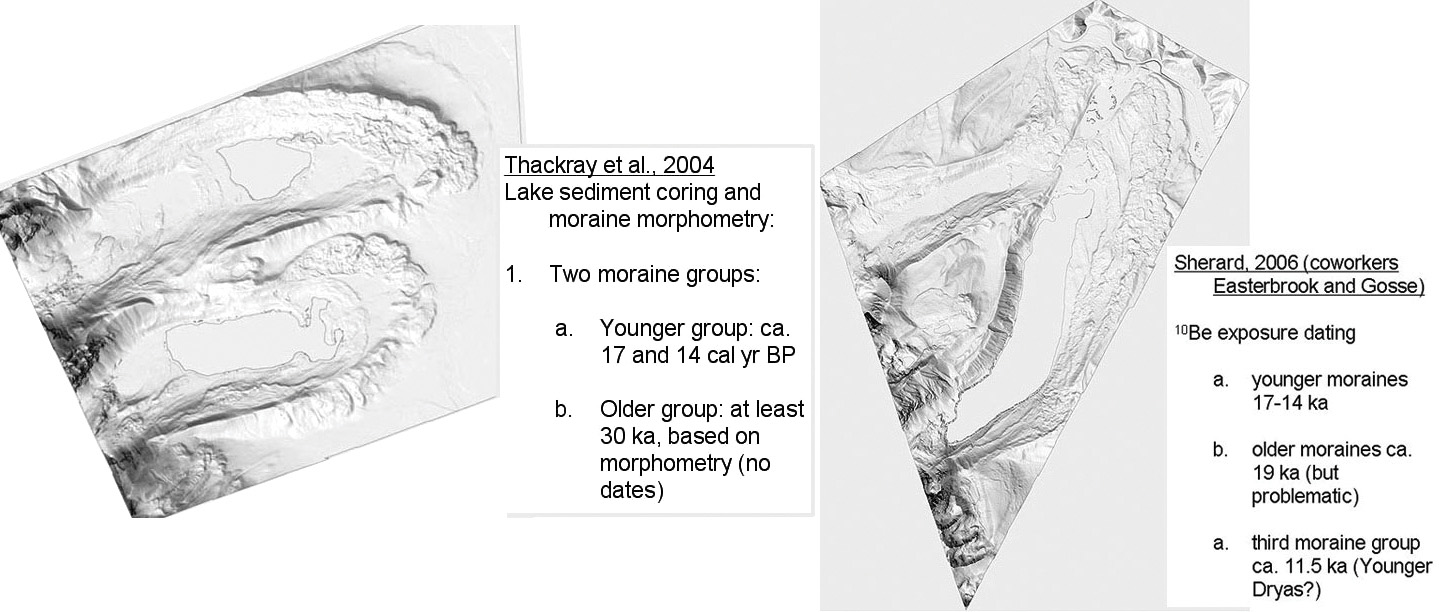
(Above) Late Wisconsinan extent of glacial ice in North America. The Sawtooth Mountains represent the middle small patch of ice in the northern Rocky Mountains (Thackray et al., 2004, and Sherard, 2006).
The figure to the left/above shows the extent of glacial ice in North America in the Late Wisconsinan about 20,000 years ago. The Laurentide continental ice sheet on the east and the Cordilleran ice sheet on the west were divided by the Rocky Mountains. The ice-free corridor between the Laurentide and Cordilleran ice sheets is thought to have been a main corridor for human colonization of North America.
During the Pleistocene glaciations, Idaho was influenced by climatic effects of both the Rocky Mountains and Yellowstone area on the east and the wetter Pacific Northwest climate on the north and west. In northern Utah, the growth of Lake Bonneville served to make the climate there more moist, and to provoke "lake effect" snows, which focused precipitation in the Wasatch and Uinta Mountains. This expanded the impact of the glaciers, and ultimately provided a positive feedback for growth of Lake Bonneville.
Greater Yellowstone glacial system
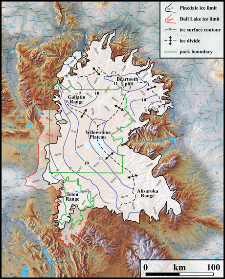
(Left/Above) Extent of glacial ice in greater Yellowstone Glacial System during the Pinedale and Bull Lake glaciations. Light shaded areas bounded by black lines indicate the areas covered during the Pinedale glaciation, whereas the areas bounded by red lines represent areas covered during the Bull Lake glaciations. Blue lines are contours in thousands of feet on the reconstructed Pinedale glacier surface. Black dashes with double-pointed arrows indicate main ice divides. Modified by J. Licciardi in December 2015 from Licciardi and Pierce (2008) and taken from https://www.nps.gov/yell/learn/nature/glaciers.htm.
The Greater Yellowstone Glacial System covered about 20,000 km2 at its maximum Pleistocene extent. Its Pleistocene glacial history was summarized by Pierce and Licciardi (2008; 2018). The large extent of this glacial system was a result of the high elevations within the Yellowstone area (likely as a result of the underlying Yellowstone hotspot), the wet climate resulting from precipitation delivery along the eastern Snake River Plain, and the relatively low-relief landscape, which allowed lots of snow to accumulate.
The older, Bull Lake glacial deposits in greater Yellowstone are dated to ca. 150-140 thousand years ago and extended well beyond the extent of the younger Pinedale glacial deposits along the southern and western regions. However, younger Pinedale glaciers (ca. 22-13 thousand years old) overrode Bull Lake ice limits on the north and east sides. The Yellowstone region experienced widespread deglaciation ca. 15-14 thousand years ago in response to a warming climate.
Chronology of glaciation
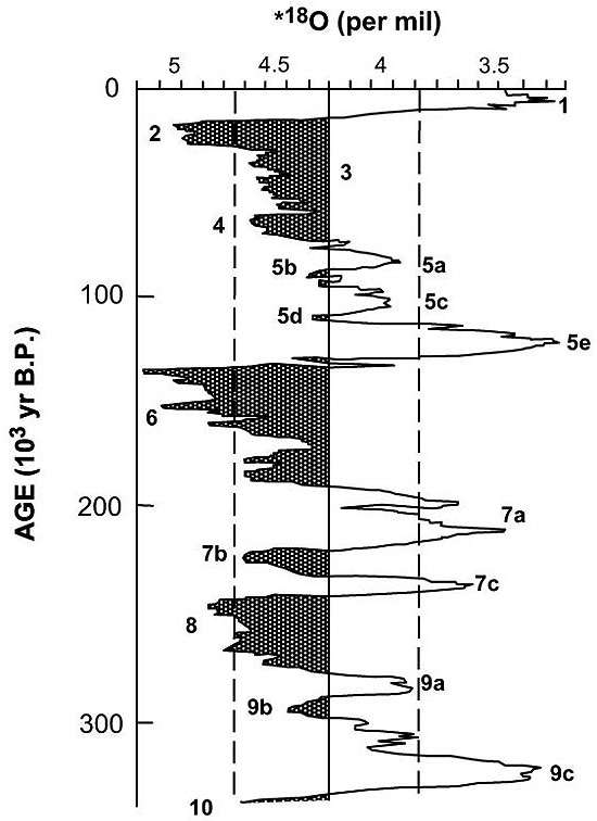
The record of oxygen isotopes in marine successions tracks the overall general temperature of the ocean water, and thus, ultimately the glacial history. Light oxygen in water (H2O16) evaporates more readily than water with heavy oxygen (H2O18). Hence, oceans are relatively rich in O18 when glaciers grow and hold the precipitated O16.
(Left/Above) Composite of oxygen isotope records of benthic foraminifera from several deep sea cores reflecting global ice volume (Shackleton and Pisias, 1985; Martinson et al., 1987; Porter, 1989). The peak of oxygen isotope stage 2 (about 20,000 years BP, or about 18,000 14C years BP) is generally considered the Last Glacial Maximum. The Pinedale, or Wisconsin glaciation spans stages 2-4 (and possibly to 5d), and the Bull Lake, or Illinoian glaciation is thought to be correlative with stage 6.
In general, the climate was coldest about 140 ka (the Illinoian (called Bull Lake in the northern Rocky Mountains) glaciations), warmed to present levels by 120 ka, and then cyclically cooled to 20 ka (the Wisconsinan (Pinedale in the northern Rocky Mountains) glaciations), after which a major warming, Holocene deglaciation, and rise in sea level occurred (the present). The marine oxygen isotope stages 2-4, and possibly stage 5d, represent the Wisconsin glaciation [or Pinedale], whereas stage 6 represents the Illinoian glaciation [or Bull Lake]. The last glacial maximum (from 18,000 to 14,000 14C yr BP) is represented by the peak in oxygen isotope stage 2. Latter stage 2 to stage 1 (ca 14,500 14C yr BP to 10,000 14C yr BP) is loosely termed late-glacial (from Borgert, 1999; after Porter, 1989).
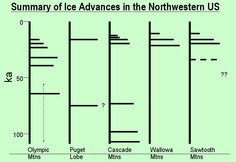
(Above) Summary of northwestern US glacial advances (from G.D. Thackray, Idaho State University). Glacial advances did not happen at the same time in different climatic zones, even in the northwestern U.S.
- At Oxygen Isotope Stage 4/5 (about 60 ka) was the maximum advance in Olympics and Cascade mountains
- At ca. 33 ka there was a major advance in the Olympics (and Sawtooths?)
- At ca. 19-22 ka (Last Glacial Maximum) there was the maximum Late Pleistocene advance in Wallowa Mountains of eastern Oregon, and in the Sawtooths, with lesser advances in the Olympics and Cascades
- At ca. 17 ka was the maximum advance of the Puget Lobe of the Columbian Ice Sheet, plus a readvance or recessional still stand in the Wallowa Mountains and in the Sawtooths
- At ca. 14 ka there was a readvance or recessional still stand in Sawtooths
- At ca. 11-12 ka there was a readvance or recessional stillstand in the Wallowas and the Sawtooths
In the McCall to Cascade area of Long Valley, an Idaho Geological Survey surficial geologic map by Breckenridge and Othberg (2005), is available from the Idaho Geological Survey - Surficial Geologic Map of the McCall area, Valley and County, Idaho: Idaho Geological Survey Digital Web Map DWM-35.
The chronology of Middle and Late Pleistocene glaciations in the Rocky Mountains have local names. In general, we can think of a Middle Wisconsin, ~140 ka Bull Lake (Copper Basin) advance, and one or more Wisconsin (~70 to 20 ka) Pinedale (Potholes) advances.
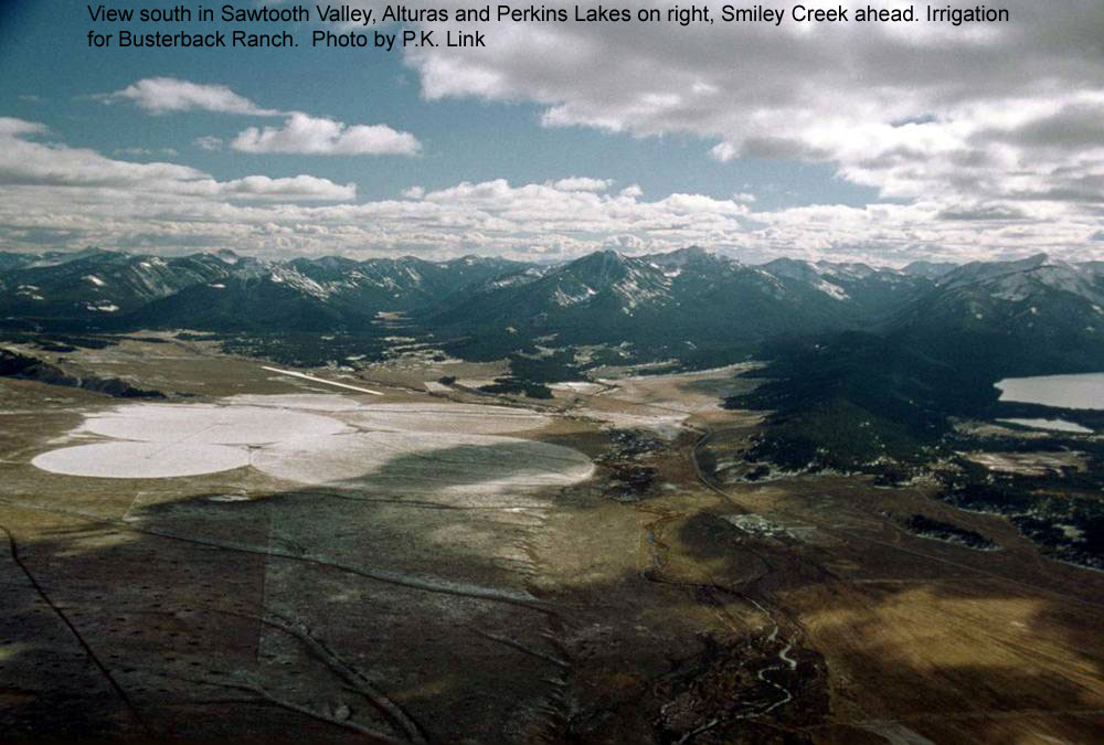
Glacial sequences in central Idaho
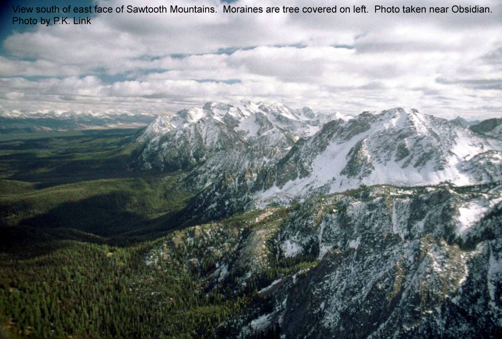
High elevation mountains in the northern Rockies, including in central Idaho, were the sites of mountain glaciers during the Pleistocene Bull Lake (ca. 150-140 thousand years ago) and Pinedale (ca. 22-13 thousand years old) episodes.
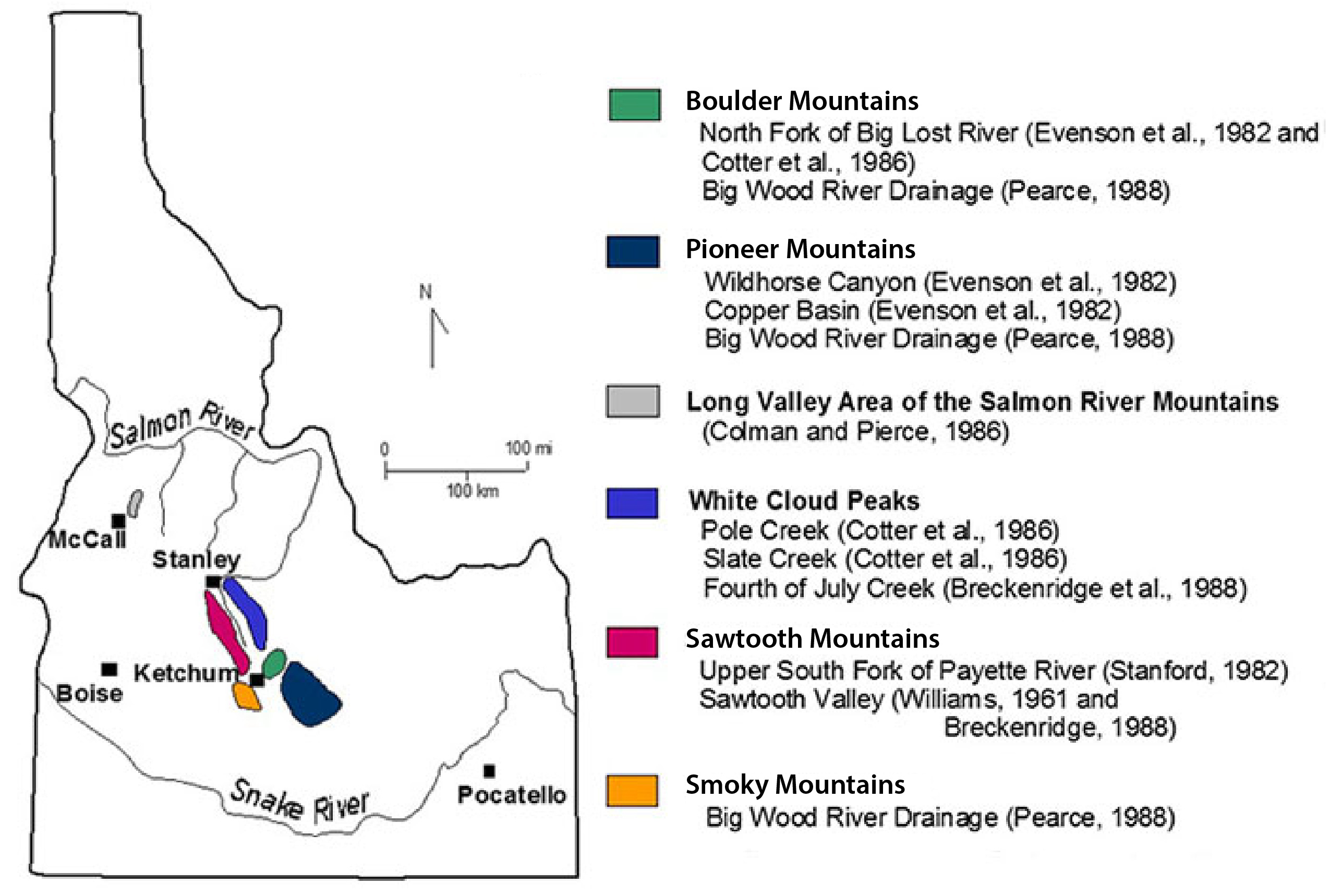
(Above) Previous work conducted on glacial sequences in central Idaho, summarized by Borgert (1999).
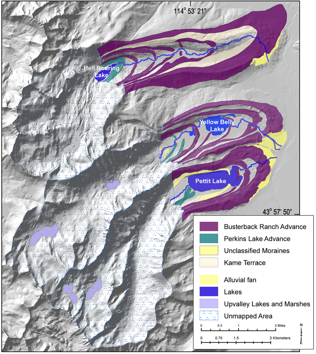
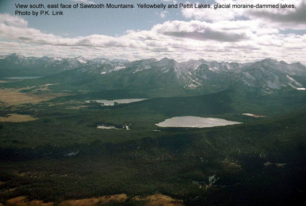
(Above) Pettit Lake, Yellow Belly Lake, and Hell Roaring Lake glacial advances (Lundeen, 2001).
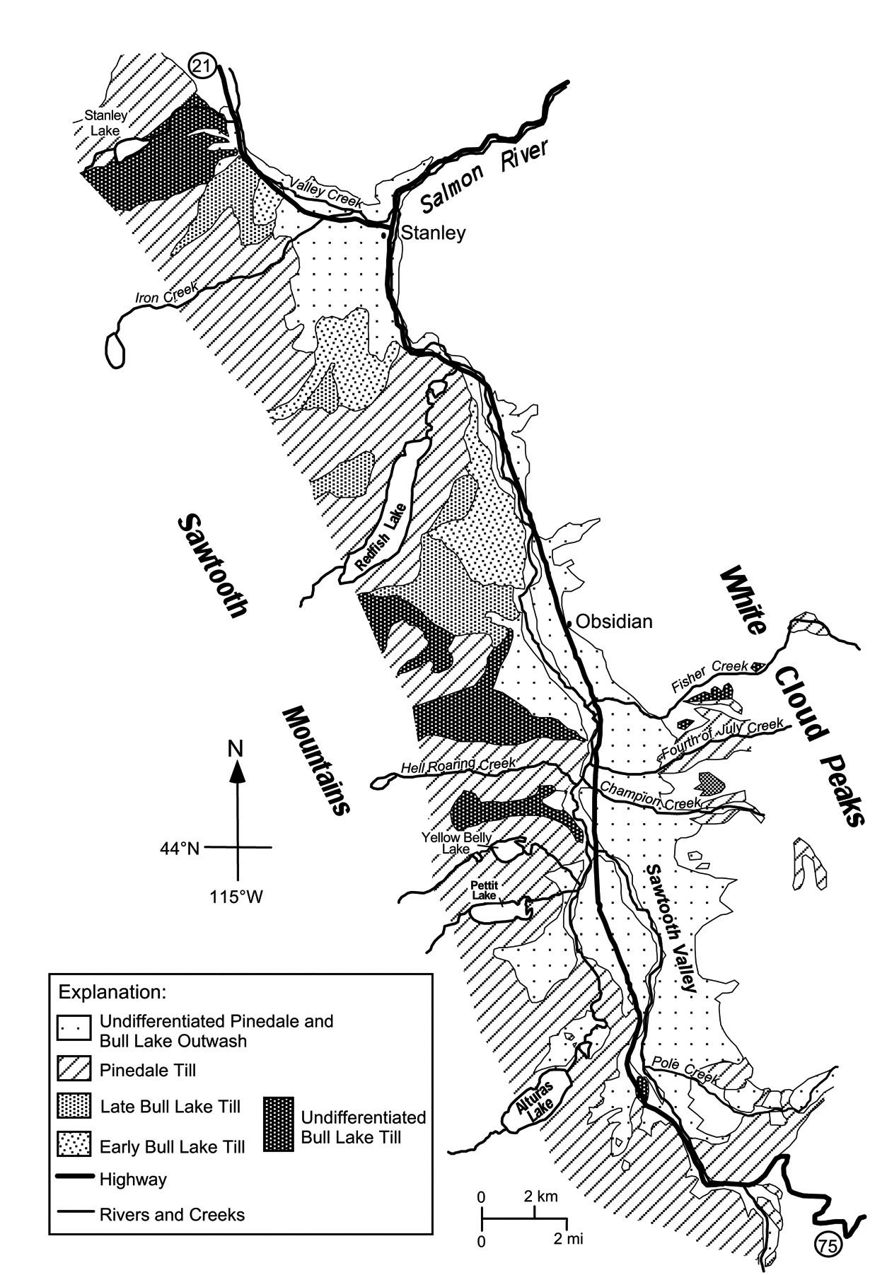
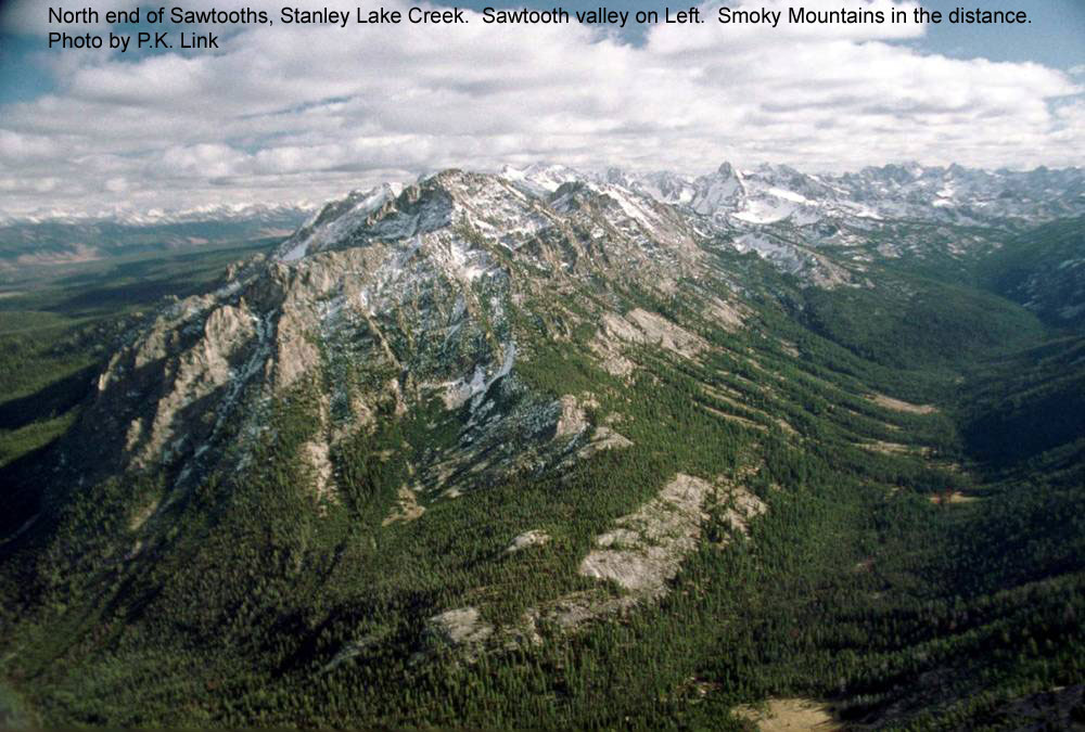
(Above) Map of late Pinedale moraines from Pettit to Hell Roaring Lake, Sawtooth Mountains, from Borgert, 1999.
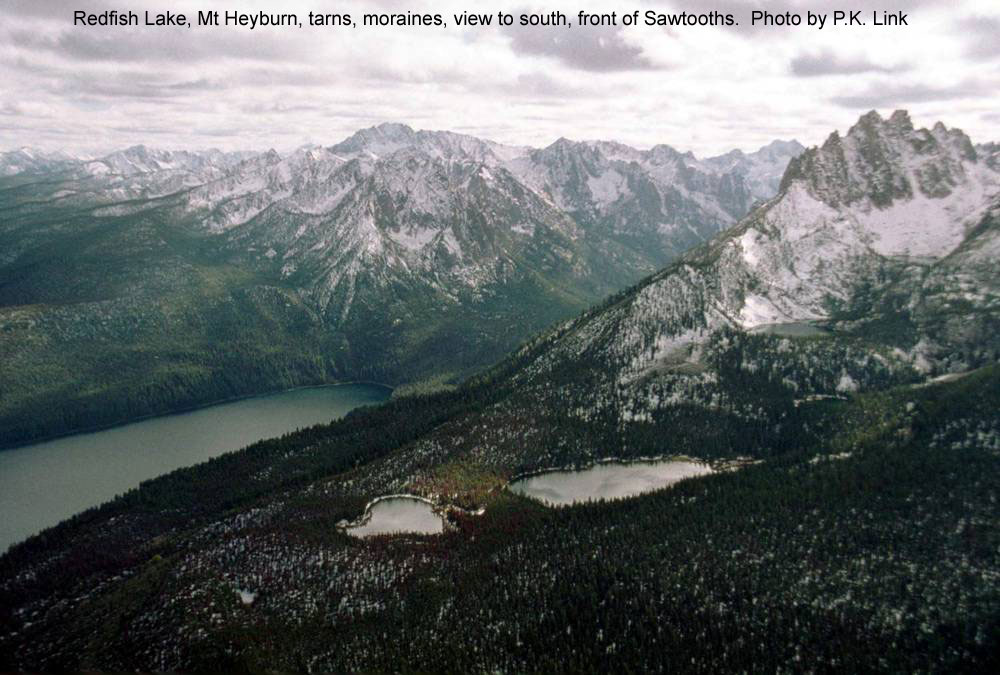
(Above) LIDAR images of moraines in the Stanley Basin. Pettit Lake is the left image. Redfish Lake is the right image. From G.D. Thackray, Idaho State University.
Continue to Module 13 - Palouse and Lake Missoula
References and further reading
Borgert, J.A., 1999, Extent and chronology of alpine glaciation in the Alturas Valley, Sawtooth Mountains, Idaho [M.S. thesis]: Pocatello, Idaho State University, 100 p.
Cerling, T.E., Poreda, R.J., and Rathburn, S.L., 1994, Cosmogenic 3He and 21Ne age of the Big Lost River flood, Snake River Plain, Idaho: Geology, v. 22, p. 227-230.
Gosse, J.C., Evenson, E.B., Klein, J., Lawn, B., and Middleton, R., 1995, Precise cosmogenic 10Be measurements in western North America : Support for a global Younger Dryas cooling event: Geology, v. 23, p. 877-880.
Licciardi, J.M., Clark, P.U., Brook, E.J., Pierce, K.L., Kurz, M.D., Elmore, D., and Sharma, P., 2001, Cosmogenic 3He and 10Be chronologies of the late Pinedale northern Yellowstone ice cap, Montana, USA: Geology, v. 29, p. 1095-1098.
Licciardi, J.M., Clark , P.U., Brook, E.J., Elmore, D., and Sharma, P., 2004, Variable responses of western U.S. glaciers during the last deglaciation: Geology, v. 32, p. 81-84.
Licciardi, J.M., Pierce, K.L., 2008, Cosmogenic exposure-age chronologies of Pinedaleand Bull Lake glaciations in greater Yellowstone and the Teton Range, USA: Quaternary Science Revews, v. 27.
Lundeen, K.A., 2001, Refined late Pleistocene glacial chronology for the eastern Sawtooth Mountains, central Idaho [M.S. thesis]: Pocatello, Idaho State University, 117 p.
Sherard, C., 2006, Timing of early Holocene Glacial Advances in Idaho and Washington. Unpublished M.S. Thesis, University of Washington.
Thackray, G.D., 2001, Extensive early and middle Wisconsin glaciation on the western Olympic Peninsula, Washington, and the variability of Pacific moisture delivery to the Pacific Northwest: Quaternary Research, v. 55, p. 257-270.
Thackray, G.D., Lundeen, K.A., and Borgert, J.A., 2004, Latest Pleistocene alpine glacier advances in the Sawtooth Mountains, Idaho, USA: Reflections of midlatitude moisture transport at the close of the last glaciation: Geology, v. 32; no. 3; p. 225-228.
Credits
This page was originally created by Paul Link, Idaho State University, with material from G.D. Thackray and students; it was modified and updated by Dave Pearson at Idaho State University.