Unmanned Aerial Systems

Program Description
Prepare to immerse yourself into the high-tech world of unmanned aerial systems (UAS). Through hands-on experience flying a variety of unmanned platforms, you will gain knowledge on how drones can support disaster response, weather forecasting, scientific research, agricultural survey of crops, soils, and livestock, crop dusting, wildfire surveillance, wildlife surveys, power line and pipeline survey, industrial security, oil, gas, and mineral exploration, payload transport, search and rescue as well as aerial photography for fields like real estate, construction, film and entertainment industry, and accident investigation.
Graduates will learn the basics to operate, test, calibrate and maintain small unmanned systems as well as collect and analyze imagery data taken from a variety of sensors.
Graduates Employed or Continuing Education Five-Year Average
97%
Average Idaho Income
$29,420 - $40,250
Program Overview
- Program begins in August and January
- Typical classroom hours are Monday through Friday from 9:00 a.m. to 3:00 p.m.
- Program is located in the Trade & Technology (T&T) Building #51, 1152 Martin Luther King Jr Memorial Way
Degree Options
- Unmanned Aerial Systems Basic Technical Certificate (1 semester)
- Course Sequence Basic Technical Certificate: Unmanned Aerial Systems
- Program Costs
- Unmanned Aerial Systems Intermediate Technical Certificate (1 year)
Career Opportunities
- Engineering and surveying companies
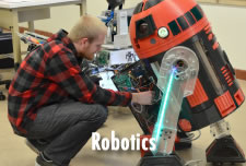
- Robotics/Autonomy
- Local, state, and federal government agencies
- Agriculture
- Inspection
- etc.
Minimum Test Scores
| SAT | Math: 500 |
| ACT | Math: 19 |
| ALEKS | Math: 20 |
Programs Related to Unmanned Aerial Systems