
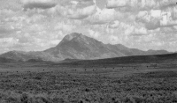
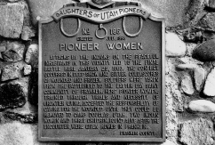
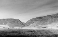
The Bear Lake Valley
The Oregon Trail in Bear Lake Valley
The Oregon Trail entered Bear Lake Valley near present Montpelier and followed the valley of the meandering Bear River. Travelers remarked on the abundant flowers, berry bushes and mosquitoes on this stretch of trail, in distinct contrast to the dry and windy sagebrush plains of Wyoming.
Osborne Russell comes to Bear Lake Valley
On the 2nd of July, 1834, Osborne Russell, traveling with Nathaniel Wyeth's band of trappers left Ham's Fork, Wyoming, crossed a high range of hills (the Preuss Range), and
"fell on to a stream called Bear River which emptied into the Big Salt Lake. This is a beautiful country. The river which is about 20 yards wide runs through large fertile bottoms bordered by rolling ridges which gradually ascend on each side to the high ranges of dark and lofty mountains upon whose tops the snow remains nearly the year round. We traveled down this river northwest about 15 miles and encamped opposite a lake of fresh water about 60 miles in circumference which outlets into the river on the west side." Haines (1965, p. 3).
Bear Lake and Bear River
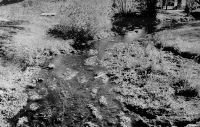
The Bear River was named in 1818 by Donald Mackenzie and a party of trappers. Bear Lake is shallow, about 20 feet deep at most, but it overlies up to ten thousand feet of lake and marsh deposits. The lake at the south end is fed by streams from the nearby mountains, and not by the Bear River, which flows north of Bear Lake, and into which the Lake formerly drained. Today water is pumped out of the lake through a series of canals controlled by Utah Power and Light Company and several irrigation companies.
Early Settlement of Paris
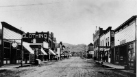
Charles C. Rich and a group of Mormon settlers founded Paris on Sept. 26, 1863. A young man named Frederick Perris surveyed the town and left for California. The town was named after him, and the incorrect spelling was used. Robert Price, one of the leaders in Paris after 1870, built a sawmill at the mouth of Paris Canyon, designed to provide building material for all the settlements in the Bear Lake region.
Utah or Idaho?
Unfortunately for the early Mormon settlers, the newly formed communities of Paris, Saint Charles and the country around the north end of Bear Lake were not in Utah, but in Idaho. Nonetheless, the 1,925 residents of Bear Lake County were included with the Utah Territorial census of 1870. The location of the boundary was in dispute until it was surveyed in 1872. Bear Lake County was established in 1875 with Paris as county seat, broken out of what had been Oneida County. For several years in the 1880s, C.C. Rich served in the Utah legislature and his son in the Idaho legislature, though they both lived in Paris.
Montpelier
Montpelier (elevation 5,920) was founded in 1864 as a Mormon farming community, comfortable with its remoteness. The west-building Oregon Short Line reached the community in 1882, and for a while there were two Montpeliers, one the established Mormon community, the other the largely Gentile railroad outsiders, regarding each other with suspicion. The railroad built a repair shop and a roundhouse and the town served until recently as a railroad division point. Farnworth (1993) relates stories of Montpelier and the Oregon Short Line. At the time of statehood in 1890 Montpelier was the 9th largest city in Idaho.
The population of railroad workers was separate from the Mormon settlers of Bear Lake County, who farmed the western and southern ends of the lake and established the county seat at Paris. In the late 1800s and early 1900s, the road from Paris to Montpelier was often impassable due to washouts and mud. In 1911, the railroad company built a branch line to Paris to serve the farming area but motor vehicles and World War II brought its demise in 1943. World War II also brought a large airfield out on the flat marshy country north of Bear Lake, but it is almost totally unused now.
Geology
Bear Lake Valley is topographically high, (near 6,000 feet) and has long cold winters and short summers. The valley is a fault-bounded basin, or graben, with normal faults on both the east and west sides. The largest fault borders the east side of Bear Lake, and has been dropping the valley downward and tilting it eastward with respect to the Bear Lake plateau for perhaps 10 million years. Total displacement on this fault is close to 10,000 feet.
The mountains of the Preuss and Aspen Ranges to the northeast of the Bear Lake Valley belong to the Meade thrust plate of the Idaho-Wyoming thrust belt. This is the area that contains the rich phosphate deposits of the Permian Phosphoria Formation, deposited in a nutrient-rich warm sea about 250 million years ago. Mining of the Phosphoria Formation has been and will be a major influence on the economy of not only the Bear Lake area, but much of southeast Idaho.
The Bear River Range on the west of the Bear Lake Valley contains Lower Paleozoic and Late Proterozoic rocks of the Paris thrust plate. The Paris thrust extends along the east side of the Bear River Range and places these older rocks over younger Paleozoic rocks of the Meade thrust plate.
Phosphate Mining History
Underground phosphate mining began in Georgetown Canyon in the early 1900s and a phosphate processing plant was built in 1957. Open pit mining began in 1958. An avalanche destroyed many of the facilities and the processing operations were moved to Conda, north of Soda Springs, in 1964.
The oldest phosphate mine in Idaho is the Waterloo Mine in Montpelier Canyon, about 3 miles east of the city of Montpelier. Mining began in 1907 and the mine was closed in 1929. The property was reopened from 1945 to 1958.
Underground mining of phosphate began in the Slight Canyon area north of Paris in 1920.
Soda Springs Area
Oregon Trail
Soda Springs was a well-known landmark on the Oregon Trail which passed along the Bear River and turned northwest at Soda Point (Sheep Rock). Ruts can be seen in many places along the Bear River, including on the north side of Soda Point Reservoir in the Soda Springs golf course and in the Historic Park area just west of town. The mineral springs were remarkable to the early Pioneers. Steamboat Springs emitted sounds similar to a steam-powered boat and were mentioned by most of those who kept journals. It is now covered most of the year by the waters of the reservoir.
Settling of Soda Springs by Morrisites
Soda Springs was settled in May 1863, by a group of refugees (morrisites; followers of Joseph Morris) fleeing from the Mormon-controlled Utah Territory. Morris, who was convinced that he was a prophet, had organized a communal settlement near the present site of Ogden and was preaching in open defiance of Brigham Young. Morrisites were active participants in the millennial dreams of nineteenth century America. They expected the imminent Second Advent of Christ and expected to take a leading role in the society that would be established after the second coming and that would last 1000 years.
|
A teenage Morrisite, Emma Thompson Just, described the trip to Soda Springs in May 1863. The letter reflects both the seductive beauty of an Idaho springtime and the naiveté of the Morrisite clan:
|
In June 1862, a Mormon territorial posse attacked the Morrisite settlement in Ogden. Joseph Morris was killed. The remnants of the movement, after their leaders were pardoned by the Utah territorial governor, realized they needed to flee.
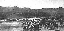
In May 1863, two wagon trains, including 160 Morrisites, left Salt Lake City, led by Colonel Patrick E. Connor. In January, 1863 Connor had commanded the California militia which had perpetrated the massacre of Shoshoni Indians north of Preston at Battle Creek on Bear River. Connor was antagonistic to Indians and intended to subdue them, open the area to settlement, and to counter the expansion of the Mormons, who were viewed by him as disloyal to the Union cause during the Civil War.
U.S. Militia troops under Connor established a post at Soda Springs, on May 20, 1863. Morristown was built on the north bank of the Bear River about a mile below the present townsite of Soda Springs. It is now under Soda Point Reservoir.
But the climate at 5,800 feet, 1,600 feet above the Salt Lake Valley, was more severe than anticipated and agricultural productivity was low. Frosts during summer nights repeatedly killed crops. The settlement disbanded within 2 years. Most of the Morrisites became discouraged and left. Some of those who remained spearheaded the anti-Mormon movement in Idaho a decade later. The gravestone on p. 90 is for two who stayed in Soda Springs.
Mormon Colonization
In 1869, Brigham Young invested in 650 acres of land, including part of the present Soda Springs townsite. In June 1870, Young and a contingent of Mormons visited Soda Springs with an eye toward colonization. A lodging house for Young and his family was built overnight by 20 volunteers from Paris. Gold was discovered at Carriboo Mountain, north of Soda Springs, later that year. The first permanent Mormon settlers arrived in Soda Springs in the spring of 1871. Also in 1871, the Utah-Northern Railroad Company, a project of the Mormon church, was started north from Brigham City, headed for Soda Springs by way of Franklin, and ultimately to the mines near Butte, Montana.
A Wild Frontier Town
By the time Oregon Short Line Railroad Company reached Soda Springs in 1882, the town was a wild frontier community. It served as the railhead for a huge area of mountains and forest to the north, over which ranged miners starting in 1870, cattlemen starting in the 1880s, and sheepherders starting in the 1890s.
 |
 |
 |
|
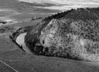
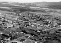
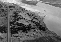
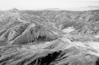
(left) Soda Point or Sheep Rock, looking east. Soda Point reservoir and city of Soda Springs are in the background. The Bear River here makes almost a 180° bend and flows southward into a canyon cut in Pleistocene basalt. Also at this point the Oregon Trail headed northwest while the Hudspeth Cutoff headed straight west across Gem Valley, (June, 1992). (center) Aerial view of Soda Springs, looking southeast, (June, 1992). Geyser is on the extreme right middle side of photo, one block west of Main Street, which runs diagonally through the right foreground of photo. Idan-ha' hotel stood east of Main Street, just north of the railroad tracks and west of the grain elevator. Soda Creek in foreground. (right) View looking east along Oregon Trail and U.S. Highway 30 just west of Soda Springs. Soda Point (alexander) Reservoir is on the right, and was the original site of the 1863 Morrisite settlement of Soda Springs. Union Pacific Railroad is just out of the view to the left. Oregon Trail followed a route just north (left) of the reservoir. Prominent scar between Oregon Trail and the Highway is a natural gas pipeline, (June, 1992). |
||
The Kackley Family
Doctor Ellis Kackley, fresh out of the University of Tennessee Medical School, came to Soda Springs in 1898, resolved to become "The Best Damn Doctor in the West". Many would say he succeeded (carney, 1990). He, his wife, Ida Sarver Kackley, and son, Evan, served the area for over 50 years, performing feats of frontier medicine by using ingenuity and common sense. He and Evan built the first Soda Springs hospital in 1925 to 1927. The hospital doubled in size to 40 beds in 1932. Ellis delivered over 4,000 babies.
Ellis Kackley died in November 1943, when Evan was in the Pacific during World War II. Twenty-five hundred people attended his funeral, which was held in the Soda Springs High School. His two large dogs created a commotion at the wake. Evan said his father would have enjoyed knowing that the dogs were still in control.
Butch Cassidy's Gang
Butch Cassidy and his band of outlaws frequented the Soda Springs area in the late 1890s, and had a camp in Star Valley, Wyoming. They, like some Mormon polygamists, found refuge in this isolated valley. Cassidy's gang robbed the Montpelier Bank of $16,500 on August 13, 1896, and escaped up Montpelier Canyon. An unmounted pack horse carried the loot out from under the nose of the posse.
On June 2, 1899, Cassidy's Gang robbed the Overland Flyer of the Union Pacific Railroad. Later that summer Dr. Kackley was asked to treat a wounded member of the gang that was holed up near Freedom, Wyoming. Both Kackley and Cassidy sympathized with underdogs and did not like the big corporations. Kackley brought the injured man to Soda Springs under cover of darkness and housed him close to the railroad. Another of the Cassidy Gang was disguised as a woman and took care of the injured man until he recovered.
Geology of the Soda Springs Area
Soda Springs is located near the trace of the Paris thrust fault, which separates the older, Late Proterozoic and Lower Paleozoic rocks of the Bear River Range from the younger Paleozoic rocks of the Preuss Range north and east of town. These younger rocks, belonging to the Meade thrust plate, contain the Permian Phosphoria Formation which is so important to the economy of the Soda Springs area.
Phosphate Mining
Phosphate mining began in the Soda Springs area in 1920 with an underground mine at Conda, named for the owner, Anaconda Copper Co. The Conda mine and townsite was officially abandoned on August 31, 1984.
Today the phosphate industry is the largest employer in the Soda Springs area, with several open-pit mines north and east of Soda Springs and large chemical processing plants on the north edge of town.
Reserves are large and demand is constant. Unlike the silver mining business, phosphate mining will be a strong industry for the foreseeable future. According to the Idaho Geological Survey, in 1990, Idaho's annual revenue from phosphate mining and processing was nearly $600 million. Silver mining produced about $70 million.
Anyone who has traveled U.S. Highway 30 through Soda Springs on a cloudy night will remember the ghostly red glow reflected off the bottoms of low clouds hanging above the molten slag piles near the Monsanto Chemical Plant north of the city.
Mineral Springs
The mineral springs in the Soda Springs area are charged with sulphur dioxide, calcium carbonate, and sodium silicate, products of their long journey through Paleozoic limestone bedrock. Formation Springs, northeast of town, has a large travertine terrace deposit.
 |
 |
 |
|
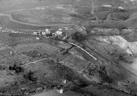
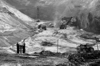
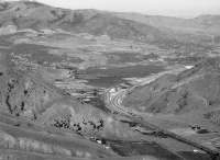
(above) Abandoned townsite of Conda, looking north, (May, 1992). The streets remain but the houses have been removed. One of the open pits of the abandoned Conda Mine is to the right of the industrial buildings. The buildings served until 1991 as a loading facility for phosphate ore brought by slurry pipeline from the new Simplot mine at Smoky Canyon, about 30 miles east. The Conda mine began as an underground mine run by the Anaconda Copper Company, and was last operated by the J.R. Simplot Company. The dry tailings pond from the mine is behind the railroad tracks. The railroad cars are probably in storage. |
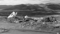
Monsanto elemental phosphorous plant north of Soda Springs. View looks east toward the Conda Mine. Highway 34 and the Union Pacific Railroad are just east of the plant, (May, 1992). | The Ballard Phosphate mine north of Soda Springs, operated by NuWest Industries, (October, 1992). |
 |
 |
|
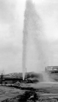
| (bottom center)The municipally regulated geyser in Soda Springs looking south. Under normal conditions the geyser is allowed to erupt about every half hour, (March, 1996). | Warm waters of Hooper Spring, north of Soda Springs. The waters are naturally carbonated and are allegedly tasty for making root beer. In the 1890s the Idan-ha' Natural Mineral Water Company shipped bottled water from the Soda Springs area all over the world, (October, 1989). |
-
Carney, Ellen, 1990, Ellis Kackley, Best Damn Doctor in the West: Bend, Oregon, Maverick Publications, 283 p.
-
Carney, Ellen, 1992, The Oregon Trail: Ruts, Rogues and Reminiscences: Wayan, Idaho, Traildust Publishing Co., 332 p.
-
Haines, Aubrey L., editor, 1965, Osborne Russell's Journal of a Trapper: University of Nebraska Press, Lincoln, Nebraska, 191 p.
-
Johnson, Elaine S. and Carney, Ellen, 1990, The Mountain: Cariboo and other gold camps in Idaho: Bend, Oregon, Maverick Publications, 245 p.
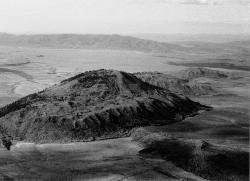
Caribou Mountain Area
Grays Lake and Blackfoot Lava Field
Volcanic activity of the Blackfoot Lava field over the last million years has produced the large flat area north of Soda Springs. Rivers here wander slowly through marshes, as if they were wondering which way to escape the basin.
 |
| Caribou Mountain and Grays Lake basin from the west, (July, 1992).The mountain is held up by granite stock intruded in Eocene time, about 45million years ago. Gold in placer deposits eroded from veins around the stock has lured prospectors to the area for over 100 years. |
Grays Lake has been an enclosed catchment area for water for at least a million years and contains a valuable record of pollen for the changing climates of Pleistocene time.
Lander Trail
The Lander Trail, named after F.W. Lander, who supervised its construction,went through the Grays Lake Valley. In the 1860s it became known as the Old Salt Road when salt was brought from Stump Creek to Montana, Boise and the west.
The Lander Trail was shorter than the Oregon Trail from South Pass to Fort Hall, but the hardships often extended the duration of the journey.Spring rains often made the trail impassable.
|
An admirer of the Lander Trail wrote:
|
Discovery of Gold on Caribou Mountain
Gold was discovered on Mt. Pisgah (now Caribou Mountain) in 1870 by Jesse Fairchilds or "Cariboo Jack", an itinerant miner who gained his name in the Cariboo Mining District of British Columbia. A typical western gold rush followed. Two good-sized towns, Carriboo City and Keenan, grew up close to each other on the mountain, which looms above Grays Lake Valley to elevation 9,803 feet. Both cities were deserted after a few years but mining has continued sporadically to the present. About one million dollars of gold was taken from the area, mainly by placer methods, with the associated ditches and pipelines to supply water to the mines. Two hand-dug ditches,with a length of about 7 miles, rimmed Caribou Mountain.
|
 |
|
| China Hat, a rhyolite dome, intruded about 100,000 years ago in the Blackfoot Lava Field north of Soda Springs. Immediately beyond China Hat is China Cap, and North Cone is to the north of it. Both of these are also rhyolite domes. View looks north to the Blackfoot Reservoir and Pelican Mountain. The town of Henry is just out of the photo in the right distance, (May, 1992). | ||
| Gold mines of Cariboo (carriboo or Caribou) Mountain, from Idaho Yesterdays, 1976, v. 19, no. 4, p. 10. Click on image for a larger view | ||
|
Report of Gustavus C. Doane's Military Expedition from Star Valley to Carriboo Mountain, December 16-22, 1876:
|
Chinese Miners
Chinese miners came to Carriboo in 1872 and were not excluded from the camp as they were in other Idaho mining camps. They were most numerous about 1880, and were generally acknowledged as being more skilled at mining than the Caucasians. The Chinese miners fled Carriboo in 1885 after a number of Chinese massacres in the west. In 1870 Chinese were the largest ethnic group in Idaho. Of the 4,269 Chinese, 3,853 were working as miners. That same year there were only 2,719 white miners in Idaho.
Freight to Carriboo Mines
Until 1871, freight traffic for the Carriboo mines came from Corinne, Utah,through Ross Fork (Fort Hall) and north of Grays Lake along the McCoy Creek drainage. From 1877 to 1878, Oxford was the railroad stop nearest the mines and in 1878, a stage road was established from Oxford through Soda Springs to the Carriboo Mining Region.
In 1878, the U & N railway reached Oneida (arimo). In 1882 the first Oregon Short Line railway train passed through Soda Springs and the town became the major center to supply the Carriboo Mines.
Old Williamsburg
Williamsburg, now almost totally abandoned, had in the 1870s, three dairies,a boarding house, saloon, school, post office and a summer tent city which included two prostitute tents. Today it is the site of management of the Kackley Ranches.
Demise of the Name Carriboo
In 1907, the U.S. Forest Service created Caribou National Forest, changing the name from Carriboo (or Cariboo) over the protests of the locals. The residents correctly pointed out that no Caribou had ever lived in the area.The incorrect spelling persists today, in the name of the National Forest and the County surrounding Soda Springs.
Polygamists in Star Valley Wyoming
Many of the original settlers of Freedom, Wyoming were Mormon polygamists who refused to give up their wives and families when Idaho and Utah enforced the Edmonds Anti-polygamy act of 1882, but Wyoming refused to do so. The name Star Valley comes from Starvation (Starve)Valley, a name the area gained during bitter winters in the late 1880s.Many cattle were lost in the severe winter of 1889. There were over 40inches of snow in two days and nights in March.
Cattle, Sheep, and Cranes
By 1875, large cattle herds were grazed in the Grays Lake area or passed through the area. Sheep became common in the 1890s. By 1894, 50,000 sheep summered north of Soda Springs. By the early 1900s that number had increased to over a million. Today much of the Grays Lake wetland area is part of a National Wildlife Refuge, and provides nesting sites for Sandhill and Whooping Cranes.
References
-
Anonymous, 1976, Gold Mines of Cariboo Mountain, Idaho Yesterdays, v. 19no. 4, p. 10-15.
-
Carney, Ellen, 1992, The Oregon Trail: Ruts, Rogues, and Reminiscences: Wayan, Idaho, Traildust Publishing Co., 332 p.
-
Codman, John, reprinted 1976, A Trip to Cariboo Mountain: Idaho Yesterdays,v. 19, no. 4, p. 18-24.
-
Derig, Betty, 1972, Celestials in the Diggings: Idaho Yesterdays, v.16, no. 3, p. 2-23.
-
Fiesinger,D.W.,Perkins,W.D.and Puchy,B.J.,1982, Mineralogy and Petrology of Tertiary-Quaternary Volcanic Rocks in Caribou County, Idaho, in Bonnichsen, Bill, and Breckenridge, R.M., editors, Cenozoic Geology of Idaho: Idaho Bureau of Mines and Geology Bulletin 26, p. 465-488.
-
Johnson, Elaine S. and Carney, Ellen, The Mountain: Carriboo and other Gold Camps in Idaho, 1990, Maverick Publications, Inc. P.O. Box 5007, Bend Oregon, 97708, 245p.
-
Mabey, Don, 1979, The Bend of Bear River. Bountiful , Utah, Horizon Publishers and Distributors, 136 p.
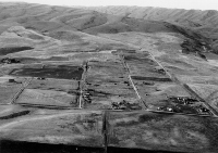
Gem Valley & Chesterfield
Gem Valley and Gentile Valley
The first settlers of the area between the Portneuf and Bear River Ranges(Gem Valley) were non-Mormons (Gentiles) who homesteaded in the southern end of the valley in the 1860s. The west side of the Bear River became known as Gentile Valley by 1875. The first three Mormon families settled in 1871 with impetus from Brigham Young, who was planning on the Utah-Northern Railroad Company coming through the southern end of the valley on the way to Soda Springs.
|
Oscar Sonnenkalb wrote, concerning Gentile Valley in the 1880s, that:
|
City of Grace
The first bridge across Bear River north of the present site of Grace was built in 1893, and the city was established shortly thereafter. Farming on the surrounding country was dependent upon irrigation efforts of the Last Chance Canal Company, which proceeded slowly and with great effort.In 1913, the Oregon Short Line completed the Grace Branch Line. In 1915,the village of Grace was incorporated. The village was named after the wife of the land agent in Blackfoot.
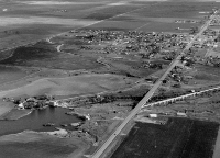 |
| Aerial view looking south at Grace, (May, 1992). The Utah Power and Light Company dam is in the left foreground, with the flume on an elevated trestle crossing under the highway to the right. Bear River occupies canyon cut in Pleistocene basalt. The East Branch of the Last Chance Canal winds east of town in the center left of the view. |
Last Chance Canal
Attempts to get water to the Grace area were unsuccessful between 1895and 1902. Although the Bear River ran just to the north, it was deep in a basalt canyon, and the water was inaccessible. Furthermore, Gem Valley's winters were harsh, and wooden flumes for canals using water from Bear River were repeatedly destroyed by winter snows. On March 4, 1897 the Last Chance Irrigation Co. filed for Bear River water and a dam site was selected a mile and half below Soda Point (Sheep Rock). Construction started in1898. The canal was opened in 1902-1904 and today provides water for farmland both north and south of Bear River on the upland around Grace.
The Last Chance Canal was built without federal assistance and without outside capital by local farmers, who worked cooperatively in the best spirit of the Mormon settlers. To provide footings for the dam, the farmers built log cribs of timber and rocks which they set on the ice-covered river in the winter. They hauled huge timbers 60 feet in length.
|
Fred Cooper who served as secretary of the Last Chance Canal Co. from1928 to 1961 said:
|
In June 1917, the Utah Power and Light Co. brought suit against Last Chance Canal Co. to get a decree on waters of Bear River and Bear Lake.Litigation of the suit lasted for three years until the Canal Company won the case with the Dietrich Decree of June 1920. This case adjudicated Bear River water for the first time.
Grace Power Plant
In 1906, L.L. Nunn and his Telluride Power Company moved in from Colorado and began construction of the a major hydroelectric plant on the Bear River, taking advantage of the 500 foot drop in the elevation of the Bear River between Sheep Point and the floor of the canyon west of Grace. In 1908, they finished a dam north of Grace above the elevation of the Lake Bonneville shoreline, with the power plant a few miles down the valley and 525 feet lower, on what had been the lake floor. At that time the plant was the largest hydroelectric station west of Omaha. At first the electricity was for use in the mining districts of Bingham, Utah and Eureka, Nevada; it was not sold to local customers.
The Telluride Power Company eventually became the Utah Power and Light Company. In 1915, the Grace plant was the biggest station on the newly integrated Utah Power and Light system.
Lake Thatcher and the Gem Valley Volcanic Field
Bear River makes nearly a 180° bend around Soda Point and runs south into southern Gem Valley and Cache Valley (mabey, 1979). However, as hypothesized in the 1963 Ph.D. dissertation of geologist Robert C. Bright, a native of Preston, the river's course prior to about a million years ago was probably north to near Chesterfield and then down the present Portneuf River canyon past Lava Hot Springs and to the Snake River west of Pocatello. At this time, Gem Valley drained to the north, much as Bear Lake Valley does today.
At times in the last million years the outlet of the ancestral Bear River became dammed and a lake, named Lake Thatcher, formed in Gem Valley. Volcanic activity of the Gem Valley volcanic field produced basalt lava flows which filled the north end of the valley, damming up the former Bear River course and forcing the river to turn south. The highest shoreline of Lake Thatcher was established at about 5445 feet elevation, after the lake was restricted to the southern part of the valley. Sediments deposited in Lake Thatcher underlie the farming country south of Grace and are recognized in water wells drilled as far north as Chesterfield. At its thickest point the Thatcher Formation is about 590 feet thick.
Some lava flows in northern Gem Valley were sourced from the Blackfoot lava field to the east. The lava flowed westward over the Chesterfield Range through Ten Mile Pass. Other main sources for lava flows were a fissure system that runs along the east side of the Gem Valley. The largest known lava tube is now an ice cave about 800 feet east of the cinder cone at Niter, south of Grace. About 600,000 years ago two basalt lava flows from northern Gem Valley ran down the course of the Portneuf River to Pocatello to form the Basalt of Portneuf Valley.
After Lake Thatcher occupied southern Gem Valley for perhaps several hundred thousand years, the Bear River drainage was captured, in Oneida Narrows, by south-flowing tributaries to Strawberry Creek and the Lake Bonneville basin. After Lake Thatcher drained southward into Cache Valley, the input of water from the Bear River plus a time of generally greater precipitation (a pluvial interval), caused Lake Bonneville to grow in the Great Salt Lake basin. The high level of Lake Bonneville,about 5,140 feet, reached into Gem Valley about 20,000 to 14,500 years ago. The shoreline was located just south of the site of the Grace Power Plant.
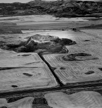
Chesterfield-Mormon Outpost in Idaho
Chester Call, a Mormon bishop from Bountiful, Utah, established a ranch near Chesterfield in 1879. Call convinced many of his relatives and friends to move to the new settlement.
|
Oscar Sonnenkalb wrote of Chester Call that he was:
|
Early settlers came to the Chesterfield area in 1881 and 1882 and built crude dugout shelters along the bottom land of the Portneuf River. The community was dealt a major setback in 1882, when the Oregon Short Line was built through Bancroft to the south, but the proponents of Chesterfield refused to believe this would doom their town.
in Wyndham, editor, (1986), Famous Potatoes |
Mormon Church authorities from Cache Valley visited Chesterfield in November, 1883, and advised that a townsite be laid out on high ground east of the Portneuf River flood plain. The townsite was a mile long and3/4 mile wide, and was divided into 10 acre blocks that would then be subdivided into four equal lots of 2.5acres. The settlers followed the pattern of Salt Lake City and laid out a city with streets ninety-nine feet wide, with sixteen foot sidewalks at each side. The streets of Chesterfield were wider than the boulevards of New York.
The site was named Chesterfield in memory of Chesterfield, England,and to honor Chester Call. Some families chose home sites in the village, but many did not. Prosperity came slowly, if at all.
Most of the buildings of Chesterfield were built between 1884 and 1904. By the mid-1890s 50 families had moved into the village. A kiln was built east of town to fire the bricks used to build new church buildings. By 1900, Chesterfield had 418 people on its ward records. A few brick homes were built, the pride of the community. The agricultural Depression of the 1920s and 1930s was the final blow to the city of Chesterfield.
 |
 |
 |
|
(left) Aerial view looking north at Alexander Crater, a cinder cone on the Oregon Trail in Gem Valley. The Chesterfield Range is in the background,(September, 1984). (center) Aerial view looking north at the Chesterfield townsite. The ambitious town plat was never fully subscribed and houses were not built on many of the possible sites. The Moses and Mary Vashti Call Muir house is at the lower right. The Chesterfield Range is in the background, (May, 1992). (right) Moses and Mary Vashti Call Muir house, Chesterfield, (April, 1996). This is the oldest brick house in the Chesterfield area, built in |
||
Mormon Families in Chesterfield
Chesterfield, though today largely a ghost town, lives on in the spirit of the descendants of its Pioneers. The Chesterfield Foundation is dedicated to preserving the Chesterfield heritage, and has published the exquisite book "Chesterfield: A Mormon Outpost in Idaho."
Most Mormon farm families in the Chesterfield area were monogamous, though there were some polygamous households. Large families were considered an asset in Chesterfield, as in most Mormon communities; 8 or 10 children was a small family. Sixteen children was normal. Boys married at age 18 or 19 and girls at 16 or 17.
The history of Chesterfield's residents is a cycle of dreams and hard work to plow the sagebrush, followed by tragedy with the loss of land, crops, and livestock. Then the process would start over again, usually somewhere else. Chesterfield was always a cold and dry place. The farmers tired of watching summer storms pour a deluge on Gentile Valley to the south and miss their land. The knowledge that the Snake River Valley to the north was well watered through irrigation further disillusioned them. Most early settlers, including church leaders, eventually sold out and moved away.
|
Nathan James Barlow recorded the leaving of Judson Tolman, a polygamous Mormon Bishop, and his family. Tolman had been for three decades one of the pillars of the community.
|
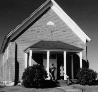 |
| Chesterfield LDS church and meeting house, dedicated August 23, 1892. Photo taken October, 1988. | |
|
The diary of Wanda Katie Whitworth, born in 1905, and who lived on a ranch about eight miles from Chesterfield, is quoted in Swetnam (1991,p. 61).
|
|
|
Farming in the Chesterfield area today mainly consists of large dry farms and ranches, operated by a few hardy survivors.
|
|
Lava Hot Springs Area
Hudspeth Cutoff
The Hudspeth Cutoff, after climbing high over the Portneuf Range south of the Portneuf River, wound down through Henderson Canyon and what is now the Lava Hot Springs golf course, to the river at a hill of Silurian dolomite known as Island Butte. The river formerly passed south of the Butte, but now flows only on the north side except in large floods. The dry channel can be seen from Highway 30. The Cutoff then headed up a small canyon south of the river and down into what became the rail station of Oneida and now is Arimo. From there it struck out west across Marsh Valley, crossing the Bannock Range south of Garden Creek Gap. Although this part of the Cutoff gained and lost considerable elevation, it was, at least, well-watered. The same cannot be said for the Cutoff west of the Bannock Range.
Mountain Man Bob Dempsey
Bob Dempsey, one of the last of the mountain men in southeastern Idaho,had a permanent camp west of Lava Hot Springs, where Dempsey Creek flows into the Portneuf. From 1851 to 1861, he trapped the mountains south of Lava, and effectively kept other trappers out. When the Hudson's Bay Company ceased operations in southeastern Idaho, Dempsey moved north to the Montana gold fields. Until 1915, the town of Lava Hot Springs was known as Dempsey, Idaho.
Lava Hot Springs and the Portneuf River
Lava Hot Springs was deeded to the state in 1902 to provide a health and recreation facility. The Lava Hot Springs area contains several hot springs which occur along a north-south normal fault southwest of town and an east-west normal fault which follows the Portneuf River canyon. The clear waters in gravel-bottomed pools at the state-operated resort make for a wonderful, relaxing visit. The east end of the pools are just as hot as a person can bear.
After the train depot was constructed in 1902-1905 the hot springs were accessible to the western traveler. The state built a natatorium in 1918 and now oversees operation of the swimming pools and hot baths through the Lava Hot Springs Foundation. The South Bannock County Historical Center located in the former Bank of Idaho building in Lava Hot Springs acts to preserve the heritage of the area.
On cold winter nights, when the steam of the hot springs reduces visibility to a few feet, people of all ages talk and play in perceived anonymity.Yet the city of Lava Hot Springs has been slow to take off as a recreational development. It has been for the last 30 years a quaint, tattered place, very much small-town southeast Idaho.
 |
 |
 |
| (left) Ligertown, a ramshackle compound where dozens of lions, "ligers"(lion-tiger crosses), and hybrid wolves were kept (October, 1995). In September 1995 some animals attacked the owners and escaped. Several were shot and the owners were charged with numerous violations. The compound was destroyed in April, 1996.
(center) Postcard of Lava Hot Springs, looking south from U.S.Highway 30, 1942. Abe Lillibridge collection, Idaho State University. (right) Waterfalls along the Portneuf River west of Lava Hot Springs, (January 1984). The falls cascade down terraces of algally deposited travertine, and the calcium carbonate deposits of hot springs. |
||
Cache Valley
Geography
About half of Cache Valley is geographically in Idaho, but 80% of its people live in Utah. Logan, at the southern end of the valley, site of Utah State University and a Mormon Tabernacle, has historically been the center of commerce. The solidly Mormon agricultural towns of Preston and Franklin on the east side of the Bear River, and Oxford, Clifton, Dayton, and Weston,west of the river, are geographically and economically closer to Logan than to the Idaho towns of Malad City, Montpelier or Pocatello. This area was settled by Mormons who thought they were living in Utah Territory,and even in the 1990s, some Preston area residents see themselves as part of Utah, feeling that they have little in common with the politicians in Boise who collect and spend their tax money.
Geologically, Cache Valley is a graben, bounded by normal faults on both the east and west sides. On the east side is the Bear River Range, which passes into the Portneuf Range on the north side of the Bear River across the canyon at Oneida Narrows. These ranges contain mainly Late Proterozoic and Paleozoic bedrock (limestone and quartzite) above the Paris thrust fault, which is exposed on the east side of the Bear River Range. West of Cache Valley are the Bannock and Malad Ranges and the Wellsville Mountains in Utah, underlain by the same Paleozoic formations as well as Late Proterozoic strata beneath, including the Brigham Group and the Pocatello Formation.
Lake Bonneville
Cache Valley was filled with the northeastern arm of Lake Bonneville, and the lake flooded to the north through Red Rock Pass into Marsh Creek, the Portneuf River, and Snake River. The unconsolidated sands and silts deposited on the floor of Lake Bonneville form the surface of Cache Valley, and, when irrigated, make excellent agricultural soil. A network of canals, the trademark of lands settled by Mormon Pioneers, provide water to much of the valley.
|
Franklin
Franklin was the first settlement in Idaho, established by Mormon Pioneers in 1860. Clifton, Weston, and Dayton were established in 1864, 1865, and1867.
Lorenzo Hill Hatch was Bishop of Franklin from 1863 to 1875. His son was bishop from 1875 to 1907. He came west with the 1846 migration from Nauvoo, Illinois. Hatch married plural wives and was the father of twelve sons and twelve daughters. At the time of his death in 1900 he had 170 grandchildren and 32 great grandchildren.
Utah-Northern Railroad
The Utah-Northern Railroad Company, a cooperative project of the Mormon Church and local farmers, reached Franklin in 1874 and the Bear River at Battle Creek in 1876, but the company ran out of money. Utah-Northern shops had been built at Battle Creek, just south of the Bear River, at the site of Connor's Massacre.
The roadbed for the Utah-Northern Railroad, headed north to Soda Springs, was built toward Riverdale and Oneida Narrows, but tracks were never laid. It is still plainly visible near Johnson Reservoir north of Preston.
When construction was begun again (by the reorganized Utah & Northern Railway), the route headed north through Red Rock Pass to Marsh Valley and Pocatello.
Preston
Preston (originally called "Worm Creek' when it was founded in 1874), was located where it is because ground water, though alkaline, was shallow on the west banks of Worm Creek. In 1880, the name Worm Creek was changed to Preston, honoring Bishop Wm. B. Preston of Logan. Mormon leaders had, thankfully, objected to the word "worm." In 1881, the Cub River and Worm Creek irrigation system began. It was the first of several canal systems that would bring water to Cache Valley. In 1888, the townsite of Preston was surveyed and platted.
Logan Rapid Transit System
The Logan Rapid Transit system, consisting of inter urban trolleys connecting Logan to Ogden and northern Cache Valley, was organized in 1910 and reached Preston in 1915. The first timetable showed 16 trolleys daily, with the trip from Ogden to Preston taking 31/2° hours.The line was discontinued in 1947 and the material sold for scrap.
West Cache and Twin Lakes Canals
In 1899, the West Cache Canal, designed to water 17,200 acres on the west side of Bear River, was begun. The Twin Lakes Canal was begun in 1902 by enthusiastic farmers who were advised that the project would take 5 years and cost $282,000. Instead it took 20 years and cost $1,500,000.
Hot Springs
Natural hot springs exist along the Bear River at several locations north and west of Preston. The water is emitted along the trace of the normal fault which bounds the east side of Clifton Hill or Little Mountain east of Twin Lakes Reservoir. Commercial hot springs were operated at Old Bridge Porte just south of Battle Creek and at Riverview Sunset Del Rio Hot Springs half a mile downstream. Presently a hot springs complex at Riverdale is operated as a swimming pool.
 |
 |
 |
|
(left) Headwall scarp of "Highway slide" which cuts the old alignment of U.S. Highway 91 north of the Bear River and Preston, (august, 1983). (center) Wide canyon of Bear River, looking east from the old grade of Highway 91, cut in unconsolidated sands and silts deposited in Lake Bonneville.The landslide shown in the upper photo on p. 99 is directly across the tree-lined course of the Bear River. Bear River Range in the background,(June, 1992). (right) Squaw Hot Springs building west of Preston. Building was vacant at the time of this photograph (June, 1992). It had been used in the past ten years as a greenhouse and a pig farm. Large travertine-coated open well flows water at 84° centigrade. |
||
Bear River Landslide Complex
Active rotational landslides exist on both banks of the Bear River north and west of Preston. These landslides represent response of unconsolidated Lake Bonneville silts, sands, and clays to the lowering of the base level of the Bear River after the drying up of the remnants of Lake Bonneville about 14,000 years ago. Installation of irrigation systems in the country both east and west of the river resulted in major landslides in the 1910s. Wet cycles of several years of duration with higher than normal rainfall have triggered periods of landsliding since then. The last period of active earth movement was in 1983-86. In 1993, the grade of U.S. Highway 91 was reconstructed to the west, away from the face of the hill, to avoid its former grade over a headwall scarp of one of these landslides.
Oxford
Oxford was settled in 1864. With completion of the Utah & Northern, the town became a mixed Mormon-Gentile community and aspired to replace Malad City as county seat of Oneida County. Oxford obtained the public land office in 1879 and a newspaper, the Idaho Enterprise, in 1880. Oscar Sonnenkalb lived there from 1881 to 1889.
Oneida County, in the 1880s, embraced 13 of the present counties of southeastern Idaho, extending 180 miles south to north from the Utah border to Montana, and about 100 miles east to west from the Wyoming border. The County Seat of this vast territory was first at Soda Springs, but in 1866,was moved to Malad City. However, as Malad City was far from the railroad, more than half of the county-officers resided and had offices in Oxford, on the narrow gauge railway.
1863 Bear River Massacre
California Volunteers from Camp Floyd, south of Salt Lake City, annihilated between 240 and 300 Shoshoni Indians at the mouth of Battle Creek, north of Preston on a frigid morning, January 29, 1863. Only 23 soldiers were killed. The attack was led by Colonel Patrick E. Connor. Although the Mormon settlers had asked Connor for help, the attack was also motivated by Connor's desire to open the Bear River area to settlement by non-Mormons. Five months after the attack Connor led the Morrisites to Soda Springs. A decade of Indian skirmishes followed the Massacre, but the patterns of Native American hunting and settlement were effectively disrupted forever by this attack (madsen, 1985).
 |
 |
|
(above) Bear River Massacre Historical Marker, updated in the 1980s to the generally accepted account of the incident. It reads:
(above right) 1932 monument that paints the Bear River Massacre in a rather different light from the modern view. (right) 1953 monument; its emphasis is in keeping with the 1932 monument. |
Malad Valley & Country to the West
Hudspeth Cutoff
West from Marsh Valley the Hudspeth Cutoff crossed the Bannock Range, Blue Spring Hills, Deep Creek Range, and Sublett Range before reaching the Raft River Valley and joining with the California Trail near present-day Malta. Twin Springs, between present-day Rockland and Holbrook was one of the few reliable water supplies.
Pioneers chose the Hudspeth Cutoff in the great rush of 1849, when, sheeplike, they sought a more direct route to California. It is estimated that from June 20 to August 31, 1849, 250 wagons a day (an estimated16,000 to 25,000 people) traveled this route, even though it was unproven, more difficult, and as it turned out, did not save any time. The Pioneers were desperate to get to California first. About 45,000 traveled it in 1850 and 50,000 in 1852. The cutoff had a life of perhaps 10 years since few went that way after 1859, as the California gold fields played out. Arthur Hope's book "The Hudspeth Cutoff, Idaho's Legacy of Wheels" is a detailed account of the route.
Empty Country
The vast area from Malad City west to the Raft River Valley is mainly empty. There are few paved roads, and no gas stations. This is dry, sparsely settled country. Although much of it was homesteaded near the turn of the century, most of the farm houses were abandoned in the 1930s and the land is now divided into thousand-acre dry farms. The mountains are not high enough to catch significant winter snows and the streams in the valleys are small and unreliable. Extensive irrigation systems are not feasible. However, if most of these hardy farmers, who remain here, were given the choice, they would live nowhere else.
Geology of the Malad Area
The Wasatch fault runs along the east side of Malad Valley, and there are several active faults in the area to the south and west. Malad Valley is thus a half-graben, with the sedimentary valley fill generally tilted east.
The Bannock, Deep Creek, and Sublett Ranges as well as the Samaria and North Hansel Mountains are underlain by Paleozoic rocks, mainly limestones. These mountains are generally good fossil hunting country, with horn corals, brachiopods and gastropods easy to find if one knows the right place and is prepared to walk. There are several areas of limestone caverns. Air escaping from these caves on northern Samaria Mountain sometimes causes the mountain to "moan" in early spring.
Lake Bonneville extended north into the southern parts of Malad, Curlew and Juniper Valleys. Its shorelines can be seen if one looks closely, usually near the top of the level of plowed fields. They are generally more prominent in the southern parts of the valleys, closer to the Utah border.
Settlement and Brigham Young's Placement of the Utah Border
The first colonization of the Malad Valley, by Mormon cattlemen, was in the early 1850s. The settlers were recalled to Salt Lake City with the coming of the federal army of occupation (Johnston's army) to Utah in 1857-58. The first permanent settlement was in 1863. Malad City was settled mainly by Mormon converts from Wales.
Brigham Young came through the Malad Valley in 1855. Acting on the basis of astronomical observations by Orson Pratt, he marked the boundary line between Oregon and Utah territories as 108 miles from Salt Lake City, near the present town of Woodruff, Idaho. Although this placement was very close to correct, many Mormon settlers in Malad, Cache, and Bear Lake Valleys claimed that they were actually in Utah. The matter was not settled until the U.S. Government survey of 1872.
Early Malad City and Oneida County
Malad City grew up as a composite community in which Mormons, Gentiles, and Mormon apostates (the Josephites) dwelt without much friction. Soda Springs was the first county seat of Oneida County, which in the early 1860s included all of southeastern Idaho. Transportation from the Malad Valley to Soda Springs was difficult and the county seat was moved to Malad City in 1866. This move quieted hostilities between Malad Valley Mormons, who thought (or hoped) they were actually in Utah, and Gentiles. Oxford (in Cache Valley), served as the Federal Land Office until 1885, and many Oneida County officials lived there.
The Gold Road
In the early 1860s, two overland stage routes operated from Utah to the Snake River Plain and the mines in Montana. Both came north to Malad City. The Bannock Road split off up the Malad River and crossed into Arbon Valley to the mouth of Bannock Creek, and then north and east along the south bank of the Snake River. The more-used Portneuf Road, operated by stages owned by Ben Holladay, went over Malad Summit and to Marsh Valley, along the road followed by Interstate Highway 15 today. Holladay sold the Portneuf Road to William Murphy. In April 1870 Murphy was fatally shot in Malad City, by a deputy sheriff, after a dispute with county commissioners about how much he could charge. Leigh Gittins' book "Idaho's Gold Road" is a rich source of this history.
Josephites
In 1866 a splinter group of Mormons, led by one of the sons of Joseph Smith, came to Malad City, seeking a community far enough away from Salt Lake City not to cause friction but close enough to allow missionary work. They formed the Josephites, the Reorganized Church of Jesus Christ of Latter Day Saints, which still exists.
 |
| Grain elevator east of Twin Springs, along the Hudspeth Cutoff, (June, 1992). |
 |
| Garden Creek Gap, looking west from west of Arimo. Garden Creek meanders through the narrow defile cut in hard east-dipping quartzite of the Scout Mountain Member of the Late Proterozoic Pocatello Formation. The stream is superposed, that is, it established its course on a cover of valley fill above the present level of the quartzite ridge. Vegetated stripes near the top of the slope north of the gap are normal faults, dropping the rocks down to the east, toward Marsh Valley, (august, 1982). Near here in July, 1994 supermodel Niki Taylor married Matthew Martinez, a McCammon man. Super-supermodel Cindy Crawford was among the wedding guests. |
Indian Settlement at Washakie
After the Bear River Massacre in 1863, the Shoshoni Indians, with help of the LDS church, made a permanent settlement in Malad Valley. Chief Sagwitch, wounded at the massacre, lived to join the LDS church and is buried at Washakie 2 miles west of the Malad River south of Malad City.
Holbrook
The Holbrook valley, only fifteen miles west of Malad City, but drier and less hospitable, was settled in 1878, 30 years after the Pioneers entered the Salt Lake Valley. But the big rush of homesteading did not come until about 1895. The main growth was 1901-1907.
Holbrook did not get electricity until 1946. Today its homesteads are largely abandoned. Dry farming for grain and cattle grazing are the primary agricultural activities.
References
-
Beus, S.S., 1968, Paleozoic stratigraphy of Samaria Mountain,Idaho Utah: American Association of Petroleum Geologists Bulletin, v. 52, p.782-808.
-
Eliason, Carol, and Hubbard, Mary, 1987, Holbrook and surrounding areas history book 1878-1987: Holbrook, Idaho, 491 p.
-
Gittins, H. Leigh, 1976, Idaho's Gold Road: Moscow, Idaho, The University Press of Idaho, 165 p.
-
Haines, A.L., ed., 1965, Osborne Russell's Journal of a Trapper: University of Nebraska Press, p. 124.
-
Harstad, P.T., editor, 1972, Reminiscences of Oscar Sonnenkalb, Idaho Surveyor and Pioneer: Pocatello, Idaho, The Idaho State University Press, 66 p.
-
Hope, A.C., 1990, Hudspeth Cutoff, Idaho's legacy of Wheels: Idaho Falls, Idaho, Bookshelf Bindery and Press, P.O. Box 2204, Idaho Falls, Idaho, 222 p.
-
Howell, Glade F., 1960, Early history of Malad Valley: M.A. Thesis, Department of History, Brigham Young University, 130 p.
-
Kerns, G.L., and Kerns, R.L., Jr., editors, 1985, Orogenic patterns and stratigraphy of north-central Utah and southeastern Idaho: Utah Geological Association Publication 14, 328 p.
-
Link, P.K., and Smith, L.H., 1992, Late Proterozoic and Early Cambrian stratigraphy, paleobiology, and tectonics: Northern Utah and southeastern Idaho: in Wilson, J.R., editor, Field Guide to Geologic Excursions in Utah and Adjacent Areas of Nevada, Idaho, and Wyoming: Utah Geological Survey Miscellaneous Publication 92-3, p. 461-481.
Marsh Valley
Geography and History of Drainage
Marsh Valley, bordered on the east by the Portneuf Range and on the west by the Bannock Range, is the primary access to the Snake River Plain from the south. As the area was, after 1867, part of the Fort Hall Indian Reservation, legitimate settlement of the southern part was delayed until after 1889 when the land south of McCammon was excised from the reservation. Euro-American settlement of northern Marsh Valley began with the Land Run of 1902.
The Portneuf Range contains east-dipping Lower Paleozoic and Late Proterozoic rocks and the Bannock Range contains the same sequence, repeated across a normal fault that bounds the east side of Marsh Valley. The Basalt of Portneuf Valley is at the surface at the north end of Marsh Valley, having been erupted from the Bancroft area about 600,000 years ago.
The north end of Marsh Valley today contains an example of "inverted topography" with the lava flows filling the middle of the valley and the rivers confined to the sides. The Portneuf River is on the east and Marsh Creek, the main path of the Lake Bonneville Flood, is on the west. At the time of eruption of the lava flow, the center of the valley was lowest, and thus the term "inverted topography."
Geophysical surveys indicate that there is as much as 10,000 feet of valley fill underneath Downey, and that over the last few million years, drainage in Marsh Valley was primarily to the south, perhaps into a lake basin which periodically had an outlet to the Bonneville Basin. The prominent pediment surfaces seen below Scout Mountain and Mount Bonneville were established during this time of southward drainage and are graded to a base level several hundred feet above the present valley floor.
After establishment of the throughgoing drainage of the ancestral Bear River, the base level fell and the pediments were incised. Garden Creek which had been flowing east on deposits of gravel and sand began cutting down and encountered the bedrock ridge at Garden Creek Gap. It continued downcutting, resulting in the superposed canyon seen today.
|
Osborne Russell's thoughts on leaving southeastern Idaho for the Willamette Valley of Oregon in 1842.
|
Henry O. Harkness and early McCammon
Henry O. Harkness took over the operation of William Murphy's stagecoach service between Corinne, Utah and the Montana gold mines in 1870 and set up operations at the toll bridge over the Portneuf River at what is now McCammon (named for the man who negotiated purchase of the right of way for the Oregon Short Line Railway across the Fort Hall Indian Reservation). Harkness was an archetypal American entrepreneur of the late 19th century and a testimony to the power of the American Dream. In 1871, he married Murphy's widow Catherine, who had inherited her husband's property rights to land on the Fort Hall Indian Reservation.
In 1874, Harkness turned to ranching and purchased land at Oxford, just south of the border of the Fort Hall Indian Reservation. He also became partner in a bank in Corinne, Utah, which moved to Ogden in 1878. For his ranching endeavors Harkness imported the best stock and bred horses, cattle, and mules. He grew rich fields of potatoes and grain.
Henry and Catherine Harkness had no children. A year after Catherine's death in 1898, Harkness married her niece, Sarah Scott, who had come to care for Catherine during her last illness. Sarah bore five children. When he married for the second time Henry O. Harkness was 65 years old.
|
James L. Onderdonk, Territorial Controller for the Territory of Idaho, wrote, in "Idaho, Facts and Statistics" in 1885:
|
The building of the U & N Railway to Pocatello in 1878 saw the end of the freighting business and of steady use of Portneuf River toll bridge, but Harkness turned to other ways to make money. The Oregon Short Line railway bridges over the Portneuf River at McCammon were constructed near Harkness' bridge and farm. He built the grand and spacious Harkness House hotel to take advantage of the increase in traffic brought by the railroad. The chief competition was the Pacific Hotel, operated by the railroad in Pocatello, 25 miles away. By 1891, he had built a flour mill powered by waterfalls on the Portneuf. "We lead, others may follow" was advertised on bags of his flour. By 1893, the Harkness hydroelectric generating plant was established. Harkness expanded into the booming sheep business in the 1900s. In February 1905, he marketed a trainload of sheep in Chicago. In 1907, Idaho ranked third in the nation in amount of wool produced and fourth in size of flocks.
Bad floods occurred on the Portneuf River after January rains in 1911. The floodwaters destroyed some of Harkness' buildings and the stress brought on by the flood no doubt hastened his death in April 1911, at the age of 77. In June 1913, fire, a recurring scourge on the early towns of southeast Idaho, destroyed the Harkness House hotel.
Harkness' children moved away from McCammon and only remnant structures of the grand farm and ranch spread remain today.
Camp Downey
Although World War II was the most popular war in American history, a few people, because of religious convictions, refused to participate in an enterprise that involved killing one's fellow human beings. A Civilian Public Service Camp for conscientious objectors was established on 27 acres one-half mile east of Downey using what had been a Civilian Conservation Corps camp built in 1939 (Olinger, 1991). The camp consisted of 21 buildings and could hold 150 persons. It was operated by the Mennonite Central Committee, for the purpose of soil conservation and general farm work during manpower shortages caused by the war. The camp was closed in 1946, after the fall harvest.
Southern Bannock County
Residents of southern Bannock County generally have thought themselves separate from the dirty urban center of Pocatello. Before 1960 several towns had commercial centers, but the building of the Interstate Highway System of the 1960s and the decline of rail transportation produced the present system of people who live in the country, but go to Pocatello if they need to do some serious shopping.
Inkom & the Portneuf Narrows
The Gateway to the Northwest
The narrow canyon of the Portneuf River through the Bannock Range between Inkom and Portneuf Narrows is the geographic key to the development of southeast Idaho and the city of Pocatello. It was this water-level route that became the Idaho Gold Road followed by stages and freighters from 1864 to 1878, and then the route of the Utah & Northern and the Oregon Short Line railways. This was not, however, the route followed by the Oregon Trail.
The canyon was probably cut by the ancestral Bear River, on the order of a million years ago, in response to the subsidence of the area of the Snake River Plain near Pocatello after passage of the ancestral Yellowstone Hot Spot.
The canyon follows a line of weakness along the east-west Portneuf Narrows tear fault that probably formed in Cretaceous time during folding of rocks of the Putnam thrust plate. This tear fault passes north of the Portneuf River at Portneuf Narrows and separates rocks of the Late Proterozoic Pocatello Formation to the north and underlying Chink's Peak, that are structurally overturned, from correlative strata on the south side of the fault that are right-side-up.
The rocks exposed between the west side of Portneuf Narrows and Inkom span about 250 million years of earth history, that is from Late Proterozoic to Upper Cambrian time (750 to 500 million years ago). They thus were deposited during the development of complex invertebrate life forms which appeared on earth between about 610 and 540 million years ago. Several of the references cited at the end of this section discuss the complex geology of the Portneuf Narrows area.
 |
 |
|
(left) Column of basalt lava from the Basalt of Portneuf Valley near Inkom. Dark holes in the lava are vesicles or gas bubbles which exsolved out of the molten basalt. Basaltic lava tends to cool to six-sided columns as it shrinks during the change from liquid to solid, (June, 1989). (right) Portneuf Narrows from the southeast, looking west to Pocatello,(July, 1990). Gibson Mountain is on the horizon at the left, and Howard Mountain on the far horizon at the right. Late Proterozoic rocks of the Pocatello Formation are present north of the Gap, on the overturned limb of a large fold. Rocks of the same age on the south side of the gap are right-side up. The boundary is the Portneuf Narrows tear fault, which cuts through the small saddle about 1/3 of the way up the slope on the north side of the gap. |
|
Drainage History
In the Miocene, about 8 million years ago, the Yellowstone Hot Spot was located near Pocatello. The Pocatello-Blackfoot area was a high volcanic plateau, and drainage in the Inkom area was probably to the south. After the Hot Spot migrated northeastward and the former high plateau subsided, the direction of drainage was reversed. This was when the Portneuf Narrows was cut, by the ancestral Bear River. The gap was cut when streams began to flow north to what became the west-flowing Snake River, draining west in the wake of the east-migrating Hot Spot.
The floor of the Narrows had been lowered by 600,000 years ago to near the level of the present valley floor. Basaltic volcanic activity in Gem Valley, near present-day Bancroft, produced the Basalt of Portneuf Valley, which flowed down this canyon for about 50 miles, through the Narrows and to what is now Ross Park in Pocatello. Two lava flows can be distinguished.
The Bear River was diverted by these or associated volcanic eruptions to flow south into southern Gem Valley, and eventually to cut a passage at Oneida Narrows into the Lake Bonneville basin. The Portneuf River is thus the remnant of the ancestral Bear River.
The Lake Bonneville Flood
About 14,500 radiocarbon years ago, Lake Bonneville, which occupied much of the presently settled part of Utah, overflowed through a dam of alluvial fan material at Red Rock Pass at the north end of Cache Valley and produced the catastrophic Lake Bonneville Flood which scoured and cleaned loose rocks from the canyon west of Inkom. It is estimated that at Portneuf Narrows the floodwaters were 300 feet deep, (O'Conner, 1990).
The flood removed the Basalt of Portneuf Valley from the Portneuf Narrows area and deposited basalt Boulders which are common in parts of downtown Pocatello. The topography left behind by the flood is called scabland topography, and is manifested in dry waterfalls, alcoves, scoured bedrock surfaces, and Boulder bar accumulations along the flood path. Such topography is easy to see both south and west of Inkom.
The Abandoned Utah & Northern Railway Grade
The Utah & Northern narrow-gauge rail line followed a grade along Marsh Creek and generally on the south side of the Portneuf River through the canyon west of Inkom. It crossed the Portneuf River on a bridge that still exists near Blackrock and ran parallel to the present Union Pacific right of way through Portneuf Narrows.
Fort Hall Mine
Copper was mined in the 1890s and early 1900s in the Fort Hall Mine west of Portneuf Narrows. A railroad siding was built and a bunkhouse existed at the mouth of the canyon. In 1905 it is reported that Eugene O. Leonard, the founder of Idaho State University pharmacy school, made a trip to visit the mine, operated at that time by Henry Palmer. Leonard observed a rich vein of chalcopyrite Copper ore in one of the mine's drainage pits. This vein was covered up during subsequent operations, and even though 4,000 feet of tunnel were dug in the mine, its location was never found again.
Pocatello: The Gate City
Pocatello, initially a treeless sagebrush plain, carved from the Fort Hall Indian Reservation, settled by railroaders, owes its location directly to its geographic setting at the gateway to the Snake River Plain. Its layout was dictated by the railroad, around which the town was built. Its politics have reflected a never-affluent, pluralistic blue-collar town at the edge of Mormon country. These inherent internal conflicts have repeatedly stymied Pocatello's efforts to become prosperous. It has been a town without an upper class. In Idaho in the 20th century, things traditionally have come to Pocatello last. Now, in the 1990s, the prospect of growth and prosperity have returned.
Early Pocatello: The Townsite and the Indian Reservation
The early community of Pocatello, from 1882 until 1888, had to exist within the confines of the Oregon Short Line right of way because the Fort Hall Indian Reservation surrounded the area. Houses were erected along the west side of the railroad right of way, with prefabricated buildings moved in from railroad settlements at Omaha, Nebraska, and few from Battle Creek, Idaho, (north of Preston). Some were moved from Eagle Rock (Idaho Falls), to Pocatello in 1887. The townsite was too small and trespass on the Reservation was practiced by many. It was a tense situation.
There were not at first any churches in the community. A railroad official, who was a Mason, arranged for a school to be established in one of the railroad houses during the day; upstairs at night the first Masonic chapter in the area met and on Sundays a Congregational Church service was held.
Treaties and Enlargement of Pocatello
By the time the Treaty of May 27, 1887, was signed, which resulted in the Act of September 1, 1888, affirming the use of Indian lands by the Utah & Northern Railway Company and setting aside a townsite for Pocatello, Oregon Short Line Railway Company and Utah & Northern Railway Company together were occupying about 63 acres for right of way, shops and related facilities. An additional 150 acres were provided for by the Treaty. Included in the treaty and Act of Congress was recognition of the Utah & Northern right-of-way for which Oregon Short Line paid to the United States $7,621.04, at approximately $8.00 an acre. In addition, it paid $13,182.72 for the additional right-of-way and land acquired under the Treaty.
Also included in the 1888 Act of Congress were almost 50 acres for a reservoir and pipeline from City Creek to the railroad right of way. This right-of-way reverted to the U.S. Government in 1992, and a parkway, connecting downtown with the Portneuf Greenway system was constructed, starting in 1996.
Surrounding the railroad premises was the townsite of Pocatello, consisting of 1,840 acres, less the land occupied by the railroads. The townsite plat contained no park land and did not acknowledge that the Portneuf River meandered through its flood plain in the middle of town. The river is not indicated on the plat. The individual lots contained in the townsite were surveyed and sold at public auction in 1891, though it was understood that persons already in possession were to have first choice. Under the 1888 Act, lots not sold at auction became part of the public domain, subject to purchase by the public. Accordingly, permanent buildings began to be erected throughout the townsite prior to the 1891 auction. Photographs of downtown Pocatello taken in 1889 show many large, permanent buildings. Even after the auction, there was an almost immediate need for the new town to expand, but it could not because the lands surrounding the townsite were reservation property.
Reduction of Area of the Fort Hall Indian Reservation
The original Fort Hall Reservation had approximately 1,500,000 acres; the first reduction was contained in a treaty entered into between the Indians and the government in 1880 but not ratified by Congress until February 23, 1889, restoring the southern one-third of the reservation to the public domain.
The Oregon Short Line right of way was sold in 1882. Pocatello townsite and the Utah & Northern right of way were removed in 1888. The next major reduction was by an 1898 treaty, which was ratified in 1900, removing the middle third of the Reservation upon proclamation by the president. This proclamation was issued by President Theodore Roosevelt in 1902, causing a land rush in the area surrounding Pocatello and south to McCammon.
Rapid Growth in the 1890s
Although the townsite had not yet been surveyed nor the lots sold, a government was provided for the future town by the commissioners of Bingham County on April 29, 1889. In 1889 the two railroads merged, becoming known as the Oregon Short Line and Utah & Northern Railway Company. Growth was rapid and by 1893, a new county, Bannock, was carved out of Bingham County by the State Legislature, with Pocatello as its county seat.
Southwest is West; Southeast is South
The railroad line ran through Pocatello townsite in a south-easterly to north-westerly direction and when the streets of Pocatello were laid out, they followed the railroad configuration, resulting in some confusion throughout the years. We follow custom in this book, referring to the northwest-southeast streets as running North-South, and the northeast-southwest streets as running East-West.
The Legacy of No Urban Planning
In his reminiscences of life in territorial Idaho just before statehood, Oscar Sonnenkalb, a surveyor and civil engineer, commented on the layout of Pocatello with vitriolic language. The practice of building on either side of the railroad established, in effect, two competing villages, laid out without regard to drainage, natural barriers or the desirability of providing streets where buildings would have the "desirable equal chance for morning and afternoon sunlight."
Visitors often comment on the narrow streets of Pocatello, but both Pocatello and Idaho Falls were laid out with them. That was the norm in city planning at that time. The lack of park land along the river banks has remained a blight on the ambiance of downtown Pocatello.
|
Pocatello Townsite, Sonnenkalb charged, was laid out with little foresight because the plans were not worked out by practical civil engineers but by clerks in the Land Office,
|
 |
 |
|
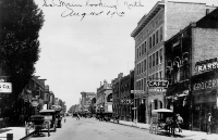
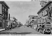
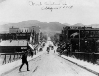
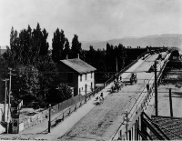
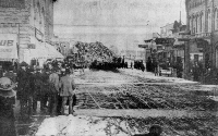
(left) View looking west on West Center, about 1890. The Hub Building is on the right hand side. The next cross street is Main (then Cleveland Avenue). The Pioneer Building is southeast of the intersection of West Center and Main. Bannock County Historical Society Collection. (right) View of the 100 block of South Main Street looking north, August 1913. Both horse-drawn and internal combustion vehicles are on the street. The Nicolet (Whitman) Hotel occupies the tall light-colored building. The Palm Cafe (originally the Wrensted Building) to the right of the hotel was destroyed by a windstorm in June, 1992. The site was rebuilt in 1993 as the Continental Bistro. The Pioneer Building is on the southeast corner of Center and Main. In 1996 the downtown U.S. Post Office branch was relocated there. The Petersen Furniture building can be seen in the distance on the east side of Main. This street was, until 1906, called Cleveland Ave., but the name was changed because of retrospective political animosity toward the Democrat, the only man to be twice President. Bannock County Historical Society Collection. |
|
Naming the Streets of Downtown
The matter of naming the streets tells us something of the political character of the early town. At the outset, streets paralleling the railroad were named for presidents, beginning with the current president, Harrison, next to the right-of-way, and moving westerly by earlier presidents in a reverse order, that is, Cleveland, Arthur, Garfield and so forth. The equivalent streets east of the railroad were given number designations, viz. 1st, 2nd, 3rd, etc. East-west cross streets on both sides of the tracks were given letter designations, A, B, C, etc.
By 1906, the growing municipality felt the need to require the numbering of buildings to facilitate "free" mail delivery and to give some streets more appropriate names. The east-west street designations were changed from letters to the names of early explorers, trappers, generals, railroad officials and the like, which names they still bear. One American president was slighted in the naming of Pocatello's streets. As already noted, the street next to Harrison was Cleveland. In 1906, a Republican city council responded to a petition signed by every merchant along Cleveland Avenue by changing its name to Main Street. Not only that, but in later years a plat annexed to the north side of town bore the names of the presidents following Harrison, and although the next president in time was Cleveland, the new plat picked up the president names with McKinley, so that the man who was president twice does not have a street named after him in Pocatello.
Dusty Streets and a City Divided
The problems faced by the young town were those of all frontier communities. The fine loess soil produced clouds of dust when wagons rolled over dry streets. The streets were not paved so it was necessary to water the streets to keep the dust down. However the city water supply was privately controlled and little water was made available for this purpose. Sidewalks were slow in coming.
The only way to cross the tracks between the two sides of town was by using at-grade crossings. Because of the number of trains using this busy terminal, it was hazardous to cross the tracks, especially for school children. Coal smoke from steam engines was always in the air and cinders found their way into every nook and cranny.
 |
 |
|
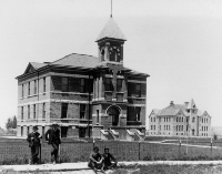
(left) Early 1920s postcard of Main Street, Pocatello, looking north near the intersection with Lewis. On the left is the Benson Hotel. On the right is the present Station Square, then the Fargo-Wilson-Wells Department Store, which housed the bus depot and the Western Union office. Bannock County Historical Society Collection. (right) View looking north from East Center Street at the Bannock County Courthouse in foreground and Bonneville School in background, about 1903. Note the lack of trees. The Courthouse was built in 1902, added onto in 1913 and razed in 1955. It occupied what is now the parking lot of the new courthouse, which was built in front of it. The school (on the present site of the U.S. Post Office) was built in 1895 and razed in the early 1960s. The Bear Lake County Courthouse (still standing in Paris) has the same architectural design as the old Bannock County Courthouse. Bannock County Historical Society Collection. |
|
Pluralism
At the turn of the century "Downtown" was on the west side of the tracks, as were the best residences and several churches. On the east side there were more commercial establishments, many being of a kind not desired on the west side, such as the "walled city" red-light district, a number of saloons and houses of minorities. Being a railroad town, in the 1910s and 1920s Pocatello became a city of cultural diversity with communities of Blacks, Greeks, Italians, and Chinese. This mosaic flavor remains today, with the addition of University Professors.
 |
 |
 |
|
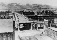
(left) East end of Center Street Viaduct, spring 1914. Note the Mansard Roof of the Pacific Hotel, which had to be partly destroyed to make way for the viaduct. The old freight depot is north of the Pacific Hotel, with the peaked roof. The right angle bend was required by East Center Street merchants who feared they would be cut off from business if the east slope of the structure were continued to street level. Pocatello economic development has always been difficult, and sometimes stupid decisions had lasting impacts. This was one. Bannock County Historical Society Collection. (center) View of West Center Street from Center Street Viaduct, August, 1915. The automobile had taken over personal transportation from the horse. The Kane Building, built in 1915, is the white brick structure on the south side of West Center. The hand written date on the photo is incorrect. Bannock County Historical Society Collection. (upper right) West side of Center Street Viaduct over the Union Pacific tracks, summer 1912. This viaduct was the source of the term "going over town." Note the Indian riding a horse accompanied by his dog on the sidewalk. Three early motorcars are on the crest of the bridge. The Pacific Hotel (reduced in size) can be seen north of the viaduct. Bannock County Historical Society Collection. |
 |
|
| Parade with Santa Claus at the head on the west side of the Center Street Viaduct, December, 1913. Picture taken from the corner of Center and Main. The Hub Building is on the left, and the Pioneer Building is on the right. Bannock County Historical Society Collection. | ||
The Center Street Viaduct
The Center Street Viaduct and the Halliday Street Subway were built in 1911 by the Union Pacific Railroad, on contract to the city of Pocatello, to allow traffic to cross the tracks without danger or interference with railroad operations. The viaduct opened Oct. 3, 1911, and the subway in August, 1911. The viaduct was replaced with the present subway in 1934.
Congregational Church
The Congregational Church was the first church in Pocatello. Its history is recorded by Minnie Howard (1927). Starting in 1887, the church met in one of the houses owned by the railroad in Company Row east of Harrison Avenue. The first sermon by a Congregational minister took place at 145 North Harrison on February 24, 1888. Formal organization of the Congregational Church took place on July 8, 1888, with 13 charter members.
On November 10, 1888, construction was commenced on a separate church building on West Center Street by the alley between Cleveland (now Main) and Arthur Avenues. This was a small structure, only 22 x 36 feet, but it had a steeple, built in 1890, to house the first church bell in Pocatello.
Need for a larger building was apparent and under the direction of Rev. C.W. Luck, lots were purchased where the present church stands, at the northwest corner of North Garfield and Lander, despite objections that this was "too far out" of town. The new church was occupied in 1894 and enlarged in 1928.
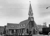 |
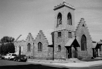 |
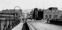 |
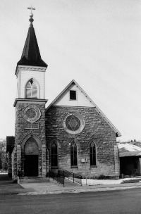 |
||
|
(left) Trinity St. Andrew's Episcopal Church, built in 1898 in Gothic Style. First stone Episcopal Church in Idaho, (March, 1993). (center) First Congregational Church, Pocatello, Idaho, built in 1894 with rear addition added in 1928, (March, 1993). (upper right) View of east side of Center Street Viaduct, 1914. Eastbound traffic off the viaduct made a right turn and a full clockwise circle under the viaduct to get back onto East Center. Westbound traffic turned north on 1st Ave. and then back south on an on-ramp to get onto the viaduct. The Phoenix Building is to the right of East Center. The Pocatello House Hotel with the pointed cap is east of it. The building with the gabled top was the Pocatello Opera House, which burned in 1899 and was rebuilt as an auditorium. It now is occupied by Southeast Furniture Store. The gable is no longer there. The Commercial Hotel (later the Keystone Hotel) is the large building on the north side of East Center. Bannock County Historical Society Collection. (right) St. Joseph's Catholic Church, built in 1897, (March, 1993). |
||
St. Joseph's Catholic Church
Catholicism was the most successful European religion in the western United States during the early fur trapping period. In efforts to convert Native Americans to the white man's religion, Catholics were much more successful than Protestants, the trappings and mysticism being more attractive than the straight-laced Calvinist doctrine. Beginning with the missionary zeal of Father Pierre Jean De Smet in 1840, there was a strong Catholic presence among the Pioneers, the railroad workers and the early settlers in Idaho Territory.
An Idaho Vicariate was formed in Boise in the 1860s and this church served the religious needs of Idaho Catholics in the Pocatello area until 1889. At that time, a small church was erected in the 100 block of South Garfield. In 1891, the present properties where St. Joseph's Church and Convent are located were obtained, but the church on South Garfield continued to be used and a parochial school was conducted in the building beginning in 1892.
The small church could not accommodate the school and growing church attendance and in 1896 ground was broken on the present property for a permanent church which was completed and dedicated in 1897.
Growth was constant and in 1914, St. Anthony Church was built on the east side (the ethnic side) of town. In 1919, ground was broken for a school building and convent next to St. Joseph's church.
The Need for Water in a Semi-Desert City
Early Pocatello used the Portneuf River for all its water needs. Hemmed in by the reservation, and severely so until 1888, the railroad junction had other problems than a pure source of water. Since the site was a barren sagebrush flat and covered with fine loess soil, the perennial late summer winds made it a dusty and scruffy place.
Pocatello Portrait and the Water System
The book "Pocatello Portrait" by H. Leigh Gittins, chronicles the early history of the city and especially the water system. A group supported by banker James A. Murray of Butte, Montana developed the first water supply in Pocatello in 1892, from Gibson Jack and Mink Creeks. Parts of the flume can be still seen on the north side of Mink Creek. A reservoir was built on the West Bench, and trees were planted. After fifteen years, this had become a "beautiful park-like area." In 1893, the city attempted to buy the system from Murray, but the matter was defeated by the city council. As was predicted at the time, this was an expensive mistake for the growing city. Murray was never anxious to spend his money to upgrade the system and conflict continued for twenty years.
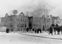 |
| Fire destroys Pocatello High School, December, 16, 1914, two years before the city obtained control of its water system. After this fire and a severe drought in 1915, fire underwriters refused to insure the city because of low water pressure. The new Pocatello High School was built on the same spot, and opened two years later, in 1916. A major addition, including the gymnasium, was built in 1939. Bannock County Historical Society Collection. |
In 1898, an outbreak of typhoid fever caused alarm, as did the customary finding of dead gophers, toads, and rotting debris in the screens in the reservoir. In 1898 the City Council established water rates favorable to Mr. Murray, and for a time he and his water superintendent George Winter took better care of his system. In 1899, the city council passed an ordinance to contract for sprinkling of parts of the downtown streets. Since no one had water meters, excessive use could not be controlled, and summertime water shortages were standard procedure. A fire during a time of low water pressure would have been disastrous. The Union Pacific Railroad provided water from Batiste Springs west of town during emergencies.
Droughts and Urban Conflict, 1900s Style
The droughts of 1900 and 1901 caused enmity. Water system owner Murray at times was stubborn and intransigent. The poor quality and uncertain quantity of water provided by Murray's water system was a recurring concern. To prevent problems like those of August, 1903, when two full bands of sheep were found bedded down on the intake dam on Mink Creek, the Pocatello Forest Reserve was established later that year around the headwaters of Gibson Jack, Mink, Cusick, and City Creeks. However periodic drought and lack of maintenance remained troublesome. The flood of January, 1911, was a catastrophe, especially after the dry year of 1910. A lynch mob or "posse" was sent to the water reservoir in August, 1911, after Superintendent Winter had fired shots at a deputy sheriff. Winter was arrested quietly, and eventually convicted of resisting an officer. A major building boom began in 1913, but concerns over inadequate water supplies continued.
Establishment of a Public Water System
The city took James Murray and company to court over rates and finally, in 1914, won ownership of the water company. A water bond was passed August 26, 1914. However, appeals of the decision to the Idaho Supreme Court and intransigence by Murray delayed city possession until 1916. Water meters were installed shortly thereafter.
Water Meters and Annexation of Alameda
Some progress comes slowly in Idaho. In 1996, much of what had been the town of Alameda still did not have water meters in private houses, pursuant to an agreement made when Alameda was consolidated with Pocatello in 1962. The mayor of Alameda at the time was George Hansen, later long-time congressman and convicted felon. The annexation made Pocatello, for a short time, Idaho's largest city. Boise immediately annexed ground on its perimeter and regained first place.
Although many in Idaho and even some in Pocatello, do not know this, the Portneuf River area contains a great diversity of natural settings where birds and wildlife may be seen through all twelve months. Glenn Ray Downing's 1991 book "Days Out Of Doors" contains a year's cycle of vignettes on nature close to Pocatello. Despite years of industrial abuse, the Portneuf Valley remains a gentle and beautiful place. |
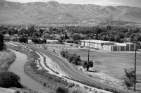
|
Photograph by Cook Photography, Bannock County Historical Society Collection. |
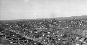
Public Water and Growth before World War I
With public ownership of the municipal water supply in 1916, growth was facilitated. The Pocatello water case was a benchmark in the early years of the Idaho Public Utilities Commission, but the lasting solution to Pocatello's water problems did not come until 1926, when the first city well was drilled at what is now Lower Ross Park. The Pocatello water system uses several wells to tap the Portneuf River Aquifer, which easily has sufficient capacity for today's use. Even during prolonged drought years the levels of the city wells historically have dropped only a few feet.
The Fort Hall Canal
In 1907, Idaho Senator Fred T. Dubois, who had risen to power by advocating and exploiting anti-Mormon laws of the 1880s, helped negotiate the building of the Fort Hall Canal, which would provide water by May, 1911, to 14,000 acres of Indian land and 12,000 acres of land ceded to whites. The canal ran along Hiline road, through the east side of Pocatello, along the alley between 5th and 6th Avenues, across the Idaho State University campus and behind Mountain View Cemetery. It is an interesting geographic fact that this water comes from the Blackfoot River rather than from Ross Fork or the Portneuf.
Frank Paradice
Frank C. Paradice, Jr. was Pocatello's foremost architect in the first half of the 20th century. Paradice designed or redesigned most of the buildings in downtown Pocatello between 1913 and 1952. These include the Valentine Building (former First Security Bank), Fargo Building (Station Square), Central Building (Harrison's Jewelers), the Old Federal Building (Dudley's), and Pocatello High School. Paradice was a master of the Art Deco and Neoclassical Revival styles.
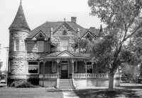 |
| The Standrod House, north Garfield Ave., (June, 1992). |
The Standrod House
A majestic house on the west side of Pocatello is on the National Register of Historic Places. Built in classical revival style, the two-story, turreted castle cost around $12,000 to build in 1902, at a time when a dollar was a dollar. The 16 room structure is faced with stone which was quarried in the McCammon area. After a period of little use, the City of Pocatello acquired the house in 1974 and it was available to rent for special events until 1995. Because it was not handicapped-accessible it was sold in 1995, and is presently occupied by the Backroom furniture store.
The Standrod House was built by Judge D.W. Standrod. Standrod was born in Kentucky in 1858, and lived first in Idaho in Malad City where he was associated with banks. He was a member of the drafting committee for the Idaho Constitutional Convention in 1889. While he ran for several political positions, he was never elected (he was a Republican from a Democratic city). He was, however, a power in Republican politics in eastern Idaho. He served as a district judge in Pocatello.
The Standrod family was prominent in civic and cultural affairs. Mrs. Standrod was active in women's clubs. A daughter who was active in school activities and a leader of her class died at 16, to the great distress of the family. A son, Drew Standrod, Jr., lived in Pocatello for many years and died in 1937. A veteran of World War I, he was a well-known attorney, was musical and a leader in community cultural activities.
The judge died in 1942. The castle passed to his wife, who died in 1946, and the house passed to Drew Jr.'s wife who lived in it for a few years, then moved to the east, boarding up the house. It was sold in 1957 to Mrs. Madelyne Roper who lived in it until she sold it to the city.
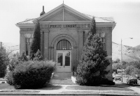 |
| Carnegie Library, Garfield Ave. and Center St., (June, 1992). |
The Carnegie Library
In the early 1900s, steel industrialist Andrew Carnegie began a program to encourage education by financing community libraries across the United States. Carnagie was an immigrant from Scotland who had little education but who realized the importance of education, especially for the stream of immigrants who lacked sufficient education to compete in the American job market. His public program furnished libraries for thousands of communities across the country.
Many towns in Idaho have such libraries. The one in Pocatello, at the corner of West Center and South Garfield, was completed in 1907 at a cost of $12,000.The two story structure was larger inside than it appears but the library service outgrew the building prior to World War II. It was not until the 1950s that the city could construct a larger building on East Clark Street to replace the cramped Carnegie facility. In 1994 a new, larger Marshall Public Library was built on the original site, attached to the original Carnegie Library. The Bannock County Historical Museum occupied the old library building until its grand new home in Ross Park was completed in 1990.
The initial Carnegie Library was a city service, administered by an appointed library board and full salaried librarian. The first board chairman was Judge F.S. Dietrich. Dr. Minnie Howard, prominent Pocatello physician, historian and women's rights advocate, who lived just next door to the structure, where the new library now stands, also was a member of the first board.
In the 1910s a matching structure was erected across from the library on the east side of South Garfield as a Methodist Church. It, too, was outgrown and was replaced in the late 1950s by the present church at the corner of North 15th and East Clark. The original structure no longer exists.
Hydroelectric Power
In 1892 Daniel Swinehart built a 60 kw power plant and mill at 1000 N. Grant, near Irving Junior High School. The power house in the picture below was built in 1899, and owned by the Pocatello Power and Irrigation Company. It was located at the corner of West Wyeth and North Johnson, and had a capacity of 100 kw. The dam backed up a reservoir in the area of the present Memorial Building which was a park, and used for skating in the winter. The Rainey Park area was also flooded and the ice harvested for refrigeration. In 1902 the power plant was sold to the American Falls Power, Light and Water Company. In 1915 all power companies were acquired by what was to become Idaho Power Company, and operations were moved to the Snake River at American Falls. In 1926 the American Falls Dam was built.
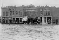 |
| Flood on the east side of the 100 block of South First Ave., January 1911, caused by a rapid thaw and rainstorm. The floodwaters came west from the hills at the head of Center Street. The Phoenix Building is on the corner of South First and Center Street. The Rooming House south of it became the Porters and Waiters Club, which was owned by a black man and one of the only places that transient blacks could stay in Pocatello at that time. Bannock County Historical Society Collection. |
Floods in the Portneuf Valley
The Portneuf River, occupying the channel of the Bonneville Flood, and following the path first carved by Bear River, in summer is quiet, muddy, and easily waded. However, it has repeatedly flooded the downtown Pocatello area. The floods have been caused either by heavy winter rains in January and February on snow-covered and frozen ground, or by high runoff of the melted snow pack in May. After two successive February floods, in 1962 and 1963, Pocatello City and Bannock County requested the help of the U.S. Army Corps of Engineers. The Corps designed and built (in 1965) the concrete flood control channel which now winds through the west side of downtown Pocatello.
This channel, functional though it may be, is a scar on the tree-lined neighborhoods of the west side and an albatross around the image of Pocatello as a beautiful city nestled against the southeast Idaho mountains. The open sewer or river channel remains, stark, fenced, and sterile, but it cannot be easily removed, since it belongs to the U.S. Government, was built to highest engineering standards, and does an excellent job of controlling floods.
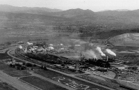 |
| Aerial view, looking east, of the phosphate plants west of Pocatello. The FMC elemental phosphorous plant is in the foreground with the J.R. Simplot Company phosphate fertilizer plant (with the white domes) in the background. Waste products or "slag" from these plants were used until the 1990s to surface the streets of Pocatello. This practice was stopped because of concerns over health hazards related to the higher than normal background content of radioactive minerals in the slag, (July, 1990). |
Pocatello: Idaho's Industrial City
Pocatello located at the mouth of Portneuf Narrows for reasons of transportation, and has always been a transportation and industrial center. It remains, in 1996, the only truly industrial community in Idaho. Processing plants using phosphate rock from the mountains to the east employ hundreds. Many light industries are found in Pocatello, serving all of eastern Idaho. There is still a sizable blue collar work force.
Pocatello is also unique in that it has ethnic communities who have lived there for many decades. These groups came with the railroad, and stayed through labor disputes and layoffs, and now serve to make Pocatello ethnically and racially diverse, another anomaly in Idaho.
Reflecting this blue collar and ethnic population base, Pocatello generally has elected Democrats to the State Legislature although the area outside Pocatello and indeed most of the state is traditionally strongly Republican. This political fact has contributed, in recurrent manner, to the general fact that in Idaho, Pocatello and Idaho State University get State programs last.
Idaho State University
As Pocatello began to change from the railroad town of the early 1890s to an industrial city, a need was felt in the community for an institution of higher learning. The State University in Moscow was a long way from southeastern Idaho and seemed to have little interest in extending service to such a remote area. There were few public high schools as well. Most students received no education beyond grade school.
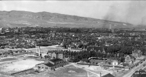 |
| Southern Branch of the University of Idaho, 1926. Many of these buildings are now gone. View looks north from Red Hill. On the right is Colonial Hall, under construction. The gabled building is Swanson Hall, before its third floor was added. West of it is the newly completed Frazier Hall, with a flat dark roof and concert hall with rounded east end. Science Hall was not yet built, nor was the L.D.S. Institute, nor the Dispensary. South of Frazier is Turner Hall, a women's dormitory, and east of it is the original Reed Gymnasium. In the distance to the right is the town of Fairview (alameda). The dark line at an angle across the right distance is the connector to the Union Pacific Montana Main Line. The dark area past the smoke in right distance is the tie treating plant, which bordered Old Highway 30 near the old Kraft Cheese Plant. Note the newly planted trees in a new subdivision on the northwest end of town. In downtown the Brentwood (Wooley) Apartments and the Bannock Hotel are prominent, as is the Petersen Furniture building on North Main, which still stands. The Center Street Viaduct crosses the railroad in the center of the view. Photograph by Cook Photography, Bannock County Historical Society Collection. |
Public spirited citizens in Pocatello campaigned for an institution which could fill the needs of the community and after the establishment of Bannock County in 1893, with Pocatello as the county seat, the campaign intensified. Senator Theodore F. Turner from Pocatello drafted a bill entitled "An Act to establish and maintain a school to be called the Academy of Idaho at Pocatello." The Act provided for a board of trustees, for the sale of bonds for erecting and equipping buildings and made an initial appropriation. The bill was passed unanimously by the Idaho Legislature on February 25,1901. One of the most notable trustees was Theo Swanson, for whom Swanson Hall was named.
The Act established the purpose as being the teaching of all the subjects commonly taught in high schools, "including also the various studies pertaining to a good common school education" and it contained a unique provision that its enactment was contingent upon the citizens of Pocatello donating to the board of trustees prior to May 1, 1901, two blocks of land adjacent to each other within the Pocatello townsite. There was considerable maneuvering and posturing over this provision but ultimately four blocks on the far southeast side of town were donated at the very last minute and the academy was assured. At first the academy served as a high school for students from southeast Idaho, and generally not from Pocatello, since it had its own high school.
A building program was commenced and by the opening bell on September 22, 1902, the Main Building, later called Swanson Hall, was completed. It was modern in every respect. A boy's dormitory, named Faris Hall, was completed in 1903. Room and board cost $16.00 a month. There was no tuition although out-of-state students were charged $5.00 a term.
There were forty students and four teachers at the opening bell but a total of seventy students were enrolled during the term. By the third year of operation, student enrollment was 122 and the faculty had increased to six. By 1906, a girl's dormitory was finished and student enrollment was up to 186, with construction of a mechanical arts building nearly completed. A library was planned and an infirmary constructed by 1907.
Originally, admission was restricted to students who had completed the eighth grade and could pass examinations in arithmetic, grammar, geography, history, reading, spelling and penmanship, or could show latent ability to do the work. In 1905 the Academy inaugurated a preparatory program to encourage the enrollment of students who had not had an eight grade education but were deserving of the opportunity to progress. In 1907, when President John W. Faris was succeeded by President Miles F. Reed, emphasis was placed on technical and teacher training, and preparatory classes.
In 1915, the academy was renamed the Idaho Technical Institute and given a two-fold purpose, as a vocational trade school and a junior college, with emphasis on occupational courses necessary in the industrial town of Pocatello. During the "Tech" period, Reed Gymnasium, Residence and Colonial Halls, Frazier Hall and a larger engineering building were added to the campus. A pharmacy school also was added. As the institution continued to move from technical and vocational emphasis to traditional academic courses, it was associated with the State University and the name was changed to the Southern Branch of the University of Idaho, commonly referred to as "The Branch," or often as "The Twig." Pharmacy became a four-year, degree granting curriculum.
Agitation began to establish the school as a four-year degree-granting college, and for years attempts to pass such a bill in the legislature were defeated, the University at Moscow arguing that its role in providing higher education for the state would be damaged even though it was not providing such education for southern Idaho. A survey of education in Idaho in 1946, performed by the Peabody Educational Survey Commission, stated that the education needs in southern Idaho were not adequately served. The commission recommended establishment of the Pocatello school as a degree-granting institution and such a bill passed the legislature unanimously in 1947. It was named Idaho State College.
In the early 1960s, pressure mounted to establish the school as a university and in 1963, the legislature created Idaho State University. Enrollment that year was about 6,000. In the 1995-96 school year enrollment was over 12,400. Both academic and vocational degrees are offered, with over 100 programs of study leading to bachelor's degrees, 46 masters degree programs, and 11 doctoral degrees, as well as 22 certificate programs in vocational education. The 800-acre campus includes more than 50 buildings and the first enclosed stadium in Idaho, formerly the Minidome and now the Dubby Holt Arena.
Most of the early buildings at Idaho State University have been torn down over the years, in notable contrast to many European and eastern U.S. Universities. Some of the early buildings had problems with unstable foundations, especially exacerbated by shaking due to earthquakes. Others were simply too small for modern uses. Baldwin Hall, the former science building, was the latest casualty, torn down in 1992 because of foundation damage.
The soils on the east side of town contain collapsible loess and clays deposited in marshes and lakes at the head of the ancestral American Falls Lake. Soils on the west side of town are on sands and Boulder gravel of the Lake Bonneville Flood and have proven more competent to supporting late 19th century buildings.
The Future: Pocachub, Pocabuck, Chubpo or Chubatello
The boundaries of Pocatello have been enlarged gradually over the years, although they have reached a rather acrimonious limit at the border of what is now Chubbuck, an initially rural community that now blocks Pocatello's growth to the north and threatens Pocatello's place as Idaho's second city. Chubbuck politicians, in the best tradition of Idaho obstructionism, have refused to even discuss the possibility of the merger. The merger might occur when the present generation of politicians passes, sometime in the 21st century. Federal standards impose "rural" status on communities of less than 50,000. Without Chubbuck's population, Pocatello was, until 1996, classified as "rural," resulting in reduced Federal funding of various programs, to the detriment of Chubbuck as well as Pocatello.
 |
 |
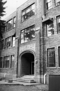 |
|
(left) Archway of Swanson Hall on the ISU campus, (January, 1993). Note crows in the elm trees along the Ralph Wilson Memorial Tree Walk, most of these trees are now gone and the Physical Science Building addition, completed in 1996, stands to the right of the arch. (top center) Pillars of learning on Red Hill, with Big Southern Butte in the background, view looks northwest, (June, 1992). |
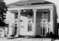 |
|
|
(center) McHan-Henderson Funeral Home, 1950s. The home stood west of South Arthur near West Lewis. The mortuary was torn down but the pillars can now be found on Red Hill, a gift of the Jack Henderson family. Some say the pillars are to mark the"Athens of the Intermountain West." Bannock County Historical Society Collection. (right) Baldwin Hall immediately prior to demolition, (October,1992). |
||
Portneuf Greenway
The Portneuf Greenway Foundation, founded in 1993, has taken upon itself the task of spearheading the reclamation of the Portneuf River for the people of Pocatello, through a string of parks and paths. Whether the concrete channel can be molded into something approaching the greenways of Boise, Idaho Falls, Blackfoot and other cities is a difficult issue. In any event, the building of the Greenway will enhance real estate values, recreational opportunities, and quality of life in Pocatello.
A major positive step for the Portneuf greenway was announced in June 1996 when the J.R. Simplot Co. purchased the Swanson Ranch on the north end of Pocatello. The Simplot Co. plans to leave the river in its natural state and construct trails along it.
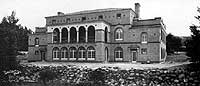 |
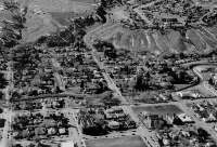 |
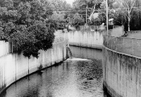 |
|
(left) Memorial Building, on the west bank of the Portneuf River at Fremont Street. The Memorial Building was built in recognition of World War I veterans and dedicated on May 30, 1926. Alex Mathers, Pocatello contractor, was the largest individual contributor to the building cost. Note the piled up rip-rap on the west bank of the river, consisting of boulders of basalt, carried by the Lake Bonneville Flood. The Memorial Building is one of the few Pocatello public meeting halls where alcohol can be served. The open-air porch on the second floor has been closed in and the concrete Portneuf River flood control channel has replaced the wall of boulders. (center) Portneuf River flood control channel and storm drain, after a summer thundershower, looking south from the Memorial Building, (July, 1991). (right) Portneuf River flood channel looking west at (l to R) Clark to Wyeth Streets. Memorial Building is in center of view. Idaho Power dam site was at the intersection of Wyeth and the river, (March, 1991). |
||
Fort Hall & Blackfoot Areas
| Founding of Fort Hall Unfurling an American flag actually was a violation of the Treaty of Ghent ending the War of 1812, which provided that the northwest should be jointly occupied by the U.S. and Great Britain. Fort Hall was actively used first as a fur trading outpost by Andrew Wyeth and associates, and after 1837, by the Hudson's Bay Company. It was closed in 1856. |
|
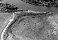 |
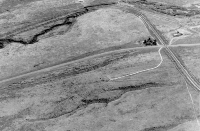 |
|
(left) Site of Old Fort Hall on the south bank of the Snake River. The Fort was located about at the small white monument between the slough and the sharp curve in the dirt road. A remnant of the Oregon Trail branch to the Fort can be seen cutting obliquely across the field in the middle of the photograph, (June, 1992). (right) Oregon Trail ruts along Lone Pine (Gay Mine) Road on the Fort Hall Indian Reservation, aerial view looking south, September, 1988. The Gay Mine railway crosses the road in the middle right part of view. Several paths of ruts can be distinguished on the north side of the road, east of the rail crossing. Ross Fork is in the distance meandering through cliffs of basalt. |
|
|
Osborne Russell's journal states:
|
Route of the Oregon Trail in the Fort Hall Area
Apparently the Oregon Trail followed several routes through the Fort Hall Bottoms. The unpublished recollections of W.A. Scadden who worked in the area of the old fort, make the somewhat heretical conclusions that the Trail did not, as generally thought, pass directly by the site of Fort Hall. Accounts are not very clear, but the ruts which are at the Fort do not seem to reflect travel by over 50,000 Pioneers and their wagons and stock.
Originally, the Trail generally followed present-day Sheepskin Road west from the present town of Fort Hall and after dropping down to the Bottoms, approached the old fort from the north. A trace of this route can be seen upstream from the Fort. It crosses the slough east of the site of the fort to the open area next to the walls where until 1843, Pioneers were convinced by Fort personnel to leave their wagons and instead to proceed further by foot or horseback. The Hudson's Bay Company wished Pioneers to believe that the route to the west was too rough for wagons, thus discouraging exploration and settlement. According to Scadden, as time went by, the main route of the Trail shifted away from the Fort and after coming down onto the Bottoms more than a mile south of Sheepskin Road, it forded Clear Creek and ran parallel to Spring Creek to the Portneuf River, with a branch crossing Spring Creek to the Fort, about four miles away. This main trail eliminated several creek crossings and after the Clear Creek ford, which is only inches deep on a good base, there remained only the ford of the Portneuf River as the Pioneers moved to the west.
Persons wishing to go to the old Fort could cross Spring Creek at a major ford and reach the Fort, four miles distant, after fording Big Jim Creek. This route actually is shorter than the north route. Hudson's Bay Company abandoned Fort Hall in 1856, after reducing its use for several years, so there was no longer any reason to visit Fort Hall.
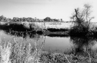 |
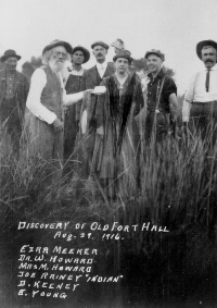 |
|
(left) View of the slough at Old Fort Hall from near the site of the old fort. The Oregon Trail branch probably crossed this slough here, (September, 1988). (right) Photo taken at Old Fort Hall, August 29, 1916. Ezra Meeker (old man on the left of the front row) was a pioneer who traveled the Oregon Trail in the 1850s and settled in Washington State. In 1916 he returned along the trail with a covered wagon and a team of oxen. Joe Rainey, an Indian and former U.S. Army Scout (left background) pointed out the site of the original fort, which had been lost in the marshes and meanders of the Fort Hall Bottoms. Dr. Minnie Howard and her husband Dr. W. Howard (behind and to her left) were champions of preservation of Oregon Trail and Pocatello history. They were both medical doctors and had four sons who became doctors. Howard Mountain, the volcanic hill northwest of the city, is named for the family. As this picture suggests, Dr. Minnie was not known for frivolity. Minnie Howard Collection, Idaho State University Library. |
Blackfoot
In 1880, Blackfoot was the largest city in Oneida County and residents thought that after the 1880 reapportionment of the Legislature their city was destined to become the new capital of Idaho territory. Eastern Idaho had more people than western Idaho. Oneida County had 2,000 more settlers than Ada County. But in a scenario which has been repeated time and time again in Idaho history, eastern Idaho came out on the short end. The apportionment committee was pressured by a group from Boise. Eastern Idaho received one vote less than the western counties, leaving Boise as the territorial capitol. Now Blackfoot is county seat of Bingham County and the Potato Capital of the World.
Gay Mine
The rocks north of Big Spring, east of Fort Hall, include the Permian Phosphoria Formation, which was mined at the Gay Mine (named for J.R. Simplot's daughter) from 1946 to 1993. Simplot, born in Dubuque Iowa, and raised in Declo, south of Burley, was an eighth grade dropout, and millionaire at the age of 30. In the 1990s he is one of the last American industrial barons. After beginning in the potato growing and shipping business, he developed a potato and onion dehydration plant near Caldwell, Idaho, in 1941, and sold his product mainly to the U.S. Government to feed soldiers in World War II. A scarcity of fertilizers prompted Simplot to enter the phosphate fertilizer business with the construction (using low-cost government war loans) of Idaho's first phosphate fertilizer plant west of Pocatello in 1944.
In 1946, Simplot negotiated a deal with the Bureau of Indian Affairs to open a mine on the Reservation east of Fort Hall, and in 1948, a rail line leading to the mine was built by Morrison-Knudsen Company under contract with Union Pacific Railroad.
The Gay Mine was closed down in 1993. Its ore reserves have nearly been exhausted. In the late 1980s, the Simplot Company opened a new phosphate mine at Smoky Canyon west of Afton, Wyoming, and FMC opened in the early 1990s, a similar new mine in Dry Valley, northeast of Soda Springs.
In 1977 Simplot and two of his companies pleaded no contest to charges of tax evasion and were fined $40,000 for failing to report $1.3 million in income. J.R. always pushed things to the limit. In a 1980 interview with an Associated Press reporter Simplot said "I'm an old man, but a tough old man. I've been lucky. I've had good people with me. I've had some breaks. But I made a lot of my breaks, son. I've been overextended all my life. It keeps me hustling."
|
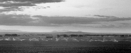
Root Hog, Big Butte, & Craters of the Moon
Geology of the Snake River Plain
The Snake River Plain contains Pleistocene basalt and interbedded sediment in the upper few hundred feet. The Snake River Plain Aquifer, the key to southern Idaho's agricultural economy, mainly consists of basalts and interbedded sediments, deposited in Pleistocene time (the last 2 million years). The underlying rhyolite does not seem to be a major aquifer because many of the pore spaces are filled with chemical precipitates. Within basalts, permeable zones are mainly the tops and bottoms of lava flows, with columnar jointing providing vertical transmission of water.
Big Southern Butte
The Big Butte, elevation 7,560 feet, is a prominent landmark visible from the entire Pocatello-Fort Hall-Blackfoot-Burley-Arco area. The Butte is a composite rhyolite dome that was intruded about 300,000 years ago and poked through a capping of basalt lava. This uplifted lava is now present on the north and east side of the Butte. For more discussion of the Butte and the surrounding geology see Bonnichsen and Breckenridge (1982), Pierce and Morgan (1992), and Hackett and Smith (1992).
Goodale or Jeffrey's Cutoff
The Goodale or Jeffrey's Cutoff of the Oregon Trail headed north from Fort Hall toward the Big Butte, crossed the Snake River Plain and wound along its northern margin through Camas Prairie to the main Oregon Trail west of Mountain Home. Its use increased after 1864 as use of the southern route fell off.
Toponce Stage Line and Root Hog
In 1878, a stage line was established by Alexander Toponce, who had previously begun a cattle business in the Northern Portneuf Range.The stage ran from Blackfoot to the copper mines near Houston (mackay), and north to Challis.
A stage station northeast of the Big Butte tapped a spring on the side of the Butte that was the only reliable water source between the Snake River and the Big Lost River. In the 1880s, the proprietors reportedly let pigs run loose at the stage stop to keep down the rattlesnakes.
Half way from the Snake River to the Big Butte stage stop was another station known as "Root Hog or Die," later shortened to Root Hog. Water was hauled to Root Hog from the Big Butte by the stage company.
|
On June 25, 1887, the Idaho News of Blackfoot reported that:
|
Atomic City
There was a great influx of settlers to the Furrey (midway) area between 1910 and 1920. Every tillable acre was taken. A wet period ended about 1919, and wheat prices plummeted. Most of the homestead land was abandoned. After the "National Reactor Testing Station" (NRTS) was begun in the desert to the north, a flurry of excitement caused local boosters to extol the virtues and growth possibilities of the town and to rename it Atomic City, but its remote location and lack of amenities caused the boom to bust.
Idaho National Engineering & Environmental Laboratory
The Idaho National Engineering Laboratory (INEEL) was established as the Nuclear Reactor Testing Station in 1949. The INEEL site is 890 square miles of sagebrush desert, and contains large areas of young basalt lava flows as well as East and Middle (or Twin) Buttes, which are small rhyolite domes. It is the site of secret activities related to nuclear research. It is also a land of acronyms (cFA, RWMC, TAN, SPERT, NRF, and etc.) The "Site" first generated electricity with nuclear reactors in 1951. In 1955 Arco became the first town in the United States lighted by nuclear power. In 1992, the INEEL employed about 10,000 people, providing almost 5% of the jobs in Idaho; it is the mainstay of the economy of Idaho Falls area. The INEEL budget, in 1987, was $800 million, two-thirds as large as the budget for the state of Idaho ($1.2 billion).
It is ironic that this politically conservative and philosophically independent region, most of whose legislators are perennially distrustful of Federal Government programs and always opposed to any increase in taxes, is largely subsidized by Federal tax dollars raised mainly in other states.
American Falls Area
American Falls Lake
The ancestral American Falls Lake formed north of a basalt dam that formed at Duck Point, east of Massacre Rocks, about 72,000 years ago. The ancestral lake covered a larger area than the present one, and may have reached into what is now downtown Pocatello. The American Falls "lake beds" contain a lower fluvial member and an upper light-colored clay member deposited under water of a perennial lake. The flood plain and lake margin sediments contain a unique assemblage of Pleistocene mammal fossils, including Bison latifrons, camels, short-faced bears, ground sloths, horses and mammoths. They overlie an older sequence of lake beds known as the Raft Formation. Early reports concluded that the American Falls Lake existed at the time of the Lake Bonneville Flood and was drained catastrophically by it (malde, 1968). Recent geological studies favor the view that a flood plain and fluvial complex had developed on the American Falls Lake beds by the time of the Lake Bonneville Flood (Hearst, 1990).
Michaud Flats and Lake Channel
The Lake Bonneville Flood about 14,500 radiocarbon years ago deposited a flat-topped delta of boulders, gravel, and sand in the area of Michaud Flats, up to an elevation of about 4,400 feet near the Pocatello airport. The flood waters cut "Lake Channel," a now-dry channel north of the Snake River and west of present American Falls Dam, which provided a means for the floodwater to escape the flat American Falls area.
Several other smaller channels exist near Lake Channel, but they carried less water and were abandoned when the main Snake River cut the basalt dam at Duck Point, allowing the floodwaters to follow the present Snake River. The water from Lake Channel emptied back into the Snake River just west of and across the river from Massacre Rocks State Park.
Oregon Trail near Massacre Rocks
The Oregon Trail followed the south side of the Snake River from the Fort Hall area across Idaho to Three Island Ferry. At Massacre Rocks, west of American Falls, and at other areas west of there ruts of the trail are still visible.
|
Oscar Sonnenkalb wrote:
|
American Falls
The town of American Falls grew up during construction of the Oregon Short Line Railway and became a major center for the wheat and stock growers of the area south and west of Pocatello.
Part of the old town of American Falls was moved in 1926 to higher ground during construction of the reservoir. Only the top of the grain elevator now pokes above the waters of the lake. In late summer when the water of the reservoir is low, foundations, sidewalks, and tree stumps of the old town are accessible.
|
American Falls itself, before the construction of the dam, was 800 feet wide with a drop of 50 feet over 200 feet. Oregon Trail pioneer Bryan McKinstry wrote in July 1850 that the water as it descends over the falls,
|
Aberdeen
Farmland near Aberdeen was initially settled, starting in 1906, by Mennonites from Newton, Kansas. Salesmen from the Twin Falls area had gone to the midwest and spoken to church groups about the new opportunities for irrigated farming on the Snake River Plain. The Mennonites are a sect of Anabaptist Christians, originally from Germany, who, because of their pacifist refusal to serve in war, were forced to flee from Holland and Germany to Poland and Russia, and later to immigrate to America. Building of irrigation canals allowed settlement of the Aberdeen area, and the town was incorporated in 1908, named for Aberdeen,Scotland.
The railroad branch line from Blackfoot, started by the Salmon River Railroad Co., but completed by Union Pacific, was completed in 1911. Also in 1911, The University of Idaho established the Aberdeen Agricultural Experiment Station. The next ten years were boom years.
The drought and agricultural depression of the 1920s and 1930s followed. The flooding of the American Falls Reservoir, in 1926, cut off the direct road across the Snake River to Pocatello. The town today remains quiet and agricultural, though Mennonites are no longer in the majority.
Arbon Valley
During the boom in dry farming in World War I, it is said that American Falls shipped more grain than any other station on the Union Pacific System. Homesteads had been settled in Arbon and Rockland Valleys and a prolonged wet period gave the farmers the taste of prosperity. This turned to the taste of failure with the crash in grain prices after World War I and several dry summers.
|
In her historical review of Arbon Valley, Laurie Ward wrote:
No matter that most dryland homesteads were not practical. This was part of the American dream. |
Rockland Valley
The sparsely populated Rockland Valley barely manages to support Rockland, a tattered town with a store, gas station, and Mormon church. This is mainly dry farming country, largely depopulated during the 1930's.
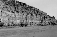 |
 |
|
(left) American Falls Lake beds, deposited between about 80,000 years and about 30,000 years ago in the ancestral American Falls Lake, (September, 1988). (right) Stumps of mature trees on street of Old American Falls, now covered much of the year by waters of the American Falls Reservoir. The town was moved in 1926 when the dam was built and the reservoir flooded part of the townsite. In drier years, the old town is accessible late in the irrigation year when the reservoir is almost empty, (November, 1990). |
|
|
Here are some recollections of Virgil Allen, born in Rockland Valley in 1914.
|
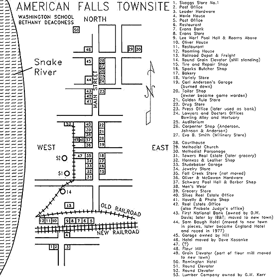 |
| Map of part of the Old American Falls townsite, after Idaho State Journal, September 20, 1992. Original is in American Falls Library. Number 1 on the map identifies the location of store number 1 operated by the Skaggs Brothers whose grocery business expanded rapidly, ultimately becoming the Safeway chain. |
Massacre Rocks
Massacre Rocks is a late Miocene (5-6 million years) basaltic eruptive center along the Snake River. Rising basaltic magma encountered groundwater from the Snake River Plain aquifer, causing explosive "phreatomagmatic" eruptions. Among the rock types present at Massacre Rocks are tuff breccias, which originated as wet mudflows on the flanks of the volcanic crater, lava flows, ash and cinder beds, lava ponded in a lava lake, and basaltic dikes of the core of the volcano. The Massacre Volcanics overlie older rhyolite that extends under the Snake River Plain.
Massacre Rocks got its name because of an Indian attack on the Adams wagon train on the Oregon Trail on August 9 and 10, 1862. It was one of a series of Indian attacks on emigrants that summer along both the California Trail and this part of the Oregon Trail. These attacks were perpetrated mainly by the band of Northwestern Shoshoni led by Chief Pocatello. At Massacre Rocks, ten immigrants were killed either in the original attack or in skirmishes following it.
 |
 |
 |
|
(left) Culvert under the Oregon Short Line Railroad, Old American Falls townsite, (October, 1987). (center) Wagon ruts of the Oregon Trail just east of Massacre Rocks State Park, south of Interstate 84. Some accounts place the 1862 massacre just east of here (October, 1987). (right) Beds of fragmental volcanic debris blown out of the Massacre Volcanic center about 5 million years ago. Photo taken southeast of Interstate 86 at the Massacre Rocks exit (April, 1995) |
||
References
-
Hearst, J.M., 1990, Paleontology and depositional setting of the Duck Point local fauna (late Pleistocene: Rancholabrean) Power County, southeastern Idaho [M.S. thesis]: Pocatello, Idaho State University, 275 p.
-
Bright, R.C., 1982, Paleontology of the lacustrine member of the American Falls Lake Beds, southeastern Idaho, in Bonnichsen, Bill and Breckenridge, R.M., editors, Cenozoic Geology of Idaho: Idaho Bureau of Mines and Geology Bulletin 26, p. 597-614.
-
Hansen, Sam, and others, 1984, Hard times in Idaho between the great wars: Pocatello, Idaho, Idaho State University Press (reprinted from Rendezvous, Idaho State University Journal of Arts and Letters, volume XX, no. 1), 90 p.
-
Harder, E. B. and Harder, H. K. (compilers), 1982, Seventy-five years at Aberdeen: A History of the First Mennonite Church, Aberdeen, Idaho: First Mennonite Church, P. O. Box 246, Aberdeen, Idaho, 83210, 383 p.
-
Malde, H.E., 1968, The catastrophic late Pleistocene Bonneville flood in the Snake River Plain: U.S. Geological Survey Professional Paper 596, 52 p.
-
Malde, H.E., 1991, Quaternary geology and structural history of the Snake River Plain, Idaho and Oregon: in Morrison, R.B., editor, Boulder, Colorado, The Geological Society of America: Quaternary nonglacial geology: Conterminous U.S., The Geology of North America, volume K-2, p. 251-281.
-
Scott, W.E., Pierce, K.L., Bradbury, J.P., and Forester, R.M., 1982, Revised Quaternary stratigraphy and chronology in the American Falls area, southeastern Idaho: in Bonnichsen, Bill and Breckenridge, R.M., editors, Cenozoic Geology of Idaho: Idaho Bureau of Mines and Geology Bulletin 26, p. 581-595.
-
Ward, Laurie, 1982, Bannock Valley: Keith W. Watkins and Sons, Inc., Providence UT 84332, 322 p.
Silent City of Rocks & Burley Area
The California Trail
The California Trail left the Oregon Trail and the Snake River west of the mouth of Raft River and headed south and west toward the Nevada desert. It was joined by the Hudspeth Cutoff near the town of Malta, on the west side of the Raft River Valley, and the two wound up Connor Creek and south to the Silent City of Rocks. There, a cutoff from Salt Lake City joined them, and a single trail led westward over Granite Pass at the south end of Middle Mountain toward the Humboldt river drainage.
The Almo Massacre: Folklore, not Fact
A recurring story in the City of Rocks area is of the Almo Massacre, in which 300 Pioneers on the California Trail were said to have been massacred by Indians in 1861. All their stock and belongings were allegedly taken and nothing was left. The bodies are said to have been buried in dry wells, and have never been found. This fable has no basis in fact, was never reported in a newspaper account, nor does it appear in any Pioneer diary (madsen, 1990). It is in the category of folklore, since it is a story that keeps surfacing. As such it must be culturally useful to those who hear and repeat it.
The Albion Range and the Silent City of Rocks
The Albion Range, including Mt. Harrison, Cache Peak, and the Silent City of Rocks exposes a "Cordilleran metamorphic core complex," one of several that extend from the Tucson, Arizona area north to northeastern Washington. The Silent City of Rocks is an Idaho treasure. The mysterious fins and monoliths eroded from the 30 million years old Almo Granite are perfect for rock climbing. A walk along the South Fork of Circle Creek when the aspens are golden is an unforgettable tour.
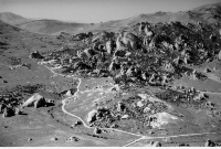 |
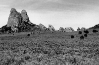 |
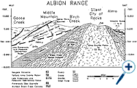 |
|
(left) Aerial view of the City of Rocks, looking northwest at the junction of the Oakley Road and the road south to Twin Sisters. Register Rock is immediately below the intersection. Other named rocks include Bath Rock, south of the Oakley Road near the summit. The creek draining the Silent City of Rocks is Circle Creek, (September, 1988). (center) Twin Sisters and the California Trail, looking west. The arcuate western contact of the Oligocene granite of the Silent City of Rocks pluton follows the edge of the granite monolith. West Twin Sister is the only rock made of Archean gneiss. The California Trail route can be seen in the foreground, slanting across the view. It passed behind the large light colored rock at the base of the view, (august, 1986). (right) Geologic cross section, west to east across the Albion Range City of Rocks area. Geologic units are as follows: Nv = Neogene volcanic rocks; Tg = Tertiary granite (Oligocene City of Rocks pluton); Z-Pz = Late Proterozoic and Paleozoic sedimentary rocks; Xe = Middle Proterozoic Elba Quartzite; Wgc = Archean Green Creek Complex (gneiss and schist). For more information see Miller and others (1983), Saltzer and Hodges (1988) and Bandy (1992). Click on image for a larger view. |
||
The upper part of the Albion Mountains is underlain by Paleozoic and Late Proterozoic metamorphic and sedimentary rocks, in places spectacularly folded, as along the road to the summit of Mount Harrison. The quartzites on the summit are structurally overturned. Below these is the green, micaceous Early Proterozoic Elba Quartzite, which can be seen in outcrops along the road below the Pomerelle ski area. South of Oakley thin-bedded micaceous quartzites including the Elba are quarried for decorative "Oakley stone," which is shipped throughout the United States and overseas. Under the Elba Quartzite is Archean gneiss and granite of the Green Creek Complex, exposed where the Mount Harrison road turns off Highway 22.
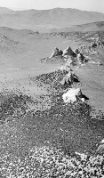 |
| The Twin Sisters, looking north from the California Trail as it leaves the Silent City of Rocks, (October, 1992). |
The contact between the sedimentary rocks and the gneissic basement is a ductile fault or mylonite zone, the Middle Mountain Shear zone, produced during rapid uplift and stretching of the earth's crust from about 40 to 10 million years ago.
The bedrock in the Silent City of Rocks is an Oligocene granite pluton which cooled about 30 million years ago. The granite intrudes gneiss of the Green Creek Complex. The City of Rocks pluton is the youngest granitic body in Idaho. The rock is coarse-grained and unfoliated. It weathers into characteristic rounded monoliths and elongate fins controlled by systems of joints produced by unloading during uplift.
On the south edge of the City of Rocks, at the Twin Sisters, called the Sentinels or the Citadels by immigrants, just north of the California Trail, the contact between the 2400 million year Archean Green Creek Complex (South Sister) and the 30 million year Oligocene City of Rocks Granite (North Sister) can be seen.
A unique type of Oakley stone is the green micaceous quartzite seen on the front of many 20th century buildings in southern Idaho and northern Utah. The green color of this "Elba Quartzite" is given by a Chromium-bearing mica, fuchsite.
Sublett Range
The Sublett Range west of Rockland Valley is composed of upper Paleozoic sedimentary rocks, mainly limestone, from which many fossil corals and other invertebrates can be collected. Because the bedrock is limestone, surface water is sparse, since water sinks into underground channels.
Cotterel and the Jim Sage Mountains
The Jim Sage mountains west of Raft River Valley contain several tilted Miocene rhyolite lava flows and ash-flow tuffs. They are best known for rattlesnakes and obsidian.
Settlement of the Cassia County Area
The first settlers to Cassia County area were Mormon emigrants from northwestern Utah, who came in the early 1870s. Beecherville (now Elba, named after the Mediterranean island where Napoleon had been in exile) was founded on upper Cassia Creek, eighteen miles east of Oakley, in 1873. Almo was founded in 1878 and named Alamo, after the great cottonwoods that grew there. The name became shortened to Almo.
|
Mary Jane Gorringe Tolman, quoted in Arrington (1979, p. 38-39) speaks of Mormon cooperative farming in the Oakley area in the 1880s.
|
Albion
Albion, at the foot of the range that bears its name, was called Marsh Valley and used by cattlemen in the 1860s. It was settled in 1869 and was county seat of Cassia County from 1879 to 1919.
In the 1890s, J.E. Miller, one of Albion's Pioneers, gave 5 acres of land for a Normal School. In 1893, Idaho's second legislature established 2 normal schools, one of which was at Albion. The college was closed in a cost-cutting move in 1952. Its fine buildings stand today, in a state of purgatory between destruction and restoration.
Mount Harrison and Lake Cleveland
In 1888, a controversy arose over naming of the mountain south of Albion. Mormons from Elba wanted to commemorate Democratic President Grover Cleveland. Republicans from Albion wanted to honor the new President Benjamin Harrison. Harrison won the Presidential election and the mountain was named after him. The glacially carved lake below the summit was named after Cleveland.
Settling of Oakley
The largest group of LDS migrants into south-central Idaho was the one that founded Oakley and other towns in the Goose Creek valley. This migration began in 1879 and consisted of residents mainly from Tooele and Grantsville, Utah. Oakley quickly became the headquarters for the Mormon community in southern Idaho. Horton David Haight, a veteran of the Mormon settlement at Nauvoo, became the first bishop of Cassia Ward. His father was the first settler of Farmington, Davis County, Utah. Haight served as first president of the Cassia stake from 1887 to 1890. The children from the union of Horton and Louise Haight became prominent citizens of early day Oakley and built most of the large brick houses which still stand. Victorian style architecture was still in vogue there, in the 1890s, even if it had lost its popularity in the rest of the U.S.
By the time other Magic Valley communities developed, twenty years later, bungalows and cottages were the architectural standard.
In 1905, Oakley had 2,000 people. Rails came in 1910. The town, in the 1990s sits at the western gate to the Silent City of Rocks and has potential as a tourist center, even though such catering to the whims of long-haired out-of-state rock-climbing tourists is antithetic to the ideological foundations of the city.
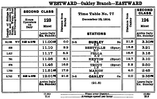 |
Raft River Valley
In the early 1800s, Raft River was a deep stream that inconvenienced trappers and travelers. Today it is depleted by upstream irrigation and is a muddy ghost of its former self.
A major effort at exploration for geothermal energy was made in the 1980s in the Raft River Valley south of Malta. A pilot plant for production of electricity by geothermal means was constructed by the Department of Energy, but the effort has not proven economically feasible.
Burley
Burley was settled in about 1910, as the headquarters for the Minidoka and Southern Railroad, and named for the first rail agent. Union Pacific completed building of the Twin Falls Branch line after taking over the Minidoka and Southern. The flat and productive fields between Oakley and Burley are irrigated with water from Goose Creek Reservoir, to the south of Oakley.
References
-
Arrington, L.J., 1979, The Mormon Settlement of Cassia County, Idaho 1873-1921: Idaho Yesterdays, v. 23, no. 2, p. 36-46.
-
Bandy, Philip J., 1992, Structural and kinematic analysis of the City of Rocks lobe of the Almo Pluton, Cassia Co., Idaho: An application of granite tectonics [M.S. thesis]: Pocatello and Boise, Idaho: Idaho State University and Boise State University, 105 p.
-
Madsen, B. D., 1993, The "Almo Massacre" revisited: Idaho Yesterdays, v. 37, no. 3, p. 54-64.
-
Maley, Terry, 1987, Exploring Idaho Geology: Mineral Land Publications, P.O. Box 1186, Boise, Idaho, 83701, 232 p.
-
Maughan, Ralph W., 1992, Anatomy of the Snake River Plain: An Amateur's View, Pocatello, Idaho: The Idaho State University Press, 69 p.
-
Miller, David M., Armstrong, R.L., Compton, R.R., and Todd, V.R., 1983, Geology of the Albion-Raft River-Grouse Creek Mountains area, northwestern Utah and southern Idaho: in Gurgel, K.D., editor, Geologic excursions in the overthrust belt and metamorphic core complexes of the Intermountain region: Utah Geological and Mineral Survey Special Studies 59, p. 1-63.
-
Mytton, James, W., Williams, Paul L., and Morgan, William A., 1990, Geologic map of the Stricker 4 Quadrangle, Cassia County, Idaho: U.S. Geological Survey Miscellaneous Investigations Series, Map I-2052, scale 1:48,000.
-
Saltzer, S.D., and Hodges, K.V., 1988, The Middle Mountain Shear zone, southern Idaho: Kinematic analysis of an early Tertiary high-temperature detachment: Geological Society of American Bulletin, v. 100, p. 96-103.
-
Wright, Bessie, M., Oakley, Idaho, Cassia County, Pioneer Town: 1987, Horizon Publishers, Bountiful, Utah, 211 p.
-
Williams, P.L., Covington, H.R., and Pierce, K.L., 1982, Cenozoic stratigraphy and tectonic evolution of the Raft River Basin, Idaho: in Bonnichsen, B., and Breckenridge, R.M., eds., Cenozoic geology of Idaho: Idaho Bureau of Mines and Geology Bulletin 26, p. 491-504.
-
Williams, P.L., Mytton, J.W., and Covington, H.R., 1990, Geologic map of the Stricker 1 quadrangle, Cassia, Twin Falls, and Jerome Counties, Idaho: U.S. Geological Survey Miscellaneous Investigations Series Map I-2078, scale 1:24,000.
Twin Falls Area & the Magic Valley
Twin Falls Area
Twin Falls is located on the south side of the Snake River Canyon in an area of Pleistocene lake beds. The soil is deep and rich except in areas scoured by the Lake Bonneville Flood on the north side of the canyon where the volcanic bedrock or fields of boulders or "petrified watermelons" remain.
|
The canyon of the Snake River exposes Miocene rhyolite underneath the cover of basalt lava. At Shoshone Falls and Twin Falls the Snake River cascades over this rhyolite in waterfalls carved during the catastrophic Lake Bonneville Flood about 14,500 years ago. Shoshone Falls are 212 feet high, higher than Niagara.
The dry waterfalls or alcoves (blue Lakes alcove) north of the Snake River were also carved during the Bonneville flood.
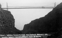 |
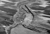 |
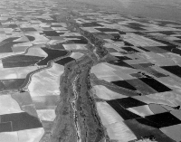 |
|
(top center) Snake River Canyon at Murtaugh Bridge, looking west, downstream.The town of Murtaugh is immediately to the left of the view. Note the scoured Bonneville Flood path, on which there is not enough soil to grow even irrigated crops. Caldron Linn is just upstream (to the right) from here, (July, 1989). (top right) Aerial view looking west, (June, 1991), of the Lake Bonneville Flood path near Murtaugh east of Twin Falls. The south branch of the flood followed the Snake River Canyon here while the farmland to the north of the river was not eroded by the flood waters. The north branch of the flood passed through the scoured basalt in the far right distance. The Hiline Canal can be seen to the south of the river. (mid center) Caldron Linn, a narrow waterfall along the Snake River west of Milner Dam. The name was chosen by the Hunt Party of Astorians,who in 1811 abandoned their attempt at navigating the Snake at this place.The word "Linn" is an old Scottish word for waterfall. The boiling waters were likened to a caldron (cauldron). During low water a person can almost jump over the river at the narrowest point, (March, 1993). (mid right) Twin Falls, 125 feet high, before 1910. A power plant now blocks the right (south) channel. Abe Lillibridge collection, Idaho State University Library. (bottom right) Shoshone Falls in one of the rare times of high water flow, (May, 1983). The falls are cut in rhyolite lava beneath the basalt cap of the Snake River Plain. Photo was taken near the site of a hotel built for railroad visitors from Shoshone in1886. This was replaced by a larger hotel in 1890 which, in later years, was served from Twin Falls by an electric interurban line. |
|
|
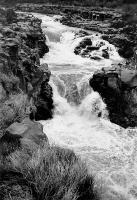
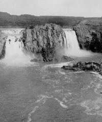
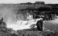
Rock Creek Store and Stricker Ranch
The Oregon Trail, and, in the 1860s, the Kelton, Utah to Boise, Idaho freight road, crossed Rock Creek about 6 miles south of what is now Hansen. This crossing avoided the deep canyon of Rock Creek to the north. The Rock Creek Store was built on this site in 1865, and purchased by Herman Stricker in 1876. After the closure of Fort Hall in 1856, this was the only place on the Snake River Plain where provisions could be purchased east of Fort Boise. The Stricker family lived here for almost 100 years and served travelers,miners, dam construction personnel, and ranchers. The site and original buildings have been preserved by the Friends of Stricker Ranch, Inc., P.O.Box 2218, Twin Falls.
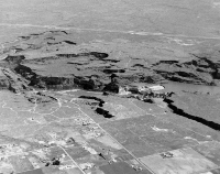 |
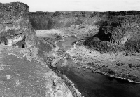 |
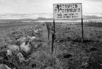 |
|
(left) Aerial view of Twin Falls and alcoves where the Lake Bonneville Flood emptied back into the Snake River. Note the lack of soil on the northside of the river where it was all eroded by the flood, (June, 1990). (center) Blue Lakes Alcove and spring-fed lake, looking north. Alcove was cut during the Lake Bonneville Flood, 14,500 years ago, (March,1993). (right) Road sign near King Hill, west of Twin Falls, (October,1990). The petrified watermelons are boulders of basalt moved by the Lake Bonneville Flood about 14,500 years ago. The sign reads: "Petrified Watermelons, Take one to your mother-in-law." |
||
The Carey Act and Milner Dam
Ira Burton Perrine spearheaded the construction of Milner Dam and the Twin Falls project which was completed in 1905. At the time this was the largest privately financed irrigation project in the world. The Magic Valley lived up to its name and boom towns sprang up. This boom was directly caused by the availability of irrigation water. Investors (Wendell and Jerome Hill, Buhl, Hansen, Milner) in Perrine's scheme got towns named for them.Other towns founded after construction of the Twin Falls project included Kimberly, Filer, Hazelton and Eden.
In 1905, the rail line was finished to Twin Falls and on to the end of the branch at Buhl. By the end of the year, Twin Falls had a bank, doctor,attorney, dentist, barber, school, newspaper, restaurant and rooming house.
Sheep and Cattle Grazing
Cattle boomed in central Idaho in the late 1870s. Sheep came later, and the Idaho woolgrowers organized in 1893. Future governor Frank R. Gooding was president and the sheep industry held great political power in the early 20th century. As with other western rangelands, bitter conflict between sheepherders and cowboys ensued.
Hagerman Valley
The sheltered Hagerman Valley, with nearby towns appropriately named (bliss),has a long growing season and abundant water supply, in stark contrast to the mountain and desert country just a few miles north or south of the Snake River Canyon. The Snake River here and to the west near King Hill,contains several "fields, or patches" of "Petrified watermelons," piles of basalt boulders left by the Lake Bonneville Flood.
The Hagerman Fossil Beds National Monument contains bones of Miocene horses, camels and other large animals that roamed the shores of Lake Idaho(a lake that occupied much of the Snake River Plain) between 7 and 3 million years ago.
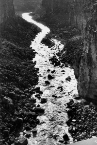 |
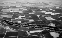 |
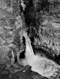 |
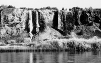 |
||
|
(left) Malad River (big Wood River) in Malad Gorge State Park.View looks downstream (southwest). The narrow canyon is geologically very young, cut in the last 2 million years, (March, 1993). (top center) View looking north at the Snake River Canyon below Murtaugh,west of Milner Dam. On the north side of the Snake River the road heads due north to beautiful downtown Hazelton. Greenwood is south of Hazelton and north of the Interstate Highway. The South Side Main Canal (Twin Falls Canal) parallels the river. The country in the distance that is not farmed is the scabland east of Eden. The farmland in the distance is near the Hunt relocation site, a World War II Japanese-American concentration camp,along the North Side Main Canal, (July, 1989). (bottom center) Waterfalls coming from part of the Thousand Springs on the north bank of the Snake River where the Snake River Plain Aquifer empties into the Snake River and feeds America's largest trout farming businesses, (May, 1986). (right) Waterfall below Interstate 84, Malad Gorge, (March, 1993). |
||
References
-
Greenwood, Annie Pike, 1934, reprinted 1988, We Sagebrush Folks: Moscow,Idaho, The University Press of Idaho, 489p.
-
Malde, H.E., 1987, Shoshone Falls, Idaho; A Pleistocene relic of the catastrophic Bonneville Flood: in Beus, S.S., editor, Rocky MountainSection of the Geological Society of America: Boulder, Colorado, GeologicalSociety of America Centennial Field Guide, Volume 2, p. 135-138.
-
Malde, H.E., and Powers, H.A., 1972, Geologic map of the Glenns Ferry Hagerman area, west-central Snake River Plain, Idaho: U.S. Geological SurveyMiscellaneous Geologic Investigations Map I-696, scale 1:48,000.
-
Stearns, H.T., Crandall, L., and Steward, W.G., 1938, Geology and ground-waterr esources of the Snake River Plain in southeastern Idaho: U.S. GeologicalSurvey Water-Supply Paper 774, 268 p.
-
Whitehead, R.L., 1986, Geohydrologic framework of the Snake River Plain,Idaho and eastern Oregon: U.S. Geological Survey Hydrologic InvestigationsAtlas HA-681, scale 1:1,000,000.
-
Whitehead, R.L., and Covington, H.R., 1987, Thousand Springs area near Hagerman, Idaho, in Beus, S.S., editor, Rocky Mountain Section ofthe Geological Society of America: Boulder, Colorado, Geological Society of America Centennial Field Guide, Volume 2, p.131-134.
Wood River Valley
Geology of the Wood River Area
The flat, alluvium-filled Wood River Valley is the gateway to the Pioneer and Sawtooth Mountains of central Idaho. The steep hills near the river are underlain by Paleozoic dark-colored shale and limestone. To the west is the great Atlanta lobe of the Cretaceous Idaho batholith. Most of the rich mineral deposits of the region are hosted by black shales of the Devonian Milligen formation and formed during Cretaceous magmatic activity and deformation. To the east is the geologically complex Pioneer Mountains core complex, which contains, in the high peaks, complexly deformed Early Proterozoic metamorphic rock intruded by Eocene plutons. Eocene volcanic rocks of the Challis Volcanic Group cover large parts of the area west of Hailey and Ketchum.
The Goodale Cutoff
Originally used by Oregon Trail emigrants, the Goodale Cutoff followed an Indian trail along the present route of U.S. Highway 20 from Carey over the summit north of the Queen's Crown and across the Camas Prairie. In the spring, near Fairfield and Hill City, the marshy areas are purple with the blooms of camas plants. Indians harvested the bulbs of this member of the lily family as a much valued food source.
The Camas War of 1878
The invasion of Europeans into western Indian lands was overwhelming to the native populations. Old ways of life could be followed no longer; tribal customs were subverted by the white society; old hunting and gathering lands were being turned into towns and farms. The reaction of many tribes was resignation. The technological and monetary power of American society was all too obvious and pervasive.
In 1878, the Fort Hall Bannock Indians, under Chief Buffalo Horn, found that settlers in the Camas Prairie east of Fairfield had cut up the marshes into fields. Cattle and horses were pastured on land where the Indians had gathered camas roots for generations. Pigs were allowed to dig up the roots that had been one of the Indians' major food sources. This provocation, on top of a general atmosphere of tension, led to a series of attacks in the summer of 1878.
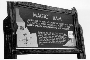 |
| Historical Marker south of Magic Dam on the Big Wood River south of Bellevue, (June, 1991). The dry years of 1987-1992 caused this reservoir to run out of water early and to deprive downstream farmers of irrigation water. The magic had ended. In 1990 and 1991 the water ran out in early July; in 1992 the water ran out in late May. After a wet year in 1993, when water was plentiful, 1994 was very dry and the canals were again empty. 1995 and 1996 were wet years. |
Chief Buffalo Horn and his followers moved southwest from Fort Hall, toward their ancestral lands in Nevada, raiding as they went. They destroyed property and killed settlers and freighters at King Hill, in the vicinity of Glenns Ferry, and in the Bruneau Valley. Several skirmishes with irregular white forces resulted in the death of Buffalo Horn and some of his followers.
New recruits were picked up along the way from malcontent and restless tribes. Some battles took place in the vicinity of the Owyhee River and the band, now numbering several hundred, headed for the John Day country. Regular army forces under General Howard, aided by friendly Umatilla Indians, caught up with the marauders and the leaders were slain, bringing an end to the outbreak. The warriors broke into small groups and gradually returned to their reservations. The Camas War was the final blow to Indian rebellion. It was followed generally by an attitude of sullen and sated subjugation that has lasted for nearly a hundred years.
Fairfield
Fairfield is the county seat of Camas County, which in 1990 was the least populous county in Idaho, with 727 persons. Clark County was next with 762 persons. Fairfield is a long way economically and culturally from its upscale neighbors in the Wood River Valley.
Mining in the Wood River Valley
Early discoveries of mineralized quartz veins west of Hailey occurred in the 1860s, but Indian opposition culminating in the Bannock War of 1878 slowed development. Idaho miners concentrated their efforts farther west near Idaho City. By 1880, however, new technology for refining lead-silver ore had been developed, and the rush to the Wood River mines came with thousands of fortune hunters. The Oregon Short Line, financed by Jay Gould, followed the miners in 1882-1883, and the area boomed. Lead-silver mines became the staple of Idaho's mining economy and in the 1890s, Idaho politicians were solidly behind the doomed silver standard for the U.S. currency.
The first discoveries in the Wood River area were in May 1879, when David Ketchum found a few small lead-silver prospects near Galena Summit. The Queen of the Hills west of Bellevue was discovered in July of that year. Ketchum, Bellevue, and Hailey were settled in 1880. Smelters were built in Hailey and Ketchum in 1881, and Idaho's first electric light system and one of Idaho's first telephone systems were installed in Hailey in 1882. Investor capital poured into the area from St. Louis and Philadelphia. A branch of the Oregon Short Line reached Hailey in 1883 and Ketchum in 1884. Production from the Wood River mines was over $2 million a year from 1885 to 1887.
But the price of silver was falling and labor troubles developed. The output decreased sharply in 1888 and nearly stopped in 1892, with the collapse of the price of silver. Ketchum was nearly abandoned.
Mining was by no means finished as the Triumph mine southeast of Ketchum produced about $28 million between 1936 and 1957. Now in 1993, it is an Environmental protection agency "Super Fund Site." Ore was brought down from the mine to the Ketchum branch of the Union Pacific on an overhead tramway to Zinc Spur siding near present-day Ketchum. The Minnie Moore Mine was in active use until 1970. The entire production of the Wood River mines is over $62 million.
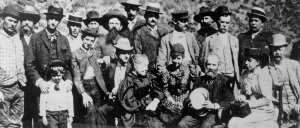 |
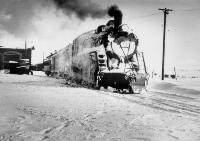 |
|
(left) Photograph at left was taken at Ketchum, Idaho in the 1880s during the Wood River Valley mining boom. The Oregon Short Line had just reached the Wood River Valley and prosperity abounded. The bearded man holding his hat is Jay Gould, financier of the OSL. The older woman holding her hands together to the left of Gould is his wife. The woman in the polka dot dress in unidentified. Minnie Howard Collection, Idaho State University. (right) Passenger train just into the Shoshone Shops after a snowstorm on the Hill City (Fairfield) Branch about 1930. Arthur Peterson collection, Bannock County Historical Museum. |
|
Sheep Grazing
Sheep and cattle raising became the main industries in the Wood River Valley in the 1890s. During this time more sheep were shipped on the Union Pacific from Ketchum than from any other point in the United States.
Sun Valley Resort
W. Averill Harriman, Chairman of the Board of the Union Pacific Railroad, arranged that Count Felix Schaffgotsch (an Austrian) should tour in 1935 the areas in the Rocky Mountains served by the railroad to locate a site for a resort to serve the newly growing sport of alpine skiing. Although the southern Wood River Valley is open, bare, and hardly alpine, the valley narrows to the north at Ketchum and the hills boast spectacular vistas of the Boulder, Pioneer, and Smoky Mountains.
Harriman bought the 3,888 acre Brass Ranch where the Sun Valley resort is located for $10.04 an acre in spring 1936. He proceeded to build a luxury resort where, in his words, "There isn't a single thing I could wish for that hasn't been provided." The Lodge cost $1,500,000 and was completed in December of that year. It was to become a resort for the rich and famous. In the last ten years, the area has grown faster than any nearby part of Idaho. Many say it resembles a piece of California transported to the Wood River. The transformation from slow and shabby Idaho ranch town to modern resort replete with million dollar homes occurs in distinct steps as one drives north from Carey to Picabo to Gannet to Bellevue to Hailey to Ketchum to Sun Valley. The first time along the road is a strange trip for an Idahoan.
Shoshone
As settlers began spreading throughout southern Idaho, some gathered at a spot along the Little Wood River. They called the community Bottoms. A few years later plans were announced by Oregon Short Line Railway Company to build a railroad through southern Idaho and this road would pass through the community. By late 1882, when the railway reached the town, it applied for a post office, to be named Naples.
Construction of the railway to the west halted while the Oregon Short Line built its first branch, extending into the mountains to the north to serve the mines at Hailey, which it reached in 1883. Later, the branch was extended to Ketchum where shipments of livestock were handled. The junction town was named Shoshone.
Shoshone and the Railroad
After the Wood River Branch was completed, the main line continued to the west, and Shoshone became a substantial railroad community. A roundhouse was constructed, along with shops. A few years later, as the Oregon Short Line expanded its operations, a major division point and repair facility was established at Pocatello. Both Shoshone and Eagle Rock (Idaho Falls) were consolidated into the Pocatello operation, and the roundhouse at each locality was discontinued.
Shoshone remained the principal entry point for railroad services to the Wood River mines and communities, being the branch line terminal for both the Ketchum and Hill City lines. The town was the point of origin during the 1880s and 1890s for tours to Shoshone Falls, but with the development of farming lands in the Twin Falls area shortly after 1900, this business ceased. After Sun Valley was built in the 1930s, passengers bound for Sun Valley for skiing were transported from Shoshone by bus.
Sheep and cattle raising have become the major industries of Lincoln County, of which Shoshone is the county seat. Railroad operations have gradually nearly disappeared. Shoshone remains a stop for Amtrak trains (in the middle of the night, as usual) affording passenger service to the Wood River and Magic Valleys.
Ketchum. The Minnie Moore Mine was in active use until 1970. The entire production of the Wood River mines is over $62 million.
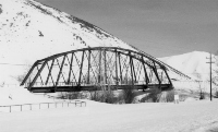 |
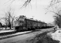 |
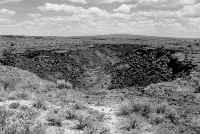 |
|
(left) Abandoned Oregon Short Line railroad bridge over the Wood River, south of Ketchum. The bridge is now used by a bike trail system, (March, 1993). (center) Special Union Pacific passenger train at Bellevue, 1972. Train is composed of both single and double deck cars, and powered by cab-style General Motors, Electromotive Division Diesel engines. Dick Beardsley Collection, Community Library, Ketchum, Idaho, Photo number 1025; used by permission. (right) Collapsed lava tube north of Shoshone, (June, 1992). |
||