
Geography
Geography Basics
How Did Idaho Get Its Name?
Originally suggested for Colorado, the name "Idaho" was used for a steamship which traveled the Columbia River. With the discovery of gold on the Clearwater River in 1860, the diggings began to be called the Idaho mines. "Idaho" is a coined or invented word and, despite popular folklore, is not a derivation of an Indian phrase "E Dah Hoe (How)" supposedly meaning "gem of the mountains."
What is the Highest Mountain in Idaho?
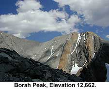
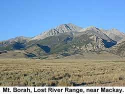
Mount Borah in the Lost River Range is the highest mountain in Idaho at 12,662 feet above sea level
 |
 |
What is a GIS?
In brief, Geographic Information Systems (GIS) is a state-of-the-art computer methodology for organizing and analyzing spatial, map-based data. Unlike other cartographic tools, GIS integrates map making with database management and statistical analysis. Results can be summarized in tables or reports, and displayed as maps. With a few commands, vast amounts of data can be summarized in visual, easily understood formats. GIS is widely used to query, analyze, and map data to support decision-making. GIS has become a fundamental tool for agricultural managers, scientists, land-use planners-and analysis and problem solving. Today, GIS is a multi-billion-dollar industry employing hundreds of thousands of people worldwide.
What is a GPS?
Many maps, such as road maps, only deal with the two-dimensional location of an object without taking into account its elevation. While convenient, these maps do not accurately represent the surface of the earth. The earth is contorted ("relief"), and because of this latitude, longitude and elevation are necessary to locate areas exactly on a map (three-points, or "triangulation" is required to accurately locate something within 3-Dimensional space). Maps that deal with three dimensions are called topographic maps. Topographic maps take into account the elevation of the area being mapped above a ‘reference datum’, thus showing the actual shape of the area.
Photographs, satellite imagery, surface and subsurface scientific exploration and other means of gathering data have changed the way modern maps are constructed. Recent computer technologies have allowed for the development of Geographic Information Systems which provide complex pictures of the earth - both on the surface and beneath it. The global address of any place on earth includes both latitude and longitude. This coordinate system is widely used in all areas of navigation and related technologies. An example is Global Positioning System technology which uses a receiver to transmit a signal to satellites orbiting the earth. The GPS unit then uses the amount of time it takes for the satellite to receive its signal, and the satellite's' position in the sky to calculate an exact latitude and longitude.
Understanding Topographic Maps
A topographic map, simply put, is a two-dimensional representation of a portion of the three-dimensional surface of the earth. Topography is the shape of the land surface, and topographic maps exist to represent the land surface. Topographic maps are tools used in geologic studies because they show the configuration of the earth’s surface. Cartographers solve the problem of representing the three-dimensional land surface on a flat piece of paper by using contour lines, thus horizontal distances and vertical elevations can both be measured from a topographic map.
General Information
The terms below indicate what information is contained on a topographic map, and where it can be found.
Map Scale: Maps come in a variety of scales, covering areas ranging from the entire earth to a city block (or less).
Vertical Scale (contour interval): All maps have a horizontal scale. Topographic maps also have a vertical scale to allow the determination of a point in three dimensional space.
Contour Lines: Contour lines are used to determine elevations and are lines on a map that are produced from connecting points of equal elevation (elevation refers to height in feet, or meters, above sea level).
The following are general characteristics of contour lines:
1. Contour lines do not cross each other, divide or split.
2. Closely spaced contour lines represent steep slopes, conversely, contour lines that are spaced far apart represent gentle slopes.
3. Contour lines trend up valleys and form a "V" or a "U" where they cross a stream.
On most topographic maps, index contour lines are generally darker and are marked with their elevations. Lighter contour lines do not have elevations, but can be determined by counting up or down from the nearest index contour line and multiplying by the contour interval. The contour interval is stated on every topographic map and is usually located below the scale.

Creating topographic profiles: Remember that topographic maps represent a view of the landscape as seen from above. For producing a detailed study of a landform it is necessary to construct a topographic profile or cross-section through a particular interval. A topographic profile is a cross-sectional view along a line drawn through a portion of a topographic map.
A profile may be constructed quickly and accurately across any straight line on a map by following this procedure:
a. Lay a strip of paper along a line across the area where the profile is to be constructed.
b. Mark on the paper the exact place where each contour, stream and hill top crosses the profile line.
c. Label each mark with the elevation of the contour it represents.
d. Prepare a vertical scale on profile paper by labeling the horizontal lines corresponding to the elevation of each index contour line.
e. Place the paper with the labeled contour lines at the bottom of the profile paper and project each contour to the horizontal line of the same elevation.
f. Connect the points.
Stream Gradient: Stream gradient can also be determined from a topographic map. The gradient of a steam or river is determined by measuring a section of a stream or river and dividing the distance (in miles) into the vertical difference (in feet) between the two points. The result is expressed in feet per mile (ft./mi.). The equation used is:
|
Gradient =
|
drop in elevation between two chosen points (feet) |
| distance between the two points (miles) |
Tips for Interpreting Topographic Maps
Vertical exaggeration: Vertical exaggeration is the effect that is created when the horizontal and vertical scales on your topographic profile are not the same.
Determining hillslope: Among other things, a topographic map can be used to measure the average slope of a hill (or hills).
 |
| Click on image for a larger view. |
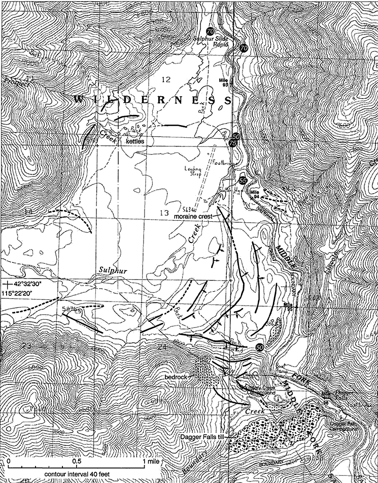
Topographic Map Example
As an example, look at a map of the Sulphur-Boundary Creek area along the Middle Fork of the Salmon River This map is a geologic map of glacial geology in the area, drawn on a topographic map base. The map has a contour interval of forty feet, which means that every place between the marked 6800 foot line and the next lowest line (which is 6760 feet, and not marked) has an elevation equal or greater than 6760 feet, but less than 6800 feet. You can figure out the elevation of any point by finding the nearest labeled line, counting the number of lines above or below it, multiplying by the contour interval, and adding or subtracting the result from the nearest marked contour line. The more closely spaced the contour lines, the steeper the slope. You can find out exactly how steep the slope of the area you are interested in by subtracting the lowest elevation from the highest, and dividing the result by the horizontal distance. Horizontal distance is found on the scale. As you look at the map, notice that the contour lines enclose smaller and smaller areas. The smallest circles represent the tops of peaks, and some are marked with x’s with numbers next to them. The numbers are the elevation at the top of the peak.
Follow a contour line along its length. Notice the indentations. As the contour lines cross gullies or stream drainages, they "vee" uphill. Drainages that have water in them year-round have solid lines connecting the points of the vees. Drainages that have water only part of the year are marked with dashed lines.
Maps & Globes
 |
 |
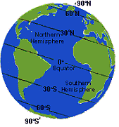
| Remember: Earth is tipped on its axis of rotation (relative to our plane of orbit around the sun). |
A map is a way of representing an object’s (or objects’) real-world location on an artificially created two-dimensional surface. Maps have been used by humans since about 1400 B.C. when they appear in the archaeological record of the ancient Egyptians. Later, as their cultures mixed, these early attempts were improved upon by the Greeks. In 150 A.D. Ptolemy (an Egyptian) added the first lines of latitude and longitude used on a map. Today typical references used for mapping include latitude, longitude, the location of the north and south poles, and the location of the equator.
Latitude and Longitude are cartographic lines superimposed on the surface of the earth. These lines create a grid coordinate system that is used to pinpoint locations on earth - each point on the globe is assigned an unique pair of longitude and latitude values so that it may be identified easily and accurately. Latitude lines (or parallels) run from east to west horizontally around the globe. Longitude lines (or meridians) run vertically from the North and South Poles.
Like other circles, latitude and longitude are measured in units of degrees, minutes, and seconds with a total of 360 degrees possible (1 degree = 60 minutes and 1 minute - 60 seconds). A protractor can be used to measure these distances.
Longitude values range from 180 degrees west to 180 degrees east, and are measured from the Prime Meridian, or zero degrees longitude (the longitude line passing through Greenwich, England). The longitude line directly opposite to the Prime Meridian is called the International Dateline and can be considered as either 180° east or west). The Equator is the line of latitude that divides the globe into two equal halves, the Northern and Southern Hemispheres. The Equator is designated as 0° latitude. Latitude is measured North or South of the Equator with a range of 0 to 90 degrees. Latitude lines below the equator have negative values, while those above the equator have positive values. The full range of latitude values then is -90 (S) to +90 (N) degrees. Some familiar examples:
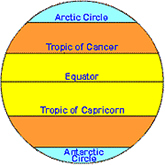 1. The Tropic of Capricorn (23.5 degrees S)
2. The Antarctic Circle (66.5 degrees S)
3. Tropic of Cancer (23.5 degrees N)
4. The Arctic Circle (66.5 degrees N).
Look at how the curvature of the earth affects the shape of the latitude and longitude lines. All of the longitude lines are identical so degrees of longitude are constant, always covering the same distance (about 60 nautical miles). In contrast, degrees of latitude vary. Near the equator, a degree of latitude is approximately 60 nautical miles, but as you approach the poles that distance goes to zero.
It is important to keep in mind that the earth is curved and maps are flat, so they do not quite represent reality. To properly map the earth, a planet shaped globe is required. Cartographers represent the curvature of the earth on a flat surface by means of a projection. Regions are projected on to a map in different ways in order to correct for real direction, area or shape. The most common projection used is the Mercator, which was invented in 1568 by the German Gerhard Kramer (a.k.a. Gerardus Mercator). The Mercator distorts the size of the continents however because it makes the earth the same width at the at the equator and the poles.
The Data Behind a Map
Reference Datum: A reference datum is a known and constant surface which can be used to describe the location of unknown points. On Earth, the normal reference datum is sea level. On other planets, such as the Moon or Mars, the datum is the average radius of the planet.
Map Projections: A map projection is a way of representing the 3-dimensional surface of the Earth on a flat piece of paper.
Distortion: Each of the different types of projections have strengths and weaknesses, and knowledge of the advantages and disadvantages of a particular map projection will often help you to choose what map you want to use for a particular project.
Grid systems: A grid system allows the location of a point on a map (or on the surface of the earth) to be described in a way that is meaningful and universally understood.
Coordinate systems: There are several types of grids (a.k.a. coordinate systems) used to divide the earth’s surface. Four of these are in common use on maps published in the United States: geographic, universal transverse mercator (UTM), state plane, and public land survey coordinate systems.
Much of the information discussed above is applicable to all types of maps.
Fun Facts:
Can You Really Get Sugar from a Sugar Beet?
Sugar is manufactured from the roots of the sugar beet, the leaves and tops being removed after harvesting and used as stock feed. The roots are cut into cossettes, or chips, at the sugar factory, and the cossettes are crushed to remove the juice. The pulp remaining after the extraction of the juice is a rich food for domestic animals.
After extraction, lime is added to the juice; the remainder of the process is similar to sugar production from sugarcane. Beet molasses is fed to livestock; table molasses is not made from beets because of difficulties in purification. The sugar that is produced from the sugar beet is chemically identical to the sugar that is derived from the sugarcane.
What Was a Pioneer Frisbee?
If you think frisbees were invented in the 1960s, you're wrong--by about a hundred years. Children on the Oregon Trail threw frisbee-like devices back in the mid-1800s. But they weren't made of plastic--they were made of buffalo dung.
During the great western immigration, the entire Great Plains region was covered with buffalo chips--they were unavoidable. And yes, kids occasionally tossed them about in a frisbee-like manner. But the chips had a much more practical purpose for the emigrants--they were burned for fuel.
There was no firewood along much of the Trail, so the only alternative was dried buffalo dung. Even though the pioneers were hardy, they didn't much enjoy gathering up bushels of chips every night.
The chips burned surprisingly well, and produced an odor-free flame. Usually, each family had its own campfire, but sometimes everyone contributed their chips for one big bonfire.
Idaho Demographics
The state of Idaho has a long-standing reputation as a place of legends and change set in the midst of breathtaking landscapes. Wide-open deserts give way to forests and to towering granite mountain peaks. Pioneers, entrepreneurs, Native Americans, Explorers, Gold, High-Tech, High-Adventure...Idaho has a little of everything - a fact reflected in its rich natural history and demographic profile. The state is home to the theater, opera, ballet, symphonies, festivals, carnivals, rodeos, and more. Celebrations occur year-round, in every region. Many are imbued with regional and historical flair and follow traditions that date to Idaho's Native Peoples and earliest pioneers. Sporting and other outdoor events are commonplace.
Three major universities exist as a part of the Idaho higher education system: Idaho State University; the University of Idaho, Moscow and; Boise State University.
Scientific research and inquiry into the natural history of Idaho is of great importance at all three institutions, as well as at the Idaho Museum of Natural History, the Idaho Geologic Survey and other organizations around the state.
The United States Forest Service plays a significant role in the state as well. They manage and study a large percentage of Idaho's forests in addition to large areas of rangeland. The BLM also manages and studies Idaho Rangelands. Both agencies employ large numbers of Idahoans.
Agriculture and timber-related industries are also significant employers, as are the mining industries. Hi-tech industry is one of the fastest-growing in the state (centered in the Boise metropolitan area).
DOE's Idaho Engineering and Environmental Laboratory (INEEL) is another significant resource for the state. As are the recreation and tourism related industries such as Idaho's Fisheries.
Significant natural resources found within Idaho boundaries include: timber, water, silver, lead, phosphate, gold, molybdenum, sand, gravel, building stone, limestone, copper, garnets and zinc.
Primary agricultural industry products include: potatoes, hay, wheat, sugar beets, cherries, peaches, beef, dairy products, apples, hatchery trout.
The most important manufactured goods produced include: french fries, sugar, canned fruit and vegetables, particleboard, computers, farm machinery and supplies, paper products, phosphate fertilizers.
Maps, Surveys & Boundaries
The principal meridians and base lines of the west are a product of the Northwest Ordinance of 1785. This measure provided for the orderly survey and sale of public lands. During the colonial period, New England had disposed of public lands by surveying them first and then selling them in orderly blocks. A system of "indiscriminate locations and subsequent survey" prevailed in the southern colonies. This permitted settlers to lay out the land they desired where they wished and then have it surveyed. The southern system led to conflicting titles as pioneers laid out irregularly shaped plots to claim the most fertile land and made it impossible for the government to dispose of the less desirable tracts. The survey of public lands was originally evolved in Ohio and was well developed by the time the West was settled.
 The Ordinance of 1785 provided that the public lands of the United States be divided by lines intersecting true north and at right angles to form townships and ranges - both six miles square. The townships and ranges were to be marked with progressive numbers from the beginning, or "initial" point that was surveyed in a given area. Such townships and ranges were to be divided into thirty-six sections, each one mile square and containing 640 acres. The sections were to be numbered respectively, beginning with the number one in the northeast section and proceeding west and east alternately through the township with progressive numbers to thirty-six.
Note that townships are counted north-south of the initial point, while ranges are counted east-west.
In order to complete this type of surveying task, it was necessary to establish independent initial points to serve as bases for surveys. Principal meridians (north-south lines) and baselines (east-west lines) were then surveyed from these initial points. Guide meridians were initiated at baselines, and standard parallels were initiated at principal meridians to form townships.
 In Idaho the Initial Point is located about 8 miles south of Kuna. It is a volcanic hill that was precisely located on April 19, 1867. Peter W. Bell used stellar observations to locate the point, by order of Lafayette Cartee, the first surveyor general of Idaho Territory. The Initial Point is marked with a small, round brass marker (about the size of a jam jar lid), and the hill is visible for miles around.
The principal meridian for Idaho is the exact north-south line as measured at Initial Point. It was called the Boise Meridian, and it runs the entire length of Idaho - from the Nevada border to the border with British Columbia.
The city of Meridian was named for the Boise Meridian as it lies exactly north on the surveyors line.
All surveys conducted in Idaho which divided the almost 54 million acres of unmapped lands are based from Initial Point.
State Symbols of Idaho
|
Land Area: Water Area: Highest Point: Lowest Point: Length: Width: Geographic Center: Number of Lakes: Navigable Rivers: Largest Lake: Temperature Extremes: Population (as of 1995): Land Ownership: State Folkdance: |
State Insect: State Fish: State Bird: State Horse: State Flower: State Tree: State Fossil: State Gemstone: State Song: Here We Have Idaho
There’s truly one state in this great land of ours,
|
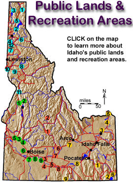
Public Lands & Recreation Areas
 |
|
|
The Idaho Department of Parks and Recreation has historically utilized its enabling legislation (Idaho Code 67-4219) as its mission statement: "It is the intent of the legislature that the department of parks and recreation shall formulate and put into execution a long range, comprehensive plan and program for the acquisition, planning, protection, operation, maintenance, development and wise use of areas of scenic beauty, recreational utility, historic, archaeological or scientific interest, to the end that the health, happiness, recreational opportunities and wholesome enjoyment of the life of the people may be further encouraged."
Prior to the authorization of the Idaho Department of Parks and Recreation, there existed in the state areas designated "scenic and recreational," usually parks and campgrounds. Since 1907 these areas had been administered by the State Land Board. In 1947, state parks were transferred to the Highway Department, and responsibility grew with the addition of a number of roadside areas, where motorists on the freeway might pull off for a night's rest. In 1949 control of the parks system was transferred to the State Land Board. A Parks Division was created within the Land Board in 1953. John W. Emmert, a retired former superintendent of Glacier National Park, took charge of the Idaho program in April 1958. This form of administration continued until 1959 when Emmert was replaced with three regional directors. Since 1965, the Department has been governed by a six-person bipartisan board, each member representing a different geographic area of the state.
Since it's inception the State Parks system has grown to include over 25 park and recreation areas. It is of interest to note that despite the vast wildernesses and high percentage of federal lands in Idaho, the state does not have a single national park within its boundaries. The National Park Service does however administer several national monuments and reserves in Idaho.
On August 25, 1916, President Woodrow Wilson signed the act creating the National Park Service, a new federal bureau in the Department of the Interior responsible for protecting the 40 national parks and monuments then in existence and those yet to be established.
This "Organic Act" of August 25, 1916, states that "the Service thus established shall promote and regulate the use of Federal areas known as national parks, monuments and reservations . . . by such means and measures as conform to the fundamental purpose of the said parks, monuments and reservations, which purpose is to conserve the scenery and the natural and historic objects and the wild life therein and to provide for the enjoyment of the same in such manner and by such means as will leave them unimpaired for the enjoyment of future generations."
The National Park System of the United States comprises 378 areas covering more than 83 million acres in 49 States, the District of Columbia, American Samoa, Guam, Puerto Rico, Saipan, and the Virgin Islands. These areas are of such national significance as to justify special recognition and protection in accordance with various acts of Congress.
By Act of March 1, 1872, Congress established Yellowstone National Park in the Territories of Montana and Wyoming "as a public park or pleasuring ground for the benefit and enjoyment of the people" and placed it "under exclusive control of the Secretary of the Interior." The founding of Yellowstone National Park began a worldwide national park movement. Today more than 100 nations contain some 1,200 national parks or equivalent preserves.
In the years following the establishment of Yellowstone, the United States authorized additional national parks and monuments, most of them carved from the federal lands of the West. These, also, were administered by the Department of the Interior, while other monuments and natural and historical areas were administered as separate units by the War Department and the Forest Service of the Department of Agriculture. No single agency provided unified management of the varied federal parklands.
An Executive Order in 1933 transferred 63 national monuments and military sites from the Forest Service and the War Department to the National Park Service. This action was a major step in the development of today's truly national system of parks - a system that includes areas of historical as well as scenic and scientific importance.
Congress declared in the General Authorities Act of 1970 "that the National Park System, which began with the establishment of Yellowstone National Park in 1872, has since grown to include superlative natural, historic, and recreation areas in every region ... and that it is the purpose of this Act to include all such areas in the System...."
Additions to the National Park System are now generally made through acts of Congress, and national parks can be created only through such acts. But the President has authority, under the Antiquities Act of 1906, to proclaim national monuments on lands already under federal jurisdiction. The Secretary of the Interior is usually asked by Congress for recommendations on proposed additions to the System. The Secretary is counseled by the National Park System Advisory Board, composed of private citizens, which advises on possible additions to the System and policies for its
Parks & Monuments
The Idaho Department of Parks and Recreation has historically utilized its enabling legislation (Idaho Code 67-4219) as its mission statement: "It is the intent of the legislature that the department of parks and recreation shall formulate and put into execution a long range, comprehensive plan and program for the acquisition, planning, protection, operation, maintenance, development and wise use of areas of scenic beauty, recreational utility, historic, archaeological or scientific interest, to the end that the health, happiness, recreational opportunities and wholesome enjoyment of the life of the people may be further encouraged."
Prior to the authorization of the Idaho Department of Parks and Recreation, there existed in the state areas designated "scenic and recreational," usually parks and campgrounds. Since 1907 these areas had been administered by the State Land Board. In 1947, state parks were transferred to the Highway Department, and responsibility grew with the addition of a number of roadside areas, where motorists on the freeway might pull off for a night's rest. In 1949 control of the parks system was transferred to the State Land Board. A Parks Division was created within the Land Board in 1953. John W. Emmert, a retired former superintendent of Glacier National Park, took charge of the Idaho program in April 1958. This form of administration continued until 1959 when Emmert was replaced with three regional directors. Since 1965, the Department has been governed by a six-person bipartisan board, each member representing a different geographic area of the state.
Since it's inception the State Parks system has grown to include over 25 park and recreation areas. It is of interest to note that despite the vast wildernesses and high percentage of federal lands in Idaho, the state does not have a single national park within its boundaries. The National Park Service does however administer several national monuments and reserves in Idaho.
On August 25, 1916, President Woodrow Wilson signed the act creating the National Park Service, a new federal bureau in the Department of the Interior responsible for protecting the 40 national parks and monuments then in existence and those yet to be established.
This "Organic Act" of August 25, 1916, states that "the Service thus established shall promote and regulate the use of Federal areas known as national parks, monuments and reservations . . . by such means and measures as conform to the fundamental purpose of the said parks, monuments and reservations, which purpose is to conserve the scenery and the natural and historic objects and the wild life therein and to provide for the enjoyment of the same in such manner and by such means as will leave them unimpaired for the enjoyment of future generations."
The National Park System of the United States comprises 378 areas covering more than 83 million acres in 49 States, the District of Columbia, American Samoa, Guam, Puerto Rico, Saipan, and the Virgin Islands. These areas are of such national significance as to justify special recognition and protection in accordance with various acts of Congress.
By Act of March 1, 1872, Congress established Yellowstone National Park in the Territories of Montana and Wyoming "as a public park or pleasuring ground for the benefit and enjoyment of the people" and placed it "under exclusive control of the Secretary of the Interior." The founding of Yellowstone National Park began a worldwide national park movement. Today more than 100 nations contain some 1,200 national parks or equivalent preserves.
In the years following the establishment of Yellowstone, the United States authorized additional national parks and monuments, most of them carved from the federal lands of the West. These, also, were administered by the Department of the Interior, while other monuments and natural and historical areas were administered as separate units by the War Department and the Forest Service of the Department of Agriculture. No single agency provided unified management of the varied federal parklands.
An Executive Order in 1933 transferred 63 national monuments and military sites from the Forest Service and the War Department to the National Park Service. This action was a major step in the development of today's truly national system of parks - a system that includes areas of historical as well as scenic and scientific importance.
Congress declared in the General Authorities Act of 1970 "that the National Park System, which began with the establishment of Yellowstone National Park in 1872, has since grown to include superlative natural, historic, and recreation areas in every region ... and that it is the purpose of this Act to include all such areas in the System...."
Additions to the National Park System are now generally made through acts of Congress, and national parks can be created only through such acts. But the President has authority, under the Antiquities Act of 1906, to proclaim national monuments on lands already under federal jurisdiction. The Secretary of the Interior is usually asked by Congress for recommendations on proposed additions to the System. The Secretary is counseled by the National Park System Advisory Board, composed of private citizens, which advises on possible additions to the System and policies for its management.
|
|
|
|
Established in 1970
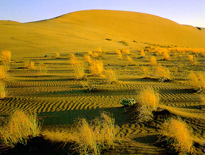
When wind looses its velocity and its ability to transport the sand it has carried from the surface, it deposits it on the ground. Sand deposits tend to assume recognizable shapes. Wind forms sand grains into mounds and ridges called dunes, ranging from a few feet to hundreds of feet in height. Some dunes migrate slowly in the direction of the wind. A sand dune acts as a barrier to the wind by creating a wind shadow. This disruption of the flow of air may cause the continued deposition of sand. A cross section or profile of a dune in the direction of blowing wind shows a gentle slope facing the wind and a steep slope to the leeward. A wind shadow exists in front of the leeward slope which causes the wind velocity to decrease. The wind blows the sand grains up the gentle slope and deposits them on the steep leeward slope.
History
The Bruneau Sand Dunes State Park, established in 1970, is located about 8 miles east-northeast of Bruneau and about 18 miles south of Mountain Home. The dunes at Bruneau Dunes State Park are unique in the Western Hemisphere. Other dunes in the Americas form at the edges of natural basins; these form near the center.
The combination of 1) a source of sand; 2) a relatively constant wind activity; and 3) a natural trap have caused sand to collect in this semicircular basin for over 20,000 years. Geologists believe the dunes seen today may have started with sands from the Bonneville Flood about 15,000 years ago.
Unlike most dunes, these do not drift far. The prevailing winds blow from the southeast 28 percent of the time and from the northwest 32 percent of the time, keeping the dunes fairly stable.
Although there are many small dunes in the area, two prominent dunes cover approximately 600 acres. These two imposing dunes are striking, particularly because they dwarf most of the nearby land features. The westernmost dune is reported to be the largest single-structured sand dune in North America with a peak 470 feet above the level of the lakes.
Desert Habitat
The park contains lake, marsh, desert, prairie and dune habitats. Since most desert wildlife is nocturnal, early morning and late evening are the best times for spotting the park's inhabitants. However, a sharp eye often is rewarded with a daytime glimpse of lizards and rabbits, or raptors such as owls, hawks, and eagles. There is no hunting in the park except with cameras and binoculars.
The colors of a desert sunset are found again in the early-morning blossoms of the sunflower and desert lily. A coyote may howl at the same moon you watch reflected in the still lakes. A cool shore breeze refreshes after a climb on the warm sands, and the lakes teem with waterfowl.
The Lakes
The small lakes at the foot of the dunes provide an excellent bass and bluegill fishery, Sport fishing from non motorized boats, canoes, rubber rafts, and float tubes is a popular activity.
Camping
Bruneau Dunes has one of the longest camping seasons in Idaho's system. Campers often start coming in March and continue to enjoy the park's warm weather late into the fall. Shade trees and shelters are abundant in the campground.
Environmental Education
The environmental-education center features displays of area wildlife and natural history.
The Eagle Cove Interpretive Program Area can be reserved for schools or other groups of 30-40 persons. Contact the park for details.
|
|
|
|
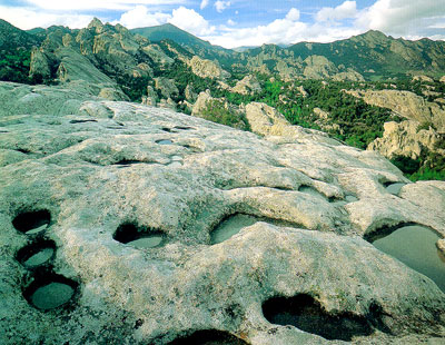
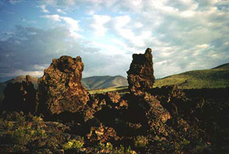
Established in 1988
The "Silent City of Rocks" covers a 10-square mile area in Cassia County, approximately 4 miles from the Idaho-Utah border. It is situated 15 miles southeast of Oakley and about 4 miles west of Almo. You can reach the City of Rocks by traveling through Oakley on the west or through Almo on the east; both routes involve travel on graded gravel roads.
The City of Rocks has been designated as a natural and historic national landmark and is under study by the Bureau of Land Management and the National Park Service for inclusion in the park system. The major obstacle to establishing better protection and management of the area is the mixed ownership. The Forest Service administers 1,120 acres; the Bureau of Land Management administers 1,040 acres, 640 acres is owned by the State of Idaho; and the remaining 4,000 acres is in private ownership.
History
Shoshone-Bannock tribes hunted the buffalo that once roamed in the City of Rocks area and gathered the nuts of the pinyon pine trees. The return of horses to the Americas in the 16th century and swelling European immigration disrupted the Shoshone-Bannock homelands and way of life. In 1826, Peter Skene Ogden and his Snake River brigade of beaver trappers were the first non-Native Americans to note the City of Rocks. Having few beaver, the area was ignored until 1843, when growing summer streams of wagons began flowing through the area. The Shobans grew to resent the intruders but could do little to stop them.
The junction of the California and Salt Lake-California connection trails is located 1.5 miles south of Twin Sisters. The California Trail, which passes through the City of Rocks, was established in 1843 when Joseph Walker led a wagon train off of the Oregon Trail at Raft River 50 miles to the northeast, through Almo, then through the City of Rocks and on to California.
Most emigrants on the California Trail saw no Native Americans, but some of their journals record smoke signals rising from high hills and the surrounding mountains. Immigrants were fascinated by the City of Rocks and those who maintained diaries recorded their impressions. Typical is the following description given by a Mr. Lord on August 17,1849: " numerous artificial hydrants forming irregular pointed cones. Nearby they display all manner of fantastic shapes. Some of them are several hundred feet high and split from pinnacle to base by numerous perpendicular cracks or fissures. Some are domelike and the cracks run at different angles breaking up the large masses into huge blocks many of which hang tottering on their lofty, pointed beds ... I have not time to write the hundredth part of the marvels of the valley or rocks . . ." Some of those pioneers left their names in axle grease on rocks in the Reserve. Many can still be seen today.
Early emigrant groups were guided by experienced mountain men such as Joseph B. Chiles. Later wagon parties followed the trails themselves, perhaps with the help of diary accounts of previous emigrants. The City of Rocks marked progress west for the emigrants and, for their loaded wagons, a mountain passage over nearby Granite Pass. By 1846, emigrants headed for Oregon's Willamette Valley also used this route as part of the Applegate Trail. In 1848 the Mormon Battalion opened the trail from Granite Pass via emigrant Canyon to Salt Lake. In 1852, some 52,000 people passed through the City of Rocks on their way to the California goldfields.
When the trails opened in the 1840's, Granite Pass was in Mexico and less than a mile from Oregon Territory, which included the City of Rocks. After 1850 the area became part of Utah Territory, and in 1872 the Idaho-Utah boundary survey placed the City of Rocks in Idaho Territory. With completion of the transcontinental railroad in 1869, the overland wagon routes began to pass into history. However, wagons saw continued use on regional supply routes that spread out from the railroad lines.
John Halley's stage route connected the railroad at Kelton, Utah with Idaho's mining hub of Boise and supplied the early economic developmnt of Idaho, which won statehood in 1890. The Kelton stage route passed through the City of Rocks, with a stage station set up near the junction of the old California Trail and the Salt Lake Alternate. Settlers began to homestead the City of Rocks area in the late 1800s. Dryland farming declined during the drought years of the 1920s and 30s, but ranching survived. Livestock grazing began with early wagon use of the area in the mid-1800s and continues today.
Geologic Setting
The Silent City of Rocks is situated in the Cassia Batholith. This small batholith covers more than 60 square miles in the southern part of the Albion Range. The batholith was at one time covered by a thin shell of Precambrian quartzite. Once the upper shell of protective quartzite was eroded away, the granite below eroded down at a more rapid rate. Consequently the City of Rocks is situated in a basin. Within the City of Rocks, more than 5,000 feet of granitic rock are exposed from the top of Cache Peak to the bottom of the basin.
More like mother and daughter than siblings, the composition of the well-known Twin Sisters helps to illustrate how the City of Rocks came to be. The darker sister is made of rock that geologists call the Green River Complex. It is 2.5 billion years old and is some of the oldest rock in the lower 48 states. The lighter sister is made of rock in a far younger formation that geologists call the Almo Pluton. At 25 million years old, it is a relative newborn.
Both formations began as molten matter in the Earth's crust. Eventually the Almo Pluton was thrust up through the Green River Complex while both formations still lay beneath the Earth's surface and other layers of rock. As time passed, the overlying rocks and the formations beneath them cracked. Along the cracks and fissures erosion took place more rapidly and exposed the rocks of the Almo Pluton and Green River Complex.
Jointing
Jointing is well developed in some parts of the batholith and is an important structural control in establishing the basic forms in the City of Rocks. Spacing of the joints varies widely. There are three intersecting joint sets: a northwest trend, a northeast trend, and a horizontal trend. Jointing controls the arrangement of outcrops. Joints facilitate the weathering processes by providing a plumbing system for solutions to migrate into the outcrops to cause the alteration and disintegration of surface layers of granite. These large fracture channels for fluids make it possible for blocks to separate and form tall, isolated monoliths such as spires and turrets.
Rock Types
The Cassia Batholith contains rock ranging from granite to granodiorite. The inner core occupied by the City of Rocks tends to be granodiorite; whereas granite is more common for the outer area. A gneissic texture is characteristic of the outer zone.
The Almo Pluton
The granite in the City of Rocks is part of the Almo pluton. Armstrong (1976) has determined that this epizonal (shallow) pluton is 28.3 million years old, much younger than most of the granitic rock in Idaho. The shallow emplacement of the pluton is indicated by its lack of foliation at the margins and the discordant contacts it makes with the surrounding older quartzite.
Pegmatites
Scattered pegmatite dikes, which have the composition and texture of coarse-grained granite, may be observed throughout the Cassia Batholith. Pegmatites range from thin seams to lenticular bodies up to 50 feet across and several hundred feet long. One exceptionally large pegmatite crops out in the City of Rocks. This pegmatite may be one of the largest to be found in Idaho with exposed dimensions of 200 to 300 feet wide and 400 to 500 feet long. Large masses of orthoclase feldspar, quartz and muscovite are well exposed over two rounded knolls that make up the pegmatite. Some of the masses of quartz and feldspar are tens of feet in diameter. Masses of muscovite display radiating crystals. Smoky quartz and miarolitic cavities are common. Numerous small workings over this large pegmatite show evidence of past interest and activity.
Weathering
Although jointing controls the general form of outcrops in the City of Rocks, weathering is the agent responsible for creating the bizarre and fantastic shapes that characterize the area. On the surface of the outcrops the weathering occurs by granular disintegration. In other words one layer of crystals after another is successively removed from the surface, This leaves the newly exposed surface in a smooth rounded condition with no sharp or ragged edges or corners. The detrital material weathers from the granite and is carried by wind and water to low areas among the prominent forms. This process has already removed some of the layers of rock bearing 150-year-old signatures left by the pioneers.
Wildlife
Part of Idaho's Minidoka Bird Refuge, the City of Rocks is home to eagles, falcons, vultures, hawks, hummingbirds, jays, sparrows, doves, and the state bird, the mountain bluebird. Among the mammals that live within the park are elk, mule deer, mountain lions, coyotes, badgers, bobcats, porcupines, ground squirrels, and bats. Reptiles such as the sand lizard, watersnake, blowsnake, rubber boa, and the park's only poisonous snake, the rattlesnake (found only at lower elevations), also live within the City of Rocks. All plants and animals are protected by law and should not be disturbed.
Vegetation
The range of elevations within the compact area of the Reserve combines with other factors to create varied patterns of vegetation and wildlife habitat. At high elevations the forests are of lodgepole pine, limber pine, and Douglas fir. Middle elevation forests are of quaking aspen, mountain mahogany, and cottonwood. Sagebrush, pinyon pines, and juniper dominate lower elevations. The Reserve boasts Idaho's tallest pinyon pines, at more than 55 feet. The nuts of the trees provide important proteins and fats for wildlife. In addition to the trees, spring and summer displays of wildflowers can be spectacular. Over 450 plant species have been recorded at the City of Rocks.
|
|
||
|
||
Established in 1924
Craters of the Moon National Monument, established in 1924, is the result of basaltic volcanic activity between 15,000 and 2,100 years ago.
Topography
Craters of the Moon lies at the north edge of the eastern Snake River Plain. There are two distinct landforms in the monument: the foothills of the Pioneer Mountains in the north give way to the low relief of the lava flows in the rest of the monument. The monument's highest elevation is in the Pioneer Mountains, 7,729 feet above sea level. The lowest elevation is about 5,330 feet located in the southeast corner of the monument. Elevations gradually decrease from north to south. Within the lava flows, cinder cones provide the greatest vertical relief. The highest cinder cone is Big Cinder Butte which stands more than 700 feet above the surrounding plain. Nineteen other cinder cones are at least 100 feet high. The Great Rift is apparent from the linear alignment of the cinder cone.
Volcanic Features
The primary resource value of Craters of the Moon is the great diversity of basaltic features in a small area. Almost all the features of basaltic volcanism are visible at the monument.
Much of the volcanism of the Snake River Plain was confined to volcanic rift zones. A volcanic rift zone is a concentration of volcanic landforms and structures along a linear zone of cracks in the earth's crust. The Great Rift volcanic rift zone is a zone of cracks running approximately northwest to southeast across almost the entire eastern part of the Snake River Plain. The entire Great Rift is 62 miles long.
The Great Rift is an example of basaltic fissure eruption. This type of volcanic activity is characterized by extrusion of lavas from fissures or vents that is relatively quiet in comparison with highly explosive eruptions such as the 1980 Mount Saint Helens eruption.
Where the Great Rift intersects the earth's surface, there is an array of cinder cones, lava cones, eruptive fissures, fresh-appearing lava flows, noneruptive fissures, and shield volcanoes.
Of the more than 60 lava flows of the Craters of the Moon lava field, 20 have been dated: their ages were found to range from about 15,000 years before present to about 2,100 years before present. The flows were laid down in eight distinct eruptive periods that recurred on an average of every 2,000 years. On the basis of recent eruptive history, the Craters rift set is due for another eruption within the next thousand years, perhaps as soon as within 200 years.
Brief Chronology of Geologic Events at Craters of the Moon
1. Around 8 million years ago the Yellowstone Hot Spot was beneath Craters of the Moon (the caldera to the west is 10 million and the one to the east is 6 million). A time of violent rhyolitic eruptions.
2. Between 6 million and 15,000 years ago basaltic eruptions produce about a 4,000-ft. thickness of basalt flows (data from east of park).
3. Between 15,000 and 2,000 years ago the present day surface of the Craters of the Moon Lava Field forms during 8 major eruptive periods. During this time the Craters of the Moon Lava Field grows to cover 618 square miles.
4. Today the monument preserves and protects 83 square miles of the lava field for present and future generations to enjoy and learn from.
The Hot Spot
One explanation for the existence of the Snake River Plain and the Craters of the Moon lava field is called the mantle plume theory. This theory states that beneath the crust of the Snake River Plain lies a "hot spot" or localized heat source. Periodically, this hot spot consists of a "plume" of molten rock (magma) which rises buoyantly to the surface of the earth. The hot spot does not move but rather remains in a fixed position. What does move is the crust of the earth; as the North American plate slides southwestward over the hot spot. As the plate moves over the hot spot volcanic eruptions occur creating a string of volcanic acitvity on the surface.
Initially these eruptions are very violent and produce a lava known as rhyolite. Huge calderas of up to 30 miles in diameter are formed when these devastating eruptions take place. Later a more fluid lava known as basalt flows onto the surface and covers the rhyolitic flows. Yellowstone National Park, the area where the hot spot is believed to be located at this time, is the place where catastrophic rhyolitic eruptions last occurred 600,000 years ago. Craters of the Moon represents the second stage of the eruptions where fluid basaltic lava covered the landscape as recently as 2,000 years ago.
Geologic Description
The Craters of the Moon (COM) Lava Field is made up of about 60 lava flows and 25 cones. It is the largest and most complex of the late Pleistocene and Holocene basaltic lava fields of the Eastern Snake River Plain (ESRP). The lava flows here exhibit a wide range of chemical compositions. In the last 15,000 years there have been 8 major eruptive periods at COM. In contrast, most of the other lava fields in the ESRP represent just single eruptions, have about the same composition (olivine tholeiites, i.e. silica over-saturated basalt), and were widely scattered in space and time.
The COM lava field formed from magma (molten rock below the surface of the earth), which came up along the Great Rift. The Great Rift is a system of crustal fractures. It extends from the base of the Pioneer Mountains near the visitor center off to the SE for 62 miles. COM lava field is the northern most of 3 lava fields found along the Great Rift. The Great Rift and other volcanic rifts on the ESRP are generally parallel to but not collinear with Basin and Range faults north and south of the plain.
When magma comes to the surface along a segment of a rift, it often begins by producing a curtain of fire, a line of low eruptions. As portions of the segment become clogged the fountains become higher. If magma comes to the surface highly charged with gas it is like taking the cap off of a bottle of pop that has been shaken-- it sprays high in the air. The fire fountains that produced many of the COM cinder cones were probably over a 1,000-ft. high. Big Cinder Butte, the tallest cinder cone in COM, is over 700-ft. high. The highly gas-charged molten rock cools and solidifies during flight and rains down to form the cinder cones. If you look at cinders you will see that they are laced with gas holes and resemble a sponge or piece of Swiss cheese; all the gas holes make cinders very light in weight.
Molten rock on the surface it is called lava. Of the 60 lava flows visible on the surface today, 20 have been dated. The oldest is about 15,000 years old and the youngest about 2,000. The lava flows at COM have similar parent (olivine tholeiitic) magma to the rest of the plain, but are fractionated and exhibit chemical characteristics of crustal contamination. Some lava flows had a smooth, ropy, or billowy surface—pahoehoe lava. Others were very dense and had a surface of angular blocks—block lava, while still others had a rough, jagged, or clinkery surface—aa lava. There are also 3 special kinds of pahoehoe that can be seen in the COM lava field: 1) slab pahoehoe, also known as semihoe, which is made up of jumbled plates or slabs of broken pahoehoe crust, 2) shelly pahoehoe, which forms from gas-charged lava and has small open tubes, blisters, and thin crusts, and 3) spiny pahoehoe, which was very thick and pasty and a transition phase to aa, has stretched elongated gas bubbles on the surface that form spines.
Most of the COM lava flows are pahoehoe and were fed through tubes and tube systems, though there are some sheet flows. In COM structures representing both inflation and deflation of the lava surface can be seen along with hot and cold collapses of the roofs of lava tubes. Inside lava tubes you can see lava stalactites, remelt features, and lava curbs. In other places lava flows formed ponds, built levees, and produced lava cascades. Some lava flows produced small mounds (tumuli) or elongate ridges (pressure ridges) on their crusts.
Some vents along the rift ejected very fluid particles (spatter) that accumulated to form steep sided spatter cones. Along eruptive fissures where a whole segment was erupting, spatter accumulated to produces low ridges called spatter ramparts. Similar in appearance to spatter cones are hornitos, also known as rootless vents. They formed from spatter that was ejected from holes in the crust of a lava tube instead of directly from a feeding fissure. COM also has rimless collapses known as sinks or pit craters. During some eruptions pieces of crater walls were carried off like icebergs by lava flows. These wall chunks are known as rafted blocks, the monoliths across from the visitor center are examples.
Monument History
The explorers, pioneers, miners, and ranchers, who traveled this area from the 1850s through the early part of this century, could find nothing to love about it. The parched and inhospitable lava beds were only an obstacle to get past as quickly as possible. All of that changed in 1918 when Robert W. Limbert, one of Idaho's most tireless and flamboyant promoters, began to explore Craters of the Moon. His curiosity piqued by stories of grizzly bears roaming the mysterious lava beds, he made two short trips into the area.
In the Spring of 1920 he was ready for a more daring undertaking. Accompanied by W.L. Cole of Boise, he completed a 17 day, 80 mile odyssey through the lava wilderness. They carried blankets, cooking gear, camera and tripod, binoculars, a compass, guns, and two weeks of dried food - 55 pounds of equipment each! They also brought along a camp dog, a decision they were to regret. After three days of travel over the rough lava, the dog's feet were raw and bleeding. For the remainder of the trip, Limbert and Cole had to carry the dog or wait for him to pick his way across the rock.
They crossed 28 miles of jagged aa flows the first three days. Sleeping at night was almost impossible, for they could not find a level place to lie down. To locate scattered waterholes, they followed old Indian or mountain sheep trails, or watched for places where groups of birds dropped from the sky to quench their thirst.
Throughout the trip Limbert photographed the landscape. He also gave colorful names to many features: Vermillion Canyon, Trench Mortar Flat, Echo Crater, Yellowjacket Water Hole, Amphitheater Cave, and the Bridge of Tears.
Limbert continued to explore the region following this journey. In 1921 he led 10 scientists and civic leaders into the lava fields and argued for protection of the area's volcanic features. During the trip he made over 200 still photographs and 4,000 feet of motion picture film.
Limber vividly described his experiences in a series of striking photo essays in newspapers and magazines. The most prominent was a 1924 National Geographic article entitled "Among the 'Craters of the Moon'." He wrote, "No more fitting tribute to the volcanic forces which built the great Snake River Valley could be paid than to make this region into a National Park." Limbert also sent President Calvin Coolidge a scrapbook with pictures and narration describing his trips along the Great Rift. Within two months after the article appeared, Coolidge issued a proclamation establishing Craters of the Moon National Monument. About 1,500 people traveled over the gravel and cinder roads to attend the dedication ceremony on June 15, 1924.
Limbert was the first person to recognize the potential of Craters of Moon to fascinate and delight visitors. He said, "Although almost totally unknown at present, this section is destined some day to attract tourists from all America, for its lava flows are as interesting as those of Vesuvius, Mauna Loa, or Kilauea." Although this prediction did not prove true in his lifetime, today more than 200,000 people visit Craters of the Moon National Monument each year.
Habitats
The barren, harsh lava flows of the monument often give the viewer the impression that this is a lifeless landscape. Even though animal populations may be relatively low on the lava itself, there are numerous hospitable habitats available here as well. Four of the most common habitats are:
1. Lava Flows
2. Cinder Areas
3. Riparian/Mountain
4. Kipukas
Older flows and cinder fields support a variety of different plant communities ranging from wildflower gardens, to sagebrush steppes, to dense forests. The different characteristics of the lava deposited here also provide varied environments of bare rock, deep cracks, jagged piles, cinder flats, and underground caves that support an equally varied group of wildlife species. The periodic eruption of lava created a mosaic of plant communities, all at different stages of succession with widely different plant and wildlife species.
Vegetation and Wildlife
Twenty-six distinct vegetation types have been described within Craters of the Moon (Day, 1985).
This unique mixture of habitats and differing vegetation supports a very diverse population of animals. A total of nearly 168 bird, 46 mammal, 8 reptiles, and 2 amphibian species have been reported in Crater of the Moon. Five of the animal species — grizzly bear, gray wolf, bison, porcupine, and bighorn sheep — are known to have been eliminated from the monument. For the most part, the animals found at the monument are those most common to the sagebrush steppe habitat of the intermountain west. Some of the common species seen at the Monument include:
1. Fox
2. Marmot
3. Mule Deer
In addition, three subspecies of unique small mammals endemic to the Snake River Plain were first identified in Craters of the Moon. A subspecies of the Great Basin pocket mouse was first taken from Echo Crater, as was the first specimen of a race of the pika. As might be expected for mammals that live on lava flows, both races are characterized by darker fur than other races of the species. The first specimen of a subspecies of the yellow-pine chipmunk came from Grassy Cone.
![]()
 |
Terms & Phrases
|
Established in 1988
Introduction
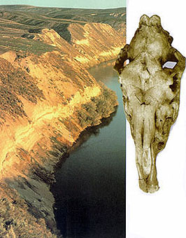
There are many fossil sites located in Idaho. One of the most important of these is the Hagerman Fossil Beds National Monument - the location of the "Hagerman Horse" fossils (Equus simplicidens) - Idaho's state fossil.
Hagerman Horse Bones
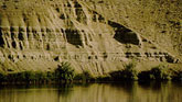
Hagerman is located in south-central Idaho on the Snake River. The beautiful Hagerman Valley was formed from the Bonneville flood, which swept through the Snake River Canyon approximately 14,500 years ago. Evidence of this flood can be found on the valley floor in the form of basalt boulders which were left by the receding flood water.
Melon gravels deposited
by the Bonneville Flood.
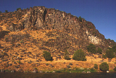
The Fossil Beds are located across the river to the southwest from the town in a series of steep bluffs formed by the Snake River cutting through the Glenns Ferry and Tuana formations. Erosion of the bluffs over time has revealed a spectacular view into Idaho's geologic past.
Sedimentary outcrops.
Elmer Cook, a cattle rancher living in Hagerman, Idaho, discovered some fossil bones on what is now monument land in 1928. He showed them to Dr. H.T. Stearns of the U.S. Geological Survey who then passed them on to Dr. J. W. Gidley at the Smithsonian Institution. Identified as bones belonging to an extinct horse, the area where the fossils were discovered was excavated and three tons of specimens were sent back to the Smithsonian in Washington, D.C.
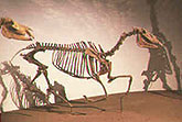
Of all the fossils uncovered, the most important find was the large volume of a species of extinct horse known as Equus simplicidens, and named the Hagerman horse.

Excavation continued into the early 1930's. The quarry floor grew to 5,000 square feet with a backwall 45 feet high. Ultimately five nearly complete skeletons, more than 100 skulls, and forty-eight lower jaws as well as numerous isolated bones were found. Finding such a large deposit of an animal in one location is a rare occurrence. An early explanation for the deposit was that the quarry area was once a watering hole where the bones of the Hagerman horses accumulated as injured, old, and ill animals, drawn to water, died there. It is now known that an entire herd of these animals probably drowned attempting to ford a flooded river and were swept away in the current. Their bodies were then quickly buried in the soft sand beneath the water.
The National Monument was established in 1988 to preserve the important finds. The Oregon Trail crosses the southern portion of Hagerman Fossil Beds. The monument is one of only 3 units in the national park system that contains parts of the Oregon National Historic Trail. In addition, many artifacts have been recovered that indicate the presence of Native Americans in the area.
Geology
Hagerman Fossil Beds are located on the eastern edge of the Western Snake River Plain. The general geology of the monument consists mainly of sediments of the Glenns Ferry and Tuana Formations of the Idaho Group which lie unconformably on siliceous Idavada volcanics. These sediments inter-bedded with an occasional basalt flow, silicic volcanic ash and basaltic pyroclastic deposits, range in age from 2.5 - 3.5 ma and represent deposition within lake, stream and flood plain environments. These unconsolidated sediments that outcrop at Hagerman have yielded a remarkable amount of fossils.
 |
Established in 1967
Gate of Death and Devil's Gate were names given to this area during the Oregon Trail period. These names referred to a narrow break in the rocks through which the trail passed. Emigrants apparently feared that Indians might be waiting in ambush.
Diaries record a series of skirmishes between the Shoshone Indians and emigrants on August 9 and 10, 1862. Ten emigrants died in the fight, which involved five wagon trains.
The skirmishes took place east of the park and not at Devil's Gate as commonly believed. Some confrontations may have occurred there, but they remain unverified.
State Park
The Massacre Rocks State Park was created to preserve the geology, ecology and historical geography of this segment of the Snake River Plain.
Oregon Trail pioneers used the Register Rock area as a "rest stop" for years. Many emigrant names are inscribed on the large rock, which is now protected by a weather shelter. A scenic picnic area surrounds the rock, creating a desert oasis for the modern traveler.
Oregon Trail remnants are most easily seen from highway rest areas in either end of the park. Other settlers artifacts can also be found.
Geology
The park is rich in geological history. Volcanic evidence is everywhere. The Devil's Gate Pass is all that remains of an extinct volcano. Towering cliffs of basalt provide
fantastical formations throughout the park.
The prehistoric Bonneville Flood also shaped the landscape of the area, rolling and polishing the huge boulders found throughout the park. The flood was caused when eroding waters broke through Red Rock Pass near the Idaho/Utah border.
Lake Bonneville, which covered much of what is today the state of Utah, surged through the pass and along the channel of the Snake River in a few short months. For a time, the flow was four times that of the Amazon River. It was the second largest flood in the geologic history of the world.
Plant & Animals
Massacre Rocks State Park is a favorite for bird watchers. Over 200 species of birds have been sighted in the park. Canada geese, grebes, bald eagles, pelicans, and blue herons are often seen.
Mammals include the cottontail, jack rabbit coyote, muskrat, and beaver.
The desert environment produces about 300 species of plants in the park. The most common are sagebrush Utah juniper, and rabbit brush.
National Forests
Introduction
Idaho is lucky to have so many beautiful forests. Almost everyone loves the mountains and enjoys the trees and animals. Though we enjoy the pleasures of the forests, the trees are valuable for other reasons as well. The forests are most important because they are part of our watershed. They help store snow and water, and control the amount of water in our streams and rivers. The trees shade the snow and make it melt more slowly. Without shade, the snow would melt too quickly. The tree roots hold the soil in place. Without roots, the soil would wash away. The soft, spongy forest floor also stores some of the water and lets it trickle clean and clear into the streams. Without the trees, the water would run down the streams and rivers in a big, muddy rush. There would be a huge, muddy spring flood, then no water later in the summer.
Idaho forests are important for another reason. They provide jobs and many of the things we use every day. Trees are used to make our houses, furniture, railroad ties, wooden boxes, wooden matches, rayon, and paper - among other things.
Native trees of the Panhandle and mountains of Idaho include aspens and needleleaf trees. These trees grow straight and tall. They are also known as evergreens. This means that these trees are green all year long and never lose all their leaves like broadleaf trees do. Several important kinds of needleleaf trees make up Idaho's forests. The most valuable is the western white pine. Idaho has the largest stand of white pine forest left in the United States. Its clear, straight grain makes it excellent for lumber and wooden matches. Next in value are the ponderosa or western yellow pine and the Douglas fir . These are excellent for lumber and timbers. Another interesting and valuable Idaho tree is the western red cedar. It is used for furniture, fence posts, telephone poles, and other uses. The largest living tree in Idaho is the red cedar growing in Land Board State Park near Elk River. It is sixteen feet through the trunk, and more than 150 feet tall. It is thought to be between 2,000 and 3,000 years old. This is nearly as old as the famous redwoods of California.
History
People have been using Idaho's trees for a long, long time. Indians used small trees to make poles for their tipis - particularly lodgepole pine. They made dugout canoes by cutting and burning out the inside of larger trees. Lewis and Clark made canoes this way near Orofino in 1805. They rode these canoes down the Snake and Columbia rivers to the Pacific Ocean.
Henry Spalding built Idaho's first sawmill in 1840 on the Clearwater River. The mill sawed logs into boards, and ground grain into flour. It was powered by a water wheel.
Trappers and early gold miners built cabins from logs.
The nicer buildings in the mining camps were made from boards cut with a two-man whipsaw. This saw was six or seven feet long, with very coarse teeth and a handle on each end. A log was laid out so one man could stand above the log, and another man could stand under it. The man under the log pulled the saw down and got sawdust in his eyes. The man above pulled the saw back up. The saw was pulled back and forth until the log was cut from end to end. It was slow work, and it took two cuts to make the first board. Heavy timbers sometimes had each side squared off with a whipsaw. More often the sides were squared by a man using an ax.
Small water-powered sawmills appeared in all parts of Idaho during territorial times. These small mills served the needs of the mining and farming towns. There was a never-ending demand for lumber. Government laws allowed people to use trees for home and farm use. A person could buy as much as 160 acres of forest land, but when those trees were gone, he was out of the lumbering business. Large lumber companies were not allowed to cut Idaho timber until 1892, when the laws were changed. Even the railroads could not cut Idaho's trees. When the railroads built their tracks across Idaho, they had to haul their wooden ties from as far away as the Black Hills of South Dakota.
During the 1800's, lumbermen thought only of cutting down all the big trees in the forest, then moving on to a new forest. They gave no thought to saving the younger trees for later harvests, or to planting young trees for future forests. After the lumbermen moved on, other people burned the stumps and trash. Much of the trash was crushed trees which were too small for lumber. The cleared land was then plowed for farming. Those forests were lost forever. The state of Maine lost its fine forests very early.
During the 1880's and 1890's, most of America's lumber was being cut in the Great Lakes states. By 1900, most of the good forests of Wisconsin, Michigan, and Minnesota were gone. Lumbermen were looking for new forests to cut. The forests of Washington, Oregon, Idaho, and Montana seemed ideal. After the Northern Pacific Railroad was built across Idaho's panhandle in 1880-1882, lumber was easy to ship. Idaho's white pine was a special prize which sold for high prices.
Lumbermen from the Great Lakes country began buying Idaho forest land in 1890. At least one company had a mill at Coeur d'Alene as early as 1890, though it was against the law until 1892. The lumbermen bought great amounts of Idaho timber land. They began building mills, and the lumbering business spread to most parts of Idaho, both north and south.
Forest Service
 President Theodore Roosevelt loved the outdoors, and he worried that all of America's forests might be destroyed. While he was President from 1901 to 1909, he set aside 148 million acres of forest to be our national reserves. He then created the Forest Service to take care of the forest reserves. He chose Gifford Pinchot to be in charge of the Forest Service. Pinchot was a well-known conservationist. The forest reserves are now called national forests. Idaho has sixteen national forests, and they cover more than 20 million acres - more than any other state except Alaska. This is about two-fifths of all the land in Idaho. Idaho's national forests are the Bitterroot, Boise, Cache, Caribou, Challis, Clearwater, Coeur d'Alene, Kaniksu, Kootenai, Lolo, Nez Perce, Payette, Salmon, Sawtooth, St. Joe, and Targhee.
Before 1940, fires burned more trees than were harvested by the lumber companies. The worst fire in the history of North America was in northern Idaho and western Montana in 1910. Though it burned only two days, the Great Fire of 1910 destroyed 3 million acres of forest, making a burn 160 miles long and fifty miles wide. Four towns and many mines and mills were destroyed. More than 100 people died when they were trapped by the fast-moving flames. Elk City was saved by its women and children, but one part of Wallace burned to the ground. One-sixth of all the forest in northern Idaho was burned. Scars from this great fire could be seen along U. S. Highway 10 (the old Mullan Road) between Wallace and Missoula, Montana, for more than fifty years.
One good thing came from this terrible fire. It made more Americans want something done to save our forests. Congress had not been very interested in the Forest Service after Theodore Roosevelt left the White House in 1909. After the Great Fire, however, Congress saw the need to give the Forest Service more money. Since then, the Forest Service has grown, and today it does a fine job of protecting our forests.
The Forest Service is now well known for its fighting of forest fires. It has a system of forest roads, telephone lines, and lookouts. Airplanes also fly over the forests looking for fires. When a fire is spotted, everything possible is done to put it out before it gets bigger. Fire fighters (called smokejumpers) are rushed to the fire by airplane. Airplanes are used to dump water and chemicals on the fire. Forest fires are still a danger to our forests, and every citizen must do all he can to prevent them.
The Forest Service also protects the forests by fighting insect infestations and diseases which kills millions of trees every year.
Forestry Science
![]() The science of logging - the cutting and hauling of logs - has grown with the rest of Idaho. Up-to-date power machinery has taken the place of the ax and two-man whipsaw for cutting down trees. One man with a small chain saw can do the work of several old-time lumber jacks. Logs are still being floated down Lake Coeur d'Alene to the mills, and trucks and trains still haul logs, which are loaded with cranes and other equipment. However, the exciting days of log drives down the Clearwater River from the mountains to Lewiston are only a memory. Dams have made that impossible. Today helicopters carry logs from steep hillsides and other places where there are no roads
The science of logging - the cutting and hauling of logs - has grown with the rest of Idaho. Up-to-date power machinery has taken the place of the ax and two-man whipsaw for cutting down trees. One man with a small chain saw can do the work of several old-time lumber jacks. Logs are still being floated down Lake Coeur d'Alene to the mills, and trucks and trains still haul logs, which are loaded with cranes and other equipment. However, the exciting days of log drives down the Clearwater River from the mountains to Lewiston are only a memory. Dams have made that impossible. Today helicopters carry logs from steep hillsides and other places where there are no roads
In the early days lumber companies cut large areas of timber without thinking of the damage to the land. All the trees in an area were cut and a large amount of the wood was lost because it was not the right size or type of wood.
 In the 1920s and 1930s people began to understand that by cutting only mature trees, the forests could be saved for the future, and the timber companies could continue to make money. The lumber companies of today manage the forests very carefully. Some of the most beautiful and most successfully managed forests in Idaho are those run by the timber companies.
The Forest Service has the job of making sure the national forests are put to the best use for all Americans, present and future. The Forest Service sells trees to lumber companies as they are needed, and makes sure the companies use good forest management. One kind of good management is called selective cutting. Only the large trees, or dead trees are cut. The loggers try to work carefully so they won't damage very many of the younger trees. Young trees are then planted to take the place of those cut. Planting young trees in the forest is called reforestation.
When the young trees grow large, the Forest Service will allow them to be cut, and more young ones will be planted to take their place. In this way, trees are harvested like a crop instead of being mined from the ground. This keeps the forests growing forever, and America will have both trees and lumber for as long as the forests keep growing.
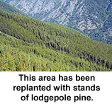
Additional changes are being made in terms of road construction, trail building and the like. Such activities have slowed considerably and are conducted in a much more ecologically sound manner today than in the past.
Economics & Uses
Economics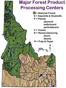 In the days of the mines, timbers to support the tunnels as well as boards and timbers for housing and places of business were needed. Local lumber companies provided each community with the wood products it needed.
Lumbering on a larger scale did not begin until after 1900 when Weyerhauser began operating plants near Sandpoint and Moscow in northern Idaho. Lumber operations still were not too large for several years, but with better forest management two large companies grew up in Idaho. The Potlatch Corporation had its headquarters in Lewiston until 1965 when it moved to San Francisco. The Barber and the Payette companies joined together into the Boise-Payette Lumber Company, which was renamed Boise Cascade in 1957. Today, Boise Cascade has its world headquarters located in Boise and is one of the world's largest lumber companies.
The timber industry was the second largest industry in the state, after agriculture, until the 1950s. Then tourism and manufacturing moved ahead of lumbering as the state's largest industries. However, manufacturing also includes the processing and manufacturing of the products from sawed timber, so the timber industry is still of great importance to Idaho . The forest industry in Idaho is responsible for a variety of wood and paper products. Idaho has 91 operating sawmills producing a variety of products such as 2 x 4 studs, plywood, waferboard and particleboard. Other plants produce house logs, posts and poles, and a variety of cedar products. Idaho also has a pulp and paper mill in Lewiston. Pulp and paper mills outside of Idaho also receive supplies of wood chips from Idaho mills. Plants manufacturing containers from pulp and paper products are located in Nampa, Twin Falls and Burley. Also important to Idaho are the industries that rely on Idaho lumber to produce finished products. Mobile homes, doors, molding, wood beams and roof supports, all bring jobs and money into Idaho's economy.
Most Idaho forest products are sold in the Midwest. However, a large amount of Idaho timber is sold to Japan. Besides lumber, Idaho mills make wooden matches, telephone poles, railroad ties, mining timbers, plywood, chipboard, pres-to-logs, food cartons, facial tissue, and many other products.
Today Boise Cascade Corporation and Potlatch Forests, Inc. are Idaho's two giants in lumbering and manufacturing forest products. However, large and small companies are important to Idaho's lumbering business. Many cities in northern Idaho depend on forest work and forest products for income. Coeur d'Alene, Sandpoint, and Lewiston are Idaho's three most important lumbering and wood manufacturing centers, Lumbering is also important in Bonners Ferry, Priest River, St. Maries, Potlatch, Orofino, Grangeville, McCall, Cascade, and Emmett.
Not all timber operations belong to the large companies. Smaller companies throughout the state produce 6.5 per cent of Idaho's lumber. Many national companies have closed mills in Idaho. In the last few years and as a result, these smaller companies are growing in importance in the state.
Land of Many Uses
Idaho's forests have many uses. Conservation does not mean that the forests are not used. It means they are used carefully so they won't be destroyed. Besides being important for watershed and for lumber, the forests have other important uses. Wild animals live in the forest, and the forest protects them. Cattle and sheep graze in many parts of the forest. People can go into the forests to cut Christmas trees and firewood and poles for fences. People use the forest for enjoyment - camping, hiking, backpacking, rafting, fishing, hunting, dude ranching, skiing, nature study, and countless other pleasures. Finally, Idaho's forest are an important and lasting part of the state's history.
Bitterroot National Forest
Forest Overview
The 1.6 million acre Bitterroot National Forest, in west central Montana and east central Idaho, is part of the Northern Rocky Mountains. National Forest land begins above the foothills of the Bitterroot River Valley in two mountain ranges--the Bitterroot Mountains on the west and the Sapphire Mountains on the east side of the valley.
Elevation ranges from 3,200 feet at the north end of the Bitterroot Valley to Trapper Peak at 10,157 feet in the mountains on the south. In the Idaho portion of the Forest, elevations drop to about 2,600 feet along the Selway River and 2,200 feet on the Salmon River.
In response to the changing needs of society, land managers on the Bitterroot National Forest use the principles of multiple use and ecosystem management to develop their objectives. Based on the sound principles of biological diversity and landscape management, the forest supports productive, healthy diverse ecosystems while providing the goods, services, values and opportunities that people desire. These include recreation, wildlife, fisheries, water, cultural resources, as well as timber, minerals, and grazing.
In the drier valley floor and lower foothills there is an arid-lands mix of grasslands, shrublands, and ponderosa pine that borders cottonwood forest along rivers and streams. On grassland ecosystems, wildlife and domestic livestock share forage. These rangelands provide benefits like wildlife habitats and recreation.
Mid-elevations receive more moisture and are habitat for stands of Douglas fir, lodgepole pine and western larch. Higher elevations produce Engelmann spruce, subalpine fir, subalpine larch and whitebark pine.
Vegetative management of the forest provides a sustained yield of forest products including saw timber, post, poles, and firewood, while providing improved wildlife habitat, forest health and high quality watersheds.
Alpine lakes, mountain reservoirs, fast running streams and the meandering Bitterroot River offer anglers the opportunity to fish for brook, rainbow, and brown trout. Be sure to consult the current Montana or Idaho fishing regulations for details.
The Bitterroot Forest is home to many species of wildlife, from mule deer, whitetail deer, elk, bighorn sheep, mountain goats, black bear, mountain lions, and moose, to many varieties of smaller animals and birds. Wildlife viewing areas offer you the opportunity to view them in their natural habitat.
Recreation opportunities abound. Try some popular activities like camping at eighteen developed campgrounds, hiking or riding on more than 1,600 miles of trails, fishing, hunting, rafting, boating, kayaking, mountain biking, rock climbing, horseback riding, wildlife watching, downhill and crosscountry skiing, snowboarding, and snowmobiling to name a few. Forty-seven percent of the Bitterroot National Forest (743,000 acres) is part of the Anaconda-Pintler, Selway-Bitterroot, and Frank Church-River of No Return Wilderness.
Heritage Resources
The Bitterroot National Forest has been occupied by humans for at least 8,000 years or longer, and is the ancestral home of the Bitterroot Salish Native Americans. It was also frequented by other tribes including the Nez Perce. These hunters and gatherers harvested plants and animals throughout the year.
The Lewis and Clark Expedition of 1805 was the first recorded contact of Euro-Americans here. After crossing the rugged divided near what is now Lost Trail Pass, Lewis and Clark descended into Ross' Hole and encountered an encampment of Bitterroot Salish preparing to travel to bison hunting areas east of the Continental Divide.
Seventy-two years later when the Nez Perce fled their homeland in Idaho. they retraced Lewis and Clark's route into the Bitterroot. After passing peacefully through the valley, they were confronted by a regiment of soldiers and the Battle of the Big Hole ensued. A segment of the Nez Perce National Historic Trail, known also as the Nee-Me-Poo, can be hiked on the Sula Ranger District.
Euro-American occupation of the Bitterroot Valley accelerated in the 1860's with the discovery of gold, first in Idaho and then in Montana. One of this area's most prominent mining operations was the Overwhich-Hughes Creek Mining District in the upper West Fork of the Bitterroot River drainage.
The lumber industry began its development in the 1880's. Much of the timber harvested was cut from public land until in 1897, when the Bitterroot Forest Reserve was created. This made it part of a national effort to help preserve the forest in the western United States from further devastation. In 1907, the Bitterroot Forest Reserve and others became National Forests with the creation of the Forest Service.
Boise National Forest
Forest Overview
The Boise National Forest includes about 2,612,000 acres of National Forest System lands located north and east of the city of Boise, Idaho. Intermingled with the Forest are 348,000 acres owned or administered by private citizens or corporations, the State of Idaho, and other federal agencies.
Most of the land supports an evergreen forest that includes pure or mixed stands of ponderosa pine, Douglas-fir, Engelmann spruce, lodgepole pine and subalpine fir. Brush-grass or grass are found in the non-timbered areas. There are many different animal species and places for animals to live. The Forest contains large areas of summer range for big game species, such as mule deer and Rocky Mountain elk. Trout are native to most streams and lakes, while oceangoing salmon and steelhead inhabit the many tributaries of the Salmon River.
Most of the land lies within the Idaho Batholith, a large and highly erodable geologic formation. Through uplift, faulting, and subsequent dissection by streamcutting action, a mountainous landscape has developed. Elevations range from 2,600 to 9,800 feet. The major river systems represented are the Boise and Payette Rivers and the South and Middle Fork drainages of the Salmon River. The average precipitation ranges from 15 inches at lower elevations to 70 inches at higher elevations.
Caribou National Forest
History
In the settlement of the west, gold fever played an important role. A vision of the mother lode could send a man searching and dreaming for years. The Caribou National Forest was named for an early miner nicknamed Cariboo Jack, who along with two friends, discovered the first gold in 1870 near what is now called Caribou Mountain. Jesse Fairchild, alias Cariboo Jack, had a reputation as a story teller, a weaver of tall tales about the Canadian Caribou Country. Today we remember him as the namesake of the Caribou National Forest.
After the first discovery, the gold rush lasted nearly 20 years and produced $50 million worth of placer gold. Two of Idaho's largest "gold" cities were Keenan City (900 population) and Iowa Bar (1,500 population), later known as Caribou City. Both sites are now abandoned.
President Theodore Roosevelt established the Forest in 1903 with the establishment of the Pocatello Forest Reserve. The Pocatello Reserve was created by the request of the local residents to protect their precious watershed. Forest Reserves were given authority to manage five surface resources: water, wood, wildlife, recreation and forage. In 1905, all Forest Reserves were converted to National Forests and moved from the Department of the Interior to the Department of Agriculture.
Geography
The Forest is located in southeastern Idaho and contains portions of six different Idaho Counties and parts of two others in Utah and Wyoming. Caribou National Forest is comprised of just over one million acres, which includes the 47,000 acre Curlew National Grassland, west of Malad, Idaho. The Forest has approximately 250 miles of streams and 8,100 acres of lakes and reservoirs.
Geographically, the Forest is characterized by several north-south mountain ranges formed by numerous geologic disruptions thousands of years ago. Caribou National Forest is situated atop a geological formation known as the Overthrust Belt, which is believed to hold heavy deposits of oil and gas. Rich phosphate deposits underlie a large portion of the Forest. These deposits have been mined on the Forest for more than 50 years. Several large mines currently operate on the Forest, supplying phosphate for fertilizer and a variety of other uses. Although no deposits have been found, oil and gas exploration activities occur with varying intensity.
Timber and Grazing
Sawtimber harvesting on the Forest averages 10 million board feet per year. Many people also obtain permits to use the National Forest for firewood, fence posts, and poles. The Caribou has some of the best range and grazing lands in the Intermountain West. Under a permit system, there are annually about 22,000 cattle and 91,000 sheep grazing on 140 different grazing allotments.
Climate
In an average year, the Forest receives 12 to 15 inches of precipitation, most of it as snow. Much of this water from the Forest is used for municipal water supplies, irrigation, and recreational activities.
Challis-Salmon National Forest
Challis Forest Overview
At 2,516,191 acres, Challis National Forest is one of Idaho's biggest national forests and more than three times the size of Rhode Island. It includes one-third of the 2,353,739-acre Frank Church River of No Return Wilderness Area - the largest wilderness in the United States outside Alaska.
The Challis forest is broken up into five pieces separated into two main sections. In total, it is 125 miles wide east to west and ninety-two miles long.
Within the Lost River Range is Borah Peak, Idaho's highest point at 12,662 feet. Also within the forest is the Middle Fork of the Salmon River at 3,790 feet.
More than 1,600 miles of trails crisscross the Challis forest. Two of these, the Knapp Creek-Loon Creek Trail and the Mill Creek Lake Trail, are designated National Recreation Trails.
For the car camper, the forest has twenty-six primary, developed campgrounds featuring 260 campsites. The campgrounds offer a variety of activities. For those hoping to escape society for a few days up to a few weeks, primitive camping is allowed throughout the forest for free.
Near Pole Flat, visitors can wander among the ruins of the ghost towns of Custer and Bonanza. Boundary Creek is the jumping-off point for floating the Middle Fork of the Salmon River. Mill Creek is a family picnic spot, while hunting and high-mountain fishing are the attractions at Starhope.
Among the more controversial parts of the forest are the more than thirty miles of designated off-road-vehicle trails in the Lost River District.
Salmon Forest Overview
Salmon is Idaho's most remote and undeveloped national forest. To give a bit of perspective, it is located 150 miles by highway from any good-sized city, such as Missoula, Montana, or Idaho Falls.
The forest's 1.8 million acres are governed by a harsh Alpine climate and a short growing season. The geology of the area is responsible for unstable soils and dramatic relief. It also provides an extraordinary amount of ideal stream habitat for steelhead and anadromous salmon spawning. Mule deer, antelope, moose, bears, elk, bighorn sheep, and mountain goats are some of the more prominent wildlife here.
The Frank Church River of No Return Wilderness Area is partially within the Salmon forest. The Salmon River, called the River of No Return by pioneers, courses ninety-seven miles through the wilderness and is essentially the only major access. The wilderness, established in 1980, contains 2.36 million acres and is just slightly larger than Yellowstone National Park. Today the roiling white water that claimed so many early floaters beckons white-water enthusiasts from around the world.
Half of the forest's 1,200 miles of trails are in the wilderness. The Salmon Forest includes several nationally designated trails, such as the Continental Divide National Scenic Trail, Lewis and Clark National Historic Trail, Nez Perce National Historic Trail, Divide-Twin Creek National Recreation Trail, and Bear Valley National Recreation Trail. Only ten primary, developed campgrounds with 142 family units are located within the forest, although there are many primitive camps.
For the Alpine skier, the modest Lost Trail Ski Area, near Gibbonsville close to the Idaho-Montana border, features a day lodge, 1,200 feet of vertical drop, and eighteen runs. The runs are served by two chairlifts and two rope tows.
Although remote and primitive, Salmon is a multiple use forest. Logging, grazing, and a variety of wildlife habitat improvement programs are in evidence. Of special note is a massive high-grade cobalt deposit. Pressure to develop this resource is strong, although many feel that it would ruin at least part of the character of one of Idaho's special places.
Clearwater National Forest
Forest Overview
The Clearwater National Forest is nestled on the west side of the Bitterroot Mountains in north central Idaho. The high mountains on the east descend to the fertile Palouse prairie to the west. Several major tributaries to the Columbia River flow through the forest including the North Fork of the Clearwater, the Lochsa, the Potlatch and the Palouse Rivers. The Clearwater River runs through deep canyons, dramatic "slashes" cut through the mountains. The North Fork of the Clearwater and the Lochsa rivers provide miles of tumbling white water interspersed with quiet pools for migratory and resident fish.
The excellent wildlife habitat of these mountains provides for large herds of elk, moose and other big game.
The ridges between the deep canyons have provided travel corridors across the mountains for centuries of mankind, including Nez Perce Indians and, in 1805-1806, the Lewis and Clark Expedition. Today the main travel route is U.S. Highway 12 following the dramatic canyon of the Middle Fork of the Clearwater River and its tributary the Lochsa River.
The forest's 1.8 million acres of diverse and spectacular mountainous country provide recreation opportunities and an important stimulus to the area's economy.
The forest is divided into three administrative units with ranger district headquarters in Potlatch, Kooskia and Orofino. There are also forest offices in Kamiah, Pierce and Powell near the Idaho-Montana border. In the summer work centers at Canyon and Kelly Creek along the North Fork Clearwater River are open.
Nez Perce National Forest
The Nez Perce National Forest has 2.2 million acres of beautiful and diverse land. From the dry, rugged canyons of the Salmon River to the moist cedar forests of the Selway drainage, the forest offers something for everyone. This vast, diverse area is managed to provide a variety of goods and services including breathtaking scenery, wilderness, wildlife, fisheries, timber harvest, livestock grazing, mining, pristine water quality and a wide array of recreation opportunities.
Origin
The Nezperce National Forest (NPNF) was created by Executive Order No. 854 signed by President Theodore Roosevelt. That Order, which became effective July 1, 1908, established the Forest from lands given up by the Bitter Root and Weiser National Forests.
Name
The Forest was the traditional home of the Ni Mii Pu (The People). The Ni Mii Pu were later named the Nez Perce Indians by the Lewis and Clark expeditions. We are proud of this name and the rich heritage it represents.
Location
The Nez Perce National Forest is located in the heart of north-central Idaho. It stretches from the Oregon border on the west to the Montana border on the east; and is roughly bounded by the Selway River drainage on the north to the Salmon River on the south. It is located entirely within Idaho County and comprises approximately 50% of the entire county landbase.
Size
Total acres 2,218,040
Wilderness
The Forest contains one wilderness in its entirety and parts of three others; nearly half of the Forest's total acres are classified wilderness:
* Gospel Hump Wilderness - 200,464 acres (entirely within NPNF)
* Frank Church-River of No Return Wilderness - 105,736 acres in NPNF
* Selway Bitterroot Wilderness - 560,088 acres in NPNF
* Hells Canyon Wilderness - 59,900 acres in NPNF (administered by the Wallowa-Whitman National Forest)
* Total = 926,188 acres of classified Wilderness
Wild and Scenic River System
The Nez Perce National Forest is known for its wild and pristine rivers. Four rivers are currently classified under the Wild and Scenic Rivers Act. They include:
* Rapid River - 12 miles
* Salmon River - 66 miles
* Selway River - 61 miles
* Middle Fork of the Clearwater River 11 miles
* Total = 150 miles
Roads and Trails
* Total miles of system roads - 3,908 miles
* Roads open with no closures or restrictions - 1,038 miles
* Roads with some or all use restricted - 2,870 miles
* Total miles of system trails - 2,906 miles
* Cross-country ski trails - 22 miles (7 miles reularly groomed)
* Groomed snowmobile trails - 500 miles
Panhandle National Forest
Forest Overview
The Idaho Panhandle National Forests comprise about 2.5 million acres of public lands which lie within "the panhandle" of northern Idaho and extend into eastern Washington and western Montana. Some 300 miles from the Pacific Ocean, the forest is in the east-central part of the Columbia Plateau, between the Cascade Mountains to the west and the Bitterroot Mountains to the east. The Idaho Panhandle National Forests are an aggregation of the Coeur d'Alene and portions of the Kaniksu and St. Joe National Forests. There are eight local points of contact including the Supervisor's Office, six district offices and the Coeur d'Alene Tree Nursery. The Forest is within nine counties in three states: Boundary, Bonner, Benewah, Kootenai, Shoshone, Latah and Clearwater Counties in Idaho; Lincoln County in Montana; and Pend Oreille County in Washington. Northern Idaho is about 20 percent farmland and 80 percent forested. The IPNF administers approximately half of the total forested acres. One-fourth of the forested land is owned by small woodland owners; the remainder is owned by industries or other government entities.
Heritage Resources
The Idaho Panhandle is rich in wildlife. Species include elk, whitetail deer, black bear and the woodland caribou, an endangered species living in northernmost Idaho, its last remaining home in the lower 48 states. The grizzly bear, another endangered species, lives in small numbers in remote regions of the forest. Abundant surface water attracts a wide variety of waterfowl, eagles and osprey.
A hundred years ago, silver, lead, and gold mining brought wealth-seekers from around the world. Today, the hot prospects have all but vanished. A few large mines remain in the Silver Valley east of Coeur d'Alene, at the mining towns of Wallace, Silverton, Kellogg and Mullan along Interstate 90. Folks with a yen to dig can still glean prizes from the earth at Emerald Creek near Clarkia. Here the Forest Service operates the world's only star garnet (the state gem) grounds outside India.
Nearby is the St. Joe River, a special place. Its lower reaches at an altitude of 2,128 feet make it the highest navigable river in the world. On this working river, tug boats pull rafts or "brailes" of logs to lumber mills in St. Maries and Coeur d'Alene. The tugs are living history, operating where paddle-wheelers once did. Part of the St. Joe River, which rises in the vast Bitterroot Range, is a Wild and Scenic River. Accessible by road and trail, the river attracts whitewater runners and fishermen. Campgrounds are nearby.
While few prospectors ever found the lead or silver of their dreams, some harvested the "green gold" of white pine, western red cedar, Douglas fir, and ponderosa pine. The timber shored up mine tunnels and finished lumber provided commercial and residential buildings, including mansions for the timber and mining barons of Wallace, Coeur d'Alene, and Spokane.
In some places the logger's axe remained sheathed. Near Priest Lake, the Hanna Flats Botanical Area and Roosevelt Grove of Ancient Cedar Area recall a time long before Europeans arrived in North America. Hobo Cedar Grove Botanical Area near Clarkia is an outstanding example of the giant trees that once filled the wet valley bottoms of the region.
Much of the timber was transported from the forest by railroad between 1900 and 1940. Today the abandoned train routes are used by logging trucks, automobiles, hikers, cyclists, snowmobiles, cross-country skiers and other recreationalists.
Remnants of the railroading era are still here including tunnels, soaring trestles and all types of old logging equipment and structures. But many are disappearing into the new forests growing up around them.
In some places, nature needs a helping hand. The Coeur d'Alene Tree Nursery produces nearly 20 million tree seedlings a year. The public is welcome to tour the facility throughout the year, but "lift and pack" season in early spring is the busiest time.
The Selkirk, Cabinet, Coeur d'Alene and Bitterroot mountain ranges feature glacial cirques and gem-like lakes high above timberline and craggy ridge tops. The country, remote and rough to travel, is a special place for those seeking solitude.
Payette National Forest
Forest Overview
Located just north of the popular resort community of McCall, Payette, like all Idaho's forests, is characterized by diversity. Its 2.3 million acres include 800,000 acres of protected wilderness, 650,000 acres of roadless land, and 850,000 acres of roaded, multiple-use forest.
Summer temperatures in the forest's lower reaches along Hells Canyon at an elevation of only 1,500 feet can easily exceed 100 degrees. High country in the Frank Church River of No Return Wilderness runs about 9,500 feet in elevation. Winter temperatures there often exceed minus 40 degrees.
Diversity also can be seen in the annual precipitation the forest receives. The Snake River country sees about twelve inches of mostly rainfall a year. The big wilderness mountains above 4,000 feet see more than sixty inches of precipitation a year, almost all in the form of snowpack crucial to Idaho's summer water needs.
Heritage Resources
The Payette forest is home to some of Idaho's most beautiful high-mountain lakes and vistas, some of which are accessible by auto. Among the more famous is the area around the Seven Devils Mountains, a series of Alpine peaks towering over Hells Canyon. Visitors are urged to contact the forest supervisor's office for detailed trip information and road conditions.
The 2,800 miles of roads in the forest are complemented by 2,125 miles of trails. Included in the trail system is the famous Lava Ridge National Recreation Trail and some 784,000 acres of the Frank Church River of No Return Wilderness.
Twenty-one primary, developed campgrounds feature 251 family units. In summer, most are busy, especially on the weekends.
Two downhill ski areas are located in the forest. Just west of McCall is Payette Lakes Ski Hill. Brundage Mountain, just seven miles north of McCall, is more popular. It features some of the deepest snows in the Northwest on 1,800 feet of vertical drop. Thirty-six runs are served by four lifts and two rope tows Cross-country skiers and snowshoers will find many miles of groomed trail in Payette, too.
Forest visitors are reminded that "multiple use" means that in all but wilderness and roadless areas grazing, logging, mining, and wildlife habitat enhancement may be going on simultaneously. These activities are another good reason to contact the forest supervisor's office before visiting.
Sawtooth National Forest
Forest Overview
The Sawtooth National Forest encompasses 2.1 million acres of some of the nation's most magnificent country. Managed and protected by the U.S. Department of Agriculture's Forest Service, the Sawtooth National Forest is a working, producing Forest that has been providing goods and services to the American people since its establishment in 1905.
The Forest is primarily located in the central heart of Idaho. There is one unit in northern Utah, four units south of the Snake River with the remainder of the units located east and west of Bellevue, Idaho all the way north to Stanley and the Salmon River. The Forest is divided into five management units. These units include the Twin Falls, Burley, Ketchum, Fairfield Ranger Districts and the Sawtooth National Recreation Area.
Heritage Resources
The Sawtooth National Forest is managed for multiple benefits. Professional management insures adequate yields of high quality water and continuing soil productivity. Cattle and sheep grazed on this National Forest produce more than 6,300 tons of red meat annually. The Forest provides homes for more than 220 species of birds, 78 different mammals, 28 species of reptiles and amphibians and 25 species of cold water fish. Trees here not only provide homes for wildlife and a pleasant visual backdrop for residents and visitors, but also contribute to the nation's need for wood products. Each year trees are harvested for firewood, posts, poles, house logs, sawtimber, landscaping and Christmas trees.
Throughout the Forest, a wide variety of opportunities exist from very primitive to highly developed recreation sites. During the popular recreation seasons, the Forest publishes a weekly recreation report that provides current information regarding campgrounds, roads and trails and various recreation activities. The season of the year makes no difference as the Sawtooth is a "Forest For All Seasons." Wintertime offers outstanding wintertime recreation experiences for cross-country skiing on both groomed and ungroomed trails. Downhill skiing is offered at four developed winter sports areas that provide some of the finest terrain and snow conditions found anywhere. Snowmobiling is popular with marked and groomed trails and warming huts available. Springtime visitors are rewarded with snow-capped mountain peaks, rushing streams and meadows carpeted with hundreds of varieties of wildflowers. Summer visitors have more than 86 developed camping and picnic areas at their disposal. High quality summer recreation opportunities include swimming, fishing, scenic driving, camping, picnicking, backpacking, photography, horseback riding and so on. Trail bike riding and two and four-wheel drive vehicle opportunities occur in many areas of the Forest. Visitor activities such as guided hikes, campfire programs, auto tours, and exhibits are provided throughout the Sawtooth National Recreation Area. Fall brings a very pleasant change to the Sawtooth. Spectacular color displays occur in areas where aspen, cottonwood, and willow trees abound. During this season the number of visitors drops off, leaving visitors with unlimited opportunities to really "get away from it all." The Sawtooth offers outstanding opportunities for hunting and fishing. These activities are regulated by the State of Idaho Department of Fish and Game.
Targhee National Forest
Forest Overview
The Targhee National Forest is an administrative unit of the Department of Agriculture, Forest Service, encompassing 1.8 million acres. Established by President Theodore Roosevelt in 1908, the Forest is named in honor of a Bannock Indian warrior. The Shoshone-Bannock Tribe, has ancestral Treaty Rights to uses of the Forest. The Targhee Forest Supervisor's Office is located in St. Anthony, Idaho with District offices in Dubois, Island Park, Ashton, Idaho Falls, and Driggs. The Forest is bordered by six other National Forests. Part of the Caribou National Forest is administered by the Targhee and part of the Targhee is administered by the Bridger-Teton National Forest.
The majority of the Forest lies in eastern Idaho and the remainder in western Wyoming. Situated next to Yellowstone and Grand Teton National Parks, the Forest is home to a diverse number of wildlife and fish, including Threatened and Endangered species, wilderness, scenic panoramas and intensively managed forest lands.
The Forest lies almost entirely within "the Greater Yellowstone Area" or "the Greater Yellowstone Ecosystem," an area of 12 million acres and the largest remaining block of relatively undisturbed plant and animal habitat in the contiguous United States. The area continues to gain prominence for its ecological integrity. The United Nations has identified the area as a Biosphere Reserve.
On a larger scale, the Forest lies along the Continental Divide, at the uppermost reaches of the Columbia River Basin, an ecosystem of 40 million acres extending from Western Washington to the Southeastern Idaho border and encompassing parts of Montana, Wyoming, Nevada and Utah. The Forest includes all or portions of several distinct mountain ranges, including the Lemhi, Beaverhead, Bitterroot, Centennial, Henry's Lake, Teton, Big Hole, Caribou, and Snake River Ranges. Elevations range from near 5,000 feet on the Snake River to over 12,000 feet on the Forest's western and easternmost reaches. The Forest contains the Island Park Caldera and several reservoirs. Topography ranges from rolling foothills to rugged, glaciated mountain peaks. Although most of the land is dry and semi-arid, 190 stream headwaters situated on the Forest provide varied vegetation to support a multitude of uses. The area has cold, moist winters and hot dry summers. Average annual precipitation, most of which falls as snow, increases with elevation. As little as ten inches of precipitation falls in lower valleys and as much as forty inches occurs at the highest elevations. Wide temperature extremes exist, with summer temperatures at lower elevations exceeding 100 degrees Fahrenheit and winter temperatures at higher elevations falling to less than 40 degrees below zero Fahrenheit.
In recent years the Forest Service has embraced the concept of ecosystem management. This is an approach to natural resource management that strives to ensure healthy, productive, sustainable ecosystems by blending the needs of people and environmental values on a given area such as the Targhee National Forest. An ecosystem is a complex system of living and nonliving components that interact and change continually. Healthy ecosystems are those that retain all of their parts and functions for future generations even though vegetation patterns, human uses, or other conditions may change. Understanding ecological processes (fire and other natural disturbances) and how these processes shaped vegetative patterns over time in a landscape are important steps towards implementing ecosystem management. Many resources are described using the ecological units known as subsections (also referred to as management areas). These units exhibit unique patterns in soils, landform, topography and potential natural vegetation, among other characteristics. The Forest encompasses part or all of seven subsections:
* Lemhi/Medicine Lodge
* Centennial Mountains
* Island Park
* Madison Plateau
* Teton Range
* Big Hole/Palisades Mountains
* Caribou
Wilderness
In October 1984 the Wyoming Wilderness Bill was signed into law creating the Jedediah Smith Wilderness (116,535 acres) and the Winegar Hole Wilderness (10,820 acres) on the Targhee National Forest. The Wilderness Act allows hiking, camping, hunting, fishing, skiing, and grazing in these areas. Fires are allowed in most areas, but some areas are closed to open fires to protect resources. Special regulations are issued by Ashton and Teton Basin districts. Motorized or mechanical equipment is prohibited. Horses can be used in both Wilderness areas; however, overnight camping with stock is not allowed in specified locations. The Jedediah Smith Wilderness is on the west side of Grand Teton National Park. The towns of Victor, Driggs, Tetonia, and Ashton, Idaho are 5 to 20 miles west of the Wilderness. The Winegar Hole Wilderness is 25 miles east of Ashton, Idaho and adjacent to the southeast corner of Yellowstone National Park.
Forest Renewal
The Targhee National Forest is an old forest becoming new. In the 1960's, timber on the Forest was primarily old growth lodgepole pine interspersed with Englemann spruce, subalpine fir, and Rocky Mountain Douglas fir. The condition of the lodgepole pine caused an epidemic of mountain pine bark beetle that destroyed the lodgepole. During the 1960's and early 1970's, Forest managers tried several methods to halt the advance of the bark beetle, but none of them were economically feasible or successful.
The dying trees interfered with effective management of other Forest resources and created a fire hazard from the build up of dry fuel. In 1974, Targhee Forest managers implemented a salvage program designed to use the deadwood and open large areas to reforestation. The wood was sold in commercial and personal use firewood sales, in small sales for posts and poles, and in larger sales for use in making pressed board.
Salvage and reforestation went hand in hand. As soon as areas were cleared of dead trees, new trees were planted. Lodgepole was combined with other native varieties too produce a healthy mixture of species. Diversification of tree species and age affords protection against recurrence of the devastating epidemic.
Targhee National Forest is in a unique phase of evolution. Most of the old, dead trees are gone. The new trees are growing well. Visitors traveling along U.S. Highway 20 through the Ashton and Island Park Districts see regeneration in progress. The highway passes through a corridor of reforestation ranging from cleared areas ready for planting to areas that were planted through the 1970's and 1980's. Signs identify management phases and explain the panorama of new trees. Growth is slow during the first three years after planting so the newest trees are hard to see, but by the time they are five years old regrowth is clearly visible. Time alone will heal the Forest. Although the lodgepole is a thrifty tree, it will take many years before the majority of the Forest is restored. In the meantime, visitors have a once in a lifetime opportunity to witness the making of a forest for generations to come.
Lumbermen in Idaho By Ralph Hidy
| Although lumbering has been one of Idaho's most important industries, little has been written about the subject. Thus, this sketch of the development of lumbering in Idaho by Professor Ralph Hidy of the Harvard Graduate School of Business Administration is especially important. Drawing upon a wide variety of unpublished sources, he stresses the role of several companies in the lumbering industry. Particularly insightful are his discussions of the numerous problems that plagued these firms and often made their existence a tenuous one. As the author points out, better administrations, more skillful use of capital, new techniques of timber management, and wider use of timber products have given lumbermen greater success in the last few years. [Source: Ralph Hidy, "Lumbermen in Idaho: A Study in Adaptation to Change in Environment," Idaho Yesterdays, VI (Winter 1962), 2-17.]
Other sources that deal in part with lumbering in Idaho include: Dallas E. Livingston-Little, An Economic History of North Idaho, 1800-1900 (Los Angeles: Journal of the West, 1965). Ralph W. Hidy, Frank Ernest, and Allan Nevins, Timber and Men: The Weyerhaeuser Story (New York: The Macmillan Company, 1963), especially chapters 12 through 30; and George T. Morgan, "The Fight Against Fire: The Development of Cooperative Forestry in the Pacific Northwest," Idaho Yesterdays, VI (Winter 1962) 20-30. |
"Nowhere in the far northwest did the Weyerhaeuser group cherish brighter hopes at the beginning of the century than in Idaho; nowhere else did they meet so many frustrations. Their enterprises in that land of peaks canyons, lava beds, sagebrush barrens, fertile valleys and towering forests have aspects of exceptional interest. The record includes a preposterous mountain railroad, fantastic adventures with logs on precipitous streams, flume building..., lawsuits, and one of the most remarkable company towns in the annals of lumbering. Hard work went into the undertakings. In the [first] forty years after 1900, however, the story was written with more red ink than black, more disappointment than success."
That quotation, the opening paragraph of "Idaho Promises and Realities," a chapter in a forthcoming book tentatively entitled Timber and Men, the Weyerhaeuser Story,1 sets the mood and theme of this essay. It is a story of profiting from mistakes at least as often as from successes, of slowly learning how to overcome handicaps and obstacles, of gradually coming to terms with a continually changing social and economic environment. The long process of adjustment provides a prime illustration of the fact that the transference of capital and experience accumulated in one area to another is no guarantee of immediate success in the new one. That the adjustment ultimately did take place also suggests that alert businessmen, if perceptive and decisive enough, and if financially able and determined to "hang on," may be able to convert an ailing industry into a healthy one and thereby make an important contribution to the economic development of a state and an area.
Analysis herein focuses on the process of participation by selected lumbermen in the development of the Inland Empire rather than on a calculation of their relative contribution to the total economic growth of the area. In the center of the stage are members of a few families who invested their accumulated capital in Idaho timberlands and in so doing laid the foundations of what today are two substantial enterprises, Potlatch Forests, lnc., and Boise Cascade Corporation.
Among the midwestern investors who pooled their resources to invest in Idaho lumber enterprises cited in this paper, Frederick Weyerhaeuser had been the key figure for a generation. He started in the lumber industry in 1856, and in another four years, this blue-eyed, genial, astute German immigrant had formed a partnership with his brother-in-law, F.C.A. Denkmann. Within ten years after that first collaborative sawmilling venture in Rock Island, Illinois, Weyerhaeuser and Denkmann were engaged in several other enterprises in the same city. In December 1870, the desirability of presenting a united front to opposing millmen on the Chippewa River in Wisconsin induced fourteen firms between Winona, Minnesota, and St. Louis, Missouri, to come together in the Mississippi River Logging Company; its purpose was to drive and allocate a desired amount of logs to mills on the middle reaches of the Father of Waters. By 1881, the leading firms on the Chippewa had also decided to collaborate with the downriver group in owning timber and driving logs from the forest to the mills.
Out of these activities, plus other joint ventures in Wisconsin and Minnesota, came intimate association of Frederick Weyerhaeuser and his four sons not only with the Denkmanns but also with such families as the Lairds and Nortons of Winona, the Mussers of Muscatine and the Youngs, Lambs, and Joyces of Clinton in Iowa, the Ingrams, Carsons, and Moons in Eau Claire, the Humbirds of Mason and Edward Rutledge of Chippewa Falls, all three towns in Wisconsin.2
The process of moving their capital and experience to the Pacific Northwest began in 1900. During that year and soon thereafter Frederick Weyerhaeuser and his associates made decisions which ultimately resulted in the formation of numerous companies and in a multi-million dollar investment in Idaho lumbering ventures.
Why did these Middle Westerners get interested in Idaho at this particular time? Several factors coincided to make them favorably disposed to investment. They were closing out operations on the upper Mississippi and Chippewa rivers and had money to invest. The forests of Michigan, Minnesota, and Wisconsin were being rapidly depleted. The investors had been living in a white pine economy, had been challenged for primacy primarily by marketers of southern yellow pine, and saw two types of pine in Idaho - white and ponderosa. Per capita consumption of lumber was still rising, and prosperity was obviously in the air after the long depression of the 1890's. Other lumbermen had long since established small sawmills in the state of Idaho,3 the Northern Pacific Railroad was offering timberlands for sale, and holdings of the state were also in the market. On the basis of prospects for profit, stimulated by the recommendations of a few promoters and the obvious easy availability of raw material, investment in Idaho pinelands seemed a sound idea.
Accordingly, members of several of the families put their money and faith into seven Idaho ventures. Five were north of the Salmon River canyon, the great barrier in central ldaho, and two were south of it. This surge in investment was part of a general migration of lumber capital from the Midwest to the Northwest between 1899 and 1908, known to contemporaries in the Inland Empire as "the great buying rush."
In 1900, Frederick Weyerhaeuser and John A. Humbird, joint participants in the White River Lumber Company of Mason, Wisconsin, purchased from the Northern Pacific Railroad a bundle of Mt. Rainier scrip entitling them to over 40,000 acres on the Clearwater River. They arranged for two agents to choose lands and file claims. Other buyers were in the area, but the Weyerhaeuser agents won the race for the most promising lands, which became the nucleus of the holdings of the Clearwater Timber Company, organized in December 1900 with an authorized capital of $500,000.5
Almost simultaneously, other assorted families started three other ventures in the northern part of the Idaho panhandle. First, Edward Rutledge, a lifelong associate of Frederick Weyerhaeuser in the Middle West, purchased Northern Pacific white pine lands on the Priest River. These were combined with holdings of the Sand Point Lumber Company, bought by Humbirds and Weyerhaeusers, to form the nucleus of the Humbird Lumber Company, also organized in December 1900 with an authorized capital of $500,000.6
Within less than a year Edward Rutledge had led the Weyerhaeusers into acquisition of still more unsurveyed white pine lands of the Northern Pacific (25,520 deeded acres) as well as state lands approximating 30,000 acres. Starting with these holdings, in October 1902 the purchasers organized the Edward Rutledge Timber Company with authorized capital of $200,000, Coeur d'Alene eventually becoming its center of operations.7
Still another corporation was organized that same year - the Bonners Ferry Lumber Company, a Wisconsin firm. It began with a mill site, 13,000 acres of timberland, and riparian rights on the Kootenai River. These properties had been acquired by two men from New Richmond, Wisconsin, one of whom soon induced Frederick Weyerhaeuser to invest in the venture which promised to produce white pine, ponderosa, fir. and larch lumber.8
In the Palouse basin rose the most ambitious enterprise financed by this group of families. During 1901 and 1902, William Deary, a brusque, dynamic, rotund Irishman, made initial purchases of state timber and other lands in the Palouse-Clearwater Drainage areas in the name of the Northland Pine Company, a Minnesota firm. In March 1903 these acquisitions were sold, along with those of Henry Turrish for the Wisconsin Log and Lumber Company, to the Potlatch Lumber Company. This new Maine firm began its life with an authorized capital of $3,000,000. The list of officers reflected the major family investors - Charles A. Weyerhaeuser as president, Turrish's vice-president, Clifford R. Musser as treasurer, F.S. Bell (Laird, Norton group) as secretary, and Deary as general manager.9
Separate groups set up two corporations to operate in Southern Idaho. One, the Barber Lumber Company,10 capitalized at $150,000, was organized in July 1902 by James T. Barber (the president), William Carson, C.W. Lockwood, C.D. Moon, and S.G. Moon. Frederick Weyerhaeuser was not a participant in this transaction, but the firms of the organizers - Northwestern Lumber and Valley Iumber companies of Eau Claire, Wisconsin, and Burlington, Iowa - had been associated with him in Chippewa River undertakings. Barber Lumber had originated in the purchase of 25,000 acres of timberland on Grimes and Moore's creeks, tributaries to the Boise, from Frank Steunenberg, the former governor of Idaho who was later murdered by a Western Federation of Miners agent.
The second corporation set up to operate in Southern Idaho, Payette Lumber & Manufacturing Company, was organized in January 1902 with an initial authorized capital of $500,000. it took over stumpage and timberlands in the Payette Basin originally purchased by William Deary for Northland Pine and Henry Turrish for Wisconsin Log & Lumber.11 The main attraction was ponderosa pine in the basin of the Payette River. The starting nucleus apparently was almost 33,000 acres of stumpage purchased from the state for $183,620 in November 1902. As president, the directors chose William Musser, a reflection of the special interest of his family in the enterprise.
All these lumbermen naturally brought to Idaho a complex of attitudes based upon experience. White pine had been their chief product in the Middle West, so white pine was the chief attraction in Idaho. To be sure, they had produced enough Norway pine to appreciate that other species, such as ponderosa, could also find a market, but other species were of distinctly peripheral interest to them. In all cases, the Weyerhaeuser and associated families preferred to buy large initial lots in toto, as they had in Wisconsin and Minnesota. Judging from extant correspondence, the midwestern investors regarded the acquisition of timber as the all-important problem; analyses of manufacturing and marketing processes occupied little of their attention. They had built mills, made lumber, and sold it in another area and could do the same things in ldaho; so their thinking seems to have run. Mills could be built alongside railroads, which would give access to markets. As for logging, experience dictated reliance on two-man saws, the drawing of logs to streams or to railroad loading points by horses, and transport to sawmills by either streams or rail or both. In the Midwest, water transport was preferred in the early stages of cutting, when the stands of timber near the rivers and creeks were to be felled. And recent experience in the Upper Mississippi Valley dictated the value of "clear cutting" - felling every tree of merchantable size regardless of species and of the market demand.
As might be expected, the new investors brought midwestern labor policies with them. To treat employees in the same manner as competitors was the prevailing policy. Wages and hours were to be determined by the market, not through collective bargaining with organizations of workers. The nucleus of the work force in the woods should be a group of long-employed. reliable men who worked in the mills when not logging. The logging force would be rounded out by unmarried itinerants Food would be ample, of good variety, and well prepared if managers could find good cooks. Among the investing families - Carsons, Denkmanns, Humbirds, Lairds, Nortons, Moons, Mussers, Weyerhaeusers, and others - no one could find a single Simon Legree, but one could locate an occasional benevolent patriarch. They were motivated by desires to treat employees fairly, even while they insisted on dictating the terms of labor-management relations. Heirs to an age-old tradition that the owner was the boss, they had not yet felt the necessity of changing their ideas.
The economics of the industry at the time left no alternatives but to follow the prevailing policy of lumbermen - cut out and get out. Per capita consumption of lumber was still rising and the demand was brisk; if one group did not manufacture lumber from Idaho timber others would. Much timber still was available for cutting so the obvious investment policy was to take profits on a given operation and invest them in another. The ever present threat of fires, dramatized for the Pacific Northwest by the Yacolt burn and widespread fires in 1902 and 1910 in ldaho, emphasized the desirability of cutting tracts quickly once possession of them had been taken, even though this was not always done when other factors outweighed the threat of fire.
Furthermore, the existing tax system practically forced an ambitious lumberman to cut out timber and get off the land as quickly as possible. County officials had to set up offices, build roads, and carry on schools as new areas were occupied. Assessors set rates on the properties to be paid on an annual basis, which meant that lumbermen paid the same rates before and after cutting the timber. Obviously, lumbermen wanted either to sell their cutover unproductive lands as quickly as possible or to relinquish them in lieu of paying taxes.
In terms of values and methods brought to Idaho the Humbird Lumber Company was the only truly successful venture of the seven. Thomas J. Humbird, an energetic capable executive trained under his father in Wisconsin, took over as manager and started sawing in 1902. A year later he bought a single-band sawmill at Kootenai and improved its performance. After a fire destroyed the Sandpoint mill in 1907, he rebuilt it as a two-band operation. Ten years later he purchased his third mill, one on the Pend Oreille River opposite Newport, Washington. Efficient log storage facilities on Lake Pend Oreille, wise purchases of timber, efficient logging, manufacturing, and marketing, and tight management in general resulted in the production of slightly more than 2,000,000,000 board feet of lumber from the beginning of the operation to 1931, when the last sawing was done. On paid-in capital of $1,000,000 (by 1904). dividends totaling 430 per cent were paid by 1937, when the liquidation was nearing its end. Humbird Lumber still had some timber, but "cut out and get out" had paid off well if not excessively.12
The record of the Bonners Ferry Lumber Company stood at the opposite end of the spectrum. The one-band sawmill began operating in 1904, and paid-in capital rose to its peak of $332,000 in 1905. Nothing worked as hoped. Driving logs down the rocky Kootenai proved highly wasteful, and the Great Northern declined for technical reasons to haul logs through tunnels. Spring floods annually submerged much of the drying yard and damaged log-holding facilities. The burning of the mill in 1909 required large expenditures for a new and larger plant, which in turn led to further purchases of timber. An outlay of $200,000 for timber in Canada was lost when Canadian authorities denied permission to move logs across the border. Almost all timber holdings were uneconomically scattered, causing high logging costs. A small percentage of white pine, a high percentage of other species, and unprofitably low market prices harassed operators except in wartime. Efforts to ameliorate the impact of adverse freight rate differentials in the markets of Montana and the Dakotas never succeeded. And no dividends ever went to stockholders. The Weyerhaeuser family did receive 6 per cent on loans, which rose to a peak of $1,500,000 and remained high until the mill was closed down in 1926, after producing a total of almost 733,000,000 board feet of lumber. 13
Had the properties of the Edward Rutledge Timber Company not been merged in 1931 with those of two other firms, its performance might have gone down in history as even worse than Bonners Ferry's. Acquisitions of timberland rose to 109,748 acres by the end of 1915, some of which had been sold and some logged as a result of fire damage in 1910, 1913, and 1914. ln 1915, the directors of the company embarked on a utilization program. They engaged Huntington Taylor (son of a Vassar College president, undergraduate friend of Rudolph Weyerhaeuser, and experienced in lumber manufacturing at Cloquet, Minnesota) to supervise erection of a sawmill at Coeur d'Alene and to initiate systematic logging operations on Marble Creek. The mill, which began sawing on April 1, 1916, turned out 666,495,000 board feet of lumber by the end of 1930, but high cost of logging in rough mountainous country, excessive brooming of logs mistakenly driven down Marble Creek with the aid of spectacular flumes, some disastrous fires, a managerial, error in deciding to build a railroad to salvage some fire damaged timber, heavy long-term debt, and depressed market prices for lumber all combined to produce an aggregate net loss before the merger occurred. Although some stockholders did get interest on substantial loans to the firm (its long-term debt reached a peak of $4,849,980 in 1923), they received not one dividend between 1902 and l93l.14
While the Rutledge firm was making a great display of red ink, Clearwater Timber Company was absorbing capital at a prodigious rate. Although the original investors had intended to begin manufacturing much earlier the Clearwater Company really acted only as a timber acquiring and holding agency until 1927. By September of that year, having made many small sales as well as innumerable purchases, it held 236,125 acres, estimated to contain some five billion feet of merchantable timber about equally divided between white pine and other species. Carrying charges were then running at better than $300,000 per year, having reached a total of $2,395,000 from 1913 to 1927 inclusive. By this time the Northern Pacific and Union Pacific had jointly built railroad connections from Lewiston to Headquarters on the North Fork of the Clearwater near important stands of timber. A modern electric five-band sawmill had been erected at Lewiston and the whine of its saws began to tickle the eardrums of the men on August 8, 1927. Logs coming to it from the woods had been moved by horses, tractor, flume, rail, and river.
ln spite of using the most advanced techniques and technology in woods and mill, the Clearwater Company still failed to make money. Paid-up capital amounted to $9,000,000, long-term debt to $8,233,000 and earned surplus to $2,337,000 in the red at the end of 193015. Desperate measures were needed, for the Great Depression was at hand.
In comparison with the Clearwater and Rutledge companies, Potlatch Lumber started impressively The manager, William Deary, purchased a mill and timberlands from the Palouse River Lumber Company and by 1906 had erected a gigantic belt-driven mill at Potlatch, the location of one of the outstanding company towns in the lnland Empire. Four years later a second mill, this one electrically driven, had been built at Elk River. By 1907, in the name of a one million dollar Maine corporation - the Washington, Idaho, & Montana Railway Company - Deary had constructed 45 miles of logging railroad running from Palouse, Washington, to Bovill, Idaho, where it connected with the Chicago, Milwaukee, & St. Paul Railroad. He had also bought 16 retail yards in nearby areas and built others.
From 1908 through 1927 Potlatch Lumber sawed an average of 131,000,000 board feet of lumber annually but the company was always a marginal enterprise. By 1908 paid-in capital stood at $8,000,000, where it remained until 1931. Aggregate net income for the years 1908-1930 inclusive was slightly less than $5,000,000, a sum about equaling the amount earned in the four years 1917-1920. During the next decade Potlatch Lumber operated in the black only in 1923 and 1925, losses far exceeding earnings for the period.
A variety of difficulties accounted for the poor earning record of the Potlatch firm. Initial investment was heavier than anticipated; by the time systematic accounting had been instituted in 1908, more than $8,000,000 had been put into the railroad, inventories and mill, timber and timberlands. Soon such stockholders as F.E. Weyerhaeuser began to observe shortcomings that proved perennial: Deary's decisions were often hastily made and inefficiently implemented, and his policy of "clear cutting" often resulted in losses on unmerchantable logs. The Potlatch plant, one of the last of belt-driven commercial sawmills, was not as efficient as those electrically driven. At Elk River deep snows shut down the plant for several months each year.
Along with other Idaho companies, Potlatch Lumber was at a competitive disadvantage in midwestern markets with southern pine produced at lower costs and shipped at lower freight rates. Not until 1922 did the Northern Pacific, for example, grant joint rates to the W.I. & M. Road. Pacific Coast mills had the advantage of low rates via the Panama Canal to east coast markets after World War I. To make matters worse, A.W. Laird, who became general manager when Deary died in 1913, lavished his interest on the town of Potlatch and delegated authority to a sawmill manager whose product was so poorly graded that, by the early 1920's, salesmen had become reluctant to handle Potlatch lumber. A new mill manager improved the product but much damage had been done.
In summary, certain basic reasons, exclusive of particular accentuating circumstances, accounted for the miserable showing of many Idaho lumber companies up to and including the 1930's. The trees harvested yielded a low percentage of clear lumber. Only Humbird Lumber had a preponderance of white pine, the most easily marketable species; a market had to be developed for the lumber produced from the high percentage of ponderosa, fir, and larch in many stands. Logging costs were always relatively high as a consequence of rough terrain, high transportation costs, and the small volume of timber per acre that required much shifting of crews and equipment. In every instance, high freight costs to the Middle West and East in comparison with those on lumber from the South, the Midwest itself and the Pacific Coast tended to limit potential profits. This high cost Idaho lumber had to compete in a national market characterized by sawmill capacity in excess of effective demand, with the result that realized prices often yielded a return to Inland Empire mills below cost of production.
By 1931 stockholding families - Lairds, Nortons, Mussers, Weyerhaeusers, and others - were ready to combine the three weak north Idaho firms. Managers of Humbird Lumber elected to cut out and liquidate, but on April 29 Potlatch Forests, Inc. (PFI), a continuation of Potlatch Lumber Company under a new name, took over the properties of Clearwater Timber and Edward Rutledge Timber companies. As of January 1, 1931, the starting date of PFI for accounting purposes, the books showed capital stock at $26,595,000.16
In point of fact, in spite of severely depressed markets in 1931, managers of PFI could note several circumstances promising well for their enterprise. Even before the passage of Idaho's basic forest fire law in 1907, leaders of PFI's antecedent companies had informally joined others in voluntarily protecting their timber from fire. After that date they had also taken an active part in the various formal, private, voluntary, cooperative associations - Pend Oreille Timber Protective Association, Coeur d'Alene Timber Protective Association, Clearwater Timber Protective Association, and Potlatch Timber Protective Association. And they had not only welcomed but supported every enactment to bring about cooperative fire protection with State and Federal agencies - such acts as the Weeks, Clarke-McNary, McSweeney-McNary, and other laws.17 As a result, the system was working as well as could be expected, given the extremely complicated character of the problem.
During the 1920's Idaho lumbermen had also vigorously tackled the problem of taxation. One of the most energetic of many campaigners on the topic was G.F. (Fritz) Jewett. Active in both Clearwater Timber and Edward Rutledge Timber Company, he urged, both publicly and privately, that the Idaho legislature should pass a realistic forest tax law. Finally, in March 1929, partly as a consequence of the serious difficulties which all lumber companies had encountered since 1920, and partly as a result of the "educational" campaigns of Jewett and men of like mind, Idaho legislators enacted a law providing for a low tax on cutover and reproducing lands (assessed at $1.00 per acre) and a 121/2 per cent yield tax when the trees were cut. At least in part through the persuasiveness of lumbermen themselves, the way was paved for treating timber as a crop, as a renewable resource. Planners J.P. (Phil) Weyerhaeuser, Jr., and C. L. Billings, the manager and assistant manager of Clearwater Timber, and later of Potlatch Forests, could start selective cutting, advanced logging practices, and a program for sustained yield of Idaho forests.18
In 1929, the same year the tax system was modified, Phil Weyerhaeuser and C.L. Billings started Clearwater Timber on operations in perpetuity. As early as 1916, David T. Mason had pointed out that, under conditions and practices at the time, the average earnings of Idaho lumber companies were too low to encourage continued utilization of trees in the state. After a temporary period of prosperity from 1917 to 1920, the unfavorable conditions for profitable operations in Idaho reasserted themselves. Through his consulting firm of Mason & Stevens, David T. Mason then became an ardent advocate of selective logging and sustained yield - cutting of merchantable trees and reforestation according to carefully formulated principles - and laid out a forestry program for Clearwater. Weyerhaeuser and Billings lent willing ears, initiated selective logging in Clearwater Timber holdings, and in October 1929 successfully applied to the National Forest Service for enough timber to round out sustained yield operations for their firm. Enlightened forest management was launched in Idaho, in accordance with detailed plans drawn by E.C. Rettig, chief forester of the company. In little more than a year all PFl woods operations were following the same pattern. Following the lead of Weyerhaeuser Timber Company, PFI officially announced its first tree farm in 1943.
C.L. Billings, who became the general manager of PFI in 1933, when Phil Weyerhaeuser left the company to become general manager of Weyerhaeuser Timber Company, soon assumed the position of a dominant personality among operating lumbermen of the Inland Empire. Blunt of speech but warm in personality, he improved public relations of PFI and successfully maintained close cooperation with State and Federal forest services (he had served with the National Forest service before entering the employ of the Rutledge and Clearwater companies). Conservation of timber resources was a basic policy with him. Similarly, he experienced little difficulty in relations with labor, having only two serious brushes with unions during his period of leadership, 1933-1949, perhaps the reason was that he and Phil Weyerhaeuser had built Clearwater Timber's labor policy in 1927 on a report by Rettig detailing the most advanced techniques of all firms in the Pacific Northwest.19
For all his modern policies, Billings had to work for ten years before Potlatch Forests, Inc., began to show consistent profits. Accounts presented net earnings in black for only one year (1937) during the thirties. War demand and rising prices then coincided to make entries possible in black ink instead of red. Starting in 1940, dividends have been paid annually. ln fact, profits were favorable enough that sums could be set aside for postwar expansion.
The expansion, carried out by William P. Davis from 1949 to 1958, involved the conversion of PFI from a local ldaho lumber operation to a national, integrated forest products activity. All sawmills have been periodically improved, many new items (such as plywood) added to the company's lumber product lines. Under Davis's eye, a pulp and paper mill was erected at Lewiston in 1949-1950 and subsequently expanded. Not only white and ponderosa pine but red fir, larch, white fir, cedar, and spruce were increasingly used in PFl products. (Broad utilization of species had begun before World War II.) Through purchases, mergers, and large capital investments under Davis and his successors, the company has enlarged its timberland holdings to more than 900,000 acres in Idaho, Washington, and Arkansas. Professional managers who are not members of stockholding families have moved the firm into manufacturing and marketing such products as food board, milk carton blanks, folding cartons, napkins, paper plates and bond and fine papers from the Atlantic to the Pacific.
Selective logging, sustained yield, full utilization of trees, and integrated operations had won the day. Retained earnings in the company at the end of 1958 totaled $52,690,000, largely accumulated in the preceding decade. From 1931 to 1958 the net worth of the company had increased almost three times. The new ideas seemed to be profitable. To what extent had managers in southern Idaho lumber companies applied them? That is the next question.20
Barber Lumber Company started operations in 1905 but almost immediately met a series of difficulties. It built a mill six miles from Boise and began driving logs to it. River driving "broomed" the logs, and silt accumulated behind the dam of the storage pond. Heavy snow hindered logging, and ponderosa logs stained blue if cut one season and driven the next. Therefore, as early as 1907 executives of Barber Lumber got a charter for a railroad - the Intermountain Railway Company - but then decided to postpone construction of the road, to suspend attempts to buy additional state timberlands, and to stop manufacturing operations. The trigger for the decisions was a Federal suit, instituted against Barber Lumber, W.F. Borah (the company's attorney), and Frank Steunenberg, for conspiracy to defraud the government in acquiring timberlands. Borah was acquitted almost immediately, but not until 1912 was the Barber Company cleared of the charge. By that time the total investment, some of it made with funds supplied by the Laird-Norton group and the Weyerhaeusers in 1906, had exceeded $1,600,000, and no earnings were in sight.21
Meanwhile, for stockholders of Payette Lumber & Manufacturing, F.M. Hoover, general manager from 1904, had added valuable timber year after year. At the end of 1913 the company owned 154,000 acres, expected to yield 1½ billion board feet of lumber. On the assumption that logs could be driven down the Payette River, Hoover had also arranged for building a dam at the head of Black Rock Canyon on the North Fork and an 18-mile road along the stream to Smith's Ferry. Though no logs were ever floated down the river, he later thought the improvements were a factor in inducing the Union Pacific to push its rails northward after 1911 to the Payette Lakes - thus assuring the company of log transport facilities when a mill was erected. By 1913, stockholders could visualize the possibility of such construction, of utilization of the timber, and of some earnings if a merger with Barber Lumber could be effected.22
That action was taken on December 24, 1913, when the Boise Payette Lumber Company was incorporated in Idaho. With its paid-in capital of $7 million, Boise Payette bought the stock and property of Payette Lumber & Manufacturing for $3 million, those of Barber Lumber for $1 million, leaving a residue of $3,000,000 for constructing a large new mill at Emmett and for other purposes. Total timberlands slightly exceeded 200,000 acres. The new firm had been made possible by Barber Lumber's successful acquisition of 12,000 acres of important state timberland, by assurance that a railroad would be built from Arrowrock Junction to Centerville, and by confidence that sawing could begin as soon as logs started to arrive at the mill.
C.A. Barton, the new manager, officially launched Boise Payette operations on March 9, 1915. The Intermountain Railway was completed on May 1; it brought logs from Centerville to Arrowrock Dam on its own line and from there to the mill over rails of a road constructed by the Federal Reclamation Service, which was building the dam. Sawing started immediately. In view of the competitive disadvantage of Idaho lumber with southern pine in midwestern markets, Barton decided to push sales in the intermountain area. In 1915, John Kendall began a system of retail yards; Clement Gamble was soon operating them, building the total to 72 by 1920.23
Aided by retailing profits during several years when manufacturing was in the red, Boise Payette had satisfactory earnings through 1923, with the exception of 1921. From 1924 to 1929 inclusive, however, annual net profits after taxes averaged less than 1 per cent of invested capital, and during the next five years red ink dominated the books. Losses averaged $600,000 annually for the three years 1930-1932.
Various factors accounted for this increasingly dismal situation. Not only was the investment in timberland substantial, but the investment in the railroad ($1,037,499) was larger than originally contemplated. Logging costs remained relatively high because of scattered growth and rough terrain beyond the capacity of the trucks and caterpillar tractors of the 1920's. National oversupply of lumber kept prices low. Finally, even the market in the intermountain area, where the company's 5 retail yards were located, grew weaker and weaker as farms in the area sank deeper and deeper into the depression. In 1931 Barton resigned as vice-president and general manager, a very discouraged man, and President Carson, equally dejected, died a year later.24
Always adhering to the "cut out and get out" policy, two new leaders of Boise Payette Lumber carried the company through the years from 1931 to 1949. Dr. F.P. Clapp, the president, was a physician by profession and had earned a national reputation as the author of one of the earliest local health codes in the United States, that at Evanston, Illinois. As the husband of Mary Elizabeth Norton, this man of breadth and initiative represented Laird-Norton investors and labored hard to promote the best interests of the company. Such an attitude required close cooperation with Sumner G. (Jack) Moon, the resident manager. An experienced lumberman 25 and one of the originators of Barber, Moon devoted all his thought and energies to his new charge, incidentally giving much attention to civic and philanthropic enterprises in Boise.
Policies of the new managers during the early 1930's followed classical lines of retrenchment. Many of the retail yards were permanently closed. From 1931-1934 the Emmett mill did not operate, and the Barber mill was intermittently shut down, finally sawed its last timber, and was dismantled in 1934. A year later the Intermountain Railway was also liquidated. Much good but then inaccessible timber was traded to the Forest Service for accessible trees. Logging techniques were sharpened to the point that only merchantable trees were harvested. Black ink finally replaced red for net earnings in 1935.
Encouraged by increasingly profitable operations, Clapp and Moon made some new departures during the last few years of their administration. A new mill at Council, some one hundred miles north of Emmett in the Weiser River Valley, began operations in 1939. Early in the 1940's Boise Payette initiated logging through contractors, a policy which has proved eminently successful. Moon kept hoping that conditions would permit abandonment of the "cut out and get out" policy, but several surveys of available timber reiterated the desirability of making no change. In 1945, the author of a report said that "it would be neither feasible nor economical for the Boise Payette Lumber Company to operate its remaining stands of virgin timber on a systematic yield method."26
During the next three years events seemed to be pointing toward early termination of manufacturing operations by Boise Payette Lumber Company. Its forest holdings had been depleted at an accelerated rate in response to war demands for increased output. Under the aging officers, relations with labor and forest services worsened, timber cutting became wasteful, cutover lands with considerable stands of virgin timber "in the corners" were sold in quick, rough fashion. In 1947 the manager of manufacturing estimated that available timber would provide logs for little more than three years. In that same year Boise Payette acquired the capital stock of the Merrill Company of Salt Lake City, a purchase which added a wholesale lumber business, a millwork factory, and 39 retail yards in Idaho, Utah and Wyoming to Boise Payette activities. Since the retail yard division had shown profits for 28 of its 31 years, the Boise Company's managers were expecting to continue that phase of activity after the anticipated liquidation of logging and manufacturing.
Liquidation has never occurred, however. The policy was reversed in 1949 when a new, young board of directors, including John M. Musser and Norton Clapp, son of F.P. Clapp, took the reins. Clapp was elected president and Clement Gamble was named Executive Vice President and General Manager. John Aram, a stocky imaginative Idahoan who had studied business administration at the University of Idaho and had been working for Potlatch Forests since 1936, was soon thereafter put in charge of Boise Payette's timber and manufacturing activities. The officers and directors wanted to place Boise Payette on a permanent basis so as to be able to supply its large and profitable facilities with lumber. The task was how to do it.
The basis of their decision was a report entitled: "A Survey of Future Operating Possibilities," made in 1948. Its author suggested that supplementary timber might be purchased from the National Forest Service and that the company could retain its large acreage of cutover lands while waiting for new growth, for income from grazing fees promised to make such lands self-supporting.
Under Aram's management Boise Payette Lumber Company was set on a policy of continuous production at a reduced rate, with the hope of being able to operate in perpetuity. By August 1949, the Board and manager had initiated policies of cooperation with state and national forest services, of recognizing social and economic responsibilities to employees, customers, and communities as we'll as to stockholders, and of working toward high utilization of timberlands and other resources. Pending sales of lands were canceled and plans made to reduce overhead and to upgrade mill operations.
Within a year the company had demonstrated its intention of treating timber as a crop. A sincere effort to regain the good will and respect of various governmental agencies, particularly the forest service, proved successful. Aram and his fellow officers began a close integration of log production on their own lands with cutting of stumpage purchased from State and national forests. In 1950 Boise Payette lands were certified as a Western Pine Tree Farm. Advanced forestry principles characterized all felling of trees, whether on Boise Payette lands or on governmental stumpage. Trained personnel had taken charge of all phases of operations from forests to retailing. Following the death of Gamble, Aram was elected President and G.H. Osgood, who had acted as Secretary, was named Chairman of the Board of Directors.
During the 1950's the directors gave Aram and his successor, Robert V. Hansberger, great freedom in leading the company, with the result that nonfamily professional management has taken the helm of the firm. The original families are now minority stockholders. Managers have cooperated with the government agencies in fighting fires, disease, and pests, in building access roads, in advanced forestry practices, and in purchasing a substantial share of ripe public timber. Through special purchases and mergers Boise Payette (called Boise Cascade Corporation since 1957) has further developed integrated operations. lt has acquired more stumpage and timberlands, modernized plants, built a pulp and paper mill, began manufacturing paper products, added concrete products to the company line of building materials, expanded and improved marketing facilities, and established a distinctive trademark - Tru-Grade. Not surprising are the facts that the net worth of the company produced by both mergers and plant expansion, has risen from $7,838,000 in 1935 to $45,431,000 in 1959, and in the same years annual net earnings from $158,000 to $5,616,000, both trends accompanied by a rise in debt. The principles of continuous yields and full utilization have begun to pay off, not only for stockholders but for the State of Idaho and society generally.27
Over six decades of the twentieth century, through seven corporations, the Weyerhaeusers and their co-investors had adjusted to changing conditions and in so doing had contributed materially to the economic development of Idaho. Their experiences had covered a full range from excellent profits for Humbird Lumber to the lifelong unprofitability of the Bonners Ferry Company. Managers of the other five corporations and their two successors, Potlatch Forests, Inc. and Boise Payette Lumber Company, had wandered in the wilderness of irregular or nonexistent profits for almost forty years. New executives, employed by family-dominated boards, thereafter took cognizance of changes in their legal and economic environment and gradually shifted the goals of their firms from cutting out timber and liquidating the companies to rational planning for full utilization of timber and for operation in perpetuity. Fundamentally, the successes came from effective response to a substantial increase in lumber prices in the years immediately following World War II, particularly in relation to costs. The resulting highly satisfactory profits enabled the companies to adapt to altered public policies, to adopt the most advanced technology, and to diversify investment by going into the pulp and paper fields, with attendant better utilization of all species, lower unit costs, and increased financial realization.
But whether following the original goals successfully or operating at a loss, all the firms were attracting population to the State, providing employment for hundreds of workers, stimulating the growth of cities and towns, producing lumber for both urban folk and farmers, paying taxes into the coffers of Idaho, and setting the stage for long-term policies. Tree farms, sustained yield programs, full utilization of trees, integrated operations, and cooperation with State and Federal authorities in every phase of modern forest management all had merely constituted a continuation of established contributions to economic growth, manifested in recent years by a substantial accumulation of capital.
Will the new policies prove successful in the long run? Given the uncertainties in business generally, and in the forest products industry particularly, the historian can only say quietly: "Only time will tell."
NOTES:
1 The authors are Ralph W. Hidy, Frank F. Hill, and Allan Nevins. This article is a modified version of a paper entitled: "The Role of Lumbermen in the Economic Development of the Inland Empire" delivered in Boise on April 13,1962, to the Pacific Northwest History Conference.
2 The data on the families and their joint enterprises are summarized from Hidy, Hill, and Nevins, Timber and Men, Chapters 1-10.
3 In 1899 the Bureau of the Census reported 87 sawmills in Idaho, producing a total of 65,363,000 board feet of lumber. See Henry B. Steer, compiler, Lumber Production in the United States, 1799-1946, USDA Miscellaneous Publication No.669. (Washington, 1948), 11.
4 I.V. Anderson and F.F. Rapraeger, "Highlights of the Lumber Industry," Forest Industries of the Inland Empire, Occasional Paper No. 2, Northern Rocky Mountain Forest and Range Experiment Station. (Missoula, Montana, March 15, 1940).
5 Potlatch Forests, Inc. Papers, Clearwater Timber Co. Minute Book; F.E. Weyerhaeuser, "A Record of the Life and Business Activities of Frederick Weyerhaeuser. 1834-1914," (Unpublished manuscript in possession of F. K. Weyerhaeuser. St. Paul), 548-561. Clearwater Timber was a Washington corporation, the first president being J.A. Humbird.
6 Interviews with T.J. Humbird and John A. Humbird (grandson of the first J.A. Humbird), 1953 and 1956, respectively; F.E. Weyerhaeuser, "Record," 562-568; John A. Humbird, "History of Humbird Lumber Company," manuscript in possession of author, Vancouver, British Columbia. J.A. Humbird was the president of HLC, a Washington corporation.
7 Edward Rutledge Timber Company Papers (Coeur d'Alene, Idaho) Minute Book and correspondence; R. D. Musser Papers (Little Falls, Minn.). 1901-1904; Laird, Norton Co. Papers (Winona, Minn.), 1902-1904; F.E. Weyerhaeuser, "Record," 600-609. ERTC, a Washington corporation, had Edward Rutledge as its first chief executive.
8 Edward Rutledge Timber Company Papers (Coeur d'Alene); Bonners Ferry Lumber Co. Timberland Books; Bonners Ferry Lumber Company, Annual Reports, 1903-1926 (F. Weyerhaeuser Co. vaults, St. Paul): F. E. Weyerhaeuser, "Record," 609-613. BFLC was a Wisconsin corporation, with Frederick Weyerhaeuser as first president.
9 F.E. Weyerhaeuser, "Record," 574-581; Laird, Norton Co. Papers (Winona), 1902-1905. The Denkmanns also invested in Potlatch Lumber Co.
10 Boise Cascade Corporation Papers, "Records of the Barber Lumber Company." Barber Lumber Co. Minute Book; F. E. Weyerhaeuser, "Record," 617-622. Barber Lumber Co. was a Wisconsin corporation.
11 Boise Cascade Corporation Papers, copy of Articles of Incorporation of Payette Lumber & Manufacturing Co., Dec. 9, 1902; F.E. Weyerhaeuser, "Record," 625-631. Payette Lumber & Manufacturing's State of domicile was Minnesota. The authorized capital was raised to $1,000,000 in 1903.
12 F.E. Weyerhaeuser Papers, T.J. Humbird to F.E. Weyerhaeuser, Feb. 17. 1937, and enclosures; J.A. Humbird to F.E. Weyerhaeuser, Feb. 4, 1937; J.A. Humbird, "History of Humbird Lumber Company"; F.E. Weyerhaeuser, "Record," 567-568. For purposes of comparison, it may be noted that 6% on $1,000,000, compounded annually for thirty-three years, would have netted $5,840,590, a figure considerably higher than the $54,300,000 actually paid out in dividend payments. Humbird Lumber began disbursing dividends annually and the two figures given are therefore not comparable.
13 F.E. Weyerhaeuser Papers, 1905-1934, passim; "Statement, Production and Shipments" by various associated mills, 1900-1927; Bonners Ferry Lumber Co. Annual Reports. 1903-1926 (F. Weyerhaeuser Co. vaults. St. Paul), and Timberland Books (Potlatch Forests. Inc., Coeur d'Alene); F.E. Weyerhaeuser. "Records." 609-616.
14 Edward Rutledge Timber Company (URIC) Papers (Coeur d'Alene), including Minute Book and correspondence; R. D. Musser Papers (Little Falls, Minnesota), 1901-1904; Laird, Norton Co. Papers (Winona, Minnesota), 1902-1904; F.E. Weyerhaeuser Papers (St. Paul), 1902-1934; F. E. Weyerhaeuser, "Record." 600-609. Accounts of ERTC showed the firm owning shares in the St. Joe Improvement Co., a log driving corporation, and the St. Joe Improvement Co., which processed logs before the Red Collar Line of steamboats towed them to the mill. The steamboat line was purchased outright by ERTC in the late 1920's.
15 Clearwater Timber Company (CTC) Papers (PFI vaults. Lewiston, Idaho), copy of Timber Report, questionnaire for income tax, September 15, 1927; correspondence files; CTC Balance Sheets, 1927-1930; J.P. Weyerhaeuser Papers (F. Weyerhaeuser & Co., St. Paul), 1923-1927; F.E. Weyerhaeuser, "Record," 585-594.
16 Potlateh Forests, Inc., Papers, Accounts of Potlatch Lumber Co., 1908-1930; Palouse Republic, Sept. 14,1906; Laird, Norton Co. Papers (Winona), 1905-1927, passim.' F. F. Weyerhaeuser Papers, 1905-1930, passim; J.P. Weyerhaeuser Papers (St. Paul), 1905-1906, passim; F.E. Weyerhaeuser, "Record," 576-585; Charles J. McGough, Reminiscences.
17 EIoise Hamilton, Forty Years of Western Forestry, A History of the Movement to Conserve Forestry Resources by Cooperative Effort, 1909-1949 (Portland: Western Forestry & Conservation Association, 1949); PFI Papers, correspondence, Coeur d'Alene and Lewiston.
18 Idaho Session Laws, 1929, 329; PFI Papers (Coeur d'Alene), Jewett correspondence, 1927-1931. See F.R. Fairchild et al; Forest Taxation in the United States USDA Miscellaneous Publication No. 218. (Washington. 1935).
19 Sidney C. Jenkins, "Permanent Production in Potlatch Forests," American Forests (Aug. 1938); D. S. Masin, Timber Ownership and Lumber Production in the Inland Empire (Portland, 1920); D. S. Mason. Forests for the Future (St. Paul, 1952), 68; H.A. Simons, "Forests for the Future," 4-Square News (Mar. 15, 1930); Clearwater Timber Co. Papers (Lewiston). E.C. Rettig to J.P. Weyerhaeuser, Aug. 12, 1929, and memos on logging practices and plans for selective logging; E.C. Rettig, Reminiscences.
20 PF1. Annual Reports, 1931-1958.
21 Boise Cascade Corporation Papers, "Records of Barber Lumber Co."; Barber Lumber Co. Minute Book; U.S. vs Barber Lumber Co. et al, 194 Fed. 24-36; Evening Call (Boise), Dec. 10.1904; Idaho Daily Statesman, July 26,1908, Feb.20, 1912; F.E. Weyerhaeuser Papers. F.E. Weyerhaeuser to C. A. Weyerhaeuser, Aug. 6, 11, 31, 1906; S.G. Moon to F.E. Weyerhaeuser, April 24, 1937; Laird, Norton Co. Papers (Winona), articles of incorporation of Intermountain Railway Co.
22 Boise Cascade Corporation Papers, Payette Lumber & Manufacturing Co. Minute Book; contracts and annual reports by F. M. Hoover; F.E. Weyerhaeuser, "Record," 625-631; Laird Norton Co. Papers (Winona), correspondence of Deary, Hoover, Thatcher, and Borah, 1903-1905; F.E. Weyerhaeuser Papers, Hoover to F.E. Weyerhaeuser, Feb. 8, 1910; J.P. Weyerhaeuser Papers, Hoover to J. P. Weyerhaeuser, Feb. 3, 1912; State of Idaho vs E.M. Hoover. 19 Idaho 299-304.
23 Boise Cascade Corporation Papers. "Records of Barber Lumber Co."; correspondence in J.P. Weyerhaeuser Papers, R.D. Musser Papers, F.E. Weyerhaeuser Papers, and Laird, Norton Co. Papers, 1905-1915 on merger plans, final merger, and operations; Idaho Daily Statesman, Oct.26, 1913; FE. Weyerhaeuser, "Record," 631-638; Boise Payette Lumber Co. Minute Book and Annual Reports, 1915-1920; F.W. Hewitt, Reminiscences.
24 Boise Payette Lumber Co. Minute Book; Annual Reports. 19211932; F.E. Weyerhaeuser, "Record," 636-638; F.E. Weyerhaeuser Papers. F.E. Weyerhaeuser to J. P. Weyerhaeuser. Aug.30, 1932.
25 Moon had entered the lumber business in 1903. Clapp resigned as president in 1946 and was succeeded by Moon for three years.
26 Boise Cascade Corporation Papers. H.J. McCoy to Boise Payette Lumber Co., April 25, 1945; Boise Payette Lumber Co., Minute Book and Annual Reports, 1933-1945.
27 Boise Payette Lumber Co. (Boise Cascade Corporation since 1957), Minute Book and Annual Reports, 1946-1959; Boise Cascade Corporation Papers J.E. Bishop to Executive Committee. "Survey of Future Operating Possibilities," Sept.20, 1948; "Proposed Land Timber Management Program for Boise Payette Lumber Co.," Dec. 3, 1952, approved by Board of Directors; Aram to Clement Gamble, Aug.19, 1949; John Aram, Reminiscences; Norton Clapp, Reminiscences.
Idaho Game Fisheries
Idaho's fisheries are divided into 8 large-scale regions that are shown on the map at right. Click on each region for information on fish. These units are managed by the Idaho Department of Fish & Game under Title 36 of the Idaho Code which mandates the preservation, protection and perpetuation of such wildlife. Fish & Game has responsibility for 83 species of fish in Idaho, including 14 species of native game fish and 28 species that have been introduced. Fish populations occur throughout the 26,000 miles of rivers and creeks, 225,000 acres of lakes, and 239,000 acres of reservoirs found in the state.
Fishery Types
Fisheries are divided into one of four categories determined by the dominant type(s) of fish found within their waters: cold water, warm water, anadromous, and mixed. Populations of special concern (such as introduced or endangered species) are monitored in each fishery, and are reported as unique categories.
Cold Water:
Fisheries supported by resident populations of salmonid game fish including trout, char, nonanadromous salmon (kokanee, coho, chinook), and whitefish (family Salmonidae).
Warm Water:
Fisheries supported by warm water or cool water game fish including bass, crappie, sunfish, catfish, northern pike, tiger muskie, walleye, and yellow perch (families Centrarchidae, Ictaluridae, Percidae, and Esocidae).
Mixed:
Fisheries supported by a combination of cold water and warm water fish species
Anadromous:
Fisheries supported by anadromous salmonids (steelhead trout, chinook salmon, and sockeye salmon). See below for detailed information.
Introduced Species:
Introduced fish, such as brown trout, lake trout, brook trout, landlocked coho and chinook salmon, bass, sunfish, perch, crappie, catfish, walleye, northern pike, and tiger muskie, provide sport fisheries where habitat conditions are unsuitable for native species.
Species of Concern:
A small group of fish species have been designated as "Species of Special Concern" because of limited range in Idaho, low populations, or threats to their existence.
Primary species of concern for Idaho's fisheries include rainbow trout, cutthroat trout, bull trout, steelhead trout, chinook salmon, kokanee salmon, sockeye salmon, whitefish, and white sturgeon (all native fish). Idaho Coho salmon were declared extinct in 1985.
Different fish populations exist in Idaho's different drainages, as a result of the hydrologic and geologic history discussed above. Human influence and the introduction of species has also affected the balance of fish populations.
Anadromous Fish:
Idaho's anadromous fish (steelhead trout, chinook and sockeye salmon) are of particular importance, and their management involves cooperation with other state, federal, and tribal agencies. This is because these fish are ocean-going species. They spend their adult lives in the pacific ocean, then travel to the streams and rivers of Idaho to spawn. Juveniles live in the streams and rivers for a short while until they themselves make the long journey to the Pacific via the Columbia River drainage system. Changing water conditions and the construction of numerous dams along the migratory routes of these fish appears to be casing a drastic decline in their population numbers. In fact, the decline is so pronounced that extinction for wild members of these species is a very real threat.
Idaho Fish Hatcheries
| 1. Kootenai Hatchery 2. Sandpoint Hatchery 3. Clark Fork Hatchery 4. Cabinet Gorge Hatchery 5. Mullan Hatchery 6. Clearwater Hatchery 7. Powell Trap 8. Red River Trap 9. Crooked River Trap 10. Rapid River Hatchery 11. Oxbow Hatchery 12. McCall Hatchery 13. South Fork Trap 14. Pahsimeroi Hatchery 15. Henrys Lake Hatchery 16. Sawtooth Hatchery 17. East Fork Trap 18. Mackay Hatchery 19. Ashton Hatchery 20. Eagle Hatchery |
21. Nampa Hatchery 22. Hayspur Hatchery 23. Hagerman Hatchery 24. Niagara Springs Hatchery 25. American Falls Hatchery 26. Magic Valley Hatchery 27. Grace Hatchery |
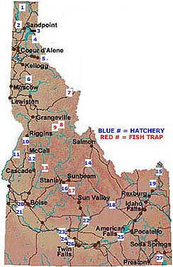 |
Fish hatcheries have been present in Idaho for over 60 years. In 1934 the State of Idaho and the Civilian Conservation Corps constructed the first rainbow trout rearing facility in American Falls. The purpose of the facility was to improve the availability of the fish for sportsmen, while also helping preserve native lineages.
In 1955 Idaho Power Company began planning construction of the Hells Canyon Dam Complex on the Snake River. Out of concern for Idaho's wild anadromous salmon and trout species, the Federal Regulatory Commission required that Idaho Power Company compensate for potential population losses resulting from the new hydroelectric facilities. In conjunction with the construction of the Complex (consisting of Oxbow, Brownlee and Hells Canyon dams) Idaho Power constructed four facilities including Rapid River Hatchery (1964) and Niagara Springs Hatchery (1966). Initially, the Niagara facility was used to relocate some of the Snake River steelhead run into the Salmon River. Idaho Power currently provides funding for the operation and maintenance of the hatcheries.
In 1976 Congress passed the Water Resources Development Act and the Lower Snake River Fish and Wildlife Compensation Plan was created. The plan required the construction of fish hatcheries whose operation was intended to help offset the loss of Idaho's native salmon and trout species. Fish populations were declining - apparently as a result of construction of four dams and locks on the lower Snake River by the Bonneville Power Administration (Ice Harbor, Little Goose, Lower Granite and Lower Monumental were all built between 1962 and 1976).
In response to the Compensation Plan the U.S. Army Corps of Engineers has built over 20 facilities such as the McCall Hatchery (1980) and the Sawtooth Hatchery (1984). To date, the United States Federal Government has provided funding for the construction and operation of over 20 trout and salmon hatcheries. Bonneville Power Administration (BPA) is in the process of repaying this loan out of hydroelectric power revenues. In addition, each year they provide revenue to continue hatchery operations.
The U.S. Fish and Wildlife Service is the primary agency responsible for oversight of the hatchery program. They reco
ver and distribute the BPA monies.
The Idaho Department of Fish and Game is the agency responsible for staffing, operating and maintaining the majority of Idaho's salmon and trout hatcheries.
Under Title 36 of the Idaho Code the mission of the Idaho Department of Fish and Game's fish hatcheries is to:
|
These goals guide hatchery activities and research. As an example consider a brief summary of hatchery activities in 1998:
* Resident fish hatcheries reared and stocked nearly 23 million fish weighing 1.2 million pounds .
* More than 2,500 stocking trips were made to plant fish in over 500 waters in the state .
* Three captive broodstocks were maintained and spawned at the resident hatcheries producing over 18 million eggs for various resident programs. These stocks include Kamloop and Hayspur rainbow trout maintained at Hayspur Hatchery; and Westslope cutthroat trout at the Clark Fork Fish Hatchery.
* Cabinet Gorge Hatchery produced 9.9 million kokanee averaging 1.94 inches in length using a seven month growing season.
* American Falls Fish Hatchery used the entire 12 months of fish production and produced an average 5.1 inch rainbow trout.
Idaho Game Fishery Economic Facts
Take a look at some assorted economic facts and views about Idaho's game fisheries:
Recreation & Tourism
The Idaho Department of Commerce estimates that the recreation and tourism industry is the third largest in the state. Sport fishing is a significant part of this big business. Sport fishermen in Idaho spent nearly $400 million in 1991. The 1992-93 steelhead fishery generated $52 million to $98 million of economic activity. Even the short nine-day fishery on three miles of the Little Salmon River for 500 spring chinook returning to Rapid River Hatchery in 1992 generated $675,000 to $1.5 million to the state's economy that year.
In 1997 the travel and tourism in the United States brought in $502 billion in revenue. Visitors spent an average of $1.38 billion per day. Close to $40 billion was spent on fishing and fishing-related activities alone. The tourist industry has become one of the nation's largest growth industries, and a top employer. Of the 1997 gross only $1.7 billion was spent in Idaho, accounting for almost 6% of the state's annual $29 billion gross revenues. Clearly, tourism already plays a significant role to the Idaho economy. Recreation and visits to natural and cultural areas account for 48% of the 1997 tourist revenues. It seems that there is room to aquifer a "bigger piece of the national pie"by enhancing visitor opportunities ion Idaho - particularly in the area of outdoor recreation.
In the Northwest: $500 million in annual economic benefits and 25,000 jobs in the commercial and sport fishing industry have been lost due to the loss of salmon.
$70 to $150 million annually will be added to Idaho's economy with an improved salmon fishery, and 2,100 full-time jobs. A 1996 study by the Idaho Fish and Wildlife Foundation found that a restored salmon and steelhead fishery would pump $23 million a year or more into river communities like Stanley, Riggins and Orofino and could sustain 4,500 family wage jobs.
In 1997, 6,500 Idaho residents purchased salmon fishing permits in Oregon and Alaska. An estimated $5 to $8 million in revenue could be returned to Idaho if residents did not have to go out of state to fish for salmon.
Hatcheries
Resident hatchery program costs were 2.1 million dollars for an average cost of $1.63 per pound or $0.08 per fish. Cost varied greatly between the hatcheries. Cabinet Gorge Hatchery had the lowest cost per fish at $0.018 and American Falls Hatchery had the highest at $0.23 per fish. This is due to the great diversity in the resident hatchery system goals. Rainbow trout of catchable size (8 to 12 inches) composed approximately one-half of the program costs at approximately $1 million.
Dams
There are 500 dams in the Columbia Basin, and the four lower snake river dams (the ones in question) account for just 1% of the total. These 4 dams provide limited flood control. $23 to 60 million a year in tourist income will be lost from the loss of four reservoirs behind the dams in question.
These four hydropower facilities (in 1999) provide 3483 Megawatts, about 5% of total power, to the regional grid, but only 1.5% of the Idaho supply. A 1998 Northwest Power Planning Council analysis found that bypassing the dams would have no effect of regional market rates for electricity. However, according to Idaho Power, a five percent contribution would not be an easily absorbable amount. Initial impacts were underestimated because the four facilities allocate their power to a smaller grid, which is only a part of the regional grid. That local grid would experience a 35% power loss. A possible solution would be to introduce a natural gas burning turbine to make up for the loss. The difference in cost however is nearly three times: hydropower 1-1.5¢/Kilowatt hr. vs. 3.2-3.5¢/Kilowatt hr for a gas turbine.
Each has a lock to allow commercial barging to occur as far inland as Lewiston which currently serves as a port town and terminus for shipping grain, for Potlatch, Boise Cascade and the like. Currently this form of shipping is subsidized by tax dollars. Railroad access is available as an economic alternative to barging.
Cost of upgrading and maintaining the dams if left in place: $200 million.
Cost of complete breaching: $100 to $500 million. The lower Snake River dams will not need to be destroyed to help the fish populations, only the earthen dam portions are to be removed so that the river can flow around them. If necessary the earth fill could be replaced to make the dams operational again. The cost of removing just the earthen berms? $25 million per dam. While this seems expensive, it may actually save money to bypass dams. According to a 1988 Oregon Natural Resource Council study, bypassing the dams will actually save the region $87 million a year, not including the benefits of a restored fishery.
Businesses
Approximately $34 million in annual revenue will be lost to the city of Lewiston (once it no longer serves as a port) An estimated range of 40 to 1,500 jobs may be lost.
The Bonneville Power Administration has spent almost $3 billion on current fish recovery programs (i.e. hatcheries, barging and trucking).
Drainage Areas & Fisheries
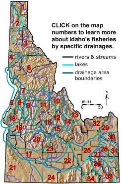 |
1. Kootenai River 2. Pend Oreille River 3. Spokane River 4. Palouse River 5. Snake River-Hells Canyon 6. Clearwater River 7. Salmon R. Mouth to Horse Cr. 8. Little Salmon River 9. Salmon River-S. Fork 10. Salmon-Horse Cr.-N. Fork 11. Salmon-Middle Fork 12. Salmon-N. Fork to Head 13. Lemhi River 14. Pahsimeroi River 15. Salmon-East Fork 16. Salmon-Yankee Fork 17. Snake River-C.J. Strike |
18. Weiser River 19. Payette River 20. Boise River 21. Owyhee River/Bruneau River 22. Snake River-Lake Walcott 23. Big Wood River 24. Raft River 25. Snake River-S. & Henrys Fk. 26. Portneuf River 27. Blackfoot River 28. Willow Creek 29. Henrys Fork Snake River 30. Teton River 31. South Fork Snake River 32. Sinks 33. Bear River 34. Malad River |
The drainage areas and fisheries map shows the waters of the state broken into 34 separate drainages.
The divisions follow the State's Hydrologic Unit Code boundaries, and are used to distinguish different fisheries management regions.
Although all of Idaho lies west of the continental divide, not all of its waters drain westward to the Pacific Ocean. A portion of southeast Idaho drains into Bear Lake, which is one of the largest interior drainage systems in the United States. In addition there are a number of isolated drainages in eastern Idaho that do not flow into the Snake or Bear Rivers that we term independent drainages. These include the Lost Rivers and Birch, Medicine Lodge, Beaver, and Camas Creeks.
The remainder of the state's surface drainage flows into the Columbia River. We have divided this system, from north to south, into the Kootenai, Pend Oreille, Spokane (Coeur d'Alene and St. Joe River systems), and the Palouse drainages. The Snake River and its tributaries drain areas upstream and downstream of Shoshone Falls. The major tributaries of the Snake River drainage below the falls include Salmon Falls Creek, and the Wood, Bruneau, Owyhee, Boise, Payette, Weiser, Salmon, and Clearwater Rivers. The Snake River above Shoshone Falls is comprised of the North Fork (Henry's Fork) and the South Fork. Major tributaries are the Teton, Blackfoot, and Portneuf Rivers.
The major natural lakes of Idaho include Priest and Pend Oreille (Pend Oreille drainage), Coeur d'Alene (Spokane drainage), Payette (Payette drainage, Snake River below Shoshone Falls), Gray's (Snake River above Shoshone Falls), Mud (independent drainage) and Bear (Bear River drainage). A large number of reservoirs have been formed on Idaho's rivers. The major ones include Dworshak (North Fork Clearwater River), Granite, Hells Canyon, Oxbow and Brownlee (Snake River, behind dams of the same name), Cascade (North Fork of the Payette River), Arrow Rock and Anderson Ranch, (Boise River), C. J. Strike (Snake River below Shoshone Falls), Blackfoot (Blackfoot River), Palisades (South Fork of the Snake River), and Island Park (Henry's Fork of the Snake River).
The Sawtooth Lakes include a number of high mountain lakes in the Sawtooth Mountains near the headwaters of the Salmon River. Numerous other smaller lakes and reservoirs dot Idaho's landscape.
The geological history of Idaho's drainages is not completely understood. Lava flows have changed the courses of many streams. Later the effects of glaciation formed both temporary and more permanent lakes. Glacial melting caused tremendous floods by breaching temporary dams and resulted in the alteration of river courses. Abandoned stream channels and dry waterfalls constitute evidence of these catastrophic events. These and other past geological phenomena have had a profound impact on the distribution of native Idaho fishes.
In the southern part of the state, the development of Shoshone Falls was a major influence on the past distribution of Idaho fishes and remains an effective barrier to the present dispersal of these aquatic vertebrates. The falls were formed by unequal erosion of the very resistant bedrock materials which form the crest of the falls. This resistant rock mass may have become effective as early as 2-3 million years ago. The result of this barrier to fish distribution was to prevent any species of fish from extending its range upstream above the falls after its formation. Any species arriving on the Idaho scene after this time, such as the Pacific salmon and steelhead trout, were unable to penetrate the Snake River drainage above the falls. Any fishes found in the Snake drainage above the falls likely occupied this area before the formation of the falls or extended their range to the Snake drainage from the Great Basin or from east of the Continental Divide.
The Snake River at one time (probably prior to the Pleistocene) flowed down the middle of the Snake River Plain near the southern part of the U.S. Atomic Energy Commission Reservation (north of its present course). Subsequent downwarping and lava flows pushed the Snake River southeastward to its present course. Further uplifting and a rise of crustal divides along with deposition of large quantities of rock debris at the present southern reaches of the several drainage systems isolated the Lost Rivers and the other independent drainages of the area. These streams now flow generally in a southerly direction and sink into the permeable underground materials, including volcanic deposits, along the northern edge of the Snake River plain.
At a later time during the Pleistocene the immense inland Pluvial Lake Bonneville rose and overflowed into the upper Snake River through Red Rock Pass south of Pocatello, Bannock County. The first overflow occurred about 14,500 years ago. This great flood scoured out channels and water falls. After the flood the Bonneville Basin and the Snake River system were connected for a few thousand years until the lake fell below the Provo shoreline at 4800 feet. A number of fishes from the Lake Bonneville fauna entered the upper Snake River in this manner. The present-day remnant of Pluvial Lake Bonneville is the Great Salt Lake.
In Northern Idaho during the Pleistocene, an ice lobe blocked the ancestral Clark Fork River and formed Glacial Lake Missoula, a huge lake that occupied much of the Clark Fork Valley all the way to Missoula, Montana. Recent estimates are that forty separate times the ice dam formed by a valley glacier just east of Clark Fork, Idaho, broke, and huge floods occurred. The waters swept across eastern Washington toward the southwest and formed such features as Palouse Falls, the channeled scablands of eastern Washington, and Spokane Falls. These falls formed barriers to the post-glacial dispersal of fishes from the lower Columbia River, such as the Pacific salmon and steelhead trout. Falls on the Pend Oreille and Kootenai Rivers acted as similar barriers.
During glacial times many other river drainages probably have exchanged waters. The end result of past geological events is the present drainage patterns throughout the state. The current natural distribution of Idaho's fishes is closely related to the geologic history and associated phenomena of the past.
Agriculture & Irrigation
Agriculture in the Western United States depends on the availability of irrigation water, and the possibilities for dry land farming. The physical characteristics of a region play a significant role in the type of farming chosen for an area. What are the climate conditions? What are the soil conditions? Is the land easily tilled or will it require a great deal of clearing of brush, trees or rocks? What kind of problems may be encountered with local wildlife? These and others are all conditions that early farmers had to consider as they began settling Idaho and establishing farms.
The first known effort at irrigated farming in Idaho was by Henry Spalding in 1838 as he atempted to keep the first potato plants grown in Idaho alive (he and some Nez Perce Indians tried growing potatoes and other crops at the Spalding Mission in northern Idaho). Later, in 1855, Mormon missionaries introduced the Shoshone Indians to irrigated farming in southern Idaho. The early ditches built then are still in use today in the Lemhi Valley.
Agriculture in Idaho began in earnest when Mormon settlers began migrating into southeast Idaho from Utah. They founded one of Idaho's earliest farm settlements at Franklin, Preston county, Idaho in 1860. Later that same year miners at Pierce, some 400 miles away, began to farm to help meet their own food needs. Thirty years later farming was to pass mining as Idaho's leading economic activity - a position it continues to hold today.
Almost from the first, Idaho farmers used the most modern equipment and techniques available. Farmers were able to charge high prices for their produce from area miners, and it was difficult to ship goods into the territory - in essence, a captive market was established that worked to the farmers' benefit.
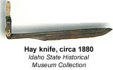 With their profits they bought new plows, threshing machines, mowers, rakes, reapers and later steam-powered tractors. With this kind technology, Idaho agriculture developed rapidly. Just 10 years after the towns of Franklin and Pierce were founded, the Boise valley had seven threshing machines. As railroads reached more and more areas of Idaho, farmers began to sell their produce to an ever expanding market. They no longer depended solely on the miners to buy their produce. Products such as Idaho potatoes began to reach all parts of the nation.
The drier areas of southeastern Idaho needed a different kind of farming. Lack of enough rainfall but a desire to grow crops created an interesting new agricultural method, dry farming, to be developed. The crops were planted every other year, and in alternate years the land was left unplanted and worked to help it hold in moisture in preparation for the next years crop. Some areas were so dry crops could only be planted every three years. Farmers using this method rotated their crops so that part of the land was in crops each year. In the Mormon settlements in the southern part of the state, church managed irrigation projects began to convert barren deserts to productive farmland.
When Union Pacific built a railroad line across southern Idaho in 1880, canal companies in Boise began numerous projects to bring water to the surrounding deserts. Although these canal companies needed government aid to complete these projects, more and more of the previously dry, barren land in Idaho was turned into rich farmland - an accomplishment that was not without controversy.
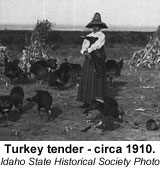 Northern Idaho had more favorable conditions for farming. It had sufficient rainfall and rolling hills covered with rich fertile land. Because of this irrigation wasn’t necessary and with a little sweat they could clear large tracts of land for wheat. Farmers from Washington moved into Idaho's Palouse country after 1870, and many new farming communities, Moscow among them, soon sprang up.
As settlement of Idaho territory continued, and with the coming of statehood federal involvement in the west increased. The Homestead Act, the Desert Lands Act and the 1894 Carey Act all contributed heavily to the increased development of agriculture and irrigation in the state - particularly in southern Idaho. To encourage settlement in drier regions Congress passed the Carey Act, which offered up to 1 million acres of federal land to anyone who could irrigate it, and turn it into farmland within 10 years. As an example of the influence of this piece of legislation consider the story of Ira Perrine. An orchardist from Indiana, he relocated to the Snake River Valley, constructed 65-miles of canal systems converting 244,000 desert acres into orchard - in the process founding present day Twin Falls. Also influential was the passage of the Newlands Act in 1902, which led to establishment of the U.S. Bureau of Reclamation. Numerous projects subsequently undertaken by the Bureau brought dams and canal system along length of the Snake River Valley. By 1910 much of Idaho was under irrigation.
All of Idaho has benefited from the programs mentioned above. Diverse crops now flourish in all regions of the state. Approximately 60 percent of all Carey Act lands are within the borders of the state, and federal irrigation projects remain significant.
Wheat is the major crop of north Idaho. Other crops raised there are grass seed, wild rice, peas and lentils. Livestock is also raised in northern Idaho.
Most of Idaho's crop farming takes place in the south. Most towns along the Snake River Plain depend on agriculture.
Southwestern Idaho is a major cattle producer, as well as growing sugar beets, potatoes and seed crops. Also important to southwestern Idaho are fruit orchards. Idaho ranks fifth in the nation in the production of sweet cherries.
South-central Idaho is a mixture of very productive irrigated farms in the lowlands and pasture land for grazing in the upland regions. A large variety of crops are grown in the irrigated areas including onions, corn and apples.
Southeastern Idaho is the ideal place to grow the famous Idaho potato. Crops of hay, wheat and alfalfa, as well as livestock and dairy farming make the area one of the most productive in the state.
The natural vegetation of the state's plains is mainly sagebrush. Since sagebrush has no value to industry, such area has been converted to farming wherever possible. There are still large areas of sagebrush land in Idaho, however, much of this land is owned by the government of the United States. Ranchers are allowed to use areas of the desert lands for rangeland where cattle and sheep graze during the summer months.
In addition to public lands ranching, numerous private cattle ranches are in operation in the state. There are also 24,000 crop farms operating in Idaho. Almost two-thirds of these farms are small farms where the families farm part-time and have other sources of income. Almost one-half of Idaho farms are less than 100 acres in size, while the largest (five per cent of the farms) take in 51 per cent of all farmland.
Most of the farm and ranch income in Idaho comes from a suite of seven major products. These are cattle, potatoes, milk, wheat, barley, sugar beets and hay. Of these, cattle contributes the most economically, while potatoes are second. The state ranks first in the nation in the production of potatoes and hatchery trout. Of all the potatoes in the United States, 24.6 per cent, in 1986, were grown in Idaho and 85.4 per cent of all hatchery trout in the nation were produced here. Idaho ranks third in the nation in the production of barley, sugar beets, hops and mint. Idaho ranked 7th in wheat production in the United States, producing 5 percent of the 1995 U.S. wheat crop. Idaho ranked 2nd in barley production in the United States, producing 13 percent of the 1996 U.S. barley crop.
Much of Idaho's economy centers around processing industries for Idaho farm products, such as plants for processing potatoes, sugar beets, and wheat. Over two dozen potato and sugar beet plants are found throughout the state. Almost 16,000 people in Idaho work in the food-processing industry. For example, the Simplot potato-processing plant near Caldwell produces a large portion of the french fries sold at McDonald's restaurants throughout the nation.
Mining in Idaho
Idaho has many different types of minerals, and it was gold that brought the first permanent white settlers to the state. Although minerals can be used up, we are lucky to have enough minerals to meet our needs for hundreds of years to come. Explore the natural history of Idaho mining with the photographs and text below.
Almost every important mineral except oil, gas and coal can be found in Idaho. Some would cost too much to mine, but others provide us with jobs and money.
The discovery of gold caused the Idaho territory to be established in 1863. As the gold deposits began to disappear, the search for other minerals began. By the late 1800s silver, lead and zinc deposits were uncovered in the Coeur d'Alene area. This area has become known as one of the world's richest mineral areas. Idaho today produces the most newly mined silver in the nation. Almost 45 per cent of all silver mined in the United States comes from Idaho. Silver and phosphate are the two major minerals produced in Idaho. We are the nation's second largest producer of phosphate with 15 per cent of the United States yearly production.
Although Idaho produces little gold, the United States Bureau of Mines says that we have more mineable gold than any other state. In recent years, as the price of gold has risen, many old mines have been reopened and the value of gold produced in Idaho has grown steadily.
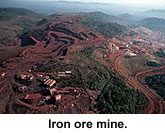 Other minerals in Idaho that have some importance are sand, gravel and crushed rock, copper, tungsten, garnets and clay. Garnets are used for polishing materials in industry. The amount of garnets in the state is large. Clay used in a variety of ways is plentiful in Idaho, but has not been developed to a very large degree at the present time.
Many types of semi-precious and precious stones are found in Idaho. Whether precious stones or sand and gravel, minerals are an important natural resource for Idaho.
When thinking about history and miners, we usually think of men with picks, shovels, gold pans, and perhaps a burro. The truth is, most of these men made very little money. It took five to ten minutes to wash the sand and gravel out of the pan, and the miner often found only five to ten cents worth of gold for his work. A few "struck it rich," but most men made only a few dollars a, day. That took the glitter out of gold for many men. The smart miners soon learned they would have to use machinery to make money from mining.
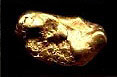 The gold rush ended when the easy gold ran out, but the real mining began after that. Most of Idaho's placer gold was gone by the time Noah Kellogg (and his burro) found that lump of lead and silver ore in Shoshone County in 1885. This led to more wealth in silver, lead, and zinc than the gold miners could have ever dreamed of finding. After railroads were built through the mining country, hard-rock mines could be developed.
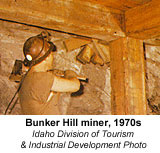 Today the Coeur d'Alene mining district (mostly in Shoshone County) is one of the two richest metal mining areas in the world. This part of Idaho has produced about 2 billion dollars in metal wealth since it began in 1885. Silver has -been Idaho's leading mineral for several years. The three richest silver mines in the United States are in Shoshone County. The Sunshine mine is the largest, the Galena mine is second, and the Bunker Hill is third. The Coeur d'Alene mines produce more silver than all the rest of the states together. The Bunker Hill mine is America's largest lead-silver mine. In mines such as the Bunker Hill, lead and silver are found mixed together. The Star mine is America's largest producer of zinc. (The city of Coeur d'Alene is not part of the Coeur d'Alene mining district. It is in Kootenai County on the edge of Lake Coeur d'Alene. The mines are in Shoshone County on the upper part of the Coeur d'Alene River.)
Metals are mined in other parts of Idaho, also. Dredge mining of gold is done on some parts of the Salmon River. Here sand and gravel are scraped from the bottom of the river and washed for placer gold. Silver and lead are mined in the Wood River galena mines in Blaine County. Tungsten and cobalt are mined in Lemhi County. Vanadium* is mined in Bear Lake and Caribou counties.
Work is being done also to develop mines for other Idaho metals. There is molybdenum* in Bonner, Custer, and Lemhi counties; platinum* in Bonneville, Idaho, and Valley counties; and thorium* in Boundary and Lemhi counties. Thorium is a metal that could take the place of uranium* for atomic energy.
Of the following metals, some are now being mined in Idaho, and some are not. However, these are the most important metals found in Idaho: antimony*, beryllium*, chromium*, cobalt*, copper, gold, lead, molybdenum, platinum, silver, thorium, tungsten*, vanadium, and zinc.
When we think of mining, we often think of exciting metals like gold and silver. However, there are many important minerals which are not metals. These are called industrial minerals. Idaho is rich in industrial minerals. Idaho has seventy-two kinds of gem stones. This is more than any other state, and second only to Africa in the rest of the world. Agates, jade, opal, garnet (pink, green, and red), and diamonds-to name a few-have all been found in Idaho. It is believed the biggest diamond ever found in the United States - weighing nineteen and one-half carats - was found between McCall and New Meadows. (Idaho's state gem is the star garnet.)
Other industrial minerals are not as exciting as opals and diamonds, but they bring Idaho more wealth. It may be hard to think of stone, gypsum, cement, and clay as important minerals. However, they are widely used and are very valuable. Idaho's leading industrial mineral, and fastest growing, is phosphate*.
Most of Idaho's phosphate mining is done in eastern Idaho around Soda Springs. It is believed more than half of America's phosphate reserves are in Idaho in Bear Lake, Bingham, Bonneville, and Caribou counties.
Phosphate was Idaho's second leading mineral in 1974, and was very close to silver in value. Phosphate is used to make ammonium phosphate fertilizer and other important chemicals.
Below are several important Idaho industrial minerals and their uses:
cement - concrete and construction clay - brick and tile garnet - gems and sandpaper gypsum - fertilizer and
wall board lime - sugar beet processing phosphate - fertilizer and chemicals pumice - concrete and construction
sand and gravel - roads, concrete, and construction stone - building construction
Mining is an important source of income for towns near the mines and processing plants. Mining makes jobs and money for many people, those working in the mines, and those working in businesses which serve the mining families. Kellogg, Wallace, Mullan, and several smaller towns depend on the Coeur d'Alene mines. The phosphate mines of eastern Idaho bring wealth to Soda Springs, Blackfoot, Pocatello, and other towns.
The story of mining in Idaho should close with the story of Stibnite, one of Idaho's youngest ghost towns. Stibnite is also the mineral name for antimony ore. Mining for gold and antimony began at Stibnite in 1931. Later a body of rich tungsten ore was found. During World War 11, Stibnite produced ninety-eight percent of America's antimony, and much of her tungsten. Both metals were vital for making machines and weapons for fighting the war. The rich tungsten ore had run out by the end of the war in 1945. Later a. rich antimony mine opened in Central America. The new mine made the price of antimony drop so low, the Stibnite mine could not stay in business. It closed in 1952. Today only the pieces of a few old buildings and machines remain. The huge open-pit mine, once busy with men, machines, and trucks, has become a small mountain lake.
Mineral Deposits
Idaho has excellent examples of many diverse types of mineral deposits- however the classic lode and placer deposits tend to dominate. A lode deposit is a tabular-shaped deposit between definite boundaries. A lode may consist of several veins spaced closely together. A vein is a fissure or crack in a rock filled by minerals which were transported in by fluids. A placer deposit is one where gold or other heavy minerals are concentrated in a gravel deposit.
The purpose of this excerpt is to explain how the common types of mineral deposits form and describe the types and Availability of minerals that may be of interest to the recreational collector, Particular emphasis is on gold and gem minerals. Gold, in both lode and placer sources, is abundant in Idaho. Numerous gemstones such as sapphire, topaz, garnet, zircon, opal, jasper, aquamarine and man others have been found in both lode and placer deposits.
Mining began in Idaho about 1852 and continued on a small scale using mostly hand methods until the 1880s. Later, development of the lead-silver lodes began on a large scale. The initiation of large-scale placer mining using hydraulic mining and dredges resulted in a huge increase of gold production. Placer mines outnumbered lode mines until World War 11 put a temporary stop to gold mining.
Hydrothermal Deposits
A hydrothermal deposit is one precipitated from a high temperature solution. As hot water with minerals in solution rises towards the earth's surface, the lower temperature and pressure near the surface cause the minerals to precipitate out of solution. Molten rock or magma below the surface supplies the hot fluids which travel upwards along the pressure gradient. Magma is 3 to 8 percent water by weight and lavas contain about 4 percent water.
Preparation of Rocks for Mineralization
Several processes must affect the rock in order to make it more receptive to mineralization. The rock must become more permeable and brittle. Rocks are hardened by silica, then shattered by faulting so as to increase permeability. Broken silica causes clean fractures with little or no powder so that fluids may move easily through the rock. Typically rocks with a high porosity such as sandstones and conglomerates also have a high permeability. Shales, on the other hand, have a high porosity but a low permeability. Consequently, shale beds may confine and trap a mineral deposit rather than allow it to pass through. joints and contraction cracks in igneous rocks make excellent channelways for fluids. Vesicular layers and interbeds between lava flows also provide very good permeability.
Mineral veins and faults
Faults are fractures along which displacement has occurred. A shear zone is a highly-fractured zone with closely-spaced, subparallel fault planes. It is normally a very permeable zone; however, the presence of clay zones called gouge (finely-ground rock) greatly reduces permeability. The greater the displacement, the more gouge forms. Therefore, small faults with slight displacement are the most favorable locations for ore deposits. Brittle quartzites make either clean breaks or shattered zones, whereas shales and many igneous rocks make tight fractures with much gouge, so they have a low permeability. Faults formed near the surface are generally more open and consequently have higher permeability. Thrust faults are caused by compression and typically have a fault plane that dips 30 degrees to horizontal. Thrust faults have tight fractures containing much gouge, low permeability and are poor for mineralization. Gravity or normal faults are caused by extension; they tend to be open, permeable and excellent for mineralization. The fault planes of normal faults tend to dip 40 to 70 degrees. Mineralized faults generally occur where more than one fault is involved. Typical configurations include (1) subparallel groups of faults, (2) one fault intersected by another fault (the zone of intersection is very commonly mineralized), (3) faults that branch like the limbs of a tree, and (4) a zone of intersecting faults called stockworks. Stockworks generally have a cylindrical or pipelike shape and are caused by shattering of igneous rocks.
Ore Fluids
As hot fluids are discharged from magma, they circulate through huge volumes of shattered rock dissolving a variety of minerals. After taking minerals in solution at high temperatures and pressures, the fluids move towards the surface along permeable channels such as fracture zones. When the temperature and pressure drops sufficiently, minerals will begin to precipitate along the walls of the fractures.
Classification of Hydrothermal Deposits
A widely used classification of hydrothermal mineral deposits is based on the temperature of formation:
Hypothermal: 300' to 500' C (deep deposits)
Mesothermal: 200' to 300' C (medium deposits)
Epithermal: 0 to 200' C (shallow deposits)
Epithermal Deposits
Epithermal deposits are an important source of lode gold deposits in Idaho, They are formed at less than 3000 feet from the surface and at low temperatures ranging between 50 to 200 degrees centigrade. Mineralization occurs by open-space filling with such textures as drusy (crystal lined) cavities, symmetrical banding and comb structures. The fissures may open at the surface as hot springs. Epithermal veins are typically related to 'Tertiary plutons and volcanism.
Mineralogy of Lode Gold Deposits
Lode gold deposits are formed by hydrothermal solutions precipitating such minerals as quartz, barite, carbonate minerals, flourite, gold, gold tellurides and silver. Many of these deposits have yielded much more silver than gold.
Host Rock
Host rocks are typically found in altered volcanic rocks of Tertiary age, and to a much lesser extent they occur in granitic rocks of Late Cretaceous to Early Tertiary age.
Gold Content
The epithermal gold-quartz lodes have been referred to as "bonanza" lodes because they tend to be much richer than the other types of lodes. Although the ore grade commonly ranges to one ounce of gold per ton, ore can carry up to 20 ounces of gold per ton.
Quartz Veins and Gossans
Only a small percentage of vein quartz will contain gold. "Bull quartz" is a term for a glassy quart that is generally barren of gold. Gold below the oxide zone is generally associated with sulfides. Sulfide gold includes pyrite, chalcopyrite, arsenopyrite and galena- however gold may also exist in a free state be low the oxide zone. Iron streaks and vugs lined with rusty crystals in quartz veins are promising for got If gold is present in such veins, it may be possible t see it with a hand lens or the naked eye. Commonly gold is the only valuable mineral left in a gossan. Gossan (iron hat) is a porous, rusty capping on a sulfide deposit. Any outcrop or float of iron-stained light-colored igneous rock, fractured and recemented with silica, should be carefully examined.
Predicting Gold Value with Depth
Gold is an inert, insoluable mineral and is not susceptible to teaching. As a result, the gold content o the rock may decrease with depth. Another depth problem occurs if the gold is contained in sulfides. In such a case, free gold is only available in the zone of weathering above the water table.
Linear Features
Major linear features may be used to find mineral deposits. Linear features are topographic features such as ridges and canyons that follow a straight line and are probably the surface expression of a fault. Satellite imagery and high altitude aerial photography are useful for this purpose. Mineral deposits tend to be aligned along linear features. The intersection of linear features are an excellent place to prospect. Lineaments may represent deep fractures which could provide access to ore fluids.
Deposits Formed from Secondary Enrichment
Some mineralized vein deposits are enriched at or below the water table by a process called supergene enrichment. Surface water moving along the fractures above the water table in the zone of oxidation dissolves minerals and carries them in solution down to the water table. At the water table, secondary minerals are deposited which are generally much richer than primary minerals originally deposited in veins. For example, a typical primary sulfide mineral is calcopyrite with 34.5 percent copper. If this mineral is taken into solution and carried down to the water table, the copper may again be deposited in the form of bornite (63 percent copper), covellite (66 percent copper) or chalcocite (80 percent copper). The following minerals are commonly found in gossans or oxidized upper portions of veins:
Iron minerals - rusty brown, yellow, red
Copper minerals - blue, green
Nickel ores - pale green
Cobalt - pink, red color
Molybdenum - pale yellow
Manganese - sooty black
Uranium - bright orange, yellow, green
Contact Metamorphic Deposits
After intrusion, a magma gives off heat and fluids. These hot fluids migrate upwards towards low temperature and pressure. New minerals and textures form along the contact of the pluton and the country rock. Minerals grow larger and grain size increases. If the country rock is a limestone, it is recrystallized into a marble. The intruded magma supplies valuable metals and silica. Silica precipitates in the pores of sedimentary rock as a quartz cement. Silica also reacts with chemicals in the country rock to form silicate minerals. Hot solutions leach out portions of the country rock and in its place silica and other minerals are deposited. Deposition occurs in permeable beds along bedding planes, cavities and fractures. Metals are very mobile and tend to be driven out of the magma and localized in the roof of the magma chamber.
Skarn minerals are formed at the contact between a granitic pluton and a carbonate-rich rock such as a limestone. Skarn minerals desirable for collecting include garnet, mica, corundum, quartz, diopside, tremolite, spinel, epidote, wollastonite, flourite, tourmaline and topaz.
Pegmatites
Pegmatites are very coarse-grained igneous or metamorphic rocks. Igneous pegmatites form from residual volatile-rich fractions of the magma whereas; metamorphic pegmatites are formed by mobile constituents that concentrate during metamorphic differentiation. Pegmatites have a tubular or dikelike shape or may be lensoid masses. They are generally small with a thickness from several feet to more than 100 feet and may have a length measured in tens or hundreds of feet.
Most pegmatites in Idaho have a silicic to intermediate composition- however, some mafic pegmatites are known. Pegmatites are generally found in and near the roofs of large plutons. Most pegmatites in Idaho have a very simple mineralogy. Typical minerals include quartz, orthoclase feldspar and mica. Small red garnets and black tourmaline are also common as small disseminated crystals. Many valuable economic minerals as well as crystal specimens are recovered from pegmatites. These minerals include quartz, feldspar, micas, chalcopyrite, molybdenite, sphalerite, beryl, apatite, tourmaline, monazite, topaz, garnet, spodumene, cassiterite and lepidolite. Rare earth minerals found in pegmatites include tantalum, niobium, beryllium, lithium, cesium, uranium, cerium and thorium. Most pegmatites are characterized by a crude zoning. This happens because a pegmatite crystallizes somewhat like a geode, from the outside towards the center. Pegmatites typically have a quartz core because quartz is generally one of the last minerals to crystallize.
Some pegmatites have a gas cavity at the center of the pegmatite. These cavities range from several inches to more than a foot in length and often contain large crystals with fully developed crystal faces. Gem minerals such as amazonite (green microcline), topaz, beryl (aquamarine in Idaho plutons) and smoky quartz are common in Idaho pegmatites.
Prospecting for Pegmatites
One of the best ways to find pegmatites with pockets or cavities in which crystal specimens may be found is to carefully examine the float. Float is a term used to describe fragments of the pegmatite deposit that might be detached and moved downslope. Look for large pieces of quartz with attached crystals of amazonite and tourmaline. Also large pieces of feldspar and mica indicate a pegmatite. Crystals with faces are especially diagnostic because they indicate a pocket exists in a pegmatite where other crystals may be found. Pegmatites form low areas because they tend to weather relatively quickly, as a result, vegetation may thrive over pegmatites. However, the quartz core is more resistant that the surrounding minerals and will stand out in high relief. This quartz may be rose, gray, smoky or amethyst capped. Pegmatites generally do not occur as a single dike but rather as a group of dikes. So if you find one, there 'II most likely be more within 50 to 100 feet.
Mineral Identification
Books of white mica called muscovite are very common in pegmatites. These books tend to increase in size towards the centerline of the pegmatite body. Pink, lithium-rich mica is called lepidolite. Orthoclase feldspar is very commonly found as large fleshcolored crystals. Beryl crystals are generally found imbedded in quartz; they tend to range from pale green to blue in color. Tourmaline occurs as long, black rod-like crystals which generally point towards the center. Translucent white quartz typically forms in the core of pegmatites.
Beryl in Idaho Pegmatites
Beryl-bearing pegmatites are associated with the Kaniksu Batholith in the vicinity of Priest Lake. Most localities are west of the lake. In eastern Latah County near Avon, a muscovite-rich pegmatite with beryl, tourmaline and garnet is exposed. The beryl crystals reportedly range up to 18 inches in length. Blue to bluish-green beryl is found in the Sawtooth Range near Glenn Peak and Mount Everly; some of this beryl is gem-quality aquamarine and is accompanied by flourite. Beryl-bearing pegmatites in a Tertiary granitic pluton are found in the Cathedral Rocks area of Lemhi County. Gem-quality blue beryl has also been found in granitic rock in the Boise Basin area. Pegmatite mining in Idaho began in 1888 for minerals such as mica, feldspar and beryl.
Idaho Gemstone Deposits
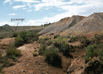 Although Idaho has a variety of gem mineral deposits including rock crystal and amethyst, jasper, chalcedony, agate, agatized wood, opal, garnet, aquamarine, topaz and zircon, only a few of the nationally-significant Idaho deposits are discussed in this module.
Old Mine Dumps
Old mine dumps are an excellent place to search for crystal and mineral specimens. Every year weathering and erosion break down these old minewaste materials and new specimens are exposed to the view of the collector.
Garnets
Garnets occur throughout the State of Idaho in a variety of rock types, including pegmatites, garnetiferous schists and other metamorphic rocks. On the East Fork of Emerald Creek in northern Idaho, gem-quality almandite garnets are found in placer gravels of the stream bed.  These purple to red garnets are significant for the asterism or stars caused by inclusions aligned in layers. Emerald Creek garnets are formed in a mica schist by metamorphism. Through the processes of weathering and erosion, the garnets are freed from the mica schist matrix. The high specific gravity of almandite garnets allows them to be concentrated on the bedrock of Emerald Creek in placer deposits. Collectors recover this gem by digging to bedrock and using screens to recover the garnets.
Bruneau jasper The most famous jasper in Idaho is the " Bruneau jasper," a red and green gem-quality stone. The Bruneau jasper deposits are, for the most part, covered by unpatented mining claims and are situated approximately 50 road miles south of Bruneau in Owyhee County.
At the Bruneau-jarbidge eruptive center, 8 to 10 large rhyolite flows fill a structural basin. These flows average about 320 feet thick and several exceed 650 feet thick.
Gas cavities are abundant in the upper zones of the rhyolite flows but are fairly uncommon in the lower zones. They range in size from small vesicles to large cavities more than three feet in diameter. Some cavities are spherical, but most are irregular due to stretching while the rhyolite was still hot and plastic. Typically, those of similar size tend to occur together in horizontal zones. Some flows have abundant cavities, whereas others are nearly devoid of them.
Fractures, gas cavities, spherulite shrinkage cavities and openings around breccia fragments serve as sites of deposition for secondary silica. Silica occurs in various forms, including opal, chalcedony and red and brown jasper. As the flow cools, silica is leached from it and then redeposited in cavities when the silica-bearing fluids cool sufficiently.
The Bruneau jasper deposit is a zone of jasper filled sperulite shrinkage cavities. There are two small fractures in the upper zone of the Bruneau jasper rhyolite flow in the Indian Hot Springs area, The deposit which is several hundred meters across has been commercially exploited. The Bruneau jasper flow is the most silica-rich rhyolite flow in the area and is the source of silica that resulted in the predominantly red and brown jasper.
Spencer Opal Deposit The Spencer opal deposit is located about 5 miles east-northeast of the town of Spencer. The best access to the deposit is by driving east from Spencer on the Spencer-Kilgore county road for approximately 5 miles, then turning left (north) on a dirt road and continuing 2 miles to the mine site. Many opal prospects lie on the south side of Opal Mountain; however, most of these deposits are covered by patented or unpatented mining claims.
Opal occurs in a Tertiary-age rhyolite flow. As the rhyolite was extruded from deep within the crust, the sudden release of pressure caused gas to separate from the fluid magma and form large vesicles or cavities. The opal was later deposited in the cavities by hot water percolating through the silica-rich rocks. As the hot water moved through the rocks, it took silica into solution and then redeposited the silica as opal in the cavities and fractures.
The nodules, which are mineralized with opal, range in size from less than an inch to more than a foot in diameter. Opal occurs in the nodules as stratified cavity filling or closely-spaced layers, generally less than 0.1 inch thick. Where the silica is precipitated as microscopic spheres in an orderly arrangement, the entering light is refracted through the opal layers causing bands of "fire" with colors of green, yellow, pink, blue and red.
Opal consists of noncrystalline (amorphous) silicon dioxide (SiO2) and up to 20 percent water. The best quality opal contains less than 10 percent water. Exposure to sunlight will cause dehydration and fading of the colors. Consequently, the stone must be maintained so as to prevent water loss. Opal-filled nodules are disseminated through thick zones in the rhyolite.
Mining of the nodules is accomplished with a large dozer or by setting off small explosives. The opal-filled nodules can then be extracted by hand methods.
One of the best deposits in the area is the well known Deer Hunt Mine. The mine was reportedly discovered in 1948 by two deer hunters who were lost in a storm. The Deer Hunt Mine is open to rock hounds interested in digging the opal for a set price per pound. People from all over the world visit this mine every year to mine the popular opal gemstone.
Corundum The mineral corundum is composed of aluminum oxide and is second only to diamond in hardness. Corundum occurs in a variety of colors. The transparent red corundum is the gemstone ruby; the transparent blue variety is the gemstone sapphire. All of the Idaho deposits of gem-quality corundum are found as placer deposits rather than in the original rock where the gems were formed. Most of these alluvial placer deposits yield dull-gray corundum which is not considered to be gem quality. Crystals have been found at the following localities:
1. Gravel bars along Rhodes and Orofino Creeks in Clearwater County near Pierce.
2. Placer deposits of the Stanley Basin in Custer County.
3. In the Gold Fork tributary of the Payette River in Valley County.
4. Between McCall and New Meadows on the headwaters of Goose Creek is a collecting area known as Rocky Flat.
Corundum concentrates in placer deposits along bedrock similar to gold and garnet because of a high specific gravity. Consequently, gem corundum is recovered in the same manner as placer gold. A screen is generally used to separate the course material containing valuable crystals from finer dirt and sand.
Mining Minerals
Cobalt: Cobalt is a silver-white metallic element with atomic symbol Co. Oxides of cobalt tend to be strongly colored - deep blues and greens being the most common. As such, these compounds have long been used for art pigments and dyes.
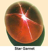 Star Garnet: ‡Garnets belong to a group of hard, vitreous minerals that are composed of silicates of magnesium, calcium or iron. Alternatively they can be composed of manganese with aluminum or iron.
They vary across a wide color spectrum, with their dominant color determined by mineral composition.
Clear red garnets are valued as jewelry. In addition, they are useful as industrial abrasives.
Six-ray star garnets can be found in only two places in the world - Idaho and India. Seeming to float just below the surface of the stones, the stars appear magically when the stone is held in sunlight. These stars (the more valuable garnets have stars with six arms, but some garnets have stars with four arms) are caused by a residue of titanium dioxide trapped in the garnet crystal. The result is so beautiful that this stone has been named Idaho's state gem.
Raw garnets - both intact twelve-sided crystals up to two inches in diameter and broken pieces - are found in streambeds in the Emerald Creek area near Fernwood. The gemstones are not on the surface, but mixed with the sand, rocks, roots, and dirt between the stream and the bedrock several feet below. Separating the gems from the surrounding soil is a difficult and dirty job, but one that draws thousands of visitors every summer to the digging area managed by the Forest Service.
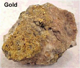 |
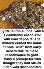 |
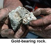 |
Gold: Gold is a yellow metallic element with atomic symbol Au. It is highly prized for such properties as luster; a strong resistance to oxidation, rusting , tarnishing or other forms of chemical destruction; malleability; and strength.
Much interesting human history has been created during the search for gold and associated riches. Gold was first discovered in Idaho in the Clearwater Country in 1860 by Captain Elias D. Pierce. Only a small amount was found (the monetary equivalent of about 3 cents) but it was enough to start the Idaho Gold Rush.
The Gold Rush lasted into the early 1900s and moved from one end of the state to the other as gold was discovered in new locations. People of all nationalities (Chinese, Welsh, Irish, Scandinavian and more) immigrated to Idaho to seek their fortunes. Although some few did "strike it rich" most did not.
Eventually "gold fever" subsided. However a number of productive gold mines continue to operate in Idaho today, and exploration for new deposits is an ongoing process.
Disseminated Gold Deposits:
Much of the recent exploration in Idaho has been for very fine grained gold disseminated in volcanic or sedimentary country rock. Sometimes there are also veins, but more often the gold is deposited as tiny particles in a dark-colored or altered host rock. Generally these deposits have formed where hydrothermal cells generated by magmatic activity have transported dissolved gold in ground water. The gold is deposited in the country rock where the temperature falls or the pH of the water rises. Usually these deposits are mined by open pit methods. Examples include the Black Pine deposit south of Burley, the Beartrack and Grouse Creek projects between Salmon and Stanley, and the Delamar project in extreme southwest Idaho.
Copper-Gold Skarn:
A skarn is a high temperature contact metamorphic deposit formed where a granitic pluton intrudes a limestone. The Cambior Exploration company in Mackay is exploring the old Empire mine property where skarn mineralization is present. Old mining activity in this district focused on veins of Copper, Silver, Zinc and Lead.
Placer Mines:
The mining of stream gravels which may contain concentrations of heavy minerals, especially gold, has been important in several places, notably Caribou Mountain, Placerville on the South Fork of the Boise, and the Yankee Fork of the Salmon River. This method of mining is detrimental to stream water quality. Only recreational placer mining occurs now. There is a large resource of very fine-grained placer gold on the Snake River on the Fort Hall Indian Reservation, but the technology of mining such fine grained gold has not been developed and also the potential for environmental damage is significant.
Lead: Lead is a heavy, bluish-gray metallic element with atomic symbol Pb. The metal is relatively soft and malleable. It typically occurs in nature as sulfides (such as Galena), and is often associated with silver and zinc.
Silver-Lead-Zinc Veins:
These deposits are found in the Silver Valley near Kellogg along the Coeur d'Alene River in north Idaho and near Hailey and Bellevue in south central Idaho. These generally have supported the mining economy of Idaho over the last 100 years, but their importance is decreasing. These veins are formed when sulfide minerals fill void spaces in cracks or shear zones.
Coeur d'Alene District:
The Coeur d'Alene district in northern Idaho is one of the major lead-zinc-silver producing areas of the world. Since mining began in the early 1880s, mines in the 300-square-mile district have produced more than 2.89 billion dollars worth of silver, lead, zinc, copper and gold.
The country rock (host rock) consists of six formations of the fine-grained, siliceous, Precambrian Belt Supergroup. The sediments are intruded by several types of small stocks and dikes. The structural geology of the area is complicated by a variety of folds and faults of diverse acres and movements. The district is at the intersection of the west-northwest-trending Osburn fault and a north-trending anticlinal uplift.
Six periods of mineralization ranging in age from Precambrian to Tertiary have been identified. The main period of mineralization probably occurred during the Late Cretaceous.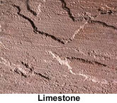 The productive veins, apparently controlled by deep fractures, trend northwesterly. Although many veins crop out at the surface, some apex several thousand feet below the surface. Depth appears to have had little effect on the occurrence or type of ore.
Limestone: Limestone is a soft, sedimentary rock primarily composed of calcium carbonate deposits. Limestone has the general chemical formula of CaCO3.
Molybdenum: Molybdenum is a silver-white metallic element with atomic symbol Mo. Although the most important use of molybdenum is as an alloy to enhance the strength and durability of steel, it has many other uses.
Molybdenum Veins:
Commercially useful molybdenum is found in one location in Idaho. The Thompson Creek molybdenum mine, owned by Cyprus Mining Company, between Challis and Salmon is located in altered Cretaceous granitic rock. The mine is an open pit and produces from a stockwork of tiny veins on the edge of a granitic body dated at about 87 Ma.  Exploration of the mine began in 1967 and continued for 14 years. In 1978 the decision was made to develop the property. The ore body consists of an igneous granitic stock of Late Cretaceous age intruded argillites of Mississippian age. The intrusive and sedimentary rocks are overlain by Challis volcanics of Eocene age. The molybdenite occurs primarily veins and veinlets disseminated throughout the deposit.
The ore body has an estimated 181 million tons of reserves, averaging 0.18 percent molybdenite. Actual mining and ore processing began in 1983, more than 17 years after Cyprus staked its claims. This mine, with associated facilities and equipment, is one of the most modern large open pit mines in the western United States.
Phosphate: †Phosphorus is a solid, nonmetallic element with atomic symbol P. It can exist in two forms - one yellow, poisonous and highly flammable, the other is red, less poisonous and less flammable. An interesting property is that water does not put phosphorus fires out, the element will continue to burn under water. Phosphorus is an extremely useful element and is of great commercial importance. Production of the element and byproducts (such as fertilizer) contributes significantly to Idaho's economy.
The southeast Idaho phosphate industry produces the greatest amount of income to the state of any precious mineral. The deposits are found in the Permian Phosphoria Formation and are mined by open pit methods. These are stratigraphically controlled concentrations of P205. Concentrations of about 15 to 30% are minable.
Southeastern Idaho contains both the thickest and richest phosphate deposits in the western United States. Idaho phosphate accounts for as much as 14 percent of the total phosphate produced in the United States, and is second only to phosphate production in Florida and North Carolina. Phosphate is of economic interest primarily for production of fertilizer and a myriad of products from detergents to soft drinks.
The geology of southeastern Idaho was first studied by members of the 1877 Hayden Survey, They recognized some of the broad structural features and the Carboniferous and Triassic rocks in the area however, the Permian phosphate deposits were not discovered until 1889 by Albert Richter. Since that time
geologic efforts have focused on the area's vast phosphate resources and secondarily as a possible source of vanadium and uranium.
Phosphoria Formation:
The Idaho phosphate deposits are sedimentary rocks that occur in the Permian Phosphoria Formation. The Phosphoria Formation is centered in Idaho, but extends regionally into northeastern Nevada, northern Utah, western Wyoming, and southwestern Montana.
In southeastern Idaho, the Phosphoria is subdivided into three members, in ascending order: the Meade Peak Phosphatic Shale Member, the Rex Chert Member, and the cherty shale member.
The rich phosphate beds occur in the Meade Peak Phosphatic Shale which reaches a maximum thickness of about 230 feet in southeastern Idaho. Since the Meade Peak is a relatively soft lithologic unit, it is rarely exposed, but is recognized at the surface by the presence of adjacent erosion resistant units. The region is structurally complex and strongly folded so the bedding of the Meade Peak is commonly tilted to steep angles. Because of differential erosion and the tilting, the Meade Peak is characterized by a dominant surface swale that occurs parallel to the strike of the bedding.
Phosphate occurs in the Meade Peak in sedimentary rocks called phosphorite and phosphatic mudstone.
Phosphorites are composed dominantly of phosphate minerals, varieties of the mineral apatite, that occur in tiny spherical particles called ooliths and peloids (less than 2 mm in diameter) and in larger nodules and fossil fragments. Ooliths, the most abundant of the smaller particles, are accretionary particles composed of concentric bands around a nucleus. Individual phosphatic particles are hard and nearly black. Weathering of phosphate-rich rocks produces a bluish-white coating referred to as "phosphate bloom" which aids in recognition of phosphate in surface samples.
Deposition in a Shallow Sea:
The Phosphoria Formation was deposited in a shallow sea during the Permian Period. While phosphate-rich water may have originated and upwelled from deeper ocean waters, phosphate-rich sediment accumulated, was reworked and deposited as sediment in the relatively shallow waters of an epicontinental seaway or embayment. Some phosphate deposition is also thought to have occurred as a result of diagenetic processes, that is, formed by precipitation of apatite within intergranular spaces and pore water after initial deposition of sediments. The formation and concentration of spherical peloids and oolites, as described above, required agitation by wave action and winnowing of sediment that would occur in a shallow-ocean environment in times of maximum regression of the sea.
Structural Setting:
The geometry of the southeastern Idaho phosphate deposits is attributable to the complex structural geologic setting of the region. Most of the structural deformation of the region is the result of major episodes of tectonic activity occurring in the Mesozoic and Cenozoic eras. Southeastern Idaho is part of the Idaho-Wyoming thrust belt where regional compression from Late Jurassic to Cretaceous time resulted in substantial crustal shortening. This crustal shortening, achieved by thrust faulting and folding, is responsible for the effective doubling of the overall stratigraphic thickness. In Tertiary time, regional extension of the Basin-and-Range Province produced north- to northwest-trending normal faulting in southeastern Idaho. Recent seismic activity indicates that Basin-and-Range-type deformation continues to the present. As a result of the overprinting of these structural events, the Phosphoria Formation and associated stratigraphic units are folded, faulted, and tilted.
Mining of Phosphate:
In southeastern Idaho, phosphate is mined in large open-pit mines. Because the phosphate beds are tilted and oriented along large folds, open-pit mines in southeastern Idaho are long, linear trenches excavated along strike of the bedding. Phosphate rock is mined downward along the dip of bedding to an economic depth (currently as much as 300 feet or more). The economic viability of a particular phosphate deposit is related to many factors including the thickness and grade (P2O5 content) of the rock, the amount of overburden that needs to be stripped off to reach the phosphate beds, location, market considerations, and structural geologic complications. The depth to which the phosphate is weathered is also a critical factor. The more weathered the phosphate is generally the richer the ore and the more easily mined. Phosphate ore is mined using large mine shovels and scrapers and is transported by ore truck, rail line, or slurry pipeline to processing plants in Soda Springs, Pocatello, and other locations in the region.
Processing of Phosphate Ore:
Phosphate rock in southeastern Idaho is either: 1) processed into chemical fertilizer products by a wet process that dissolves phosphate rock with sulfuric acid to produce phosphoric acid; or 2) processed into elemental phosphorus by smelting a mixture of agglomerated phosphate rock, silica, and fine-free coke in a submerged-arc electric furnace. Phosphate rock in the western phosphate field is generally classified as followed:
* High grade (or acid grade) is plus 31% P2O5
* Medium grade (or furnace grade) is 24 to 31% P205
* Low grade (or beneficiation grade) is between 16 and 24%P2O5
High-grade rock is used directly in fertilizer plants- medium-grade rock can be used directly in the elemental plants; and low-grade rock needs to be upgraded (beneficiated) to furnace or acid grade.
Potential Byproducts of Phosphate Production:
Phosphatic units of the Phosphoria Formation are enriched in many rare elements; however, only vanadium is currently being recovered as a byproduct of elemental phosphate production in the western phosphate field. Vanadium is used as an alloying element in steel to improve its strength, toughness, and ductility. Other elements with potential as byproducts are uranium, fluorine, rare earth elements, silver, cadmium, chromium, molybdenum, arsenic, selenium, strontium, tellurium, and zinc. Some elements such as fluorine, uranium and its decay products, cadmium, thallium, and mercury should be recovered to avoid environmental risks from phosphate products or waste materials from phosphate processing.
Reclamation of Mined Lands:
While open-pit mining of phosphate has definite impacts on the natural environment, substantial progress has been made in southeastern Idaho to mitigate impacts and reclaim surface disturbance through the cooperative efforts of phosphate companies with Federal and state agencies. Land reclamation is the process of returning land disturbed by mining to productive uses. Specifics of the mine operation dictate the type and timing of the reclamation done. Reclamation of the surface disturbed by mining includes the regrading of waste dumps and mine cuts to stable gradients and the establishment of vegetation. The establishment of the suitable vegetative cover aids in improving the soil, protecting the land surface from erosion, improving aesthetic values, and in restoring the land to productive uses such as grazing and production of crops.
Future of Idaho Phosphate:
As in the past, the future of the Idaho phosphate industry will depend on the market demands for phosphate fertilizer and chemical products which is strongly influenced by fluctuations in the agriculture and consumer industries.
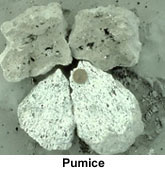 Pumice: Pumice is a porous form of volcanic rock that is used as an abrasive.
Quartzite: Quartzite is a granular metamorphic rock consisting of interlocking grains of quartz - or silica dioxide. It has the general chemical formula of [SiO2]x.
It is largely used as a building stone. Idaho quartzite is mined in the City of Rocks area. The most well-known is called "Oakley stone".
Oakley stone is mined from a group of quarries situated on the west flank of Middle Mountain. This mountain, which terminates several miles south of the town of Oakley, has the appearance of a tilted fault block with a gentle slope on the west side and a steep slope on the east side. In the vicinity of the stone quarries, the crest of Middle Mountain reaches an elevation of 8457 feet. The quarries are situated about half way up the west flank of Middle Mountain at an elevation ranging from 6000 to 7500 feet.
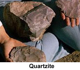 |
| Click here to look at a picture of the plates. |
This rock is unusual because it splits into large flat plates up to 8 feet in diameter and less than one-half inch thick. Geologists call this stone a micaceous quartzite because it is composed primarily of quartzite and muscovite mica.
Marketing History:
The micaceous quartzite, sold under the trade name of "rocky mountain quartzite" or "Oakley stone," has been mined and sold in significant quantities since 1948. By the middle 1950's, this quartzite was well known by the stone industry throughout the United States. A national market was quickly established because it was much thinner than competing stone veneers. A ton of quartzite from Middle Mountain could cover 150 to 300 square feet; most competing stone veneers would generally cover less than 60 square feet per ton. This superiority in coverage as well as durability and color played a significant role in the stone's penetration of Canadian and European markets by the early 1970's. In Idaho, the quartzite veneer is commonly used to pave entryways, to cover fireplaces and to cover the exterior of homes.
Origin of the Quartzite:
As the name implies, the micaceous quartzite is a metamorphic rock. The foliation or planes of parting in the micaceous quartzite were created by deformation and metamorphism of an original quartz-rich sandstone. The original sedimentary rock was composed of thin clay-rich beds alternating with quartz rich beds. When pressure was applied normal to the bedding by the emplacement of the granitic pluton, the sedimentary layers thinned and flowed away from the directed pressure. The pressure caused the clay layers to flatten into mica-rich layers. The alternating quartz-rich layers were also flattened so that porosity was removed and the quartz grains formed an interlocking mosaic. Spacing between the foliation or planes of parting is very consistent, averaging about 0.75 inch, but ranging from 0.25 to 4 inches. The foliation planes also tend to be flat, except at small localized areas.
Extraction from the Quarry:
Large plates are removed from the outcrop using only small hand tools such as pry bars, hammers and chisels.
Typically the plates are removed from the underlying rock by driving a chisel in along the thin mica-rich layers (foliation). Once broken free from its source, an individual plate may be shaped on the edges. The workers sort each plate by color and size and then place it in one of the several pallets kept within several feet of the working face of the quarry. The largest plates are packed vertically to prevent breakage during handling and transportation; all other sizes are packed horizontally. When the pallet is completed, it weighs almost 2 tons.
| Click here to look at a close-up picture of sand. |
Silica: Silica is the oxidized form of silicon. It has the chemical formula SiO2, and is also called silicon dioxide.
In nature silica commonly occurs as quartz or agate.
Sand is composed of rounded and polished grains of silica.
The substance is crushed and used in numerous industrial processes including the manufacture of glass, ceramics and abrasives.
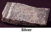 |
Silver: Silver is a white metallic element with atomic symbol Ag. It is highly lustrous and ductile.
Silver is used in a number of important industrial processes including the manufacture of mirrors, jewelry and tableware.
Silver-Lead-Zinc Veins:
Idaho silver deposits are found in the Silver Valley near Kellogg along the Coeur d'Alene River in north Idaho and near Hailey and Bellevue in south central Idaho. These generally have supported the mining economy of Idaho over the last 100 years, but their importance is decreasing. These veins are formed when sulfide minerals fill void spaces in cracks or shear zones.
Coeur d'Alene District:
The Coeur d'Alene district in northern Idaho is one of the major lead-zinc-silver producing areas of the world. Since mining began in the early 1880s, mines in the 300-square-mile district have produced more than 2.89 billion dollars worth of silver, lead, zinc, copper and gold.
The country rock (host rock) consists of six formations of the fine-grained, siliceous, Precambrian Belt Supergroup. The sediments are intruded by several types of small stocks and dikes. The structural geology of the area is complicated by a variety of folds and faults of diverse acres and movements. The district is at the intersection of the west-northwest-trending Osburn fault and a north-trending anticlinal uplift. Six periods of mineralization ranging in age from Precambrian to Tertiary have been identified. The main period of mineralization probably occurred during the Late Cretaceous.
The productive veins, apparently controlled by deep fractures, trend northwesterly. Although many veins crop out at the surface, some apex several thousand feet below the surface. Depth appears to have had little effect on the occurrence or type of ore.
DeLamar Silver Mine in Southwestern Idaho:
Gold was discovered in the DeLamar area in 1863; however, production, primarily by underground mining, terminated in 1914. The exploration phase for the DeLamar silver mine began in 1969 and by 1977 open pit mining was started.
In 1986, ore reserves totaled approximately 11 million tons, averaging 1.8 ounces per ton of silver (and 0.023 ounces per ton of gold). Approximately 27,000 tons of ore and waste are moved each day, of which 3,300 tons are ore. Current production includes about 1.6 million ounces of silver and 29,000 ounces of gold annually.
Silver and gold mineralization occurs in Tertiary silicic volcanic rocks at the DeLamar Silver Mine. The silicic volcanics and subsequent mineralization were controlled by large normal faults. Ore-grade mineralization is best developed in porphyritic rhyolite domes overlying basalt flows.
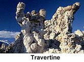 |
| Look at a picture from Lava Hot Springs. |
Travertine: Travertine is a type of rock composed of mounds of calcium carbonate. It is primarily formed from calcite (calcium carbonate) or aragonite deposition.
Travertine is most commonly seen near hot springs containing calcium rich waters. The hot water bubbling up to the surface of the earth where it cools down. As it cools the capacity of the water to hold calcium is reduced. The calcium compounds deposit out of solution as solids, forming the travertine mounds.
Travertine is sometimes used as an ornamental stone. It is polished as a type of marble, and used for building.
Zinc: Zinc is a metallic element with atomic symbol Zn. The metal is used in the manufacture of galvanized iron and other alloys. Zinc is also an important part of voltaic cells.
Silver-Lead-Zinc Veins:
Idaho zinc deposits are found in the Silver Valley near Kellogg along the Coeur d'Alene River in north Idaho and near Hailey and Bellevue in south central Idaho. These generally have supported the mining economy of Idaho over the last 100 years, but their importance is decreasing. These veins are formed when sulfide minerals fill void spaces in cracks or shear zones.
Coeur d'Alene District:
The Coeur d'Alene district in northern Idaho is one of the major lead-zinc-silver producing areas of the world. Since mining began in the early 1880s, mines in the 300-square-mile district have produced more than 2.89 billion dollars worth of silver, lead, zinc, copper and gold.
The country rock (host rock) consists of six formations of the fine-grained, siliceous, Precambrian Belt Supergroup. The sediments are intruded by several types of small stocks and dikes. The structural geology of the area is complicated by a variety of folds and faults of diverse acres and movements. The district is at the intersection of the west-northwest-trending Osburn fault and a north-trending anticlinal uplift. Six periods of mineralization ranging in age from Precambrian to Tertiary have been identified. The main period of mineralization probably occurred during the Late Cretaceous.
The productive veins, apparently controlled by deep fractures, trend northwesterly. Although many veins crop out at the surface, some apex several thousand feet below the surface. Depth appears to have had little effect on the occurrence or type of ore.
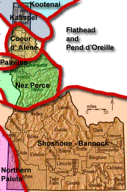 |
|
Native Tribes of Idaho
|
The Peoples of Idaho: Native Settlers
The ancestors of the modern native peoples entered the North American continent at the close of the Pleistocene Epoch perhaps as early as 25,000 years ago. Naturally, as the hunters and their families journeyed deeper into the continent climates and resources changed from region to region. In response to these changes the people also needed to change the ways in which they lived.
The Native Tribes of Idaho
Kootenai
Kalispel
Coeur d' Alene
Palouse
Nez Perce
Northern Paiute
Shoshone - Bannock
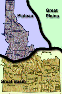 |
|
Culture Areas in Idaho
|
Culture Areas
As the people traveled over thousands of years they eventually inhabited and lived within what are now called "culture areas" by anthropologists. America is loosely sectioned into several regional "culture areas".
The term "culture area" means that the tribes which lived within a "culture area" were more similar to one another than to tribes which inhabited other regions. The tribes within a "culture area" might share similar clothing styles, foods, customs, stories & myths, languages and there may be marriages between the various tribes.
Idaho has very different regional areas, such as the: Snake River Plain, Salmon River country and mountains, the Panhandle and arid Western Idaho. Each of these regions have differing climates, geography, plants, animals, fish and other resources such as rocks, minerals, and water. Not amazingly, the tribes which came into these areas after 4,000 years ago used the variety of regional resources in differing ways.
Plateau Culture Area
Today anthropologists identify two "culture areas" in Idaho. The Northern Panhandle area is designated as part of the Plateau culture area which was inhabited by the Nimi'ipuu (Nez Perce), Kalispel, Kootenai and Schitsu'umsh (Coeur d' Alene) tribes. The Plateau culture area also included tribes of people living in eastern Washington.
Great Basin Culture Area
Great Basin culture area extends over much of Nevada and Utah and reaches north into Idaho to Corn Creek on the Salmon River. The Great Basin culture area of Idaho is inhabited by the Shoshoni, Bannock and Northern Paiute tribes.
Great Plains Culture Area
The Shoshoni and Nez Perce tribes were influenced by tribes living east of Idaho in the Great Plains culture area. Among the Great Plains tribes were the Piegan and Blood (Blackfoot), Tsistsistsas & Suhtai (Cheyenne), Arapaho, and Lakota (Sioux). The Nimi'ipuu (Nez Perce) and Shoshoni peoples adopted clothing styles, hunting techniques, horses and shelter designs from their neighbors on the Great Plains.
|
|
Native Tribes in Idaho
|
The Northern Shoshoni
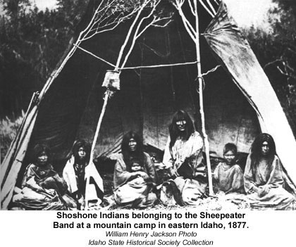 The Shoshonean peoples began their journey to Idaho in the southwestern United States, just north of Mexico. Their journey began perhaps as early as 8,000 years ago base on new archaeological research which traces their toolmaking and technology.
The Shoshoni and Bannock had lived comfortably in what is now New Mexico and Arizona until the climatic changes brought on at the end of the Pleistocene changed the region into desert which would no longer support the population. As the climate became ever more dry some of the people traveled deeper into Mexico and eventually were known as the Aztec and built a great civilization.
The remainder of the people, by about 6,000 years ago, had traveled west into the Lake Mohave desert of southern California where hunting and gathering would provide food and clothing for their families. Eventually, available resources in the desert country of southern California were insufficient, forcing the nomadic Shoshoni to scatter into small bands and travel over expanses of desert in constant search of food.
The nomadic lifeway utilized by families and small bands slowly expanded around 5,000 years ago to encompass most of the territory now known as Nevada and western Utah. Investigation of the technological archaeology suggests that by 4,000 years ago the Shoshoni were moving into southern Idaho, as the last of Pleistocene big game hunters followed what remained of the large animals north. Sometime later the Shoshoni entered Wyoming, and by the 1700's Shoshonean people called Comanche were living in Oklahoma. In Idaho the population density of people before Lewis & Clark was perhaps only 1-2 persons per 100 square miles.
However, The Shoshoni did not have political characteristics ascribed to tribal organizations. The Shoshoni were primarily extended families related, through intermarriage, as a Band. The Shoshoni people, having already learned how to live in desert regions, understood very well how to efficiently exploit the meager resources of the far flung Great Basin region. The Shoshoni, in fact, found southern Idaho to be an under used cornucopia of food resources. However, the needed resources were spread out upon the land at great distances, and were harvestable at different elevations during different seasons of the year. In general, the Shoshoni and Bannock lived in the valleys during the winter and traveled into the mountains throughout the spring and summer, returning to the valleys as winter set in.
This meant that the families and bands usually camped and lived removed from each other by great distances. During certain times of the year however, the bands and families would gather in order to harvest pinon nuts, hunt rabbit and pronghorn, spear salmon and live in winter camps. It was at these larger gatherings that the Shoshoni strengthened their bonds between the bands and families.
Making a Living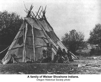
Hunting was an important aspect of life for the Shoshoni. The men hunted large and small game with dead falls, traps and spears (after 1500 years ago with bows and arrows). Among the large game animals hunted were deer, pronghorn, bison and big horn sheep. Small game animals were often available and plentiful. Small game which were hunted include groundhog, jack rabbits, prairie dogs, rodents and porcupine. Insects were not heavily utilized, but some such as grasshoppers would occasionally be used for food. Fish, such as salmon, were also hunted by the men with spears.
Birds, such as ducks, geese and several varieties of grouse were hunted by the men and boys. Eggs, when found, were also included in their diet.
Gathering was the food providing activity of the women. Many different kinds of plants would be dug and picked including wild onion, bitterroot, arrow-leaf, balsam-root, and the tobacco root plants which were all harvested and gathered in by the women and children. The camas bulb, Camassia quamash, was harvested and stored as a staple source of food. However, Zigadenus venenosus, the Death Camas would poison and kill any animal which ate it. It was very important for everyone gathering food to know which plants were edible and which were poisonous.
Many plants supplied seeds which were gathered by the women in the late summer and fall. The seeds of junegrass, blue bunch wheat grass, thick spike wheat grass and Nevada bluegrass would be ground and stored for winter food.
No diet would be complete without fruits. In southeastern Idaho the Shoshoni and Bannock women would gather serviceberry, chokecherries and currants. The berries would be dried and stored for winter use. Berries could also be found and used in puddings, soups, stews and pemmican.
During the fall pine nuts would be gathered in by the bands. These nuts would store over many months and could be used in many dishes.
Women would also gather trout in weirs, a fishing trap set into the stream. Freshwater mussels would be gathered and eaten whenever the people camped near streams. Evidence for this is found at Wahmuza, an archaeological site of the Fort Hall bottoms.
Nimi'ipuu: The Real People of the River Valleys
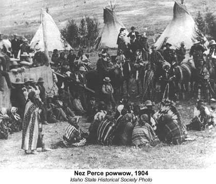 The river region of the Nimi'ipuu, Nez Perce, people allowed them to live a much more secure life than the arid desert allowed to the Bannock & Shoshoni. Because the Nimi'ipuu founded their villages along the banks of the Clearwater, Salmon and Snake River drainage the resources available to them were somewhat easier to gather and hunt. This mountainous region of Idaho has outstanding changes in elevation which causes a diversity of animals and plants to thrive. The Nez Perce, like the Shoshoni & Bannock had to migrate seasonally to gather and hunt food, but the relative plenitude of the resources encouraged these people to live and associate with settled villages during much of the year. Local villages usually had populations from 30 to 200 individuals, which permitted the Nimi'ipuu to develop into the largest population in Idaho before settlement by land hungry pioneers.
This living area, based on a riverine system, allowed the Nimi'ipuu a diversity of resources not easily had by the Shoshoni & Bannock to the south. The men hunted large game animals which lived in the mountains bordering the rivers and small game such as rabbit, squirrel and marmot which lived in the neighboring valleys. Game birds were also common in this area of river drainage. Ducks, geese and grouse would have been available as food.
The water in itself was a bountiful resource. Game birds would not only seek it out on their yearly migrations, but the people used the water systems for transportation, drinking, and as a source for fish. Many varieties of fish were included in the diet of the Nimi'ipuu. Salmon, dolly varden, trout, suckers, sturgeon, lampreys and squawfish would be either speared of trapped in weirs.
The women gathered and prepared many roots, such as camas, wild carrot and onion, kouse and bitterroot. Berries were also available in the form of gooseberries, serviceberries, hawthorneberries, currants and chokeberries. Pine nuts and sunflower seeds were also gathered and processed by grinding with mortar and pestle.
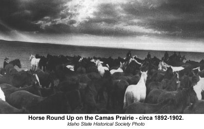 The grassy valleys which provided roots, seeds and forage for large game also provided grazing for horses. Horses had not been native in Idaho for 10,000 years, having become extinct in North America after the climatic change at the close of the Pleistocene Epoch. The Spanish conquest of America's southwest, however, ensured that horses would gradually spread throughout the Great Basin and Columbia Plateau. The Nimi'ipuu acquired horses from peoples who had contact with the Spanish in California. The impact of the horse upon the people resulted in changes. With the aid of the horse as transportation and a hunting partner the Nimi'ipuu were able to travel into Montana in pursuit of bison which increased the wealth and food reserves of the tribe considerably.
Horses were bred for strength and for endurance, but not necessarily for colors. Boys were most often the herdersof these large herds which eventually numbered in excess of five to seven horses per each person. Horses could be sold, traded or acquired also through raids on other tribes which had horses.
The use of horses as wealth encouraged elaborate horse trapping and great herds to be kept by families. Since horses were an indication of an individual's wealth, exchanges of horses would be made as gifts for marriages.
"Heart of the Awl" --- People of the Panhandle's Rivers
In French Coeur d' Alene translates roughly into "heart-of -the-awl". Why this appellation was given to these people by French trappers is now hidden by history. The people called themselves Schitsu'umsh.
One of the panhandle tribes, along with the Kalispel and Kootenai, the Schitsu'umsh made their encampments along the Spokane, Coeur d' Alene and St Joseph rivers. These three tribes not only lived near one another, but the Schitsu'umsh & Kalispel also shared similar languages. Both of these tribes spoke languages included in the Salish language family.
In common with Nimi'ipuu, the Schitsu'umsh had available rich resources provided by the rivers and the surrounding forest. The resources were so plentiful in fact that the population density was five humans per each 100 square miles; with local populations increasing to 100-200 people, many more humans than could live on the deserts of the Snake River Plain. Subsistence for the Schitsu'umsh was attained through hunting and gathering activities of the men and women.
With bows made of syringa and sinew the men hunted deer, elk and bear. Trips would also be made into Montana to hunt bison, although the Schitsu'umsh did not keep large herds of horses for doing long distance traveling. Hunting techniques included using fire to encircle animals then killing them. A similar strategy involved driving the animals into lakes and then killing them from canoes. Many of the hunts were community activities rather than single hunters which would ensure that everyone in the village would have food. Small animals such as beaver, marmot, squirrel, badger and rabbit were also hunted.
The fish available in the streams were the trout, squawfish, white fish and some shell fish. Amazingly, fish were rare even though the Schitsu'umsh lived in an area with many streams. To solve this problem the Schitsu'umsh would travel, sometimes great distances to fish for more than their streams provided. Bands would travel south in the spring to the North Fork of the Clearwater River and west to Kettle and Spokane Falls where they could fish the early salmon and visit with their neighbors the Nimi'ipuu and other tribes. Tools for fishing were complex and made under the supervision of a "boss" who regulated the construction. Naturally hooks and line would be used, but they also used spears, weirs, traps, harpoons and dip nets which were made from bone, stone, wood, antler and sinew.
While the men fished, hunted and made tools the women followed their own calendar of activities to provide food. June signaled the beginning of the root harvest. Small groups would move from one area to the next to gather ripening roots using a syringa digging stick. In July large groups would come together to harvest camas near Desmet, Clarkia and Moscow, Idaho. Because of the large, temporary populations at these three areas, activities other than food gathering developed. Ceremonies, such as marriages, trading between tribes and organization of late-summer buffalo hunts would take place.
As summer faded into fall the women busied themselves gathering bitteroot, wild onion, berries, nuts and wild rhubarb (which was a delicacy). Foods were processed by the women using mortars and pestles made from river cobbles.
Original Tribal and Band Names of Idaho's Native Peoples
The Tribes which entered and settled Idaho did not originally call themselves Shoshoni, Bannock, Nez Perce or Coeur d' Alene. These peoples, before the invasion of the Europeans, described themselves by tribal names which are not commonly used today.
The people which today are called Nez Perce, from the French meaning "pierced nose", call themselves Nimi'ipuu.
Coeur d' Alene is another tribe which was incorrectly named by French fur trappers. Coeur d' Alene means possibly "heart-of-the-awl", but the people called themselves Schitsu'umsh.
The Bannock, which are closely related to the Northern Paiute, called themselves Nimi', Pan a'kwati or Panaite.
The Shoshoni designated themselves by various names, which confused the daylights out of regimented Europeans. The Shoshoni referred to themselves by whatever primary wild food resource was being harvested by the different bands or family groups, living in different geographic areas. Causing further confusion, multiple names were sometimes attached to the people of a single area, the same name could be found given to the people of widely separated areas, and a single group could be known by a series of names as they traveled from an area identified by one kind of food to another with different harvestable food.
An overall name used by the Northern Shoshoni was "Nemme sosoni'ihnee'e", which means "the people" or "us". There are many names by which the Shoshoni Bands called themselves, those that follow are names used by the Northern Shoshoni in Idaho, both to describe themselves and other bands living near them.
Hukkandeka (hukkantikka)- "eaters of seeds". Also used for the Northern Shoshoni of Bannock Creek, which called themselves Kammedeka.
Kammedeka (kammitikka)- "eaters of jackrabbits". These people ranged from along the Snake River from Bannock Creek to Raft River. Also, called Hukkandeka.
Pohokwi- "people of sagebrush butte" which refers to Ferry Butte at Fort Hall.
Tetadeka (tipatikka)- "eaters of pine nuts". A group or Band living in northern Utah.
Pengwideka (penkwitikka)- "eater of fish".
Agaideka (akaitikka)- "eaters of salmon". These people lived in the Lemhi River valley and upper Salmon River. Lemhi is not a Shoshoni word, rather it was invented by European settlers.
Tukudeka (tukkuikka)- "eater of mountain sheep". These people living in Idaho's central Sawtooth Mountains were called Sheep eaters and Lemhi by early settlers. In 1878, the infamous Sheepeater War was with the Tukudeka band, not a separate tribe called Sheepeater.
Kutsundeka (kuccuntikka)- "eaters of bison". These people are also referred to as the poho'ini or "sagebrush people".
Yahandeka (yahantikka)- "eaters of groundhogs" were the people who lived on the lower Boise, Payette and Weiser rivers. This country was called si.wo.kki?i -- "willow-striped".
These Bands spoke the same language and had similar customs, but were not politically organized as a tribe and did not identify themselves with only one name.
The differences in resources available in Idaho's regions encouraged diversity among the tribes and bands which settled Idaho after 4,000 years ago. Because each region offered different varieties of animals and plants, the people, by necessity, responded in kind. It is the diversity of people which will create a special place.
Ice Free Corridors?Two glacial ice sheets covered North America during the last glaciation of the Pleistocene. The "Laurentide" ice sheet extended from the Atlantic seaboard, across the southern shores of the Great Lakes and into Alberta. In the west a "Cordilleran" ice sheet covered the seaboard mountains in British Columbia and, by 14,500 years ago, extended down the Pacific coast to about 30 miles south of Seattle. These two glacial ice sheets were periodically joined together stopping migrations of animals and humans through Beringia into southern Canada and the United States. For at least 10,000 years after 25,000 years ago, great icy barriers would have limited travel between Beringia and North America south of Alaska. However, at other times during the late Pleistocene, the dates are uncertain, an ice-free corridor was possible through the major river valleys coming from the Rocky Mountains where the "Cordilleran" glacial ice did not meet the western edge of the "Laurentide" glacial ice. Perhaps the important question is not whether the ice sheets allowed travel from Beringia into Canada and the United States, but whether resources existed in this passage between the ice sheets to support animal and human life. As on the Bering Land Bridge, the climate in this possible corridor would have been brutally cold and windy; a difficult country even at favorable times of the year. Blocking passage would be large, biologically sterile, cold meltwater lakes which had formed at the margins of the ice sheets. This is a landscape so barren that scant vegetation would have supported few animals and therefore very few humans. The human traveler would have to cross dangerous glacial ice, which even today experienced mountaineers try to avoid. Boreal forests and forest-tundra, where humans and animals could survive, would have been found much farther south of the Laurentide ice sheet. Beringian hunters probably had the skills to survive in such hostile environments, but with better food reserves in Beringia there would be little reason for them to travel into this chilly and inhospitable highway between 25,000 and 15,000 years ago. |
Emergence of People in North America
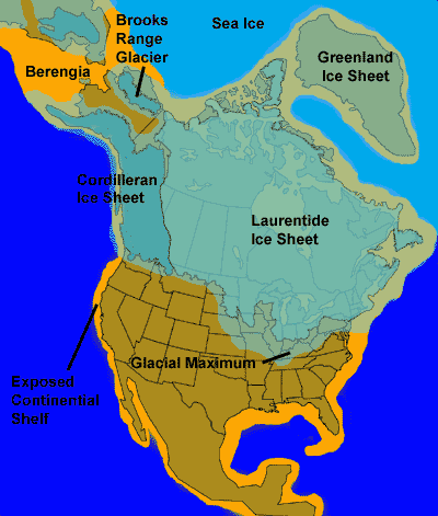 |
|
Glaciers in North America
|
During the late Pleistocene the Bering Land Bridge (Beringia) was an important connection between Asia and North America. Beringia was a large landmass spreading east from Siberia and extending deep into Alaska. It was the only avenue over which Pleistocene animals, such as the mammoth, could travel between the two continents.
Today Beringia is submerged and we know it as the Bering Sea, a cold and inhospitable arctic domain where remains of ancient plants survive near-perfect in prehistoric muds. The Bering Strait is locked in ice in winter and hazardous with icebergs in summer. Only with great difficulty do the Inuit and Aleut peoples live along its shores.
But What Was Beringia Like During the Pleistocene?
Russian and American scientists have learned, by studying the shoreline and taking sea cores of the Bering Sea, that during the Pleistocene Beringia fluctuated at least twice from being a dry landmass as the glaciers spread, which locked up the ocean water, to sea as the glaciers melted. For two long periods: from 75,000 to 45,000 years ago, and again from 25,000 to 14,000 the Bering land bridge was exposed.
During those thousands of years Beringia was an arid, desolate land with thin snow cover and strong winter winds and storms. In the spring, rains and melting snowdrifts would change the barren land into a patchwork of vegetation. Beringia was mainly a treeless land with most plants being very low shrubs. In the rare more sheltered places alder, dwarf-birch and heath shrubs would be found. In these sheltered area animals would graze and browse on the available plants.
Possibly the animals would move from one favored location to another throughout the annual growth season of four or five months. This way fresh food was available from spring until the first late fall snows. Be careful however, not to think of Beringia as a land teeming with herds of herbivores. Most likely the animals were scattered throughout the landscape, concentrated at many special sites. In lowland meadows and near rivers, for example. Also, not all the mammal species would be in the same place at once. They would have succeeded one another, feeding at the same locations, but on different plants and in different months.
So what species of animals would have been present in Beringia? Coming from Asia into Beringia would have been mammoths, bison, caribou, muskox, deer, dire wolves, sabre-tooth cats, dall sheep, saiga antelope, yak, moose, flying squirrels, lynx, lion, dhole, dogs, river otters, ferrets, bears, jaguars, lemmings, mice and voles, fox, rabbits, and wolverines. Two very important species living in Beringia which had developed in western North America were the horse and camel. These diverse species, and others not included here, lived in Beringia following seasonal migration routes between Siberia and Alaska. Remember that Beringia was not an intercontinental highway for these animals. There was not a deliberate crossing from one continent to another by any animal species. The Pleistocene mammals lived throughout Beringia and only by chance, following their migration routes, would travel occur between Asia and North America. Travel farther into North America was blocked periodically by glacial ice sheets which occasionally limited the range of Pleistocene mammals living in Beringia.
What About Human Beings? Where Do They Fit Into This Place Called Beringia?
By 35,000 years ago humans were moving into Siberia from Europe. There are two areas in Siberia where archaeological remains of early people are found. Artifacts of people living in settlements are found in the Lake Baikal region and in the Middle Aldan valley of Siberia.
Emergence
In the Lake Baikal area the most famous archaeological remains come from Mal'ta on the Angara River. People lived here between 25,000 and 13,000 years ago in subterranean houses, which were winter dwellings, using animal bones to support a roof made of locked reindeer antlers and covered with hides or sod. Mal'ta is famous for its ivory carvings of mammoth, women and birds. Other artifacts from Mal'ta show that the people buried arctic fox after skinning them. And a child's burial place has also been excavated.
In the Middle Aldan Valley remains of a group of settlements have been found. At an important site called Dyukhtai Cave the Russian archaeologist, Yuri Mochanov, found mammoth and muskox remains together with spear and arrow points flaked on both surfaces. Also found were burins, blades, and large stone choppers. Because the cave had been undisturbed, reliable radiocarbon dates indicated that Dyukhtai had been used by Siberian hunters from 14,000 to 12,000 years ago. Mochanov argued that these same hunters were the people who had followed mammoth and other big game into North America by 11,000 years ago. This claim has not been scientifically proved because no other evidence has been excavated through archaeological investigation which would show that the Dyukhtai people did travel across Beringia.
Another argument suggesting that the ancestors of America's native people came out of Siberia comes from Cristy Turner, a scientist studying the physical characteristics of human teeth. He pores over human teeth and jaws looking for the differences and similarities between the teeth of the Pleistocene Siberian hunters and modern Native American peoples. He has found that the teeth of the Pleistocene people who lived at Dyukhtai are different from the teeth of the people who traveled across Beringia. Turner suggests that the Siberian hunters who followed the animals into North America are not the same as those hunter living at Mal'ta and Dyukhtai, but are hunters who lived in northeastern Siberia, closer to Beringia. Turner thinks that the settlement of North America by these Siberian hunters took place as they traveled through eastern Mongolia and the Upper Lena Basin, across eastern Siberia and from there into Beringia.
Archaeological and anatomical (teeth) evidence shows that possibly several different groups of humans were living and hunting in Siberia during the late Pleistocene and that these various groups of people had the technology to enable them to hunt the animals which migrated across the Beringia. As yet solid evidence showing which group of Pleistocene hunters crossed Beringia is scant, although it is certain that America's first people did emigrate out of Siberia.
The emigration out of Siberia led the Pleistocene hunters and their families into Alaska and eventually deeper into North and South America. Over a few thousand years these peoples utilized the animals and plants found in the new land and because the climate did not change appreciably they didn't have to change their cultural habits greatly. However, over time conditions began to change.
First, the climate of the Pleistocene became drier and warmer as the glacial ice retreated into the Arctic, approximately 10,000 years ago. Large geographic areas which had been lakes (such as Lake Bonneville) dried up, forests shrank and man of the large Pleistocene animals upon which the people had depended became extinct. Secondly, the people themselves had become very skilled at hunting the large animals with spears and atlatl. Possibly, the hunters, by over hunting animal species which were already under stress from a changing climate and habitat, contributed to the extinction of the mammoth, camel, horse and giant ground sloth. Third, the changing climate also forced the people to find the needed resources at greater distances as plants and animals spread out over greater areas in order to survive. At 10,000 years ago the people were forced to change their hunting patterns. After the extinction of the mammoth, camel, horse and sloth they had to hunt fleet running animals like deer, elk, and rabbits. The people also were forced to leave regions which before 10,000 years had provided enough resources, but after 10,000 years had become dry, desert areas which did not provide sufficient resources.
This changing climate altered the easy simple lifestyle of the hunters and forced the people to experiment with other cultural solutions. One solution adopted by some tribes was to domesticate plants, such as maize, squashes and beans, and begin to experiment with horticulture. Horticulture meant living in sedimentary villages and hunting only to supplement the plant crop. Horticulture meant developing ceremonies to encourage the spirits to provide rain and protect the crops. Horticulture meant depending on unreliable plants to grow and harvest. Horticulture meant digging irrigation ditches to supply water from distant areas. The risks and labor investment involved with horticulture were greater than the risks of hunting.
Geographic Variety of Resources
Naturally the Siberian hunters who crossed into Alaska from Siberia during the Pleistocene did not realize that they had come into a new continent. Their survival needs remained the same. What perhaps had changed, as they traveled deeper into North America and South America, was the variety, kinds and concentrations of resource materials as they traveled from one geographic region to another. It is obvious that each region in America has different plants, animals and rock from which materials can be made. Consider all of the different regions just in Idaho. The forests and lakes in the panhandle compared to the desert, basin and range country of southern Idaho. Each region presented different raw resources to the people which they could use for food, clothing, shelter, tools and weapons. The common denominator however was technology. Technology, provides the ability to take raw materials and apply them to a specific use.
Prehistory of Southern Idaho
The earliest undisputed archaeological evidence of human occupation in southern Idaho is from the Wasden Site (also referred to as Owl Cave), located west of Idaho Falls. The Wasden Site has radiocarbon and obsidian hydration dates averaging approximately 11,000 years ago. Associated with these dates are stone and bone tool fragments, including fluted projectile points classified as Folsom. Other evidence for human occupation near the end of the Pleistocene comes from undated contexts, usually surface finds of fluted points all thought to date between 12,000 and 11,000 years ago. Most notable of these sites is the Simon Site near Fairfield, Idaho that contained numerous Clovis points and associated bifaces.
Desert Dwellers in Idaho
Climates continued to dry and warm after the end of the Pleistocene. This caused the slow retreat north and east of the long-time residents of southern Idaho leaving the Snake River plain open for neighboring peoples to expand into the area from what is now Nevada. Those groups, who had for millennia been desert dwellers, had acquired the knowledge and technology to take advantage of the wide variety of plant and animals species that thrived in the dry and warm climate of southern Idaho 4,000 years ago. They exploited deer and antelope along with an occasional bison in conjunction with smaller animals including fish and waterfowl. It is apparent from the archaeological record that their success in desert areas relied on taking a much wider range of species than their predecessors.
Important sites documenting this changing life way include the previously mentioned Wasden and Simon sites along with Wahmuza, which is located on the Fort Hall Indian Reservation, and Dagger Falls, on the Middle Fork of the Salmon River. The distinctive style of spear point for this period is the large corner-notched points of the Elko series.
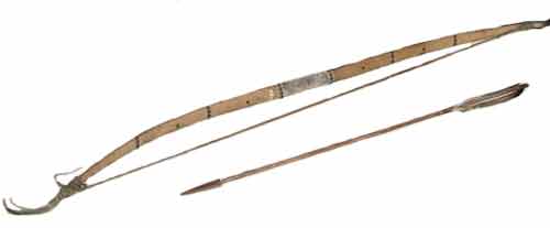 |
| Shoshoni Bow and Arrow. Courtesy of the Idaho Museum of Natural History, Pocatello Idaho |
Bows & Arrows & Pots
The desert life way continued up to historic times as the climate cooled into modern times. Techniques of hunting and preparing food changed as new technology was developed. The bow-and-arrow was adopted in southern Idaho about 1500 years ago, although the previous spear technology continued to be an important part of hunting and fishing. Pottery was adopted at about the same time apparently from neighbors to the south in what is now Utah. Sites such as Wahmuza document the wide variety of species relied upon for food. At that site, Shoshoni, while in winter encampments, harvested over 60 species of fish, waterfowl, and land mammals. Evidence from the site shows that deer, pronghorn, bison, trout, ducks and geese were among those species hunted. Distinctive arrow points, such as the Rosespring corner-notched and Desert side-notched, and pottery are indicative of this time period.
Lifestyles of the First and Only
The Cultural DifferenceIdaho's first people have lived successfully within their regions because their ancestors had brought a very important ingredient from Asia which helped them survive. That ingredient was CULTURE. In the science of Anthropology CULTURE is defined as the learned lifestyle people pass from one generation to the next. Culture includes knowledge, beliefs, arts & crafts, morals, laws, customs, behavior and any other habits held by a group of people. Culture made possible the knowledge of how to: care for children, build a warm shelter, make appropriate clothing, hunt successfully and how each person was to behave. The fact that CULTURAL traits are learned ensured the passing of a peoples' knowledge and beliefs from one generation to the next. In Idaho, there were, as there are now, various tribes of people, each living within different regions which supplied different amounts and varieties of natural resources. For the tribes, CULTURE is the one ingredient that allows each tribe to make special use of the resources within their regions and then pass that knowledge on to their children's children. This mix of Culture, resources and people eventually made for different life-styles among various tribes. |
Harvesting the diverse resources, provided by nature, the peoples of Idaho altered natural materials into the necessities of life. Each tribe inhabited distinctive regions, called Culture areas, which supplied them with a unique variety of raw materials the people invented the basic necessities. The most important basic necessity of course was food, but after food came shelter and clothing to keep bodies warm.
Living Well Requires Resources
Living in the Plateau Culture area, which supplied their needs with a minimum of nomadic traveling, the Schitsu'umsh used forest trees to construct double lean-to-long houses which were covered with woven mats. The Schitsu'umsh also constructed and used conical lodges generically called tipi. Several families, sometimes more than ten, would live in the long houses together and would frequently be extended families compromised of aunts, uncles grandparents, cousins, and parents.
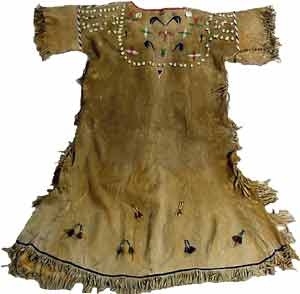 |
|
Shoshoni Womans Dress. Courtesy of the Idaho Museum of Natural History, Pocatello Idaho
|
The forest supplied not only trees for lodging, but animals such as deer & elk for clothing. Both men and women wore buckskin tunics with long loose sleeves. The sleeves on the men's tunics reached to their knees, while the sleeves and hems on the women's tunics gracefully descended to their ankles. In the winter months extra hides from large animals such as bison would be worn to provide warmth.
Also living within the Plateau Culture area were the Nimi'ipuu (Nez Perce). They had similar resources and also built double lean-to long houses which were covered with woven plant fiber mats. Some of the largest could measure 100 feet in length and were used for ceremonial affairs. The Nimi'ipuu erected conical tents (tipi) as temporary shelters when traveling.
Periodically the travel involved trips out onto the Great Plains to hunt bison. These bison hunting trips brought the Nimi'ipuu into contact with Plains tribes. Intertribal contact meant exchanging trade items and fashion trends. Consequently, the clothing worn by the Nimi'ipuu had a strong similarity to clothing from the Plains which was made with Buckskin of deer and elk hides with long fringed sleeves. The style of the Nimi'ipuu and Plains clothing shared several fashion trends; such as being heavily decorated with beadwork strips and designs; using furs, which were worn in the braids of the women; knee length moccasins; and the use of the saddle as fashion decoration, especially for women.
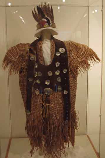 |
| Northern Paiute womans Sagebrush bark Dress. Courtesy of the Idaho Museum of Natural History, Pocatello Idaho |
Lifestyles and the Trends of Fashion
Making Much Out of Little
In stark contrast to the Nimi'ipuu and Schitsu'umsh, the Nemme sosoni'ihnee'e (Shoshoni/Bannock) were a nomadic people living in the Great Basin Culture area, a land of scarcity. Building and living in a permanent shelter for the warm summer months was a waste of precious energy for the Nemme sosoni'ihnee'e, who would soon have to vacate and travel elsewhere to harvest food. Shelters by necessity were temporary and shaped like conical tipis, but were thatched with bundled grass, bark or tule mats. Winter shelters, however, were sturdy and constructed so that the family would be protected from blowing snow and cold.
Hunting large animals could be difficult before the horse was acquired and the hides of large animals were rare and needed for winter clothing; consequently, hides were rarely used to cover shelter. Where possible, caves, especially lava caves on the Snake River plain, made the absolute best shelter because they could be fortified, warmed by fire and provided dry refuge from stormy weather.
Large animal hides, even for clothing, were not often available for the Nemme sosoni'ihnee'e family. Other materials, such as plant fibers, were plentiful and more available in the region. The Great Basin and Snake River plain is a country of extreme variable temperatures, either freezing or frying. The Nemme sosoni'ihnee'e had to have clothing which could respond to the seasonal climate changes, and plant fiber clothes for summer wear were most cool and comfortable, whereas heavy, sweltering hides were not.
One of the most plentiful plants was the sagebrush. Sagebrush bark was stripped and woven into light, cool summer apparel. Items of clothing included sagebrush bark woven into breechcloths for the men, shirts, aprons for the women, leggings and foot wear like moccasins.
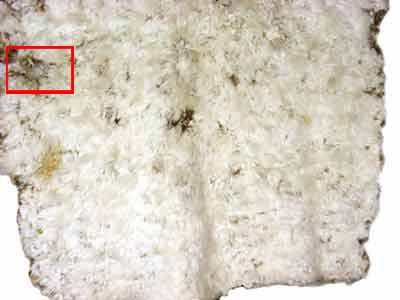 |
| Rabbit skin Robe/Blanket. Courtesy of the Idaho Museum of Natural History, Pocatello Idaho |
 |
| Close up showing stitching. Courtesy of the Idaho Museum of Natural History, Pocatello Idaho |
Winter clothing was frequently made from rabbit hides. Rabbit drives were conducted each year as a hunting technique which provided a meat surplus and hides for clothing. A rabbit would be skinned so that the hide made on long thin continous strip, while leaving one eye hole intact. Then separate rabbit hides were connected by linking the leg of one rabbit through the eye hole of another until a very long strip of hides was made. This hide strip was then tightly twisted. This twisted strip of hide was then looped back and forth and sewn across the loops and fashioned into winter leggings, blankets, cloaks, shirts, dresses and other warm winter clothing.
After the 1700's the Nemme sosoni'ihnee'e acquired the horse and pushed out onto the Plains where bison could be hunted and a surplus of large animal hides taken for shelter and clothing. Bison hides soon covered their conical tipis, replacing the bundled grass and tule mats. Like the Nimi'ipuu, the Nemme sosoni'ihnee'e acquired new fashion trends from the Plains tribes. Their clothing soon reflected the "Plains Look" with buckskin dresses, shirts, leggings and moccasins. Quillwork and beadwork decorated the clothing with many colors sewn into beautiful floral and geometric designs.
Shaping the Future: Growing Up Within One's Culture
Of course, the adults had the immediate responsibility for providing food, shelter, clothing, weapons and tools for their families. But what about the children? Were the children simply consuming these things, or did they also have some responsibility for their production?
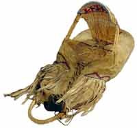 |
| Northern Paiute Cradleboard. Courtesy of the Idaho Museum of Natural History, Pocatello Idaho |
Differences and variations existed among Idaho's people, but in general within a couple of hours after birth a newborn would be carefully wrapped in soft hides and laced into a cradle board or small receiving cradle which was a combined portable crib, highchair and playpen. The cradle board kept the infant warm, protected and supported. Tucked safely in the cradle board, the infant was always with her/his mother and naturally included in all family activities.
What the cradle board did for the mother was to keep her hands free to perform all of the work involved in caring for her family. The mother could not just sit and hold the infant all day, she had work to accomplish. While the mother was working, the baby nestled in the cradle board, was carried on her back.
But infants need lots of attention and the baby was frequently out of the cradle board for feeding and nursing, daily bathing, "diaper" changing and as well as being played with, talked to and cuddled. As with all human infants, the baby developed on a normal schedule and could sit at 6 months, crawl at 8 months, stand at 11 months and would begin walking at about 12 months. In this respect the cradle board did not hinder normal growth. Whenever the family group was traveling the baby usually rode in the cradle board, even after having learned to walk. The child would eventually, by about age 2, be too big for a cradle board and often would be carried in a hide slung over the Mother's back and, of course, was encouraged to walk with the family as they moved throughout their area.
Growing up means learning how to live
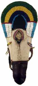 |
| Miniture cradle and doll. Courtesy of the Idaho Museum of Natural History, Pocatello Idaho |
Growing up means learning how to fit into your family and where you belong in your CULTURE. Growing up also means learning how to live and survive. As a child grew she/he was given chores to do which helped the family survive, but the chores also taught the child responsibility. Both young boys and girls helped their mothers gather firewood, fetch water and gather plants for food. Eventually, as the girls and boys grew older, their responsibilities began to separate and they learned how to live as men and women within their cultures.
When the boys became about seven years old, they began to spend more time with their grandfathers, fathers and uncles. From these men they learned how to stalk and track prey animals for the hunt and how to manufacture the weapons which would be appropriate for different hunting situations. Learning how to make quality tools by knapping was also an important element of a boys education.
As horses began to be more common, after 1700 AD, the boys would guard the herds and learned to be expert riders and horse breeders. They learned to care for the health of the horses by cleaning their hooves and making well-fitting bridles and saddles so that the horses did not get sores.
The men taught the boys how to observe the lands, expecting each boy to know the geography of the land so that they would never be lost or confused. The boys needed to know the techniques of scouting. For example, what the moccasin tracks of other tribes looked like, how old horse tracks would look, how to cover one's own trail, how to run for hours and sleep alone in the open at night at a cold camp.
The religious ceremonies of the tribe would also be taught to the boys as they learned the prayers, songs, and dances of their people. Some boys would begin to learn the ways of the shaman. These boys would learn which plants to gather and how to process them into medicines, which ceremonies and songs should be performed to cure different ailments and how to properly diagnose the ailments.
While the boys were learning the lessons of manhood the girls took up their lessons in womanhood. With their mothers, grandmothers and aunts as teachers the girls learned which edible plants to harvest at the various seasons of the years and at what elevation. Harvesting the plants was only part of the lesson. The girls then needed to master the techniques which would turn the wild plants into useful foods. This required understanding how many times to boil some plants and which plants are poisonous, how to grind or pulverize the plants, how to safely cache a surplus of food for winter, how to dry the berries and jerk the meat and how long to roast bulbs like camas. Of course, the girls had to know the recipes by heart for stews, pemmican, soups, puddings and some medicines.
The women taught the girls how to gut and butcher the animals, how to tan and prepare the various hides, how to sew the hides into clothing and construct hides and wood into warm shelters.
Keeping a neat and orderly shelter (lodge) was also part of a girl's education because her skill at homemaking would help to attract a good husband.
Caring for younger children taught the girls good mothering traits, so that, when they became Mothers they would know how to raise strong and healthy children of their own.
Learning the different weaving techniques for manufacture of baskets was an important part of a girl's training for womanhood. A girl needed to know how to weave cradleboards for babies, cooking baskets for foods, burden baskets for carrying loads and winnowing baskets for seeds and nuts. Weaving clothing and hats was also taught to the girls so that their families could wear comfortable clothing in warm weather or when hides were scarce. Naturally, the girls learned which plants were useful for weaving and how to process those plants to prepare them for weaving.
There was much to learn for both girls and boys. How well they mastered these lessons would ensure the continuance of their culture and tribal life-style.
The Family Connection
Unlike children today, these children grew up surrounded by their families. Now we all have families, but sometimes we do feel surrounded, but modern families usually include only a Mother, Father, Brothers & Sisters. The children of the "People" grew up surrounded by extended families who often lived in the same long houses, as with the Schitsu'umsh and Nimi'ipuu, an traveled together, as with the Shoshoni & Bannock. They lived with their aunts, uncles, grandparents and cousins, as well as parents, throughout their childhood. Often aunts/uncles were not considered different from parents and were referred to as Mother and Father. This meant that cousins were called Sister or Brother and treated the same.
Interestingly, children of the Nimi'ipuu & Schitsu'umsh were quite formal with their parents. However, the relationship with their grandparents included joking, playing and teasing. Children have always been quite special to their grandparents and among the "People" children often went to live permanently with their grandparents until they were older. During the years that the children lived with their grandparents they learned many of their first basic lessons about life. Boys frequently experienced their first hunting, fishing and horse riding lessons from their grandfathers, with whom they probably shared a close affectionate relationship. Grandmothers would be teaching the girls how to sew and to identify plants for gathering with a digging stick.
By Any Other Name
A child of the "People" was given a name sometime after girth and usually nicknames were common for children among most of Idaho's first people. Among the Nimi'ipuu, children's names were from important family ancestors in order to positively influence a child's development. The names were regarded by the Nimi'ipuu as family property. Among the Nemme sosoni'ihnee'e, however an ancestor's name was never given because the names of the dead could never be spoken again.
As children grew their names might be changed at any time. The name change might be as a result of some significant accomplishment or as a result of an outstanding personal characteristic. The spirit visions experienced by children also could result in a name change if, for example, the tutelary spirit bestowed or instruct a child to declare a new name. A tutelary spirit was usually an animal which appeared to a person in a dream and acted like a spiritual guide, messenger and protector throughout a person's life.
Right Tools for the Right Job
The Big Question - What Is A Tool, Anyway?
Humankind has successfully survived because within our cultures we use many different types of tools. Tools are used all of the time by peoples living everywhere on Earth. Some types of tools are quite ordinary, but many are amazingly unexpected. Humans are not the only creatures which use tools. Birds build nests, and nests are tools. Chimpanzees chew leaves and then use the partly chewed leaves to soak up water to drink; the leaves are tools. Gorillas "fish" for ants using a twig; the twig is a tool. So, what is a tool, anyway?
 |
| Stone vessel (bassalt pot). Courtesy of the Idaho Museum of Natural History, Pocatello Idaho |
Tools can be incredibly simple; such as a rock used to crush seeds. Some tools are incredibly complex; consider the computer used to write these words into sentences. There are some tools that are not immediately obvious as being tools; like clothing, blankets, shelters and houses and fire.
Often tools must be used to skin the hide from a deer, which is sewn together using an awl and sinew thread to make clothing. Consider the saw which cuts the wood, which is hammered into place as a house is built. The knife, awl, sinew thread, hammer and saw are all tools used to fabricate other tools like clothing and shelter. All of these tools have been modified and manipulated to make work and survival easier.
The earliest tools were crudely chipped stones used by early humans, living in Africa, about 2 million years ago. Those crude stones, modified into tools, were used to make work and survival easier. Eventually, because tools had become more complex, the skill of tool making became necessary and, through experimentation, stone tools were further modified and made more efficient and intricate.
As the knowledge and science of toolmaking expanded the toolmakers began to invent tools designed to suit a particular job or need. This succession of tool use, tool modification, tool making and tool invention and deign to suit a job required much time (2 million years), experimentation and invention to occur. In the end humans were using tools in every aspect of life and survival.
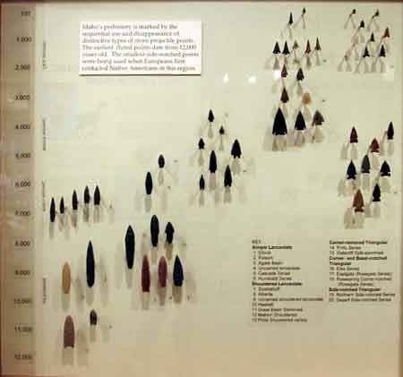 |
| Projectile point sequence for Eastern Idaho. Courtesy of the Idaho Museum of Natural History, Pocatello Idaho |
Tools of the Trade
The "People" had seven technological systems based on the different material available as resources: stone, wood, plant and fiber, basketry, pottery, bone-horn-antler and hide.
Somewhere Between a Rock & a Tool
Stone working made tools for processing seeds and other plant parts, for cutting wood, shredding plant fibers, incising and polishing bone-horn-antler and cutting and scraping hides. Various types of stone had properties which allowed them to be flaked, pecked or ground.
For stone to be fashioned into a useful tool it must be hard, tough and of a smooth, fine-grained consistency. Flint, chert, jasper, chalcedony, agate and obsidian are all types of stone which are solid, but have the property of a cooled, heavy liquid which is also somewhat elastic and free of flaws and cracks. These particular types of stone were the most frequently used for tools because they have a fine-grained consistency and behave like glass, and will break along a controlled line, rather than crumbling as will granite. Breaking along a controlled line meant that a toolmaker could break off flakes that were razor-sharp.
By working these assorted kinds of stone with various techniques many different tools were fashioned. The finer-grained the stone, the flatter and more leaf-like the flakes that could be chipped loose from it.
The size and shape of stone flakes could be further controlled by the ways in which they were broken from the original stone. The flakes could be knocked loose by a hammer stone (percussion flaking) or pried loose by a pointed stick or bone (pressure flaking). With percussion flaking the angle at which the hammer stone blow was struck was changed to produce either a small, thick flake or a large, thin one. Also, different kinds of hammer stones made different kinds of flakes. Relatively soft hammers of woods or bone made on kind of flake, hard stone hammer made another. Pressure flaking, using a wooden or antler point pressed against the edge of the stone, would make a finished, sharp edge. Even the way a tool was held while it was made affected the kind of flake that was struck from it: when it was held in the hands, the results were not the same as when the stone was held on a rock anvil.
Every toolmaker had to have a good deal of skill, based on necessity, on years of practice, and on an intimate knowledge of the natures different stones. For each stone has its own qualities, which vary further depending on whether the stone is hot or cold, wet or dry.
Techniques of Stone Working
Stone could be flaked or pecked and ground. In flaking, the toolmaker first selected a stone that had suitable characteristics. This core nodule was struck with a hammer stone. Conchoidal flakes, which are cone shaped, were made in this way that could then be used to create smaller finished tools like projectile points, scrapers and drills. A core with flakes removed to create a sharp edge could be used to chop down trees and shape wood.
In pecking and grinding stone tools, the toolmaker often first selected a core nodule that was about the shape of the tool he wanted to produce. It took a lot of time and effort to peck out a pestle or mortar for pulverizing nuts or a mano and metate for grinding seeds. The surface of the core was pounded withy a hammer stone roughly to the desired finished shape. Then, the surface might be smoothed through grinding. As the ground stone tools wore down with use, they would be resharpened using the pecking technique.
Tools of Wood
|
| Shoshoni Bow and Arrow. Courtesy of the Idaho Museum of Natural History, Pocatello Idaho |
Wood-working was often a difficult, time-consuming task for people without metal tools. In building a shelter, for example, pieces of wood were used that were about the right size and shape for the task, simply because stone axes and adzes were not terribly efficient. Dwellings were often constructed along streams, which supplied drift wood for structural supports, as well as tules and willows which would cover the framework. Wood for other tools like bows and arrows had to be laboriously shaped. A juniper limb might be selected because it was about the right thickness for a bow. Cut off the tree, the limb was then split into halves or quarters with a stone or antler adze, and scraped to shape with stone scrapers.
Larger projects requiring the cutting or trees usually meant that fire had to be used in some combination with the stone axes. The tree was girdled with fire, the sides of the trunk charred, and a stone axe used to chop out the charcoal. This process would be repeated until the tree could be felled.
So Who Used Which Tools?
Within each community of the "People" each gender had certain jobs which were to be performed. The various jobs required tools and some tools were used only by the gender performing a particular job.
Generally, the men hunted, provided protection for their families and communities and were the toolmakers. These occupations required many different varieties of tools, and tools to produce those tools. Tools used by the men included: duck decoys, nets, knives, hammer stones and the tools used for making tools, the spear & atlatl, the bow and arrow, anvil, hand pump drill, awl, and adze.
The occupations of the women were more extensive and included: gathering plants, sewing, food preparation and cooking, tanning hides, weaving, slaughtering animals and caring for children. The tools used by the women were: nets, baskets, knives, scrapers, digging stick, awl, sinew, cradle board, winnowing tray, mortar and pestle and the teshoa.
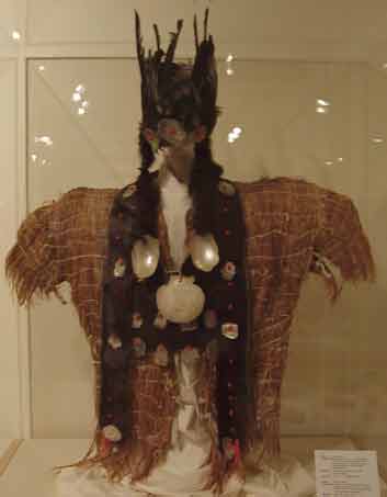 |
| Northern Paiute mans Sagebrush shirt. Courtesy of the Idaho Museum of Natural History, Pocatello Idaho |
Whether, used by men or women the tools were all made of plant fibers, stone, sinew, hide, bone-horn-antler and wood.
Plants: Natures' Garden of Woven Tools
Many of the tools used by the "People" in Idaho were made from plant fibers. Plants like dogbane was pounded to produce fine, tough fibers that were twisted, by repeated rubbing on the thigh, into longer strands that could be used to make cordage. Through use of knots, this cordage was transformed, through weaving, into a variety of useful and beautiful objects. Cords became carrying bags, nets for ensnaring animals, arts of nooses and traps, and elements of composite tools of different materials. Cordage was also woven and tied into clothing like aprons, skirts and capes.
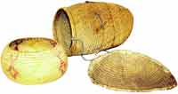 |
| Shoshoni baskets. Courtesy of the Idaho Museum of Natural History, Pocatello Idaho |
Today, we most often find stone tools in the archaeological record, either on the ground or hidden in the soil layers of an archaeological excavation. However, the "People" mostly used tools of perishable materials like fiber and basketry. Consequently, many tools are not preserved in the archaeological record.
Baskets were woven from all kinds of plants, from various kinds of grasses, willows, and tules or rushes. Twined and coiled baskets were both made, and were often gaily decorated with designs done in natural plant and mineral dyes. Baskets were common tools for storing plant and animal material that needed to be kept off the ground and away from pests. Baskets transported the family possessions when the "People" traveled. Some baskets were small and open, others were larger with rigid walls and lids. Baskets frequently hung from the rafters of the dwellings and assumed places of honor in the house as cherished heirlooms.
A Pot In Every Fire
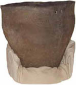 |
| Shoshoni cooking pot. Courtesy of the Idaho Museum of Natural History, Pocatello Idaho |
Pottery was made, but it was never as important as crafts in fiber and basketry. Usually, people made pottery as it was needed at campsites for cooking and storing food and other materials.
Local clays were taken from stream banks, mixed with water, and coiled and shaped into vessels. The formed pots were then left near the fire to be carefully dried. When ready, the pottery was placed on a bed of coals, and a fire built around it. Potters carefully watched their vessels for a change in color showing that the temperature had gone high enough to harden the clay. The pot was then removed and used to hold water, boil meat, or store seeds. Pottery was brittle and expensive to make, and usually stayed at the campsite until people returned to use it again.
Tools From Animals
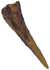 |
| Bone Awl. Courtesy of the Idaho Museum of Natural History, Pocatello Idaho |
Bone, horn, antler and hide from animals supplied all kinds of useful tools. Hides were cured and shaped into clothing. Hides, horns and hooves could be boiled to make glues that held projectile points to shafts or sinew-backing to bows. Sinew was used for all manner of tasks that required something to be tied to something else. It was strong, durable, and water-resistant.
Horns were used for cups and spoons. Antlers were used to flake stone into tools, and could be used for any type of tool that had to be strong and durable.
Bones were cut and ground to shape as sharp tools like awls for hide-working and basketry and as the hook on the end of an atlatl into which the spear was notched. Bone needles were used to sew hide clothing.
Hides were stripped from bison, antelope, mountain sheep, deer, rabbits and other animals, and cured for all kinds of uses. Most often, hides were cleaned, stretched, and left in the sun to dry. When dry, the hides were scraped down to the thickness that was wanted. Hair might or might not be removed. Once the hide was clean and thin, animal brains were rubbed in to soften the hide. If the makers wanted to make it water-resistant, they would build a willow frame, stretch the hide over the frame and build a fire, using "green" wood, which would smoke the hide.
The tools and lives of the "People" were intimately related to their natural environments. Technology was limited by resources in the environment, and lack of metal tools meant that people had to work very carefully within what nature provided. Stone, fiber, basketry and hide crafts were highly developed. Wood-working and pottery less so, simply because available tools were not terribly efficient in working wood or producing lots of pottery.
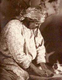 |
| Ute woman using a metate and mano. Photo by L.C. Thorne, Thorne Studios, Vernal, Utah. |
Tools of the Trade: Idaho As A Hardware Store
Dependent upon the natural products of the environment for their needs the tribes of "People" living in Idaho had to invent tools and weapons which would serve to provide for all their necessities. Their ancestors had brought the knowledge of toolmaking with them from Asia at the end of the Pleistocene. However, over many thousands of years the toolmakers had made improvements and changes in the tools to meet the changes in the plants and the animals. The "People" formed tools from stone, wood, plant and animal fibers, horn, antler and hide. Their workshops were out-of-doors, and they took advantage of every possible resource to ensure survival of their families and cultures.
Idaho, with it's surrounding mountains and wide plains, shows a broad range of temperature, precipitation, and local climates. Part desert, part high country, this landscape is both harsh and productive. People needed tools to harvest and use the natural products of this diverse environment. Some tools, like fire, ensured basic survival. Other tools, like grinding and pounding stones, allowed seeds and pin on nuts to be made into flour suitable for hard tack. Additional tools were weapons. Tools such as the atlatl and spear brought down deer and larger game that supplied meat for eating and raw materials for more tools like thread, awls, needles and clothing. Eventually, by about 500 A.D., the atlatl and spear were improved upon and replaced by the bow and arrow.
The "People", dependent upon the natural world, wasted little. When out hunting, or moving throughout their range, the "People" gathered plants. Such plants as dogbane, also called hemp, provided fibers that were twisted into cordage. Cords were used to make nooses to capture small animals, nets to catch rabbits and strings to hold together twists of rabbit fur for winter robes. Other plants like tule and willow ere collected for making baskets that stored raw materials for future use. They also supplied the covering for dwelling roofs and mats for dwelling floors.
 |
| Digging stick and Camas bulbs.Courtesy of the Idaho Museum of Natural History, Pocatello Idaho |
Edible plants such as rice grass and camas were important in the diet. Growing in dense stands, these plants were easy to gather and highly nutritious. The tribes living in Idaho had a store of knowledge about what plants were useful, and would gather these species as they moved about the environment. Visits to certain areas would be timed to coincide with the ripening of grass seeds, nuts and berries. Campsites would be chosen for their closeness to water and sheltered aspect. Willows and tules were found near water sources, as were other important plants and animals that could be gathered.
People moved about the landscape not only to gather plants. Movements, from one locality to another, were also intended to sample animal resources. In general, plants and small animals supplied most of the diet. Small animals were hunted all the time. Nooses, snares, and traps, made up of fiber cordage, were set up near camps to take small animals that lived there or were attracted there because of peoples' activities. Because of their small size, rodents were seldom hunted except by little children practicing their skills with snares and weapons. Most small animals were trapped in dead-falls made by propping up a stone with a stick, then rigging the trap to fall when the bait was taken.
Fishing was an important seasonal activity, although, some fish could be caught all year round. Available throughout the year, bottom-feeding, scavenger species, like suckers and carp, were usually caught by hook-and-line. Sloughs and river channels near camps were favorite fishing spots for young and old anglers.
Seasonally migrating species, like the salmon, were not found in all of Idaho's streams, but where they did occur, they were a focus of great seasonal activity. Families and bands would come together at favorite fishing spots to catch salmon in nets, weirs, and with spears. The fish were taken, dried, and used as a stored food source throughout the year. While going to the salmon runs, people would gather camas and other plants using tools called digging sticks, as well as the small and large animal species they might find.
 |
| Northern Paiute Duck Decoy. Courtesy of the Idaho Museum of Natural History, Pocatello Idaho |
Waterfowl, like ducks, were also gathered whenever possible. Marshes, ponds, and backwaters, where basic raw materials like tules and willows grew, also supplied migrating and resident waterfowl in quantity. The waterfowl could be caught by hand, lured with duck decoys made from the tules and willow, trapped in corded nets, or shot with bows and arrow.
Some small and large animals, because they are social species, can be herded and gathered in large numbers. Rabbits, antelope, mountain sheep, deer and bison were all important animals because they could be lured or driven to waiting hunters, where few would escape.
Families and bands would travel to selected spots to drive hundreds of rabbits into long cordage nets, made from plant fibers, which were strung out over hundreds of meters. Rabbit meat was delicious, and rabbit pelts were used for winter clothing. Antelope are naturally curious, they could be lured by hunters sitting quietly and waving some interesting object. Antelope could also be by hunters wearing antelope skins, who worked carefully around the herd. Mountain sheep, a naturally skittish animal, could still be easily taken by cooperating hunters. Some hunters, would skirt a game trail, and take up positions that were out of sight, from which they could select animals as other hunters drove them up or down the trail. Bison were taken by stalking hunters or by large drives of cooperating men, women, and children. Individual hunters would try to get the herd moving in a given direction. Once moving, the herd could be kept on course by line of waving men, women and children, or by piles of rocks and brush. Channeled in this way, a whole herd would be driven off a cliff, to fall at the base in a huge mass. Then, the families would set up camps near the kill site and the bison would be skinned for their pelts, meat, and bone marrow. Hides might be cured at the site for clothing, and meat dried for transport elsewhere and storage.
Almost every activity required close cooperation amongst family and band members. Day-to-day activities were often done independently by family members, but journeys to fishing, gathering and hunting sites were made by cooperating families and bands. Successful fishing, gathering and hunting expeditions like these required large numbers of people. Rabbit and bison drives, or pin on nut harvests, were fun, social occasions, when people came together for dances, ceremonies and gossip. It was important to gather nutritious foods and raw materials for tools, but these events also served to keep social groups of people together.
What Tools Have Been Found In Idaho?
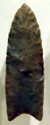 |
| Clovis point. Courtesy of the Idaho Museum of Natural History, Pocatello Idaho |
Archaeologist have found enough stone and bone tools throughout Idaho to confirm the presence of the "People". One of the oldest sites in Idaho is the Simon site near Fairfield. There, W.D. Simon discovered distinctive stone tools, now called Clovis points, that were made by Idaho's Pleistocene hunters. Mr. Simon accidentally uncovered 5 large Clovis points and over two dozen other stone tools as he was repairing a roadway through his ranch. Clovis tools are made of beautiful stone that was probably collected from any miles away by the "People" who camped at the Simon site.
The first known Idaho "People", and the tools they made, take their name from the Clovis site in New Mexico, where this type of tool was first reported. Clovis points are fairly large, with the most distinctive aspect being the "flute" or "channel flake" that was removed from each side of the base of the point.
To make a Clovis point the toolmaker struck a block of stone with a heavy stone hammer and removed a large flake. The flake was then shaped using a smaller hammer made of stone or antler. The point was then thinned using an even smaller hammer and more carefully placed blows. Finally, using pointed antler or bone, small flakes were pressed off the point to achieve the distinctive shape of Clovis points.
Clovis People were very skilled hunters. Their primary prey consisted of mammoths, camels, giant bison, horses, and musk oxen. Although little is known of their actual hunting techniques, we are fairly certain that some Clovis hunters trapped their prey in bogs or shallow canyons. They may have also separated young or wounded animals from large herds and surrounded the single animals with spear- wielding hunters.
The large animals who lived during the Pleistocene are extinct because of climatic change, over-hunting, or disease. As they disappeared, the
 |
| Folsom point. Courtesy of the Idaho Museum of Natural History, Pocatello Idaho |
hunters turned their attention to smaller prey. As a result, Clovis points were replaced by smaller Folsom points. Folsom points are much like Clovis points except they are shorter, thinner, and more delicately made. They are among the most beautiful and well-crafted stone tools in North America. Like Clovis points, the most distinctive feature of the Folsom point is the single longitudinal flake that was removed from each side of the point. It is believed that this flake was removed in order to make the point easier to attach to a spear or spear foreshaft. It must have been very important since many Folsom points were broken while trying to remove these "flutes" or "channel flakes". Although the reason is uncertain, were only used in Idaho for a short time. They were replaced by several other styles of points which lacked the distinctive flute.
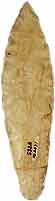 |
| Hasket Point. Courtesy of the Idaho Museum of Natural History, Pocatello Idaho |
The point that followed the Folsom points in time are called "Plano" points. They are now generally long and narrow. One common variety of "Plano" point found in Idaho is the Haskett point names after a site near American Falls discovered by Mr. Parley Haskett, of Pocatello. Haskett points were used to hunt bison and mountain sheep.
Haskett point were probably fit onto spears withy deep sockets and drilled into the end in which the tapered stem of the Haskett point was inserted and secured with a form of glue called mastic. Mastic was made of a mixture of tree pitch and ash. The pitch was first melted near a flame, then ashes stirred into the molten material. Before cooling completely, the mixture was formed into a cigar-shaped glue stick that hardened upon cooling. To use the mastic, one only needed to re-heat a portion of the stick and it would again soften. It could then be used to glue a point to a foreshaft, a knife blade or scraper to a handle, or it could be melted to form a thin waterproof layer over sinew wrapping.
The spear points were all dulled on their edges near their bases. This dulling helped prevent the sharp edges of the points from cutting the wrapping that tied the points to the shaft. These edges were dulled by rubbing them with an abrader made of a course stone.
In addition to stone spear points, the "People" used a wide variety of special stone tools to work bone and wood, prepare leather, harvest food plants, and skin animals. One of the more common stone tools is called a "biface" by archaeologists. Bifaces served as multi-purpose tools, somewhat like our modern Swiss Army knives. They were used to saw, slice, dig, chop, and could be resharpened many times. Some bifaces were shaped into spear or dart points. Bifaces were made from a variety of stone types, including obsidian, chert, jasper, chalcedony and agate. Other varieties of stone tools were made on carefully rounding one end of a blade or flake. These were used to remove hair and fatty tissue from animal hides so leathers could be produced for shelter and clothing. Scrapers were made in all shapes and sizes.
Other biface tools were spokeshaves, burins and backed blades. Spokeshaves were made by taking a long slender stone blade, then shaping a crescent-like indentation on one edge. This indentation was then drawn down the length of a branch of a tree limb to give the spear its desired shape. Bruins were used to engrave bone and carve wood, and backed blades were used to cut meat or other soft materials.
Leather was tanned and made into clothing for the cold Idaho climate. To make clothing, pieces of leather were sewn together by first piercing holes at pre-measured intervals using a sharp bone awl. Next, the pieces were sewn together using sinew as thread, and needles made of cut and polished bone. Sinew was made by removing long pieces of tendon from the backs and low legs of large animals. After the tendon had dried, it was pounded over a smooth stone anvil. The split fibers were then stripped and woven into very durable thread and string. Sinew fibers could also be soaked in the mouth for a few moments to soften, then be used to bind spear and dart points to the foreshafts, knife blades to handles, feathers to mainshafts, or repair broken tools. Once dry, the sinew formed a hard, durable wrapping that could be waterproofed by applying a thin coating of melted mastic or animal skin glue.
Exploration & Expansion
The expansion of the United States from its original size of just 13 small, eastern states is an important part of American history and the history of Idaho.
Much of the regional culture and demography of Idaho and the west can be attributed to the people that originally settled in the area. However, the settlement of Idaho was just a part of a much larger movement of westward expansion in the United States. The exploration, settlement, and development of the western frontier left behind a legacy that is an integral part of American culture.
In 1789, at the time of the Revolutionary War, the United States consisted of what now seems like a small strip of land between the Allegheny Mountains and the Atlantic Ocean. However, it would not remain that way for long. Almost immediately, settlers began pushing west into the areas lying between the Allegheny Mountains and the Mississippi River. Then, in 1803, the U.S. made the Louisiana Purchase, acquiring hundreds of thousands of square miles of land from France. This land stretched from the Mississippi to the Rocky Mountains, and would allow for the settlement of the mid-western states and the Great Plains.
Most of this area was ideal for farming, with deep fertile soils, but the western Great Plains region was found to be too dry for agriculture, so ranching would be initiated there instead.
In 1804, Meriwether Lewis and William Clark led an expedition from Missouri to the Pacific Northwest, exploring parts of what would become Montana, Idaho, Oregon, and Washington, aided by an Indian woman named Sacajawea. They wrote memoirs about the ruggedness of the mountains of central Idaho and the overall beauty of the Northwest The acquisition of these lands would come later in U.S. history, but the door to the west had been opened.
At first, the only white men living in the Pacific Northwest and Rocky Mountain regions were fur trappers or mountain men. Many of these men worked under contract with large commercial fur companies. Commercial fur hunting played a large role in opening up the western frontiers and developing relations with local Indians.
However, by the 1840s most of the beaver that were so highly sought after by the trappers, had been hunted to near extinction and the fur companies pulled out.
The rugged terrain and Indian presence had been enough to keep most people away from the Northwest and Rocky Mountains for a while, but eventually the prospect of gold, lumber, land and freedom got the best of many. All types were attracted to the frontier - from homesteaders, to loggers, miners, gamblers, merchants, outlaws and more.
By the 1840’s Oregon was a very attractive place to settlers. The rumors of good farmland brought people by the thousands. Families would sell almost everything they owned to buy a wagon and supplies for the long trip over the Oregon Trail.
Fort Hall, Idaho was a major stop along the Oregon Trail, providing a place for settlers to get supplies and rest, before they proceeded with the last part of their trip. Unfortunately, the journey was not as easy as many would have hoped. Hostile Indians and rugged mountain terrain cost the lives of many people before they ever got to Oregon.
An even bigger draw west came in 1849 when gold was discovered in California. Over 80,000 "forty-niners" made it to California, and many more died on the trail, victimized by the Nevada desert or mountains along the way. Most of the "forty-niners" that did make it to California never found gold, but the gold rush brought enough people into the area that California became a state in 1850.
After California, it was Colorado, then Nevada, Montana, and Idaho that saw a rapid influx of miners and mining settlements as mineral resources were discovered in the mountains and rivers of those states. Mining was responsible for the settlement of the areas near Boise, Ketchum, and Coeur d’ Alene, Idaho; as well as many other communities.
As mining towns sprang up and permanent settlements were established throughout the west, a need for more supplies and more efficient transportation was developed. This opened the door for the stagecoach and the railroad.
By 1869, the first railroad stretched from Nebraska to the Pacific. This allowed quicker transportation of goods and people. Spur lines were built to major towns throughout the west, and soon people began coming faster than ever before.
Between 1870 and 1890, the biggest movement westward took place. Spreading from the rail lines, hundreds of thousands of settlers moved into the Dakotas, Wyoming, Montana, and Idaho.
The last territory to be settled was Oklahoma in 1889. Eventually, territories became states, with Idaho achieving statehood on July 3, 1890.
With the frontier gone, people began to develop areas that had previously been less desirable. In the arid regions of the west, this meant implementing irrigation methods and building dams so that crops could be grown and water made available for daily uses. Areas like the Magic Valley of Idaho were turned from sagebrush and weeds to green agricultural land as canals and irrigation ditches were built. Cities such as Twin Falls could be established because of the newfound productivity of the irrigated farmland.
All over the west, cities sprang up and grew as more people moved into the region. Today, many of the largest cities in the U.S. are old frontier towns.
The history of westward expansion is a unique part of western heritage. Much of the political and cultural character of the western U.S. still reflects its frontier roots.
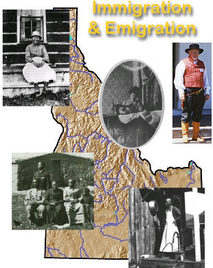 In the years from 1850 to 1890 Idaho's population landscape changed dramatically. Central and eastern Idaho were practically uninhabited in 1880; and the landscape was dominated by buffalo, antelope, deer, and elk grazing amongst the native grasses and sage. The wildlife became obscure in only three years; and was replaced by range cattle as the dominant species.
Fledgling settlements accumulated along railroad lines and major travel routes leading to an agricultural sprawl into the river valleys. This "last frontier" was settled by miners, ranchers, and farmers lured by rich mineral deposits and the chance to exploit free grass and free land. Settlement was encouraged federally by favorable land laws, irrigation capabilities and privately by addition of railroads, the invention of barbed wire, and production of cheap windmills in quantity. Furthermore, several years of above-average precipitation created bonanza farming making farmers artificially wealthy, and creating a false land rush. Thus, the juvenile Idaho Territory continued to attract new residents from many different countries and states. The vast majority were from the American Midwest and Plains states, but significant numbers also came from Europe, Asia, Mexico, and Canada.
Native Americans
The first people to live in Idaho were different Native Americans tribes. Approximately 12,000 Native Americans lived in Idaho during 1990 represented by the: Shoshone, Bannock, Coeur D’Alene, Nez Perce, Paiute, Kalispel, Kootenai and others. That is nearly the same number present when Lewis and Clark passed through the region during 1805-1806.
Idaho's Native Peoples retained their distinctive cultures, languages and traditions through the decades following the initial contact with white people. The Native Americans still cherish a respectful attitude toward the land and maintain many of their traditions, despite the historical efforts of a dominant white society to assimilate them to Christianity and European culture. The Native American response to white occupation corresponded to the changing face of American policy.
French Canadians
The first ethnic group to follow Indians in settling present-day Idaho were French Canadians.
Several, including the husband of Sacajawea, were in the Lewis and Clark Corps of Discovery. Others were fur traders with the North West Company and Hudson's Bay Company who remained in the area when the two companies consolidated. Among these were Michel Bourdon, who came with David Thompson in 1808, and Francois Payette, who traveled with John Jacob Astor's company and later was postmaster at Hudson's Bay Company's post at Fort Boise. French Canadians also found representation as Catholic priests. Andre Zapherin, for example, was assigned to Boise Basin and Alex J. Archambault to Idaho City and other mining and farming camps in the region. The impact of French Canadians is clear from many Idaho names: Coeur d'Alene, Pend Oreille, Nez Perce, and Payette River. Godin Valley in Custer County was named for French Canadian (actually an Iroquois) Thyery (Henry) Godin, who explored the country with Donald Mackenzie in 1820 and named the river and mountains after himself The river was later renamed Lost River. Pattee Creek in Lemhi County recognized Joseph B. Pattee, who came into the area as an employee of the American Fur Company and later settled on land at the mouth of the stream.
Many French Canadians joined the rush to Boise Basin with the mining boom of the 1860s. One of these was Joseph Perrault, from Montreal, who went to California, Walla Walla, Lewiston, and finally to Boise, where he became assistant editor and part owner of the Statesman. Lafayette Cartee built the first sawmill and quartz mill at Rocky Bar, moved with his family to Boise in 1866, and was appointed the first surveyor general of Idaho Territory.
French Canadians homesteaded land throughout the region. Frenchman's Island in Minidoka County was named for two French Canadians who filed a claim on the island. One of them ran a ferry across the Snake called "Frenchman's Ferry." A group of Quebec and Montreal natives moved to the Deer Flat area south of Nampa in 1903 and established a barber shop, bakery, carpenter shop, and farms. At the 1980 reunion of descendants of the original French Canadian settlers held at Saint Paul's Church and Lakeview Park in Nampa, the crowd numbered more than 300.
The north Idaho community of Colbum, nine miles north of Sandpoint, was named in Anglicized form for John Courberon, a French Canadian who worked for the Great Northern Railroad. From St. John the Baptist, Quebec, five of the thirteen children of the Poirier family moved into north Idaho and made it their home. A cove, falls, creek, and dam bear the name of Albeni Poirier. Beginning in 1883, he and a brother ran a cattle ranch in Spirit Valley. Later, the brothers built a road from Rathdrum to Albeni Falls, and the site became the headquarters for navigation of Priest River. Albeni Poirier built a small hotel, boarding house, and saloon just below the dam located there. The Poirier family now operates a museum that traces the history of the Blanchard community and the family farm. In 1910, Idaho counties included 202 French Canadians in Kootenai, 115 in Shoshone, and 140 in Bonner. Other populations were in the lumbering counties of Latah, Nez Perce, Boundary, and Benewah.
British Islanders
The British had, of course, been in the Oregon country with the fur trade. They had explored the land, named geographic features, directed international attention to the region, operated trading posts at Fort Hall and Fort Boise, and indirectly paved the way for subsequent American settlement.
Most of the large percentage of British migrants to Idaho, mirroring mainstream American society, assimilated. They did not retain ethnic enclaves, were not subjected to the job discrimination that others experienced, and were sometimes referred to as "invisible immigrants." The three exceptions were the Cornish, Welsh, and Irish. The Cornish came in comparatively large numbers to work in the mines and concentrated in the Silver Valley and the Owyhee. The Welsh came directly from their homeland or indirectly through Utah in the 1860s and 1870s. The Irish worked in Idaho mining camps, some as prospectors, others as shoemakers, grocers, saloonkeepers, butchers, and livery operators.
The discovery of gold in Idaho during the 1860s coincided with a depression in the mines in Cornwall, and hence many of the miners were attracted to Idaho. They were often referred to as "Cousin Jack", a complimentary nickname that suggested they had a cousin back home ideal for a vacant mining job. Most of them, however, stayed in the United States and sent for their families.
Because of their experience and their strong sense of family and social stability, the influence of the Cornish in mining camps was often out of proportion to their numbers. Many of them were Methodist, and they filled in as lay preachers when formally trained ministers were not available. One of the ministers was John Andrewartha, who served in Rocky Bar and Atlanta. They refused to work on Sunday, formed church choirs and brass bands, and sponsored such recreational activities as wrestling matches. They also favored their own foods-meat and vegetables wrapped in pie crust, called "pasties". Some of the men rose to political prominence, such as legislators Richard Tregaskis and Luke Williams.
The Welsh who were not Mormons were dominant in mining areas in north Idaho. Wardner, the first mining town in the Bunker Hill region, was made up mostly of Welsh miners who had worked the Cornwall tin mines. They later moved to Kellogg. Most were single men, lived in boarding houses, and were sometimes the butt of jokes by other miners because of their difficulties with the English language. A group of Welsh and Cornish miners from Butte worked in the mines at Gibbonsville in Lemhi County during the peak mining years of 1880 to 1906. A few Welsh also settled in American Falls, one of whose children was blue-eyed, red-haired David Davis, elected governor of Idaho in 1919.
The Irish sometimes favored settling together because of the strong anti-Catholic sentiment among Americans. In his statistical study of Idaho mining camps in 1870 and 1880, Elliott West discovered that one in four miners and one in four of the skilled persons in mining towns were Irish. Most were males; in Boise County, for example, Irish men outnumbered women 285 to 37.
Half the miners in the Wood River area in the 1880s were also Irish, and they likewise comprised a substantial proportion of the military in territorial Idaho. These Irish also contributed individually. Robert Dempsey, a glassblower in Ireland before he came to Idaho, mined, worked as an Indian interpreter, and established a trading post near Blackfoot on the Snake River. He founded the town of Dempsey, which later became Lava Hot Springs. Another early resident was an Irishman named Murphy who built a toll gate and charged a fee for using his private road near the present town of McCammon.
Irish women also were enterprising. Anna, Margaret, and Mary O'Gara, sisters from County Cork, operated a rooming house and restaurants catering to timber workers in St. Maries. Witty, amiable, and "respectable", the O'Garas did not hesitate to do a little bootlegging on the side. As Ruby El Hult reported, once when officers raided their place, Margaret "poured her whiskey into a clean and sterile chamber pot and placed it under the bed. The officers found it but did not recognize its contents as whiskey." During another raid Margaret "brought her small whiskey keg into the kitchen and spread her voluminous skirts around it. There she stood adamant while officers searched the quarters."
As part of labor-union activity, which they sometimes dominated, the Irish were highly visible in activities on St. Patrick's Day. Fenian Clubs, Irish Clubs, the O'Conner School of Dancers, and other such organizations allowed immigrants from the Emerald Isle to continue to celebrate their own culture and history.
Chinese
The next national group to come to Idaho in force were the Chinese.
Many Chinese fortune seekers followed the gold boom to Idaho in the 1860s. By 1870 there were 4,274 in Idaho, more than one fourth of all the people in the territory. That year, approximately 60 percent of all Idaho miners were Chinese. They were also packers, cooks, domestics, merchants, doctors, launderers, and gardeners. A typical population is shown in the example of the mining town of Pierce, Idaho. Of the 445 Chinese men and 8 Chinese women living in Pierce in 1870 the average age was approximately thirty-two years; one to eleven people lived together in households. The group consisted of 411 miners, 14 gamblers, 3 hotel cooks, 3 blacksmiths, 3 gardeners, 2 laundryman, and 1 each as trader, hotel keeper, merchant, hotel waiter, barber, doctor, and Chinese agent.
Substantial numbers of Chinese worked in all Idaho mining districts, not only in the 1860s but also in the 1870s and 1880s. Many "celestials" grew fruits and vegetables for mining camps, hauling them in two large hemp baskets equally balanced on either side of a heavy, wooden shoulder yoke, or in a wooden vegetable cart. Several communities boasted Chinese gardens. The community known today as Garden City was so named in honor of the Chinese who lived and worked there. In Lewiston, Boise, St. Maries, and elsewhere Idahoans were eating Chinese food well before the East or Midwest acquired a taste for it. C. K. Ah-Fong of Boise was a well-known herb doctor, duly licensed by the territory.
Some 4,000 Chinese worked on the construction of the Northern Pacific Railway; others worked on the Oregon Short Line, Great Northern, and Chicago, Milwaukee, and St. Paul and their branches. They also helped build the railroad and bridge at American Falls and worked in the railroad shops at Eagle Rock and Pocatello.
The number of Chinese in Idaho declined after 1870. There were 3,379 in Idaho in 1880; 2,500 in 1890; and 1,500 in 1900. Part of the reason for this decline was the anti-Chinese sentiment of the 1880s. In 1890 the Idaho legislature barred Chinese or "Mongolians" from holding mining lands. In 1897 the legislature restricted them from any mining activity. They suffered from several savage attacks; dozens were killed in prejudicial violence. Their religions, customs, clothes, burials, manners, queues of hair, insistence that their bones be transported back to China-all were ridiculed. The Chinese population declined everywhere except Boise, which was known as Cowrie City, the central Chinese community. Boise's Chinatown was first located on Idaho Street between 6th and 8th streets. About 1900 city authorities demanded that it be moved to 7th and Front streets, where it remained for the next seventy years.
After World War II the American attitude toward Chinese changed. As allies in the war they were viewed positively. Those born in the United States saw themselves as American citizens and worked to bring family members from the old country. The Chinese Exclusion Act of 1882 was repealed in 1943, making naturalization possible. Nevertheless, ldaho's Chinese population remains small. In 1980 only 625 people in the state claimed Chinese ancestry. They still have the traditional Chinese New Year, which is celebrated throughout the day and night with firecrackers, roast-pig dinners, Chinese and American candies, and special Chinese whistles. Paper dragons are popular in city and national parades, and Chinese paper lanterns adorn local festivities.
Mormons
An extended essay on the Mormons in The Harvard Encyclopedia of American Ethnic Groups written by Dean May, a historian formerly of Middleton, Idaho, suggests that the Mormons have always regarded themselves as a people in the same sense that Jews, blacks, Hispanics, and Basques are considered a distinct people.
The case for understanding Mormons as an ethno-religious people rather than simply as another religious group rests on many considerations. Mormons have (or at least used to have) a distinctive vocabulary, shared history, unique theological beliefs, definite in-group boundaries (prohibitions on the use of alcohol, tobacco, tea, and coffee), emphasis on in-group marriage, and a strong sense of peoplehood, which includes the "brother" and "sister" terminology. Mormons' block settlement, their modified self-sufficient economy, their gradual identification with Idaho, and their rural-urban transition all parallel the experience of many other ethnic groups in Idaho. Their agricultural skills, English-language background, and knowledge of western culture made their transition easier than that of many others, but the broad process of adjustment and accommodation was similar to other ethnic groups. Like others described in this chapter, the Mormons were gradually accepted into the larger society because of their economic contribution, their growing political power, and their own accommodation to the underlying values of the dominant society.
Mormons who settled in Idaho were, in approximately equal numbers, British, Scandinavians, and Americans. A substantial number of the British were Welsh, who settled in the Malad Valley and Bear Lake Valley. Many of the Welsh spoke Cymric, were clannish, and expressed their fierce nationality in their music, poetry, and the perpetuation of their language and national customs. They celebrated Saint David's Day (first two days of March); held "eisteddfods" for the development of their literary, theatrical, and musical abilities; and organized Cambrian societies. Census figures of Malad Valley showed 400 Welsh in 1890. The people were zealous Mormon converts, and one reason is that their religion helped them preserve their language and customs. Mormon scriptures were published in Cymric, and Mormon communities vied for Welsh settlers because this would assure, or so they believed, good singers for the choir. The person who gave the Mormon Tabernacle Choir national status was Evan Stephens, a Welshman whose family settled in St. John, just north of Malad. That singing tradition continued; the Welsh chorus from Malad was invited to sing at the two inaugurations of Governor John V. Evans, of Welsh Mormon heritage, in Boise.
Another large group of Mormon settlers in Idaho were Scandinavians. Some came directly from Sweden, Norway, and Denmark; others went to Utah in the 1850s and 1860s, worked on the Utah and Northern Railway, and then relocated in the upper Snake River area. Scandinavians represented about one third of all the Mormons who settled in Idaho in the last third of the nineteenth century. Scandinavians from Utah's Brigham City and Hyrum established St. Charles and Ovid in Bear Lake Valley in 1864, Mink Creek in 1871, Weston in 1875, and Driggs in the 1880s. Mormon Danes were located in Oneida, Bingham, and Bear Lake counties. They were farmers, stockmen, craftsmen, or worked for ranchers, the railroad, and the U & I Sugar Company. They were good builders of homes, business establishments, flour mills, bakeries, and power plants.
Many of the Scandinavians brought with them a folk tradition of celebrating May Day Eve with bonfires, merrymaking, group singing, and speech-making, followed the next day by a colorful Maypole dance and feast. The children might pick spring flowers and fill May baskets and place them on the steps of friends' and neighbors' homes. In some communities attention was paid to Midsummer Day, "Midsommarfest" (June 24), a celebration of the summer solstice-the beginning of summer in the Northern Hemisphere-that dates back to pre-Christian times. It was a time for visiting friends and relatives, enjoying traditional foods, wearing traditional costumes, singing folk songs, and performing folk dances. There were picnics, parades, and pageants. In some communities this holiday was postponed and celebrated in connection with Mormon Pioneer Day on July 24; in others, Midsummer and May Day Eve were celebrated together. In still others the celebrations were scheduled on June 14, the day the Mormon mission opened in Scandinavia in 1850. Scandinavians enjoyed dances, music festivals, and theatrical performances throughout the year and had a salutary influence on the communities in which they settled.
The minutes of meetings of Mormon men and women in these ethnic villages where Danish, Norwegian, or Swedish was still the predominant languages are fascinating reading, weaving, as some of them did, a mixture of English and Danish, Norwegian, or Swedish
A third important group of Mormons were the Swiss, who settled villages in the Bear Lake Valley (including Bern and Geneva) in the 1860s and 1870s. Farmers and stockmen, they accumulated large cattle herds, made Swiss cheese and butter, held Swiss Days, and continued to maintain their traditions and customs. Most of Idaho's Swiss settlers were Mormons. There were 249 Swiss natives in Bear Lake County in 1890, 362 in 1900. There were also 219 Swiss in Fremont County in 1910
Bern was founded by John Kunz in 1873 when he was called by Brigham Young to raise cattle and make cheese for the local settlers and for export to Salt Lake City. Geneva was founded by Henry Touvscher in 1879. Both towns enjoyed Swiss yodeling, sauerkraut parties, and competition in handcrafted articles.
Scandinavians
Like the Mormon Scandinavians, their fellow nationals of other faiths also adapted well to the Idaho settlement process.
In 1900 Scandinavians constituted approximately one-fourth of the total foreign-born in Idaho. They included not only Danes, Norwegians, and Swedes but Finns as well. Finnish immigrants came in smaller numbers than the other three but were nevertheless an important segment.
Most non-Mormon Scandinavians had migrated first to Minnesota, Wisconsin, and Michigan, where they worked in the forests, before moving on to north Idaho to become loggers. Some worked in north Idaho mines during World War I, settling in Coeur d'Alene, Wallace, Potlatch, Moscow, Bonners Ferry, Sandpoint, and Troy. Maintaining cultural ties for many years, they sponsored group excursions, held midsummer festivals, and organized ethnic clubs. Norwegians celebrated Norwegian Independence Day (May 17); Swedes celebrated Walpurgis Night or Spring Festival (April 30) with singing, folk dancing, bonfires, and Swedish-style refreshments. Some communities included both of the two denominational Lutheran churches.
New Sweden, west of Idaho Falls, was a result of the formation of the Great Western Land Company, which constructed the Great Western and Porter irrigation canals in 1895. The settlers built a Lutheran church and large barns even before they finished their houses. By 1919 about 12,000 acres had been cleared and a system of dams and reservoirs established, and settlers filled up the area. The New Sweden Pioneer Association was formed to "keep alive the old memories of pioneer days" and to operate the New Sweden School." Residents celebrated occasionally with potluck picnics, Swedish accordion music, square dances, horse-drawn wagon rides for children, a midsummer pole raising, and folk music.
Other communities of non-Mormon Swedes were in Firth, Minidoka County, and Nampa. Swedish children in Minidoka sometimes complained that other children laughed at their Swedish dialect, clothing, and food; their parents laughed right back at the Missouri dialect, Ozark dress, and cornpone and chittlins of their southern neighbors. Among the traditional foods of the Minidoka Swedes were clobbered milk; "valling," a dish made from potato starch with nuts and raisins; fruit cornpotes; "sill" or salt herring; head cheese; "kalvost" or milk pudding; and "skorpor," a rusk (sweet raised bread dried and cooked again in the oven). The large Swedish community around Nampa had gone first to Illinois and then moved to Canyon County. They also had an active Scandinavian Society.
Most Finnish immigrants came to Idaho between 1890 and 1920, the majority of them settling in Silver Valley in north Idaho and in Long Valley in central Idaho; most of those in north Idaho were miners from Minnesota and Wisconsin. Because Finnish is not a Germanic-based language, as is English, the Finns had difficulty learning English. Politically active, the north Idaho Finns constructed six workers' halls within a forty-mile radius of each other but built no church. In Enaville, their chief center, they held workers' meetings and performed monthly amateur plays sometimes infiltrated with socialist doctrine. Many of them sympathized with the Industrial Workers of the World. There were dances at the halls, weddings, basket socials, and dramas. They organized athletic teams and held track meets in which only Finns participated. Once, when loggers were moving logs down the North Fork of the Coeur d'Alene River, a group of Finnish women came to loudly protest their use of dynamite-it scared the setting hens off their nests and killed the embryos in the eggs.
The Long Valley Finns, primarily at Elo and Roseberry in present-day Valley County near McCall, were farmers and loggers. The first Finnish immigrants arrived in Long Valley in the 1890's. They came from eastern Oregon where they had tried homesteading. Long Valley with its forests, mountains and green meadows appealed to them more than the Oregon desert country. Most of the Finns came to Long Valley between 1900 and 1925. Many came directly from the coal mines in Wyoming and by 1905 about 40% of Long Valley's population was Finnish. Most of the later wave of Finnish settlers took up homesteads in upper Long Valley on the east side.
The Finnish men were noted for their skills in woodworking and log construction. They built many sturdy log houses, saunas and farm buildings in Long Valley. Some of these buildings are 70 - 80 years old and still in use today. Many Finnish women wove rag rugs for their houses on homemade looms. Some of their other homestead chores included baking their famous Finn bread and raising a garden. Before doctors came to the Valley some of the Finnish women were the area's only midwives.
A well-known Finnish cultural artifact was the sauna, which contained two rooms, a dressing room, and a steam room with a wood-burning stove. Several apple-sized rocks were heated on the top of the stove with a water barrel nearby. Tiered benches were built around the wall, and the hardiest bathers sat on the highest bench where the temperature was hottest. The men often hit themselves with branches to stimulate their circulation. After sufficient steaming, they raced out and dove into a nearby lake or river to cool off. Saunas were heated Saturday nights. When the men had finished and the temperature had cooled somewhat, women used the sauna. Another Finnish custom was celebrating "Juhannus", or St. John's Day, on June 24 (the equivalent of the midsummer festival), commemorating the return of summer. An all-day picnic included music, footraces, speeches, and food and drink. The community band played, a church choir sang, and the children recited verses. The Finns in north and central Idaho knew or soon learned how to ski. They fashioned their skis from red pine and old leather harness straps.
The largest Finnish community, Elo, was on the Elo Road southeast of present-day McCall. Named for its religious leader and teacher, Rev. John Eloheimo, Elo had a store, post office, school and a meeting hall. Many of Elo's Finns were Lutherans. In 1917 they built the Finn Church located on the Farm-To-Market Road about five miles north of Roseberry and the Valley County Museum. It is one of the best preserved buildings erected in that early pioneer era.
In the late 1880's, settlers, most from Missouri, began arriving in Long Valley, lured by the lush and fertile grasslands which were being offered free to homesteaders by the U. S. Government. By 1890 a small community began to grow up around a post office-store near the center of the valley. It was named after the first postmaster, Lewis R. Roseberry. The post office was soon acquired by H.T. Boydstun who, with a group of investors, platted out the town site and began selling lots. By 1905 Roseberry flourished as the trading center of the area and boasted several businesses.
Officially incorporated in 1907, Roseberry was vigorously promoted by its founders through its energetic Commercial Club. By 1910 the town had two churches, a grade and high school, a telephone exchange, bank, hotel, livery stable, newspaper office, a dry-goods store, and other businesses along with several residences. The town had become the largest community in the valley and was considered the obvious site for the county seat of the soon to be created Valley County. But Roseberry's fame and fortunes were soon to change.
In 1914 disaster struck. A long and hard fought battle to bring the proposed Long Valley Railroad spur through Roseberry was lost. The Railroad decided to locate its line one and a half miles to the west, and establish a new town site called Donnelly. Investors soon turned their attention to the railway and the new town. Many buildings and businesses that were once the backbone of Roseberry were literally picked up in whole or in pieces and moved via horse and wagon or sledges to Donnelly. The last commercial establishment closed when the McDougal store held a public auction in 1939. A few people still lived in Roseberry at that time. The grade school and high school were moved to new buildings in Donnelly. The last school class held in Roseberry was 1959 when the grade school reopened briefly for 7th-8th grades, but then its bells fell silent and in a few short years the white pine boards were removed to build yet another Donnelly structure.
The vision to revive Roseberry as a historic site began in earnest when the Long Valley Preservation Society was organized in 1973. One of the goals of the Society is to acquire and preserve as many early Long Valley buildings as possible in a town setting located on the original Rose-berry town site. Some of the buildings you will see on the walking tour were part of the original town. Others have been brought in from other locations in the valley.
The Long Valley Preservation Society members are working hard to restore and preserve the buildings in the museum complex. The Society plans to acquire additional buildings and create the atmosphere of early Roseberry.
Western Europeans
The Germanic peoples who came to Idaho were from Holland, Prussia, various states of southern and western Germany, diverse sections of the Austrian Empire, Switzerland, and the Volga and Black Sea areas of Russia where Germans had moved generations earlier yet retained their identity.
There are problems in categorizing these people because "Germans", of whom 5,221 were listed in the 1910 census, might have been listed separately in the census under Russians, Prussians, Austrians, or Dutch (often confused with Deutsch, which is the German word for "German"). Many of Idaho's foreign-born Germans came from the Midwest rather than directly from Europe; the peak year of German immigration to the United States was 1882. Many of them fled their homeland to avoid lifetime military conscription.
Germanic people began coming to Idaho Territory in the 1860s as miners, investors, assayers, brewers, and bakers. In the 1880s other Germans joined the rush to Coeur d'Alene and nearby districts. Still others arrived when Indian reservation land was opened for settlement around the turn of the century. Groups of Germans worked in mines and on farms in Bonners Ferry around 1900; others maintained a German Methodist Church at Rathdrum. Post Falls, in Kootenai County, was named in honor of Frederick Post of Herburn, Germany, who moved to north Idaho in 1871. Frank Bruegeman, who lived in the Cottonwood area of Camas Prairie, wrote to a German language newspaper in the Midwest and recruited a group of Germans from Illinois, who settled the town of Keuterville and built a Catholic church there. Others who settled around Cottonwood also built a Catholic church and parochial school. Another company of Germans formed the neighboring town of Greencreek, named after Greencreek, Illinois, from which they came. With so many German Catholics in the vicinity, they persuaded the Benedictine order to establish a convent, the Priory of St. Gertrude. Farther north, German Lutherans settled around Leland and Kendrick, and in their communities in Juliaetta and Cameron they built two churches.
A small community of Germans from a drought-stricken area of Kansas settled Council Valley; others went to Minidoka County; still others to St. Maries and Moscow. There were Mormon Germans around Blackfoot, Rexburg, Iona, Soda Springs, the Bear Lake Valley, and Teton County. Russian Germans settled as groups in the Aberdeen (Mennonites), Dubois, and Tabor areas in eastern Idaho. Another group of German Russians was in American Falls, where Lutheran and German Congregational churches were built.
Germans were also early settlers of Boise, where there were 1,000 in 1900 and 6,000 in 1910-approximately 10 percent of the population. The young men organized a Turnverein, a club dedicated to physical fitness and patriotism. They sponsored picnics, gymnastic exhibitions, singing, and dancing. In 1904 the German-American architect Charles Hummel built a Turnverein Hall in Boise with a stage, a 400-seat auditorium with a 200-seat balcony, and an exercise area in the basement. The hall was sold in 1916 when Germans and their organizations became objects of suspicion during World War I.
The Germans made important contributions to Idaho music. Nearly every small town had a brass band. Towns with a substantial number of Germans celebrated Oktoberfest, the Feast of St. Nicholas, and May Day. During the 1930s an elite group of Germans and Austrians came to Idaho to teach skiing at Sun Valley Resort. As a result, German and Austrian folk-music festivals, decorations, food, and chalet architecture became prominent in the area.
In addition to Germans and Austrians, there were three unique Dutch communities in Idaho. One, founded in 1908, was on the Camas Prairie in Idaho County where the Dutch established Christian Reformed and Dutch Reformed churches in Grangeville. Some of these settlers moved to the Salmon Tract in south Idaho and founded the town of Appledorn, later changed to Amsterdam. They built a Dutch Reformed Church and parsonage. Although many later left for other settlements, enough Holland Americans remained to maintain its ethnic character. A third Dutch settlement is much more recent. It began in the 1970s when a group of Dutch dairymen left California and relocated in the Jerome-Gooding area where they continued their dairy product operations. Their Dutch Reformed church serves about too families around Jerome, Buhl, and Twin Falls.
Belgian, Luxembourg, and French immigrants have established no ethnic communities. A non-Mormon Swiss group settled Island Park in Fremont County in the 1880s. Although the company that attracted them, the Arangee Land and Cattle Company, went broke in 1898, many of the Swiss remained as homesteaders and ranchers. After World War I a group of about 120 Czechs moved to Castleford, in Twin Falls County, where they maintained cultural traditions through lodges and community celebrations. Senators William E. Borah and Henry Dworshak, although not of this community, were of Czech origin.
Southern Europeans
Italians came to Idaho, mostly during the years 1890 to 1920, to mine, farm, ranch, construct railroads, and start businesses.
In 1910, 2,627 Italians in Idaho lived in enclaves in Kellogg and Wallace, Bonners Ferry, Naples, Lava Hot Springs, Roston in Minidoka County, and Mullan and east of Priest River. The largest concentration was in Pocatello, where as many as 400 families were supported by railroad jobs. Almost half of these left after workers lost a nationwide railroad strike in 1922.
With 1,860 Greeks working on railroad construction, about 40 percent of the total railroad work force in Idaho in 1910 consisted of Italian and Greek immigrants. Many of the Greeks, who lived where rail-line activity was busiest, also left the state in 1922 as the result of the strike. Most of the Greeks and Italians lived in the railroad center of Pocatello, although there were pockets in Boise, St. Maries, Potlatch, Sandpoint, Orofino, Wallace, and Rupert. In addition to railroads, they worked in sawmills and mines and opened small businesses such as shoe repair shops, restaurants, and saloons. The Roman Catholic and Greek Orthodox churches played a central role in fostering an ethnic consciousness among the state's Italian and Greek citizens.
There were also Portuguese, mostly from the Azores, and some Syrians and Lebanese, particularly in Gooding County. The Basques, who are from northern Spain and southern France, are discussed below.
The Basque
The people who call themselves "Euskaidunak" or "speakers and lovers of the Basque language" are perhaps the most well-known of all of Idaho's European ethnics." The Idaho Basques came from the Pyrenees in north-central Spain, mostly from farms and villages within a twenty-mile radius of the Basque capital of Guernica.
Beginning about 1895 and continuing for another fifty years, they worked as sheepherders, ranch hands, and sheep shearers. Their life was lonely and isolated, something to which the gregarious and community-oriented Basques were not accustomed.
The Basque sheepherds often took part of their wages in ewes that they ran alongside those of their employer. Once their own flocks were substantial, they broke away, seeking their own range by leasing from private landowners or moving onto unclaimed rangeland. Thus Basque-owned sheep outfits spread throughout southwestern Idaho. Most made certain their children received an education to obtain different work. Not many second-generation Basques are sheepherders.
Most Basques coming to Idaho were single, expecting to earn and save money and return home. But many remained, sent for families, and established ethnic centers in several Idaho communities. Boise was the center of Basque settlement in southwestern Idaho, and the southeastern section of the city's downtown came to be dotted with boarding houses and pelota courts. A Basque priest served the people's needs beginning in 1911, and the parish established the Church of the Good Shepherd in 1918. The enclave started to decline in 1920 as more Basques became "Americanized" and settled in other parts of the city. They abandoned their separate church and reaffiliated with other Catholics. Nevertheless, Boise still remains an important center for Basque life and culture and, drawing from smaller Basque communities in Mountain Home, Nampa, Hagerman,
Twin Falls, Shoshone, and Hailey, boasts the largest concentration of Basques outside Europe.
Basques have contributed color and variety to Idaho life in the continued existence of Basque hotels and boarding houses that feature delectable ethnic cuisine and informal, family-style atmospheres. The Basque boardinghouse was an important home away from home for Basque herders, and the women cooks and helpers treated all the men as sons or brothers. Towns like Shoshone had half a dozen such boardinghouses in the 1930s and 1940s. At Basque festivals, held annually in Boise, Mountain Home, and Shoshone, hundreds of spectators are treated to Basque cooking, athletic events (stone-lifting and wood chopping), and folk dancing. A Basque Museum and Cultural Center in Boise preserves artifacts, books, music, and other elements of Basque history to acquaint Idahoans and other visitors with their heritage. The Oinkari Basque Dancers have performed throughout Idaho and in festivals and tours throughout the nation.
Jews
Jews are considered to be a separate culture even though they may be from many nations and cultures. In relation to the majority of the populace in the countries where they have lived, Jews have been treated as a distinct people. That ethnicity results from their religion as they believe to have originated from the same ancient ancestor unless they are converts.
A few Jews, mostly single young men who were born in Germany (which included parts of Poland, Austria, and Hungary), spent a few years in the East and then ventured to Idaho in the 1860s and 1870s. Coming as peddlers, small traders, and wage earners, they quickly learned English, opened stores, and rose rapidly out of poverty. Others started in business as "sutlers"(a civilian merchant who sells provisions to an army in the field) for the U.S. Army.
Larger numbers, mostly from Central and Eastern Europe, entered the territory and state between 1881 and 1919. They spoke Yiddish, shared a common European culture, and practiced a more conservative form of Judaism than did their German predecessors. As they settled in the Boise and Pocatello areas, their large numbers made possible a group ethnic identity.
Most of the Jews from Eastern Europe remained orthodox, obeyed dietary laws and laws of ritual and ceremony in their religious and personal lives, and held religious services in Hebrew. Members of other sects came to the United States from Western Europe and brought a more liberal form of Judaism. Services were conducted in English, and they more easily acculturated to American society. As East Europeans made adaptations and adjustments to American life, in religion as in other aspects of life, they established conservative congregations that were similar to the more westernized groups; both groups represented an Americanization of Judaism. Whatever the form of their religion, Idaho's Jews celebrated such festivals as the Feast of the Booths, Hanukkah or the Festival of Lights, Passover, and such High Holy Days as Yom Kippur and Rosh Hashannah.
Among the early Jewish residents of Idaho was Robert Grostein, born in what later became Poland, who came to America at age four, went to California when he was nineteen, and in 1862 joined the rush of miners to Idaho and opened a store in Lewiston. For thirty-three years Grostein and his partner and brother-in-law Abraham Binnard, who joined him in 1865, ran a profitable business. Grostein built several public buildings and "one of the finest residences" in the city, owned 3,500 acres of farmland, and operated a branch store in Warren that he supplied by using his 200 pack mules. Louis Grostein, Robert's younger brother, operated stores in Elk City, Warren, and Lewiston. Robert Grostein's daughter Leah Grostein was the first Jewish woman to be born and married in Idaho Territory. Leah married Aaron Kuhn of Colfax, Washington Territory in 1884. Aaron, who was a German Jewish immigrant, became the President of the Spokane & Eastern Trust Company, which was eventually acquired by Seafirst, and then Bank of America. The Grostein and Binnard families comprise the enitre Jewish section of Normal Hill Cemetery in Lewiston, Idaho, the oldest cemetery in the city.
Joseph Alexander left Adelsheim, Germany, at age sixteen, worked in New York until he learned English, and in the 1860s moved to the Idaho gold fields and opened retail businesses in Lewiston, Genesee, and Grangeville. His partner was Aaron Freidenrich, who was born in Bavaria and went to Lewiston in 1868. He later opened a general store in Florence, then Warrens, and then moved to Grangeville.
David and Nathan Falk, brothers, were born in Eggenhausen, Bavaria. They came to the United States while still teenagers. In 1866 Nathan moved to Boise and worked as a bookkeeper for his brother, who had gone to Boise in 1864. In 1868 the two opened their own general store and five years later expanded to include a third brother, Sigmund.
Alexander Rossi was born in Zybrechken on the Rhine, came to the United States at age eighteen, worked in New York three years, joined the California gold rush in 1849, later went to Oregon City, and then in 1861 moved on to Lewiston. He went the next year to Idaho City, where he engaged in the lumber business and operated an assay office. In 1865 he relocated in Boise and built that city's first sawmill with his partner Albert H. Robie, from Lewiston. Rossi headed the construction of the Ridenbaugh Canal, was the first assayer in charge of the Boise City Assay Office, and did survey work in Idaho and Oregon.
Later comers included Simon Friedman, a German native, who moved to the Wood River gold and silver district in 1881, opened a general store, and invested in mining property. Another was Nate Block, who was born in Omelno, Russia, came to the United States when he was twenty-two, and moved to Pocatello, where he operated a clothing store.
Perhaps the most prominent immigrant was Moses Alexander, who came to Boise in 1891 and was later elected governor. We, have described him briefly in Chapter Twenty. His election as governor in 1914 was astonishing to the Jews since there were not more than 250 voting Jews in the state. But a survey of Boise newspapers reveals that Jewish merchants were regarded as pillars of the community, and their comings and goings were reported as regularly as those of other prominent citizens.
In 1895, at Alexander's suggestion, Boise Jews incorporated under the name Congregation Beth Israel. A temple was dedicated in 1896, with David Falk presiding over the services. It is the oldest synagogue in continuous use west of the Mississippi. By 1912 there were enough orthodox Jews in Boise to organize Congregation Ahavath Israel, which built a synagogue in 1949. In 1990 the various groups merged.
Pocatello, a younger community than Boise, established a congregation about the time of World War I, a B'nai B'rith Lodge in 1923, and its first synagogue in 1947. In 1961 Temple Emanuel was built. Eli M. Oboler described Pocatello Judaism as "Conformoxaho," meaning part Conservative, part Reform, part Orthodox, and a lot Idaho.
Japanese
The first generation of Japanese immigrants made Idaho their home in the 1880s.
During the course of their lives in Idaho the Japanese lifted themselves, through back-breaking work, from the migrant laborers who followed the railroad and agricultural circuit to become successful merchants, tenant farmers, and other business people.
Most of the early Japanese migrants came from Hawaii, where they had contracted to work on sugar plantations. Many came with wives and families, and others sent for brides as soon as they could settle down. Most of the immigrants paid for their passage and had more money in their pockets than the average European immigrant. Japanese society thus took on an air of permanence unlike that of many other immigrants, even though the Issei, those born in Japan, could not own land or become American citizens.
The Japanese were not always welcomed. The Idaho Daily Statesman carried articles in 1892 supporting Mountain Home, Nampa, and Caldwell residents who had ordered "Japs" to keep out of the state. Japanese immigration was, in fact, barred from the United States from 1924 to 1942. However, Japanese immigration had lasted for more than forty years (1882-1924), during which time the Issei could establish themselves, summon their families, teach their children Japanese traditions, and at the same time encourage their acculturation. Issei could not buy land, but they could and did lease it until 1923, when Idaho passed an act prohibiting Japanese from securing property. (The act remained on the books in Idaho until 1955.) Bonneville County had from 200 to 250 Japanese throughout 1900, 1901, 1920, and 1930. By 1980 there were 2,066 persons claiming Japanese ancestry in Idaho.
When the Oregon Short Line began construction in 1882, recruiters were sent to California and Hawaii. Within two years 1,000 Japanese men were working on the line, and by 1892 there were about 3,500. Japanese labor camps sprang up along the line through south Idaho, with shop headquarters in Nampa and Pocatello. In 1900 Japanese railroad crews worked in Ada County, Rexburg, and St. Anthony. By 1900 about 3,500 men were building branch lines in south Idaho, such as those from Murphy to Nampa and Emmett and from Weiser to New Meadows. In north Idaho a high proportion of the work force on the three transcontinental railroads was Japanese. Their earnings were low-from $1.10 to $1.50 per day-and they were lodged in broken-down boxcars fitted with wooden bunks that accommodated from six to twelve men.
Many of the railroad workers took leaves of absence to work for Utah-Idaho Sugar Company and other firms in the sugar beet fields. In 1907 all the 4,000 acres of sugar beets in Idaho Falls, Sugar City, Blackfoot, and Moore were worked exclusively by Japanese. Thinning beets by stooping with a short-handled hoe, and topping by reaching down for each harvested beet and cutting off the top, was hard work-"the kind of work to break not only backs but Spirits too". 1924 But then, as Buddhists and Shintoists, the Japanese had learned to accept whatever happens, to show gratitude for what they had, and to know that everything would come out right. They were not afraid of hard manual labor. By 1910 about 1,000 Japanese in south Idaho were employed in thinning and topping sugar beets, building railroads, constructing irrigation ditches, working as domestic labor, and employed in such private businesses as supply stores, boarding houses, restaurants, barber shops, pool rooms, and tailor shops.
Because the Japanese had achieved, by the 1920s, a near balance of sexes, they were more easily able to retain their language and customs within the privacy of their homes, where the Butsudan shrine (representation of Buddha) commemorating ancestors had its niche. Traditional foods were served, and traditional marriages and funerals were held. The Japanese also had social gatherings, dinners, and annual picnics. They honored their elders and took care of each other. Although the men learned English, the women, more protected, had less opportunity to learn the language. The husband spoke Japanese with his family in the home, thus helping the family retain its language.
Many adopted the dominant religion of the region and affiliated with Christian denominations. Japanese children (Nisei), being born here, had access to the vote, the right to own land, and the civil protections denied their parents. They formed the Japanese American Citizen League (JACL) to assist in the process of Americanization and to insure their civil rights. By the 1920S the Nisei outnumbered the lssei. Parents were caught between the desire to preserve traditional ways and the hope that their children would find success in America.
After the attack on Pearl Harbor that brought America into World War II, 110,000 Japanese from the West Coast were forcibly taken to war relocation camps in Idaho, Utah, Wyoming, and other places in the interior. These relocatees did not affect the permanent settlers in Idaho, but were nevertheless often subjected to prejudice, abuse, and hatred.
After the war, many of the internees remained in Idaho to make their home, especially in the Nampa, Caldwell, and Weiser areas. Work and educational opportunities gradually expanded, anti-Japanese legislation was repealed, and the people were allowed to live as they wished. In 1952 legislation made alien Japanese eligible for citizenship; Japanese immigration resumed. In 1955 Japanese Americans successfully obtained repeal of the Alien Land Law and in 1962 Idaho voters passed a constitutional amendment that deleted the section disqualifying Japanese from full citizenship rights.
Hispanics
Idaho's largest ethnic group has its roots in Mexico and the American Southwest.
Many Hispanics and mestizos (people of mixed Spanish and Indian heritage) worked their way up from New Mexico prior to Idaho's gold rush of the 1860s.
Once gold mining ensued, Hispanics arrived in Idaho Territory to work as miners and packers. Mexican miners worked placers in the hills near Idaho City; others found rich quartz deposits in the Salmon River mountains. Ramon Meras and Anthony Yane operated pack strings out of Lewiston; "Spanish George" ran a pack outfit out of Grangeville for twenty years; another group was based in the Loon Creek Mining District. Jesus Urquides had a large pack-string in the Boise district and built thirty cabins to house packers. He once moved nine tons of steel cable several miles in length up a mountain range to a mine in the Boise Basin. In Boise the enclave between Main Street and the Boise River was known as "Spanish Town"; some of its buildings were still standing as late as 1972.
In the 1870S Mexican vaqueros-cowboys-were hired to work ranches in Owyhee County and elsewhere, where some acquired land and stock of their own. Joseph Amera raised hundreds of cattle near White Bird, and Guadalupe Valez had a large herd in south-central Idaho.
Hispanics were employed by the hundreds to lay railway track in Idaho in the 1880s and 1890s, and many found secure employment in railroad towns like Nampa and Pocatello. Others worked in north Idaho in the Bunker Hill mine and smelters. In this century the development of large-scale agriculture in south Idaho and its subsequent need for cheap labor encouraged Mexicans to come in large numbers. Hand labor was required to pick fruit, thin and top sugar beets, weed and harvest beans, -and pick potatoes. Many of these farm workers later became permanent residents, and by 1920 Idaho had 1,125 residents of Mexican birth.
World War 11 generated a new demand for agricultural workers. Growers induced Congress to create the "bracero" program that allowed farmers to use Mexican nationals to harvest crops. Employers were required to pay transportation costs, cover living expenses, and provide proper treatment. The Forest Service also hired Mexicans to plant seedlings and fight fires; crews of Mexicans were paid to fight blister rust.
The construction and expansion of food-processing plants in Idaho in the 195os and 1960S increased industry demand for laborers to work in fields and in the new factories. In 1950 only 326 persons of Mexican birth were counted as permanent residents; many had gone to California during World War II. By 1960, 2,241 were calling Idaho home. Although job opportunities expanded, difficult problems emerged. The migratory farm work, the language barrier, and little financial and counseling assistance combined to give Hispanics the highest school dropout rate in Idaho; as late as the 1980s less than 40 percent graduated from high school.
In 1990 there were about 65,000 Hispanics in Idaho, about two-thirds of whom were citizens. A developing industry, the production of hops-a labor-intensive crop-employs many Hispanics. In 1986 Anhaeuser-Busch established a camp for about 150 Mexicans working in the hops fields north of Bonners Ferry.
Concern has increased for the operation of "decent" and "sanitary" labor centers. The Twin Falls office of the Idaho Migrant Council has taken over the maintenance and operation of the labor center a mile south of Twin Falls that has housed migrants for decades. The dilapidated housing has been transformed into a model labor camp equipped with new insulation, wiring, bathrooms, kitchen cabinets, and doors and windows.
With more Mexicans establishing permanent residence in the state, the Idaho Association of Mexican Americans was formed in 1976 to perpetuate Hispanic customs among their children.There are now dozens of Mexican restaurants, local tortilla factories, and bilingual teachers, nurses, and store clerks in most southern Idaho towns. Spanish-language radio stations and churches flourish, and Mexican bands play for dances, weddings, and fiestas. Mexican Americans give strong emphasis to familial bonds, and extended families have gathered in many places, with parents, siblings, cousins, uncles, aunts, and grandparents. The importance of an extended family is reflected in the care with which Mexican Americans choose god. parents for their children-someone to took after them in case Of death of the biological parents.
Religion has played an important role in Mexican American communities. Although the vast majority are Roman Catholics there are many who are Mormons, and some have joined the Assembly of God and other charismatic groups. In the Burt Rupert area, for example, there were eight Spanish-language churches. A large tinted picture of the appearance of the Virgin Mary to Juan Diego had a prominent place at the front of the Burley Little Flower church, and small statues of the Virgin graced the front or back yards of many Hispanic homes. A statue of the Virgin was in the center of the lawn in front of the Guadalupe Center in Twin Falls.
Recognizing that Mexican Americans are a permanent part of their communities, Anglos have learned to enjoy many local Hispanic customs: the celebration of quincineras (the rite of passage for young women); Our Lady of Guadalupe and Las Posadas holidays that begin the Hispanic Christmas; fiestas and celebrations honoring patron saints; Cinco de Mayo, celebrating the Mexican defeat of the French army in 1862; Mexican Independence Day, September 16; and such musical groups as "Los Pequefios Ballerinas" and "Ballet Folklorico de Pocatello."
African Americans
Although their numbers have always comprised less than 1 percent of Idaho's population, African-Americans have made important contributions to the state's history.
York, the personal servant of Captain William Clark, served with the government-sponsored expedition of Lewis and Clark. A few black explorers and trappers ventured into the area in the years that followed; and blacks mined in Idaho in the 1860s, even though whites in Boise County passed a law in 1863 to exclude blacks and Chinese from prospecting, and the territorial legislature considered a bill to prohibit black migration to Idaho.
Silver City reportedly had the largest concentration of black miners in the territory in the 1860s, and there were pockets of blacks in Boise County, near Wallace in northern Idaho, and at the mining camp of Custer in Lemhi County. The territorial census of 1870 reported sixty "free colored" people in Idaho. Of the twenty who lived in Boise, some were barbers, others cooks. With the growth of stockraising, black cowboys were also attracted to Idaho in the 1870s.
A few black converts to Mormonism came to the Salt Lake Valley in the late 1840s and later went to Idaho. Green Flake, for example, who drove Brigham Young's wagon to the Salt Lake Valley in 1847, later moved to Gray's Lake, near Idaho Falls, where he homesteaded and raised his family. Ned Leggroan, a former slave from Mississippi, also homesteaded in Bonneville County in the 1880s. Gobo Fango, orphaned in Africa, was smuggled into the United States by an LDS family in Layton, Utah. He herded sheep for the family north of Oakley Basin and was fatally shot there by a white cattleman in 1886.
Members of the Twenty-Fifth Infantry Regiment from Missoula, an all-black unit, were ordered to the Coeur d'Alene mining region in 1892 to crush the labor unrest. Seven years later, the Twenty-Fourth Infantry, another company of black soldiers, returned to the region to arrest striking miners. The Twenty-Fifth also fought devastating forest fire blazes near Avery and Wallace in 1910. One reporter wrote: "Black fire fighters made the mountains echo with their songs."
The 1910 census indicates that most of the 651 black residents in Idaho were waiters, servants, barbers, farm and railroad laborers, and, in the case of employed women, domestic or personal servants. A few were farmers or miners. About half lived in Pocatello and Boise, where they worked for Union Pacific Railroad Company. Ten years later there were 920 blacks in Idaho. In Boise in the 1920s they worked in clubs and hotels and in homes as handymen and domestics. They ran barbershops, rooming houses, a pool hall, a grocery. The Owyhee Hotel in the 1920s had fourteen black waiters. The largest concentration of blacks in the 1920s, however, was in Pocatello, where the men worked as laborers in the railroad yards, on section gangs, and as porters. Black railroad workers for the Union Pacific in Pocatello refused to join the 1922 strike led by white employees because they were not allowed to be members of the union.
As elsewhere, some prejudice and discrimination existed. The leading theater in Pocatello required blacks to sit on the left side of the theater; others reserved balconies for blacks and Indians. Yet blacks did have employment, lodges, clubs, and friends. They often sponsored educational events for blacks and whites. Social life usually centered around the church. Boise had an African Methodist Episcopal church and the Bethel Baptist Church, Pocatello the Bethel and Corinth Baptist churches.
During the Great Depression of the 1930s, many blacks left Idaho. There were only 595 blacks in Idaho in 1940, four-fifths of whom lived in cities. Programs of the New Deal provided road building and construction jobs and several all-black Civilian Conservation Corps camps. One of these was at Arrowrock Dam near Boise; two others were in Coeur d'Alene National Forest.
Idaho's African American population was 1,050 in 1950, some of them soldiers or former soldiers. Until the 1950s blacks were excluded from the YMCA and from working or dining in some restaurants. But in the years since World War II there have been black teachers in schools, black athletes at all the state's colleges and universities; and Les Puree became one of the first black mayors in the West when he was elected mayor of Pocatello in 1975. Puree, formerly a faculty member at Idaho State University and now president of Evergreen State College in Washington, served as chairman of the Idaho Democratic Party.
Southeast Asians & Filipinos
The most recent ethnic groups to come to Idaho were the Vietnamese, Cambodians, Laotians, and Filipinos.
Approximately 1,800 Southeast Asian immigrants were resettled in Idaho between 1975 and 1988. Living primarily in Boise and Twin Falls, they have found employment in fish hatcheries, food-processing plants, electronics factories, as tailors, in service occupations and on farms.
Like other immigrants, they wish to assimilate but do not want to lose their culture. For instance, the Lao Association of Twin Falls sponsors cultural events as well as mutual assistance. There are traditional weddings, funerals, and New Year celebrations.
Some Filipinos came to Idaho in the early decades of the century as farm workers. By 1960 there were about 200 Filipinos in Idaho, most of them in rural areas. Since then, most of the immigrants have been professional people-nurses, engineers, business people. Half of the Filipinos in Idaho in 1990 lived in Boise or surrounding towns.
A Rich Heritage
As the discussions above indicate, Idaho has been culturally rich from the time the first immigrants arrived. The state's history demonstrates that, despite occasions of intolerance and bigotry, the different cultures could prosper together without being submerged or crushed. The most compelling proof occurred as Idaho concluded its centennial celebrations in 1990 with the re-election of Pete Cenarrusa, a Catholic Basque, as secretary of state, and the election of Larry EchoHawk, an Indian Mormon, as the state's attorney general.
Pete Cenarrusa was born in Carey, the son of Basque immigrants, and graduated from Bellevue High School, then from the University of Idaho, where he was a member of the university's first national intercollegiate championship boxing team. After teaching at secondary schools in Cambridge, Carey, and Glenns Ferry, he became a Marine pilot during World War II, retiring with the rank of major, and then a farmer and sheep rancher in Carey. He was elected to the Idaho House of Representatives, where he served nine consecutive terms including, three as Speaker of the House. In 1967 he was appointed Secretary of State to fill the unexpired term of Edson Deal, who had died, and was elected in succeeding terms so that, by 1990, when he was reelected, he had served as a continuously elected state official for forty years-longer than any person in Idaho history.
Larry EchoHawk was born in Cody, Wyoming, one of six children of members of the Pawnee Tribe. He was educated in New Mexico and then attended Brigham Young University, where he played football and was named to the Academic All Conference team. He served in the U.S. Marine Corps, then went on to earn a Juiris Doctor degree from the University of Utah Law School and taught law at BYU, the University of Utah, and Idaho State University. He was named chief general counsel of the Shoshoni-Bannock tribe in 1977 and held that position for eight years. He was elected to the Idaho House of Representatives, served two terms, and then became Bannock County prosecutor. He was elected attorney general in 1990, the first Native American in U.S. history to hold statewide office. Early in 1991 USA Weekend featured EchoHawk on its cover as one of America's twenty most promising people in politics.
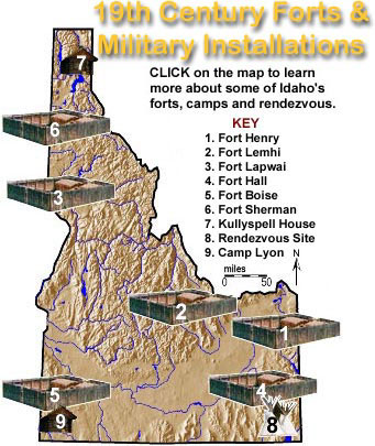 |
The early posts of the old West were seldom solidly constructed forts as we conceive of them today. Often there were no high stockades or permanent buildings. Sometimes there was only a blockhouse or two at opposite corners of the area being inhabited. Occasionally an underground shelter was the fort. Many fortifications were constructed by traders to protect their businesses and by settlers to protect their homes.
As more and more settlers moved west, the U.S. Army was called upon to move with then. Occasionally the Army would occupy fortifications already constructed by early settlers. Usually the soldiers were required to build their own forts. The material used in constructing these forts varied with the geography of the surrounding countryside. In the desert, adobe was used; in forested areas, wood was the material of choice; in rocky areas, rock was used if masons were available to shape it.
During the years of western expansion, Army posts were established on the basis of anticipated use. As the Indian tribes of the East moved to new reservations in the west, the Army was called out to keep the tribes from waging war with each other. As settlers cleared new lands, the Army moved their posts to protect the fledgling settlements from hostile Indians and to protect the Indians’ lands from being encroached upon by settlers and merchants. After gold and silver were discovered, the mass migration of miners and settlers began crowding the large Indian territories. As the Indians had no place to move, war between the whites and Indians intensified. The Army was ordered to subdue the Indians and keep them on their reservations.
Reacting to the fast changing needs of the country the Army would set up a post and then abandon it when no longer needed. In order for a post to be designated a fort, however, a contingent of troops had to be permanently assigned to it. Regardless of the life of the fort, each new outpost opened a new era in the history of the frontier, a new chapter written in courage by the soldiers, settlers, and Indian braves who fought, built, bled, and often died while creating the history of the country’s growth westward. These western forts are monuments to this heritage, and to the rich history of the period known as Idaho's Indian Wars.
Little or nothing is known of Indian warfare in Idaho prior to the arrival of horses of Spanish origin in the eighteenth century; until about that time, though, most of Indians had not organized into bands capable of carrying on anything resembling wars. Various western Indian tribes gained important advantages in warfare when were able to get horses and guns of European origin. White explorers and fur traders who reached the interior Pacific Northwest found the Indians eager to acquire the white man's weapons. By that time, the peoples now regarded as the Indians of Idaho ranged over a large area, and other lndians - particularly the Blackfeet - often raided into the Snake River country. Not many accounts of the Indian battles of that era are preserved, and none but a few of the very last of them are known at all. British traders who became active in Idaho as early as 1808 found that Indian inter-tribal warfare interfered seriously with fur hunting, and soon they managed to get the local Indians to bring their fighting to a halt. From that time on, when Indians fought each other, they generally did so only during white campaigns when Indians served as scouts for white armies against other Indians.
In the years of the fur trade, the Indians of Idaho had no major wars with the white newcomers. Hostilities were limited to minor incidents aside from a battle or two. The most important early fights were Finnan MacDonald's chastisement of the Blackfeet in the Lemhi country in 1823, and the battle of Pierre's Hole which pitted a Gros Ventre band against the combined forces of the trappers and the Nez Perce in 1832. But the fur trade did not upset the Indian way of life seriously, and most early mining was done in places that the Indians did not care very much about. Farm settlement, however, ruined the country for many of the Indians - especially for those who did not become farmers themselves - and after white farmers and ranchers began to take over more and more of the Indian country serious trouble broke out.
Even before Idaho was established, there was warfare. Practically the entire Coeur d'Alene people had gotten into battles with the United States Army in Washington in 1858, and with the beginning of farming and mining in southern Idaho, military expeditions proceeded against the Cache Valley and Salmon Falls Shoshoni in 1863. In the most colossal Indian disaster in the west, Colonel P. E. Connor's California volunteers wiped out the Cache Valley Shoshoni in the battle of Bear River on January 29, 1863. Volunteers from Boise Basin and from Oregon searched the country west of Salmon Falls, with limited success, in 1863 and 1864. Trouble in southwestern Idaho - where most of the early settlers concentrated continued to plague the army at Fort Boise and soon grew into the Snake War of 1866-1868. Indians from Idaho, Oregon, Nevada, and California were involved before General George Crook was finally able to round up the unhappy Shoshoni and Paiute bands and to enforce a peace settlement.
Major Indian wars did not afflict Idaho until years of friction and minor incidents precipitated two important outbreaks in 1877 and 1878. A clash in North Idaho came first. Part of the trouble was imported from Oregon, where stockraisers had tried for years to drive a Nez Perce band led by Chief Joseph (who was soon to be nationally famous) out from the Wallowa Valley in Oregon into North Idaho, a part of the Nez Perce reservation established by the Walla Walla Treaty of 1855.
In 1860 gold was discovered on the Nez Perce lands near Orofino Creek. Soon a gold rush to the reservation was underway. Lewiston became a main supply town for the rush and prospectors began flooding into the area. Encroachment by the whites was in direct violation of the Walla Walla treaty and the Nez Perce petitioned Washington to stop the rush. A company of cavalry was sent to the Nez Perce Reservation in 1862 to attempt to prevent whites from settling on Nez Perce lands. The troops were ineffectual, and a second cavalry company was sent to establish a fort at Lapwai.
Although originally intended to protect the Nez Perce treaty rights the Fort soon became the center for U.S. attempts to convince the Nez Perce to relinquish treaty lands that contained gold. In 1863 the federal government entered a new treaty that reduced the reservation established in 1855 to only 1,000 square miles. The reduced reservation was called the Lapwai Reservation and the Nez Perce were told to move onto it. This treaty became known as the "Thief Treaty" as only about 1/3 of the Nez Perce Chiefs signed the document, yet the U.S. Government insisted it applied to all Nez Perce.
Some of the Nez Perce refused to leave the Wallowa Valley in Oregon. Among them were Old Chief Joseph and his band. TheseNez Perce were allowed to occupy a small strip of the Wallowa Valley in Oregon. When Old Chief Joseph died in 1871 his son, Young Chief Joseph (born in 1840) became the leader of the Wallowa Nez Perce. He was given the name Hin-mah-too-yah-lat-kekt, or Thunder Rolling Down the Mountain. Over the next years Chief Joseph would become a national celebrity and earn a place in history as one of the greatest leaders of all time.
In 1877 the Federal government ordered all Nez Perce, including those in the Wallowa Valley, to move onto the Lapwai Reservation. Having no wish to leave their homeland, Chief Joseph argued for the rights of his people to remain in Oregon. They were denied, and an ultimatum was issued by General Oliver Otis Howard, stating that if they did not relocate war would be inevitable. The General imprisoned one of the Nez Perce priests to help with his persuasion.
Chief Joseph was not a military leader (the War Chief of his band was Chief Looking Glass), and did not wish to fight. He also wished to free his friend. Thus, Joseph and his band prepared to move to Lapwai. Before they could do so however a band of Nez Perce led by Chief White Bird ambushed a massacred a group of whites in the Salmon River country in northern Idaho. Although Joseph's people were not part of that band, as "non-treaty" Indians they were now considered hostiles and cavalry was dispatched to avenge the Salmon River incident. It seemed war was now inevitable. Chief Joseph gathered his band and together with White Bird's (and others) they began their famous journey of over 1,200 miles towards Montana hoping to find shelter with the Crows who were traditionally friends of the Nez Perce.
United States military operations in the Nez Perce War commenced with an army campaign which came to an abrupt halt when the Indians routed the numerically superior white force that came out to attack them on White Bird Creek. This became known as the battle of White Bird in which a large number of U.S. soldiers were killed, but the Nez Perce suffered only a handful of casualties. After successfully turning back the forces Howard had sent to White Bird Creek, the Indians did not counter with a military campaign against the United States Army or even against white settlers in the general vicinity. Rather, they crossed the Salmon River so that they might avoid any further military operations. When Howard pursued them across the Salmon, they eluded him again by returning to Camas Prairie and then moving over to the south fork of the Clearwater.
In all these various moves, they suffered almost no losses. They had routed the first unit (numerically a force equal to their own) which Howard had sent against them, and with commendable skill they had avoided further warfare - except for some incidental skirmishes which they had won with little difficulty. But nearly four weeks later, at the end of the battle of the Clearwater, July 12, the fighting Nez Perce - still outnumbered, but now grown to a maximum strength of 325 men in four bands - were dislodged from their stronghold. Even Joseph had to concede that Howard would continue to annoy them unless the non-treaty bands moved away from that part of the country. So the entire group decided to join their old friends, the Crows, in Montana. This move is often described as the Nez Perce retreat over the Lolo Trail. Except for the fact that it was an exodus in which the Indians were bringing along their women and children and hauling all their possessions, the trip resembled a traditional hunting expedition to the buffalo country. The Indians paid no attention to Howard, who followed too far behind to pester them.
After they entered Montana, a small military force from Missoula failed to hold them on Lolo Creek. Finally an army under Colonel John Gibbon caught up with them at Big Hole on August 9. Recovering from the surprise of Gibbon's attack at dawn, the Indians proceeded to besiege him. But two days later, they abandoned the siege and continued their journey when they found that Howard's army was catching up with them. Their route from Big Hole took them back across the Continental Divide into Idaho, which they crossed on their way to Yellowstone Park. Then Looking Glass (one of the four band leaders) proceeded to consult the Crows only to find these old friends less than enraptured at the thought of having any part of the Nez Perce War wished off onto them. With the Crows promising nothing better than neutrality, the Nez Perce force had to turn north to seek refuge in Canada. lf the Nez Perce had suspected that they were being pursued by still another army unit, they might have speeded up their pace and reached their destination without further incident. But they were not engaged in a military campaign, nor were they retreating; they were simply leaving a hostile area (originally their homeland and now overrun by white intruders) where they had been made to feel entirely unwelcome. Hence they were traveling in a leisurely fashion when, as they approached the United States-Canada boundary, they were overtaken by United States Army troops commanded by General Nelson A. Miles on September 29, while resting a short distance south of the border.
In their final major battle of the Bear Paws, the Indians were able to hold back the white attack. However, they could not extricate their entire band to continue their journey northward a few miles to Canada. After several indecisive days, Joseph at last negotiated his long-wished-for agreement with the army by which his band would relocate to the Lapwai Reservation in Idaho. (That had been his original objective in June, and finally it seemed he had a chance to get settled there, although his route had been somewhat roundabout.) White Bird along with the greater number of warriors decided it would be safer to go on to Canada than to return to Idaho. They feared, with good reason, that they would be far from welcome. Joseph had remained firm in his belief that the lesser evil was to move to the reservation. He had been reluctant to fight, and now that he had the opportunity to accomplish his objective by peaceful means, he accepted it. Unfortunately, the United States government disregarded the settlement Miles and Joseph had reached. Instead of recognizing the terms of the agreement, which allowed Joseph and his followers to return to Idaho, the government exiled them to Kansas and then Oklahoma, where they remained for eight years. Eventually they were relocated to the Colville Reservation in Washington. Joseph's greatest triumph - upon which his reputation largely rests - came when he at last persuaded the United States government to return his band to the Idaho even though he himself was not allowed to leave Colville.
Those who interpret the Nez Perce War in terms of a United States Army campaign have all too frequently presented a military picture which distorts Indian operations during that conflict. The use of military concepts and terms is appropriate when explaining what the whites were doing, but these same military terms should be avoided when referring to Indian actions. True, the Indians did fight a number of battles which lend themselves to military description. Yet much of what they did - particularly between battles - was not at all in the nature of a white military operation. General Howard was indeed engaged in a military campaign, but the Indians certainly were not. In the process of trying not to fight a war, they had made Howard's military campaign look foolish. But to describe their success in avoiding war (under the considerable handicap of having the United States Army out trying to fight a war against them) as some kind of successful military strategy simply confuses the issue. The Indians did not even have an army. Their forces consisted of a group of individual fighters with leaders who could recommend but not command, either in battle or in peace. Indian objectives during the Nez Perce War provide an explanatory key. In the first place, Joseph, White Bird, and Looking Glass would have preferred to remain as non-treaty Indians living in their old homelands (generally off the reservation). But by the beginning of the war, Joseph had concluded, with deep regret, that he had no choice but to move onto the reservation. General Howard had left him no alternative short of war. In choosing the lesser of two evils, Joseph had rejected war. As matters turned out, Joseph became involved in a war anyway as a result of the White Bird incident. Despite the fact that his plans received a setback because of this action, Joseph still hoped to conclude hostilities and to settle on the reservation as soon as the details of such an agreement could be worked out. And that, eventually, was exactly what he arranged to do.
Joseph's agreement with General Nelson A. Miles is usually reported as a surrender. From the Army point of view it was - and much was made over this "surrender," perhaps to conceal the obvious fact that Miles had not won the battle. Only 79 Nez Perce warriors elected to return to Idaho, and 98 decided that it would be wiser to seek refuge in Canada. Since Miles's objective had been to round up all the Nez Perce warriors, he could hardly boast of a victory. As a matter of fact, he deceived himself by construing the war as a two-sided military operation and by supposing that when he dealt with Joseph, he was dealing with the military commander of the Nez Perce Indians. Actually even during the battles, the Indians had no single military command in the white man's sense. Thus, when Joseph was negotiating with Miles, he was speaking only for himself and for those who wished to follow him. By Nez Perce standards, White Bird and those who elected to go on to Canada were perfectly free to do so. And the Indians were adhering to their own standards, not to some white military tradition of which they were probably unaware. Under the white man's system a surrender meant that the Nez Perce commander, had there been one, would have been held responsible for the surrender of his entire army, which in this case did not exist, at least not as the kind of organization the white man understood. Little of this made sense to the Indians, who were not surrendering anyway. General Miles probably could not have succeeded in explaining to Joseph the white man's concept of a military surrender, even if he had thought to try. And in any event Joseph had no army to surrender and no authority to make other Nez Perce warriors come to any agreement or terms. Thus, since Miles was unable to capture the Nez Perce warriors, he was forced to abide by Nez Perce procedure and deal with the lndians as individuals. Such a procedure was as foreign to Miles as the concept of surrender was to the Nez Perce.
In 1965 the United States Government founded the Nez Perce National Historic Park. Thirty eight sites, scattered across the states of Idaho, Oregon, Washington and Montana, have been designated to commemorate the legends and history of the Nee-Me-Po and their interaction with explorers, fur traders, missionaries, soldiers, settlers, gold miners, and farmers who moved through or into the area. The Park was also created to honor Chief Joseph and his brave band. The areas encompassing these sites display the great diversity of the American West -- topography, rainfall, vegetation, and scenery, ranging from the semi-arid regions of Washington, to the lush high mountain meadows of Idaho and Oregon, to the prairies of Montana. As you travel from site to site you gradually sense the importance of the land in contributing to the rich and diverse cultural history of the Nez Perce people.
Idaho's other major Indian uprising occurred in the summer of 1878, a year after the Nez Perce War. Trouble had been brewing for a long time among the Bannock element on the Fort Hall Reservation: the reservation was poorly administered, and a better agent was wanted; friction between Shoshoni and Bannock groups on the reservation added to the trouble; supplies promised by treaty did not get distributed to the Indians, and grain was increasingly hard to find; white stockraisers were ruining the Camas Prairie camas grounds reserved for the Indians by treaty; a series of irritations and grievances had built up. One Bannock leader in particular, Buffalo Horn, had gained considerable military experience as an army scout against the Sioux in 1876 and against the Nez Perce in 1877; now he had an important band of followers and was ready to go to war himself. An incident May 30 on the Camas Prairie when settlers released hogs that proceeded to ruin the camas harvest, inflamed the Bannock and led them to leave for the Malheur agency in Oregon to join Egan's band of northern Paiutes and fight to reclaim the Camas Prairie. Egan had his own good reasons for wanting to go to war, and the Bannock were Northern Paiute anyway. On the way Buffalo Horn's group sank Glenn's ferry and drove off a small white force at South Mountain on June 8. Buffalo Horn survived the battle of South Mountain by only four days; but his band continued the war in Oregon under the leadership of Egan, until some misadventures in central Oregon shattered their forces. Scattered in eastern Oregon, the Bannock warriors gradually made their way back to Idaho, where some of them were engaged in yet another battle at Bennett Creek on August 9. The Indians escaped, though, and army units hunted for (and sometimes came across) stray Bannock bands across southern Idaho and on into Montana and Wyoming, where fighting continued as late as September 12. Many of the Indians got back to Fort Hall; others were captured and returned there; while others simply disappeared and have never been found.
With the end of the Bannock War, attention was turned to the Sheepeaters - a Shoshoni group of expert hunters who had the skill necessary to pursue mountain sheep in the Salmon River Mountains. A massacre of five Chinese miners on Loon Creek on February 12, 1879, was blamed on some refugees from the Bannock War who were thought to have spent the winter with the local Sheepeaters. Army units went out in the spring of 1879 to ask the Sheepeaters if they knew who was responsible for the Loon Creek Chinese disaster. Deep snow held back the search for the Sheepeaters, who lived in rough country largely unknown to the whites. Suspicious of army intentions after the Nez Perce and Bannock wars of the previous two years, the Sheepeaters decided to resist. Ten or a dozen of them ambushed and defeated forty eight mounted infantry who were accompanied by twenty or more scouts and packers. After this engagement on Big Creek, July 29, one energetic Sheepeater halted the army retreat on a mountain ridge. The resulting battle of Vinegar Hill turned into an incredible fourteen-hour siege in which a handful of Indians pinned down the entire white force. Another, better-managed army expedition managed to catch up with the Sheepeaters at Soldier Bar, a little farther down on Big Creek, on August 20. Again confronted with overwhelming numbers, the Sheepeaters scattered into the Salmon River wilderness. Soon the army, exhausted by the difficult twelve-hundred-mile campaign, had to retire. Still another military expedition set out on September 16 and, after a two weeks' search, managed to catch up with the elusive warriors. They explained that they had nothing to do with the Loon Creek Chinese massacre but agreed to go out with the army and to settle on a reservation. Thus the campaign ended without a battle, and more than fifty Sheepeaters retired from their wilderness homeland. Most of them were women and children. Only ten to fifteen warriors had participated in the entire campaign, which lasted longer than the Nez Perce War. The perpetrators of the outrage against the Chinese never were found, but the somewhat clumsy military investigation of the incident brought the army campaigns against the Idaho Indians to an end. Some of the Sheepeaters avoided the army, and Eagle Eye's band did not move to the Fort Hall reservation for many years.
Considering the fact that the Indians of Idaho were forced to give up most of their land and to crowd into reservations on which many of them found it impossible to work out a satisfactory way of life, a resort to force was not surprising. Yet the armed clashes which so often terrorized the whites and ruined the Indians between 1863 and 1879 had the effect of "solving" the Indian problem for most of the whites. But for the Indians, the end of the wars simply meant that they no longer had an alternative to a disagreeable and miserable existence on small reservations allowed them by the whites - a poor solution which has never been easy for either side to live with, even to the present day.
Recommended Reading:
* "Chief Joseph's Own Story". Ye Galleon Press. Reprinted, 1999.
* "I Will Tell of My War Story: A Pictorial Account of the Nez Perce War". Discussion of the Cash Book images by Scott M. Thompson. University of Washington Press. 2000.