Surveying and Geomatics Engineering Technology

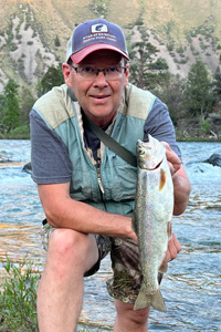
Robert Liimakka
Clinical Associate Professor / Coordinator Surveying and Geomatics Engineering Technology
Office: Roy F. Christensen Complex 271
Robert Liimakka is assistant professor and coordinator of the Surveying and Geomatics Engineering Technology Program. He is a licensed surveyor in the states of Idaho, Michigan and Wisconsin. Mr. Liimakka has extensive surveying experience in both the public and private sector having worked for the USFS in retracement surveys and private surveying and engineering firms performing construction, boundary, and land development surveys. Mr. Liimakka is the State Coordinator for the National Society of Professional Surveyors – Certified Survey Technician (CST) program. He served as Secretary of the Idaho Society of Professional Land Surveyors and is Chair of the ISPLS Education Committee. Most recently, he has received certificates in online course development and delivery.
Education
Ph.D. In progress, University of Maine, Major: Civil Engineering
MS, University of Maine, 2000, Major: Spatial Information Science and Engineering
BS, Michigan Technological University, 1986, Major: Land Surveying
AAS, Gogebic Community College, 1983. Major: Engineering
Areas of Expertise
- 13 years professional surveying experience prior to academia
- Boundary Surveying
- Construction Surveying
- Geodesy
- Land Surveying Consultant (legal issues, boundary resolution, professional practice, zoning, technology and methods)
Research Interests
- Large network adjustments
- 3D laser scanning
- Mobile and aerial mapping
- GPS data analysis
Teaching Experience / Interests
- Beginning Surveying
- Boundary Surveying Principles
- Public Land Survey System
- Autonomous Mapping Systems
- Land Use Planning
- Survey Computations
- Surveying Field Practice
- Capstone Design Projects
- GPS/GNSS
- Geodesy
Professional affiliations
- Idaho Society of Professional Surveyors
- National Society of Professional Surveyors

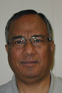
Rajendra R. Bajracharya, Ph.D., P.L.S.
Professor / Surveying and Geomatics Engineering Technology
Office: Roy F. Christensen Complex 109
Education
- Ph. D. in Geospatial Information Engineering from University of Wisconsin-Madison
- MS in Geodetic Science from Ohio State University
- BSc (Hons) in Land Surveying Sciences from North East London Polytechnic, England
- BSc from Tri-Chandra College, Kathmandu
Career Highlights
Instructional
- Faculty at Idaho State University since 2001 to current
-
Fulbright Scholar, Taught at Kathmandu University, Fall 2014
- Faculty at University of Colorado, Denver 1995-2001
- Faculty at University of Colorado at Boulder, 1995
- Instructional Survey Officer at Survey Training Center, Nepal, 1977-1981
Others
- At ISU, established GPS Continuously Operating Reference Station (CORS) at three ISU Centers for Real Time Kinematic (RTK) surveys.
- He prepared Accreditation Board for Engineering and Technology (ABET) –Technology Accreditation Commission (TAC) Self-Study Questionnaire for accreditation process of the Geomatics Technology Program at ISU in 2005 & 2011
- Chair of Faculty Research Committee for three years at ISU.
- Performed Research for Monitoring Structural Deformation of Standley Dam in Denver, CO.
- Worked at Arrow Land Surveying, Westminster, CO. 1996-2001 part time.
- Team Leader Surveyor for International Boundary Survey between Nepal and India 1983-84
- United Nations Volunteer Team Leader Surveyor in Laos, to perform survey for irrigation canals from Mekong River, and land acquisition survey, 1981 – 83.
- Terra Survey, Wales, UK to extract property information for Wales National Water Authority 1977 Jan-Feb.
Favorite Professional Experience
It has been my pleasure to see our senior year students/graduates pass their Land Surveying Intern national exam (LSI) towards becoming a Professional Land Surveyor. Since I joined ISU, about 35 graduates have passed the LSI national exam and 18 graduates have gone on to earn their professional surveying licenses. Three of the Professional Land Surveyors are the owners of their own surveying companies.
One professional experience that I will never forget is a surveying experience I had in Nepal. I walked with another surveyor every day along trails and the sides of fast moving rivers for an entire month to perform a feasibility survey study for the construction of a road in a remote portion of Nepal. Some days our work took us apart, and I did not see another human the whole day and spent nights alone under a beautiful sky ceiling. The total length of the road now constructed is about 500 km, and it gives me pride to think I was part of such a significant project in such a wonderful country.

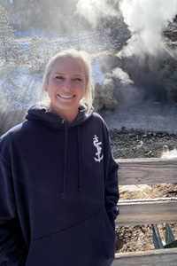
Jeannie Vahsholtz
Clinical Assistant Professor
Office: Vocational Arts Building #206
Professional Work Experience
- Clinical Assistant Professor of Surveying & Geomatics/Civil Engineering Technology – Current Position
- District Land Surveyor for Idaho Transportation Dept. for 9+ years
- Second Year Instructor for Civil Engineering Technology/Geomatics 8 years
- 35+ years’ work experience
Career Highlights
- Master of Science in Engineering Technology University of Maine 2023
- Past President of the Idaho Society of Professional Land Surveyors
- Bachelors in Geomatics Idaho State University College of Technology 2010
- Idaho Professional Surveyor’s License 2008
- Associate of Applied Science Civil Engineering Technology Idaho State University College of Technology 1987
Favorite Professional Experience
My favorite professional experience was surveying in Butte County for Lutheran Camp Pekins, and walking the boundary with the Director of the Camp and the USFS representative. The survey was for a 99-year lease, and the Camp was in need of a larger boundary area. I set pins, sealed a legal description, and filed a record of survey, up near Red Fish Lake. My sister and my daughter both helped me with that boundary survey. I re-traced GLO Brass Caps set in 1918 as part of the section work.
A little about me…
I have three sons and a daughter, two of my sons gave me four grandchildren which are such a joy! My daughter is a soon-to-be mom and will add another grandchild to make a total of five grandchildren! Camping and the great outdoors in Idaho is one of my favorite things to do. I love to travel, especially to see the grand kids. Recently I traveled to South Carolina to write exam questions for the NCEES. This was a great experience for me and an honor to serve my surveying profession in that capacity. My favorite animal is a dog, and I have always had one. My old girl is getting up there in age, she’s almost 12, her name is Sandstone Rue (Rue for short). I recently added a golden retriever lab to my immediate family. Her name is Saphira, and she is such a joy!
