
ISU Surveying Professor Offers Expert Take on Deadly Nepal Glacier Collapse Floods
October 1, 2026
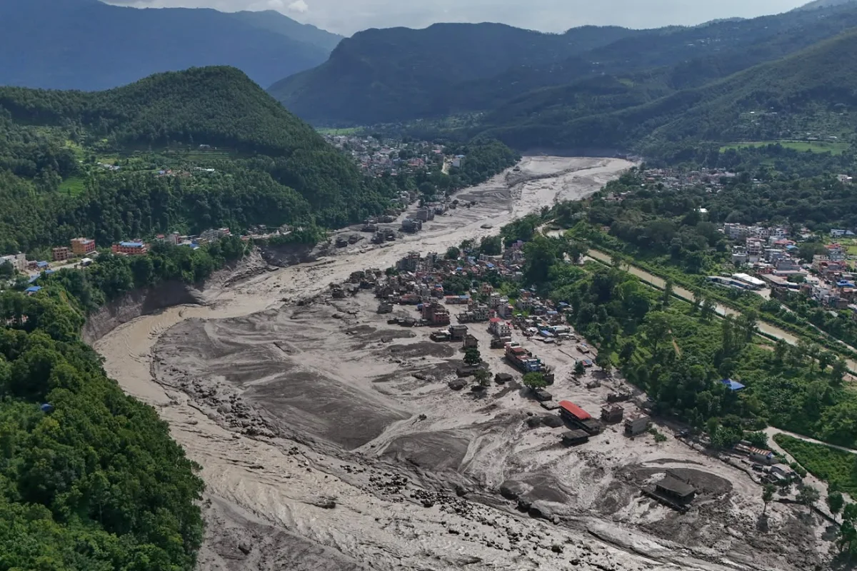
A glacier collapse in Nepal's Langtang National Park on Wednesday, August 26, has killed at least 1,410 people and left 6,145 missing, with another 43 dead and 519 missing across the border in Tibet, according to figures reported by Nepali and Chinese officials. Nepal's government has estimated the flooding caused between $4 billion and $7 billion in economic damage.
Rajendra R. Bajracharya, a professor of surveying and geomatics engineering technology at Idaho State University, learned of the disaster the day after it struck. Bajracharya has taught at ISU since 2001.
In 2014, he returned to Nepal as a Fulbright Scholar to teach at Kathmandu University, giving him direct academic ties to the country and its surveying institutions beyond his upbringing there.
That background in Nepal's terrain-mapping and land administration systems gives him a firsthand perspective on both the science behind the flooding and what recovery will require.
"I first heard about the flooding from the melting permafrost of the glacier the next day after the event happened," Bajracharya said.
Bajracharya began his career teaching surveying at Nepal's Survey Center in 1978. That winter, he led students on a monthlong fieldwork expedition through the hills and mountains around the Trishuli hydropower area — one of the same regions now devastated by the flooding.
Bajracharya said he no longer has contacts at Kathmandu University or within Nepal's survey and geodetic branch, but he's still gotten a firsthand look at the damage.
"My brother posted some of the disaster video on his Facebook," he said.
The flooding began when part of the glacier atop Langtang Lirung peak collapsed, sending debris down the Lhende Khola into the Trishuli River.
The collapse generated a seismic signal detected by monitoring stations worldwide, which was initially mistaken for an earthquake. Bajracharya said the disaster stemmed from the same forces scientists have been tracking across the region.
"The disaster happened from the melting permafrost of very huge glacier hills, which then slid into a big lake, thus displacing and pouring out water and making a huge flood down the rivers emerging from the lake," Bajracharya said.
Chinese engineering teams have been conducting aerial surveys and building 3D models of the area to assess the risk of further collapse. Bajracharya, who has taught that kind of geospatial and terrain survey work, said the results only capture a single moment in time.
"Any geospatial/terrain survey work performed by aerial survey and drones will be like time-tagging for the particular date of the survey," he said. "This survey will be invalid for even next year because of glacier melting."
Bajracharya, who helped teach Nepal's Land Administration Masters Program, said restoring property boundaries and land records in the flooded areas will be one of the hardest parts of recovery.
Nepali authorities have issued flood warnings for communities along rivers in the Rasuwa, Nuwakot, Dhading, Gorkha and Chitwan districts as recovery efforts continue.
"Rebuilding is going to be the most difficult part," he said. "As one has seen in the news, even rescuing has been very difficult, moving the dirt, mud and earth. The property rebuilding is going to take huge chunks of time, and who knows — even the rebuilding might be flooded next time."
Categories: