
Idaho State University’s Weber honored with Esri Special Achievement Award for geospatial technology application
July 12, 2013
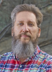
Idaho State University's Keith Weber, director of the ISU GIS Training and Research Center, received a Special Achievement in GIS Award at the Esri International User Conference in San Diego on July 10.
This award acknowledges vision, leadership, hard work, and innovative use of Esri's geographic information system (GIS) technology.
 The ISU GIS Training and Research Center uses Esri ArcGIS technology for outreach to the community in both its research and training. One of its better-known research endeavors is the NASA RECOVER post-fire project. This prototype GIS-based fire recovery "decision support system" being developed at Idaho State University will automatically generate and refresh derived fire severity, fire intensity and other information throughout the burn, producing easily understandable GIS maps.
The ISU GIS Training and Research Center offers training through a variety of workshops and the annual GIS Day it hosts.
Organizations from around the world honored at the Esri UC span industries including agriculture, cartography, climate change, defense and intelligence, economic development, education, government, health and human services, telecommunications, and utilities.
"The SAG Awards identify the organizations and people that are using the power of geography to improve our world and drive change," says Esri president Jack Dangermond. "At Esri, we are always deeply inspired by the passion and innovation of our users. They deserve recognition for both solving their communities’ greatest challenges and for their invaluable contributions to the continued evolution of geographic science."
For more information about the 2013 Special Achievement in GIS Award winners, including project information and photos, please visit esri.com/sag.
###
About Esri
Since 1969, Esri has been giving customers around the world the power to think and plan geographically. The market leader in GIS technology, Esri software is used in more than 300,000 organizations worldwide including each of the 200 largest cities in the United States, most national governments, more than two-thirds of Fortune 500 companies, and more than 7,000 colleges and universities. Esri applications, running on more than one million desktops and thousands of Web and enterprise servers, provide the backbone for the world's mapping and spatial analysis. Esri is the only vendor that provides complete technical solutions for desktop, mobile, server, and Internet platforms. Visit us at esri.com/news.
Copyright © 2013 Esri. All rights reserved. Esri, the Esri globe logo, esri.com and @Esri are trademarks, service marks, or registered marks of Esri in the United States, the European Community, or certain other jurisdictions. Other companies and products or services mentioned herein may be trademarks, service marks, or registered marks of their respective mark owners.
Categories: